 with our Megalithic Portal iPhone app")


<< Our Photo Pages >> Peckforton Mere - Ancient Village or Settlement in England in Cheshire
Submitted by vicky on Thursday, 19 September 2002 Page Views: 9749
Multi-periodSite Name: Peckforton MereCountry: England County: Cheshire Type: Ancient Village or Settlement
Nearest Town: Nantwich Nearest Village: Peckforton
Map Ref: SJ543577 Landranger Map Number: 117
Latitude: 53.114512N Longitude: 2.684213W
Condition:
| 5 | Perfect |
| 4 | Almost Perfect |
| 3 | Reasonable but with some damage |
| 2 | Ruined but still recognisable as an ancient site |
| 1 | Pretty much destroyed, possibly visible as crop marks |
| 0 | No data. |
| -1 | Completely destroyed |
| 5 | Superb |
| 4 | Good |
| 3 | Ordinary |
| 2 | Not Good |
| 1 | Awful |
| 0 | No data. |
| 5 | Can be driven to, probably with disabled access |
| 4 | Short walk on a footpath |
| 3 | Requiring a bit more of a walk |
| 2 | A long walk |
| 1 | In the middle of nowhere, a nightmare to find |
| 0 | No data. |
| 5 | co-ordinates taken by GPS or official recorded co-ordinates |
| 4 | co-ordinates scaled from a detailed map |
| 3 | co-ordinates scaled from a bad map |
| 2 | co-ordinates of the nearest village |
| 1 | co-ordinates of the nearest town |
| 0 | no data |
Internal Links:
External Links:
")
This small enclosure lies adjacent to Peckforton Mere, close to Beeston Castle and Maiden Castle. The site which has been heavily damaged by ploughing remains undated, but is believed to be Iron Age.
References
D.M.Longley “Prehistory” in C.R.Elrington (ed) “The Victoria History of the County of Chester, volume 1, Oxford University Press (1987)
You may be viewing yesterday's version of this page. To see the most up to date information please register for a free account.
")
Do not use the above information on other web sites or publications without permission of the contributor.
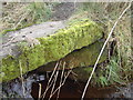
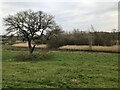
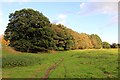
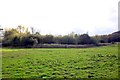
Nearby Images from Geograph Britain and Ireland:
©2007(licence)
©2022(licence)
©2013(licence)

©2006(licence)
©2013(licence)
The above images may not be of the site on this page, they are loaded from Geograph.
Please Submit an Image of this site or go out and take one for us!
Click here to see more info for this site
Nearby sites
Key: Red: member's photo, Blue: 3rd party photo, Yellow: other image, Green: no photo - please go there and take one, Grey: site destroyed
Download sites to:
KML (Google Earth)
GPX (GPS waypoints)
CSV (Garmin/Navman)
CSV (Excel)
To unlock full downloads you need to sign up as a Contributory Member. Otherwise downloads are limited to 50 sites.
Turn off the page maps and other distractions
Nearby sites listing. In the following links * = Image available
1.6km NNW 341° Beeston Castle* Hillfort (SJ538592)
3.9km NE 55° Robin Hood's Tump* Round Barrow(s) (SJ575599)
5.6km N 9° Salterswell* Holy Well or Sacred Spring (SJ552632)
6.6km SW 222° Maiden Castle (Cheshire)* Hillfort (SJ49805286)
7.3km WSW 250° St Winefride's (Clutton)* Holy Well or Sacred Spring (SJ47395524)
7.7km NW 323° Brookhouse Farm Ancient Village or Settlement (SJ497639)
8.6km N 7° High Billinge* Round Barrow(s) (SJ5548066242)
8.9km WSW 243° Carden Park* Cave or Rock Shelter (SJ463537)
9.0km WSW 242° Carden Park Barrow Round Barrow(s) (SJ46365352)
9.2km N 3° Whistlebitch Well* Holy Well or Sacred Spring (SJ548669)
9.5km NNE 12° Seven Lows Round Barrow(s) (SJ56336703)
9.7km NNE 14° Seven Lows* Round Barrow(s) (SJ567671)
9.9km N 353° Kelsborrow Castle* Hillfort (SJ5315567509)
10.0km ESE 117° Church of St Mary the Virgin (Acton)* Ancient Cross (SJ63175308)
10.6km NNE 18° Oakmere* Ancient Village or Settlement (SJ576678)
11.1km N 356° Delamere Stone Circle (SJ536688)
11.4km NNE 29° Long Stone Cross* Ancient Cross (SJ599677)
11.7km N 4° Castle Ditch Eddisbury* Hillfort (SJ553694)
11.9km ESE 116° Old Biot* Holy Well or Sacred Spring (SJ64965243)
12.9km SW 223° Meadows Farm Barrow* Round Barrow(s) (SJ45454834)
13.3km W 261° Churton* Long Barrow (SJ411558)
13.4km W 263° Knowl Plantation Barrow Cemetery (SJ410561)
13.9km N 11° Gallowsclough Cob* Round Barrow(s) (SJ570713)
13.9km W 273° Poulton Timber Circle* Ancient Village or Settlement (SJ4033558472)
14.6km WNW 294° Heronbridge Roman Strip Settlement Ancient Village or Settlement (SJ410639)
View more nearby sites and additional images


 We would like to know more about this location. Please feel free to add a brief description and any relevant information in your own language.
 Wir möchten mehr über diese Stätte erfahren. Bitte zögern Sie nicht, eine kurze Beschreibung und relevante Informationen in Deutsch hinzuzufügen.
 Nous aimerions en savoir encore un peu sur les lieux. S'il vous plaît n'hesitez pas à ajouter une courte description et tous les renseignements pertinents dans votre propre langue.
 Quisieramos informarnos un poco más de las lugares. No dude en añadir una breve descripción y otros datos relevantes en su propio idioma.