

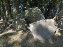

Sutton Common Iron Age site in South Yorkshire
Submitted by Andy B on Friday, 25 July 2003 Page Views: 10147
Iron Age and Later Prehistory
One of the most intriguing finds is the remains of a wooden well with a brushwood floor nearly two metres below the surface-first glimpsed three years ago but now completely uncovered for the first time.
Originally protected by impassable marshes, the fort (which covers the area of two football fields) comprises two enormous and enigmatic enclosures, one with a grand entrance, linked by what appears to be a ceremonial walkway. The site has defied explanation since it was discovered over a century ago. Now archaeologists taking part in the Sutton Common Project, designed to regenerate the landscape in this former coalfields area, have uncovered yet more mysteries in their attempt to solve the puzzle of why the enclosures, which date from about 600 to 400 BC, were built.
Director of excavations Robert Van de Noort of Exeter University said: "Within the ramparts we have uncovered the remains of several round houses, boundaries and a well and also of a wide avenue through the site. But we have found no evidence, such as bone or pottery or of the repair of any of the structures, to show that anyone actually lived here. It is as if this were a kind of ghost village, scarcely ever inhabited, and may mean that Sutton Common was primarily a symbolic or ceremonial place, rather than a political or economic centre."
Even the well, where it would be usual to find items dropped or thrown in, offers no proof that it was ever used. It appears to be filled with clean sediment.
David Miles, Chief Archaeologist at English Heritage said: "The Sutton Common fort is set to make a significant contribution to our understanding of the Iron Age regionally and nationally. English Heritage is happy to contribute to the Project's work and will fund further excavations next year with the aim of resolving the enigma of this mysterious and atmospheric site."
Earlier excavations (some also funded by English Heritage) revealed stone revetted ramparts, a palisade and waterlogged remains in the ditches, including what looks like a wheel and a ladder. The entrance to the larger enclosure would have been highly elaborate and lends credence to the idea that the post-lined avenue over a causeway linking the two was more than simply functional.
Co-director of excavations Henry Chapman of the University of Hull said: "The building techniques and architecture of the ramparts closely resemble those of early Iron Age hillforts elsewhere in England. However, instead of building the fort on a hill, the impassable wetlands were used to create an impregnable site, the biggest marshland fort in England."
Since 1997 an ambitious conservation programme (The Sutton Common Project) has been under way aimed at restoring the grandeur of the marshland setting and delivering a range of environmental benefits to the region. This includes a re-wetting scheme for the surrounding land.
Ian Carstairs, trustee of landowners CCT, said: "The Sutton Common project represents an unparalleled example of co-operation of government agencies, including English Heritage, English Nature, the Countryside Agency and DEFRA, together with local organisations and people. It is a wonderful example of what can be achieved when we all work together."
Further information on the progress of the work can be found on the excavation's website.
Access: The site is situated just off the A19 (Doncaster to Selby road) c. ½ mile south of Askern. To visit the site (centred on national grid reference SE 563 122):
From the north: go through Askern along the A19 and take the third track on the left (just before crossing the bridge/bend in the A19)
From the south: pass Owsten Park pub on the A19 and turn right immediately after crossing the bridge/bend in the A19)
Background:
The excavations form part of the ‘Sutton Common Project', which includes land acquisitions, wildlife and landscape enhancement, archaeological and palaeoenvironmental evaluations, research and conservation and engineering works to raise ground-water levels. It is spearheaded by the owners of the land, the Carstairs Countryside Trust (CCT), in partnership with English Heritage, English Nature, Countryside Agency, the Universities of Exeter and Hull and Grantham Brundell and Farran. The Project has also benefited greatly from The Heritage Lottery Fund. The Project forms one of the Countryside Agency's trial schemes in the Humberhead Levels ‘Value in Wetness' Land Management Initiative, which is seeking new, economically viable and environmentally sustainable approaches to water and land management in the Humberhead Levels. Participation with the Askern Ward Community Partnership over future public access and enjoyment of the site seeks to contribute to the environmental and economic regeneration of this ‘Coalfields' area in South Yorkshire.
Note: 2003 excavation weblog from Sutton Common Iron Age site - see comments


 We would like to know more about this location. Please feel free to add a brief description and any relevant information in your own language.
 Wir möchten mehr über diese Stätte erfahren. Bitte zögern Sie nicht, eine kurze Beschreibung und relevante Informationen in Deutsch hinzuzufügen.
 Nous aimerions en savoir encore un peu sur les lieux. S'il vous plaît n'hesitez pas à ajouter une courte description et tous les renseignements pertinents dans votre propre langue.
 Quisieramos informarnos un poco más de las lugares. No dude en añadir una breve descripción y otros datos relevantes en su propio idioma.