

Featured: New Book: Astrometrology: The Science of Ancient Metrology by Christopher Willett

New Book: Astrometrology: The Science of Ancient Metrology by Christopher Willett

Random Image

Current Archaeology Book of the Year 2019!

Current Archaeology Book of the Year 2019!

Login

Register here - as a registered user you get more features and fewer ads.

Who's Online

There are currently, 942 guests and 3 members online.

Sponsors

<< County Introductions >> County Guides No.17 - Orkney

Submitted by howar on Saturday, 28 February 2004  Page Views: 4780

Neolithic and Bronze AgeCountry: Scotland County: Orkney
Internal Links:

Comet Stone (Orkney)
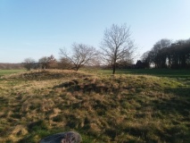
Comet Stone (Orkney) submitted by howar : Comet Stone group HY296133 Orkney (Vote or comment on this photo)
Home of the "Heart of Orkney" World Heritage area, the Orkney Isles is widely held to be the most densely packed area of surviving archaeological remains in Britain. Most famous are the Ring of Brodgar, The Stones of Stenness and Maes Howe chambered tomb, all in this area.

There are many islands apart from Mainland, including the chambered tomb 'mecca' of Rousay. Public transport is rather patchy and irregular even on Mainland in summer, so unless you have a car a fair bit of rambling is required.

The Orkney Isles were first inhabited in the Mesolithic but rising sea levels have left us scant remains from this period. In the Neolithic came the stone circles and the great chambered tombs. From the Iron Age we have the many broch remains around our coasts e.g. Broch of Gurness. Literary evidence of Roman exploration on land is sparse and much disputed. After the Picts came the Viking settlements (eg Gurness again), with this being one of the few agreed instances where one population replaced another, though this is the exception that proves the rule as Pict Orcadians had died out just previous to the first Norse intrusions.

It may be the early wood clearances that lead to the survival of so many sites. The only native woodland is on island of Hoy (where there is the massive rock-cut tomb ‘The Dwarfie Stane’). For the visitor, and even many islanders, a big problem is simply how many places have the same name or slight variants, plus names being on the map but unidentified on the ground and vice versa. With so many sites in very close proximity and identically named it can help to use CANMAP on the RCAHMS website for finding every site that exists.

<< County Guides No.16 - Cornwall

Subject Guides No.4 - Round Barrows >>

Please add your thoughts on this site

Neolithic Britain And Ireland

Neolithic Britain And Ireland

Sponsors

More County Introductions

See all County Introductions →

Latest Visit Logs

  • Pierre de Minoz
    “Beside the D28 on the left bank of the river Fremur near to the Chapelle des Vaux can be found the P…”
    by TheCaptain · 17 Aug 2026
  • Les Roches-Hues
    “Described in 1878 as an alignment of menhirs one kilometre in length, orientated north to south, now…”
    by TheCaptain · 17 Aug 2026
  • Allée Couverte de Roche-Plate
    “The allée couverte de Roche-Plate was discovered in 1975 near to the Moulin de Roche-Plate on the ou…”
    by TheCaptain · 17 Aug 2026
  • Roche a Trois Pieds
    “I visited here this morning on the way to the ferry at Cherbourg, and was only really expecting to f…”
    by TheCaptain · 17 Aug 2026
  • Menhir de Gouville
    “One of Gouville-sur-Mer's two little menhirs, this one stands within the village beside the Coutance…”
    by TheCaptain · 17 Aug 2026

"County Guides No.17 - Orkney" | Login/Create an Account | 1 comment
  
Go back to top of page    Comments are owned by the poster. We aren't responsible for their content.
Re: County Guides No.17 - Orkney by howar on Saturday, 12 November 2005
(User Info | Send a Message)
In the Orkney Room there is a black box on a shelf in the far corner that contains the record cards for our NMRS up till the early 70's. This contains more information than online CANMORE as that in places only gives a bibliographical reference instead of actual quote. Some of the cards also include maps,sketches, plans, photos. Though these are all in reduced form only the photos can occasionally less than usual. The 1946 RCAMS Inventory is also here along with the standard work on Orkney's chambered cairns (not the most recent version) and Hedge's volume on our brochs (only detailed for those he accepts but very detailed for these, including plans,sketches,photos).
[ Reply to This ]

Your Name: Anonymous [ Register Now ]
Subject:


Add your comment or contribution to this page. Spam or offensive posts are deleted immediately, don't even bother

<<< What is five plus one as a number? (Please type the answer to this question in the little box on the left)
You can also embed videos and other things. For Youtube please copy and paste the 'embed code'.
For Google Street View please include Street View in the text.
Create a web link like this: <a href="https://www.megalithic.co.uk">This is a link</a>  

Allowed HTML is:
<p> <b> <i> <a> <img> <em> <br> <strong> <blockquote> <tt> <li> <ol> <ul> <object> <param> <embed> <iframe>

We would like to know more about this location. Please feel free to add a brief description and any relevant information in your own language.
Wir möchten mehr über diese Stätte erfahren. Bitte zögern Sie nicht, eine kurze Beschreibung und relevante Informationen in Deutsch hinzuzufügen.
Nous aimerions en savoir encore un peu sur les lieux. S'il vous plaît n'hesitez pas à ajouter une courte description et tous les renseignements pertinents dans votre propre langue.
Quisieramos informarnos un poco más de las lugares. No dude en añadir una breve descripción y otros datos relevantes en su propio idioma.