

Abandoned Landscapes - From Corwen to Llangollen
Submitted by TimPrevett on Friday, 25 August 2006 Page Views: 9102
Multi-periodCountry: Wales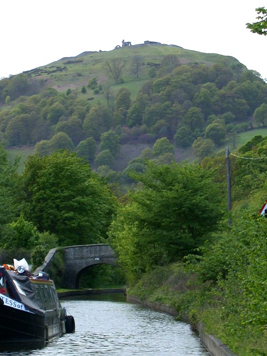
From Corwen to Llangollen
Across the North Berwyn above the Vale of Llangollen to remote grouse moors, a ruined shooting box, cairns and routeways. Spring 2000
On a Saturday in May I boarded the bus to Corwen. The rain thrummed depressingly against the windows as it wound its way along the Vale of Llangollen but by the time we reached Corwen the sky was clear and the sunlight was bouncing off the puddles. The stop is just by the gap leading to the church, allowing me to slip straight from the busy main road into the secluded graveyard. I briefly savoured the cool dark church interior and watched a man in overalls sweeping the floor. A little swing gate leads directly out of the churchyard onto a steep overgrown path up the wooded hill of Coed Pen-y-Pigyn.
A few hundred feet up is a small clearing for a well-tended 12ft high stone and concrete cairn with a flagpole on top; a stone plaque tells that it was built by 'the inhabitants of Corwen' to commemorate the marriage of Edward, Prince of Wales in 1863, and restored in 1911 (076433). This modern cairn, surrounded by oak, ash and scented pine, was sited (and has been maintained for over 100 years) at a prominent position overlooking its mother-settlement and its catchment, as a communal celebration of a symbolically important event. Is there a resonance between this site and the Bronze Age cairns built in these hills 4,000 years ago?
From this belvedere the River Dee can be seen meandering along the bottom of the Vale of Llangollen, and the noise of the traffic on Telford's A5 rises up over the tops of the trees. Across the vale, on the low shoulder which marks the start of the Llantysilio Hills, the ramparts of Caer Drewyn hillfort can just be traced [note 1].
Higher up, the mixed woodland changes to ranked conifer plantation, and the track eventually leaving the forest for open, rough moorland. Fortunately there is an old shooting-track which winds vaguely northwards through the deep heather. After half a mile or so to the right of the track amongst high, wet bog grass is a small disused sheepfold. Unusually it has a dilapidated timber and corrugated iron shelter set in one corner indicating some reuse in recent decades (089415). The cool and windy weather couldn't be better as I climbed on, although clouds returned and threatened to rain at any point.
Not far above, on the westernmost crest of the broad North Berwyn ridge, the track leads to the ruins of Liberty Hall (089410). Set on a large grassy platform edged with large stones are the remains of a well-built drystone building surviving up to two metres high in places. Its about 20m long and 5m wide divided into three evenly-sized rooms; the central one has a possible doorway, and a window-ledge can be seen in the room nearest the track. I guess it must be a later-19th century shooting lodge, sited for its glorious views of the moors, the Dee valley and the far hills. No-one working and living in the hills would build in such an exposed place - they would choose a site offering shelter and water. There are no fittings, furniture or surface occupation debris so I suspect its use was short-lived and that it was abandoned and perhaps deliberately dismantled a century or more ago.
The track, worn down to bedrock in places, now veers south west along the flat indistinct ridge-top and very quickly the soft green lowland to the north fall out of sight, and instead there is only a rolling ocean of heather, a line of grouse-butts marked by timber pallets, a few hardy sheep, and the featureless hump of Moel Fferna ahead. When the track peters out beyond the final butt, I was left floundering in the deep moorland, where forward movement was imperceptible. Very thirsty now, I hunted for the source of the Nant Llechog, bubbling from a deep swathe of marsh on the slopes of Moel Fferna. I lay on the heather and stretched down into the hidden waters to fill my cup again and again from the brackish brown water. Struggling on upwards I joined a little path beside a post and wire fence which leads onto the incised peaty morass which forms the flat top of the hill. This marks the meeting-point of the north, west and east Berwyn territories.
There is a summit cairn but I bypassed it to reach the fence-line and path running eastwards along the watershed which soon crosses the wide col providing passage from the Dee valley at Llidiart y Parc. If approached from that direction, a winding and in places deeply-worn holloway can be traced up the hillside. Perhaps this itself dates from Medieval or later times (possibly this was the way Owain Glyndwr travelled between his manors in the Dee Valley and Sycharth) but prehistoric usage is likely, as indicated by the two Bronze Age cairns sited adjacent to it on the lower slopes (121421). At the col its course is difficult to delineate as the ground is quite flat, and whilst a 'stone' is shown on the map at this point all I've been able to find here is a small heap of stones, possibly the remnants of a pass-marker cairn (123396) [Note 2]
There are a few small black skeletal trees sheltering on the southern side of the bwlch, reminding me of one of the first times I came here, having struggled through slushy snow to gain the ridge from the north, and then meeting the sudden and breathtaking view along the shining white wilderness of the whole Berwyn range, with the Rhinogau far beyond. On this day however, as so often, the high Berwyn were soaked in cloud.
It is a straightforward walk of three miles along the broad crest towards Vivod Mountain, the final high point of the ridge, occasionally accompanied by sheep trotting along the track in front of me. Half way along the southern side is flanked by the Ceiriog Forest, much of which has been recently cut down leaving torn, wounded ground. To the north are the valleys of the Nant y Pandy and the Afon Ro draining down out of sight into the Dee valley from where footpaths, probably of ancient origin, lead up to the ridgeline to cross into the Ceiriog valley at what has now become a characterless forest track colonised by trail-bikers (149394).
Despite its evocative name, Vivod Mountain is an undistinguished grassy hump; there is a summit tumulus marked on the map but I didn't locate it (169400). Keeping east I began the descent alongside a fence past stunted conifers, and gradually the view down towards Llangollen opened out ahead and the limestone scarp beyond the town shone in the distance.
Wilderness Barrow and the Nant y Bache
Soon bearing north I reached a minor watershed and saddle at a rough and wet nomansland aptly called 'Wilderness' (175403, Burnham 1995, 31). This secluded place has considerable landscape presence, accentuated by a dark heather-covered barrow, which stands here as a pass-marker; a dip in the centre is presumably the result of an antiquarian excavation. Several courses can be taken from here. East is Nant y Bache, a gentle green upland valley, its richness attested by the hundreds of sheep dotting its fields. Southwards a route curves around the side of Y Foel to offer access to the Ceiriog valley, and north west you can drop down into the valley of Bryn-newedd. The barrow has been sited with care - as you reach it, cairn-topped Moel y Gamelin, located six km. due north suddenly comes into view from behind the intervening hillside like an unexpected sunrise, and from the open moorland saddle a few paces beyond here the whole of the Llantysilio range is on display. This seems like a good site for a ‘sanctuary’ although there is no sign of other ritual monuments. A similar portentous atmosphere hangs over the small marshy area to the west which appears to be the source of the two streams before they bifurcate on each side of the watershed; it almost demands the deposition of bronze objects (c.173403) [note 3].
Running eastwards from Wilderness is a moorland track which traverses the high side of Nant y Bache. From here you can look down into the valley where there is another burial mound only about 500 metres east of the Wilderness barrow, but sited on good, sheltered pasture-ground (182405).
Next the path crosses a large steep-sided bank about 5m wide, with ditches on each side running down the slope for at least 20m which I couldn‘t identify (c. 182407). A little further on in very boggy ground is a weed-strewn pond about 30m across, which the map clearly shows to be ring-shaped (184408). I've never seen anything similar but its deliberate, functional form suggests it is quite recent, probably 19th century. Further along Nant y Bache, though still at over 400m, cows with their growing calves mingle with the sheep. Beside the track but hidden in a small wood is another barrow (196410). A little further down where the valley widens, hill farms are reached; Rhos Pengwern on the south, Blaen Bach in the centre and Ffynnon-las (the Blue Well) on its northern shoulder. The track passes close-to the latter, where in a field of wet grass there is a large painted tepee.
Gazing back up this well-favoured and sheltered little valley I pondered on its history. From at least the Bronze Age it has provided a secluded micro-territory high above the broad, rich Vale of Llangollen. The marker barrow at Wilderness and the hill-top cairn on Vivod mountain were perhaps founder-cairns, demarcating territorial claims, whilst the two barrows in the valley were perhaps on or close to occupation sites. Interestingly all four barrows are in line, although I'm not sure if this would be apparent on the ground (see Ellis Davies 1929 255-7).
From here down to Llangollen the terrain is more strenuous; the valley bottom narrows again, the stream rushes along a wooded ravine. The track bears north in a direct route to Llangollen, flanked by Ash and Rowan, and in a field above an abandoned stone building a tractor growled and churned in its struggle against the slope. Then, between beech and oak woodland, the slippery stony track dips steeply. Finally I descended across rough pasture, with Dinas Bran directly ahead across the vale, down to the white-rendered houses of the town.
Note 1: 088444. Gale (1991 96) has an excellent aerial photo of this site]
Note 2: The route is shown on the map and whilst there is no stile over the ridge-line fence, a large stone gatepost seems to mark its crossing on the ground].
Note 3: This whole area in the vicinity of the saddle and marsh is replete with earthen boundary banks and sunken trackways, probably of Medieval and Post-Medieval origin but I could make little sense of them. One bank, shown on the OL map curves off around the hill for several hundred metres to c.177409]
See here for contents page, or here for the bibliography.
Note: This is part of an original series of articles written by archaeologist M M Robinson.


 We would like to know more about this location. Please feel free to add a brief description and any relevant information in your own language.
 Wir möchten mehr über diese Stätte erfahren. Bitte zögern Sie nicht, eine kurze Beschreibung und relevante Informationen in Deutsch hinzuzufügen.
 Nous aimerions en savoir encore un peu sur les lieux. S'il vous plaît n'hesitez pas à ajouter une courte description et tous les renseignements pertinents dans votre propre langue.
 Quisieramos informarnos un poco más de las lugares. No dude en añadir una breve descripción y otros datos relevantes en su propio idioma.