

Abandoned Landscapes - 'A Short But Wild Road Through The Hills'
Submitted by TimPrevett on Tuesday, 15 August 2006 Page Views: 29961
Multi-periodCountry: Wales
'A Short But Wild Road Through The Hills':
A circuitous two day tour of the moors around World's End from Acrefair in sleet and snow, visiting the main prehistoric sites.
To the Bronze Age Sanctuary at the source of the Tref y Nant
Whilst browsing over the map at home one evening I suddenly noticed the obvious fact that the Bronze Age cairns, standing stones and kerb-cairn grouped above Creigau Eglwyseg were sited well back from the escarpment in a structured arrangement on a wide saddle which separates the east-west watershed. The implication was clear; this was not merely a concentration of activity but a carefully-sited ritual complex - a 'sanctuary', comparable in some ways to sites such as Brenig or the Druids Circle above Penmaenmawr. Looking more closely, I realised that it was sited at the culmination of a wide territory covering the south east quarter of the moors, centred on a now-inconspicuous little brook, the Tref y Nant. Thus we can speculate that there were a number of seasonally-occupied dwellings leading up the slopes (perhaps marked by cairns), with the highest settlement at the watershed which subsequently became a ceremonial centre (perhaps alongside continued summer occupation. So this was the course I chose when I came to start my journey to this sanctuary.
Acrefair merges with Cefn Mawr and Trevor in the belt of industrial settlements between Wrexham and Llangollen which for a period in the 18th and 19th century were at the forefront of British heavy industrial production and technical innovation (Grenter and Williams 1991, 219). On a cold, bright winter morning I walked down the main street and turned onto a footpath which follows beside the Tref y Nant, first through a narrow tunnel under the dismantled railway and then through mud, brambles and overgrown spreads of mining spoil. Pretty soon I discovered that is was difficult to follow the stream as it flows in an ever-deepening gully, dense with trees and undergrowth. The best I could do was pick a route along track and road which kept me in touch with its progress as it reaches up into the hills, past fields hedged with rowan, oak and beech which dappled the ground in the washed-out, cold sunlight. Near the limit of the enclosed fields and cattle pastures I passed near Hafod Farm, Hafod cottage and finally the smallholding at Bryn Goleau where thick winter overcoats muffled the ponies grazing in the adjacent field. Beyond here would be the realm of summer settlement only [note 1].
Entering the snow-dusted open moor I followed the first of many small holloways which wind round and up the shoulder of the hill away from the stream. A little above the trail, hidden in gorse, bracken and heather are two small cairns, although I'm not sure if they are for field clearance or burial (c.242434). Both have extensive views over the plain of the Dee. Veering even further from the stream I crossed over to the crest above the Vale of Llangollen. As I stopped to admire the view, the sky leadened and sleet washed horizontally in stinging waves across the moor. For the next half mile I lost all interest in archaeology and instead concentrated on staying on my feet. There are several sepulchral monuments overlooking the Vale along this stretch which have the character of ridge-top rather than settlement cairns - I missed all but the last one, a kerb cairn which now looks like a mere jumble of stone (cairns at 238437, 234437, 234441. kerb cairn at 230440). Back across the crest a dark smudge of trees on the right marks the rising corridor of the Tref y Nant. A small depleted cairn sits here on the slope overlooking it, and I spotted another one a little further up (c.230444 and c.227447)
The view ahead is still cut off by the rising ground but its only a short walk from here to the sanctuary on the snowy undulating saddle across the crest of the moor. At the core of the area is a kerb cairn about 45 ft across with stones up to a couple of feet high, inconspicuous in the tall grass and reeds (229449). Although unlikely to have been the earliest monument hereabouts it was perhaps at the focal point of the complex in its developed form. Adjacent is a small marshy patch surrounded by a fence from which a trickle of springwater emerges - the source of the Tref y Nant. Standing in the sleet in this desolate place I suddenly realised that the circle has been deliberately placed directly next to the stream's origin. Whilst some Bronze Age monuments, and more especially Later Bronze Age metalwork finds and hoards are situated in deliberate relation to water (rivers, streams, watersheds, pools and bogs), I cannot recall one so obviously and elegantly placed.
This subdued but evocative site lies in the midst of other monuments. A conspicuous feature is the way that two sites sit on the slightly higher ground on each side of the saddle forming a ceremonial axis (reflected in the modern fenceline) of which the cairn circle is the central feature: 300m to the south west is a large barrow at a prominent location on the scarp edge which is perhaps a 'founder's' monument, conversing with the cairns on the hilltops to the west. 150m in the opposite direction is a large cairn about 15m across and although much robbed, the remains of a central cist and possibly a small outlying burial on the south east can be seen (229453) - this once must have made an impressive sight. Close to this cairn is a wide and round-shouldered natural boulder which could clearly have formed part of the ritual configuration, and adjacent to it, protruding like a stubby thumb, is a true standing stone.
Following the largely dried-up channel of the stream south east down towards the little valley of scrubby woodland I met a striking natural stone, only about a metre high but massive with sloping sides and a prominent split across the middle (231449). It has been argued that split rocks could be imbued with special significance in prehistory; maybe this lichen encrusted example signalled the threshold of the sanctuary. A single bird-bone, probably the leg of a grouse or similar game bird, was lodged on a flat facet of the stone near the ground, like a delicate natural offering.
An hour or so wandering around this ground will reveal several other monuments. Prominent amongst these is a fine long-fallen standing stone a little to the south of the main group. A slight hollow has worn around its stone-packed base, and from certain angles it looks like a whale frozen at the moment of bursting through the surface of the sea (229449). Less visible are several denuded cairns dotted within and around the sanctuary area (228451, 228446).
A mere catalogue of the monuments such as this presents a dry residue of the place. The whole of the saddle is an island of turf in a heathery sea, and it is easy to imagine it as a summer grazing station, with huts and temporary stock enclosures, dogs barking and sheep or cattle drinking from near the spring. Its symbolic importance as a natural (and probably communal) boundary and as a source of water for the folk-territory below, took on a formal significance with the construction of the monuments and their attendant traditions, processions and rituals [note 2].
The sky was dark and turbulent directly overhead, and grazing wild ponies and stunted fir trees stood silhouetted against the bright blue skyline. The powder snow crunched under my boots as I turned away westwards along the fenceline towards the big scarp-edge barrow. From this side of the hill the visual-field takes in the cairn-topped terrains of the Llantysilio Mountains to the west and Cyrn-y-Brain to the north. Without warning a hailstorm swept in from nowhere stinging my eyes and forcing me to bow into it. Some distance away, near the 'founder's' barrow I saw a group of figures struggling north along the modern path into the teeth of the gale. Then the storm vanished, the sky turned azure and the sun shone over the escarpment and valley. I caught up with the walkers, two young couples, from the Liverpool area to judge by their accents, well wrapped up in fashionable goretex jackets. They were holidaying in a freezing caravan in Llangollen, and were on their way back to their car down at World's End after a hike along the top of the scarp. 'Where are you going?' one asked, and I explained I was intending to camp somewhere further along. The girls looked at me curiously, so to reassure them I added 'if its was too cold I'll phone my wife and get her to collect me'. 'Does she have a helicopter?' one of the men retorted and we all laughed.
The path crosses a trickling stream a couple of hundred yards further on where I stopped and drank. This watercourse spills west from the saddle, on the opposite side of the 'shed to the Tref y Nant. Its source lies a little uphill amongst boulders hidden in bracken and heather [note 3]. Below me it pours down the scarp edge where it has worn a tremendous boulder-strewn gully down to the floor of the glen where it joins the infant Eglwyseg river, eventually to pass Valle Crucis Abbey and thence to the Dee [note 4].
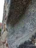
Here I left the walkers path along the scarp and beat up and through the deep heather to regain the wide ridge. At the first minor top there is a group of large natural stones, some made of conglomerate, one of which has strange erosion scoops and smoothings on its surface which appear strangely translucent and oddly beautiful in the piercing sunlight, like a melting jellyfish (233459). This location provides a natural grandstand back down to the sanctuary area.
Turning my back on it I floundered north along the wide spine. Within a few minutes I reached the large cairn at 511m, the highest point on these moors, where a new set of landscape reference points form themselves - the Llantysilio Mountains to the west, the wide Cheshire plain to the east, and World's End in the north where I now headed. Clouds cast darkly overhead intensifying the escaping sunlight which etched the cairn into relief against the horizon [note 5]. The going is tough; as well as the thick heather the ground is pock-marked with innumerable mining pits. Some stretches are relieved by strips cleared for grouse shooting but these never seem to go in the right direction.
Approaching World's End I was dispirited to see that the little alpine forest which adorned this secluded valley below the tiered limestone cliffs of Craig y Forwen (Maiden's Rock) and Craig y Moch has been recently 'harvested', leaving a sore sloughy wound in the land which will take years to heal. In the 1930's the Duke of Westminster rented a pheasant shoot here; he had huge estates in Sutherland which mainly offered fishing and stalking, but he required moorland shoots nearer to his home at Eaton Hall outside Chester. Norman Mursell, later to become the Duke's head gamekeeper recounts a distasteful incident from this time. Although the local farmers tolerated ramblers, the raising of game birds required peace and quiet so the gamekeepers kept watch for 'trespassers'. Mursell describes how one zealous gamekeeper used to look out from Craig y Forwen and one day, spying a couple setting up camp, he threatened them, kicked their cooking pot into the nearby brook and pulled up the guy ropes, forcing the campers to beat a retreat (Mursell 1996 63, 67).
The upland valley terrain beyond World's End and its monuments, a night in the forest and digressions on books and on George Borrow's walk across these moors in 1854.
Beyond World's End in the upland valley around Nant Craig Moch you enter another prehistoric terrain where the cairns seem to have a separate coherence and identity. Below lies the Eglwyseg Glen, a long fairly level valley with good pasture ground, and some arable potential in the base, nowadays occupied by a string of farms. At its northern termination lies World's End itself, a fairly steep, cliff-flanked headwall pierced by a modern zigzagging road leading to this remote heather- and bracken-covered gap in the moors which forms the crux of a natural routeway between the Alun valley to the north and the Vale of Llangollen to the south. It is a distinct high-level valley environment about three miles long which has seen human activity from the prehistoric times to the industrial revolution; again, its several cairns probably signify temporary summer stopping points on the seasonal round.
Skirting around the top of the headwall I briefly joined an old routeway on its final stretch across the moors from Mountain Lodge to the east (see fig x). This is an obvious made-trackway, perhaps associated with mining activity but there is a cairn and a barrow close above it, suggesting its on the line of a much more ancient way [note 6].
A few hundred yards further on it joins the little modern road where it crests onto the moor. Parallel with the road a score of yards to the west is the slight hollow of an earlier trackway coming up from the woods, presumably formed in the pre-tarmac era by those moving along the north-south routeway. Another cairn is marked on the map here and although I knew near enough where it should be I couldn't locate it amongst the heather. Nevertheless its situation crowning the lip of the watershed is significant, with tremendous views along the lush cliff-hemmed glen; it stands as a sentinel at the entrance to this long-wasted secret upland garden [note 7].
Under a shining sun and a risen moon I tramped happily north up the empty road towards the watershed, the edges of the asphalt peeling off and sinking into the turf and heather. On this gentle gradient there is no obvious earlier trail but it must be on or close to the traditional route. The rough gully of a stream runs alongside and I dropped down into it to investigate. Strangely, although very wet, no water flows, and every so often large scoops or quarries have been dug into its bed, perhaps something to do with mining works. Continuing along the little ravine, as I approached the watershed a heather-covered mound six feet high came into view, an obvious marker cairn sited in the cusp of this desolate terrain (234497).
Adjacent to the cairn a path strikes north west across the base of Cryn y Brain, dropping down to Hafod Bilston and Pant (where there is another tumulus). I think this must be on the line of an old route but nowadays it is part of the Offa's Dyke long distance footpath. Evening was drawing in and I hoped to make camp in the Llandegla plantation half a mile along the path above Hafod Bilston. This stretch of the footpath has become badly eroded due to the fragility of the peaty moor and the worst stretches have been protected by a walkway of pegged railway sleepers. As the light turned sullen the intense isolation of this bleak heather sea bored into my thoughts. This is always the worst time of a journey; petty worries squirm into my head - will I find water before dark, will I find a dry place to camp, why didn't I turn back before and go home? But then the path dropped a few feet to cross the Aber Sychnant, a little stream issuing from the slopes of Cyrn y Brain. Here is fresh clean water and up ahead is the forest, apparently planted in 1971 for paper maufacture, where I could make a bed.
Choosing a place on the verge of a side-track I started to make camp but in the twilight and gloom of the forest I stumbled on the uneven surface, pincushioning my hands on the pine needles. These unnatural plantations can be inhospitable, cold and damp, but this spot felt benign and still, like the eye in a storm. My candle, set by the open end of the shelter flickered but stayed lit, my breath making a mist in its light. From my pack I unwrapped the copy of George Borrow's Wild Wales I'd brought with me to read tonight. It was my grandfather's copy, an Everyman edition of 1920 with a green hardback cover, recently recovered from the bookshelves at my parents house in south Manchester where I was born and brought up. Their house spilled over with books encapsulating the thought-world of 20th century British socialism and the outdoors movement. My grandfather, a self-educated coffin-maker and avid walker was eclectic in his purchases, usually second-hand 'pocket' or Everyman editions of classic works of literature, poetry, history or travel. In the 1900's he was Book Secretary of the Blackburn branch of the Sunday Afternoon Club, helping fellow workers to save up to buy works - frequently political books on historical figures such as Gladstone, Cromwell or Keir Hardy. His also wrote his name inside copies of Jack London's The People of the Abyss, Thoreaux's Walden, and Stevenson's Travels with a Donkey amongst dozens of others.
I opened Borrow at chapter 61 where he describes his walking exploits on these very moors one Saturday nearly 150 years ago when he travelled from Llangollen to Wrexham. A local farmer had told him that the route across the moors was 'a short but wild road through the hills' and this had prompted him to journey this way (Borrow 330). Following the road past Dinas Bran and along the Eglwyseg Glen he approached World's End along the valley bottom. He writes:
'I entered the pass, passing under the strange-looking crag [Craig y Forwen, the Maiden's cliff]. After I had walked about half-a-mile the pass widened considerably, and a little further on debouched on some wild, moory ground.'
So far so good - we can place him somewhere on the watershed above World's End, but now we both begin to lose our bearings:
'Here the road became very indistinct. At length I stopped in a state of uncertainty. A well defined path presented itself, leading to the east, whilst northward before me [presumably the course of the modern tarmac road] there seemed scarcely any path at all.'
He took the track to the east, perhaps the old route which leads from above World's End across to Mountain Lodge noted above. In any event, he soon realised his mistake:
'By the time I arrived at the top of the hill the sun shone out, and I saw Rhiwabon and Cefn Mawr before me in the distance. 'I am going wrong' said I...'However I will not go back, but will steeplechase it across the country to Wrexham..' So turning aside from the path, I dashed across the hills...sometimes the heather was up to my knees, and sometimes I was up to my knees in quags. At length I came to a deep ravine, which I descended; at the bottom was a quagmire, which, however, I contrived to cross by means of certain stepping-stones, and came to a cart-path up a heathery hill. which I followed.' (357).
Although impossible to be sure, I suspect the deep ravine he describes is Nant-y-Cwm-Mawr, which I will come to shortly. Borrow is rightly renowned as a prodigious walker but most of his travels were on tracks and roads, so you have to respect his doggedness in crossing this terra incognita without map or compass. As he descended the far side of the hill he came on some miner's houses (possibly at Fron-deg 271494), carried on to a lane leading near Cadwgan Hall (299487) and thence on to Wrexham.
Chapter 62 recounts his return by the main road through Ruabon and Cefn-mawr in the evening of that same day. It presents an unforgettable picture of this physically large and confident middle-class Englishman fleetingly entering a proletarian world of rowdy pubs, drunken colliers and factories working full-belt into the night (358ff). He describes the scene which met him in the vicinity of Acrefair:
'Two enormous sheets of flame shot high into the air from ovens, illuminating two spectral chimneys as high as steeples, also smoky buildings, and grimy figures moving about. There was a clanging of engines, a noise of shovels and a falling of coals truly horrible. The glare was so great that I could distinctly see the minutest lines upon my hand.'
My candle flame wavered and snuffed into darkness. The cold had driven the blood from my arm so I closed the pages and dozed. Lying on my side with my ear against earth I sensed the soft ground shaking and rumbling as the whole sorry doomed forest, a single close-planted, paper-making organism, groaned and shifted its roots under the unsettled breathing of the wind. Much later I was woken by the soft cool touch of flakes of snow drifting onto my face from the open end of my bivouac. The wind had dropped and I lay still in the silent forest.
Aber Sychnant was still bubbling away when I returned to it early in the morning and I filled my bottle again from its cold black waters. Mud and peat on the pathway had frozen overnight making it much easier to walk on, but the snow had all but disappeared. Passing the large cairn once more I soon found its partner three hundred yards east north east beside the road, a fine barrow set amongst quarry pits with a leaning small 'boundary' stone set in the top as well as signs of human burrowing (237497). Adjacent is another similar small, thin 'boundary' stone; both may conceivably be prehistoric in origin. There is a third cairn in this little group although its more difficult to locate. Walking on a compass bearing (virtually impossible in this undulating and sodden terrain) I crossed the quarter mile to where it should be, and thrashed about in the deep heather until I triumphed - a slight bump on the side of the slope. This one lies on the opposite side of the Aber Sychnant and on the northern side of the watershed, and I wonder if it belongs to a different territory to the larger pair. Whatever the case, this cluster of monuments is in a classic location for summer settlement and subsequent ritual activity.
The modern hill road curves away north east to Minera, but the natural route follows the Aber Sychnant down to the north, gaining widening views of the lowlands on its descent. Traces of slightly worn pathways can be seen along here running downhill parallel with the stream, indicating past usage.
After investigating this way for a few minutes I struck back east, struggling across the deepening gully of the stream and then beat across the moor aiming for the road and the head of Nant y Cwm Mawr. Two wide mounds mark the site of mining shafts, now sealed by metal trapdoors (c.244500), and further on are some defunct grouse-butts - small pits surmounted by rotting wooden frames. The road is invisible in this terrain and there is no traffic; despite using my compass I veered nearly full circle on the featureless ground but eventually stumbled back onto the tarmac.
The struggle across Nant y Cwm Mawr, a visit to its remarkable isolated cairns, and the return to Acrefair around the eastern slopes of the moor.
At a bend in the road beside some spoil heaps is a good track leading up the slope, worn into the rock, perhaps of some antiquity (253501). It climbs steeply up to the northern shoulder above the cwm where I eventually located a ruined cairn on scraped, soaking, rock-strewn ground - a slight mound with a medium-sized slab lying on its side (255497). There is supposed to be at least one more cairn nearby but I couldn't see it. Although not apparent from below this is a master-viewpoint encompassing and linking in one bleak windswept panorama many of the cairns and terrains previously described. In the distance to the west I could see the mist-sheathed ridge of Cyrn-y-Brain, the Cegidog plain to the north, and the Wrexham plain to the east. South are the closer views across the moorland watershed towards World's End, whilst directly below and curving away to the south east is the steep-sided valley of Nant y Cwm Mawr itself.
Its difficult to convey the character of this cwm. Although not far from the hill road it sees few humans, and whilst less than 50m deep and 300m from lip to lip, it is the most awful terrain on these tough moors. I first came this way a few of years ago in misty weather. Having walked across from the lead mine at Minera my stride had adjusted to the deep heather, but when I unsuspectingly began descending into the cwm (I'd hardly noticed its existence on my small scale map), I had the sensation of stumbling off the surveyed world into a land where walking, clambering and scrabbling didn't result in any perceptible movement in relation to the landscape [note 8].
However, once upon a time its course signalled a passable way through the hills down onto the Wrexham Plain. Apart from the cairn-site just described two others are marked on the map, both unfortunately on the far side of the valley. Fixing a compass bearing towards the closest cairn I spotted what looked like a mining spoil-heap in its vicinity and using this as a target begin to traverse the gully. Taking a direct course here is impossible and I let the terrain buffet and carry me where it would. Getting down the deep heather on the slope was fairly easy but in the bottom are multiple threaded streams and mounds of soggy bracken. As I scrabbled up the far side I saw I'd missed what a path and good crossing place further along the cwm and made a note to use it as a crossing point in the unlikely event I ever came here again!
With great relief I reached heather moorland but was soon lost in its expanse with no sign of either cairn. Dispirited and with bowed head I slogged along one of the swathes cut in the heather hoping it would bring me away from this wretched place. It twisted and broke at random towards the watershed and suddenly I spotted one of the mounds about 50 yards away. It is very substantial, consisting of hundreds of tons of stone spread across about 20m, perhaps up to 2 metres high with a large dip in the middle (252489). From here you can see back across Nant-y-Cwm Mawr to the ruined master-cairn but the whole World's End territory is invisible; the main viewshed is deliberately eastward down to the Wrexham plain.
Having found one site by chance surely I could locate the other? And there it was, less than 400 metres diagonally down the slope towards the cwm. Instantly I realised that the mining spoil heap I originally sighted on was actually the cairn, so much bigger than I had expected. It is similar to, if a little larger and better preserved than its neighbour; still clean and shapely and, perhaps because of the large size of its stones, clear of heather. In their pristine state, perhaps tall and cylindrical with unknown forms of decoration and elaboration, these monuments must have been impressive features in the landscape [note 9]. A good worn pathway, long overgrown, passes close by this mound, parallel with the cwm rising from the eastern lowland. The map shows it as a path which peters out a kilometre to the west, possibly used for access to lead mines, but I'm sure that it more or less marks the line of an ancient way providing access into and across these uplands.
Rather than descend directly along this path I slowly traversed south east across the grain of the hill, where the heather and bracken is given over to grouse moor and rough sheep grazing. Soon I came within sight of Mountain Lodge, a group of buildings surrounded by tall pines encroaching onto the upland. I guess this was a shooting lodge, now a working farm. I heard voices and then saw two men busy at one of the outbuildings. This place stands next to the main historic route across the hill to World's End, marked by several impressively deep holloways snaking up the slope, towards a ?Bronze Age mound beside the pass a mile to the west (244477). Miners and quarrymen may have been responsible for some of this wear but surely these were droveways from lowland to upland or across the moors, perhaps originating in prehistory. At the stile where it meets the road I encountered a mountain-biker who was intending to cycle up the trail, over the top and down to World's End. His wheels would erode a little more of this ancient way.
The hill-road weaves and offshoots its way around the eastern side of the hill from Minera to Penycae and beyond; an asphalt line marking the boundary between the sloping tracts of fresh green pasture and the open moor. After following it for a few minutes I took a horrible miry path through Newtown Mountain plantation. Just uphill from here on the very edge of the moor are the stone ruins of a substantial building with the evocative name of 'Frozen Clock', apparently a 19th century broom manufactory utilising heather collected from the moor. There are various stories relating to the origin of the name but all relate to the low temperature causing the works clock to seize up (257453, Emery 1996 100).
The forest mudslide spat me out near Top Reservoir, fed by Trefechan Brook. This is a calm quiet place where I watched a family of waterfowl paddle in line across the small sheet of water. Amongst the trees at the head of the reservoir is a small but very distinct circular earthwork about 20 yards across and less than a couple of feet high looking like a well-preserved round house or perhaps a sheep shelter (c.266454). I'm not aware of any other prehistoric habitation sites in these uplands - but it lies at a good location for a prehistoric hafod site and perhaps significantly the Gardden Lodge hillfort lies two miles downstream to the east. Crossing a field I reached the road, and within a mile or so was back in Acrefair [note 10].
Note 1: Hafod is the location for the book ‘A Ram in the Well’ by Knox Mawer.
Note 2: The monuments are described in more detail in Burnham 1995, 29-30 and Davies 1929 (259ff with photo of the kerb circle on p. 266)
Note 3: 226454. A line of half-buried stones has been placed across its course a few yards along. Also there is an indistinct disused hollow path which heads directly from here towards the kerb cairn on the col but disappointingly this seems to be associated with a Post-Medieval quarry pit].
Note 4: Walking up this gully provides a spectacular approach from the valley to the sanctuary area. However, there are no signs of a worn trackway and it is unfeasible as a stock-route.]
Note 5: Cairn at 231464. A few stones apparently forming part of a kerb are visible on its south side].
Note 6: 237481, 236482. I found the cairn but couldn't locate the barrow]
Note 7: Cairn at 232486, holloway at c.232485. I'm struck by the topographic parallels between this cairn and that above the Afon Rhyader in the southern Berwyn (see chapter x).]
Note 8: rather like the traveller on a lonely country road in the disturbing ghost story 'Et in Sempiternum Pereant' who walks and walks but remains in the same place: 'There was about him a kind of void, in which he moved, hampered by this growing oppression of duration. ....the measure of it was but his breathing, and his breathing, as it grew slower and heavier, would become the measure of everlasting labour...' (Williams 1935 423).
Note 9: If you follow the stream down to the east I think you end up in the vicinity of the tumuli at Croesfoel Farm and Hafod-y-bwch (307481 and 309477) which may be the lowland equivalents to these cairns, perhaps even belonging to the same territory.
Note 10: Having studied the landscape in this way, my current view is that in the Bronze Age these uplands were the centre of a series of local, laddered territories, arranged like pie-slices to incorporate lowland and upland seasonally exploited catchments. Some of the barrows on the low ground may define their extent or mark the next series of localities. Its probable that each was integrated with larger terrains or regions covering wide tracts of their respective plains and valleys. Starting from the south and working clockwise, the following territories can be proposed:
The Tref y Nant catchment down to the Dee, with a sanctuary at its apex (perhaps a focal point for several of the surrounding communities). Trevor hillfort may relate to this zone.
Eglwyseg Glen, a complex area opening out onto the Vale of Llangollen with extensive valley ground may have been divided into more than one local territory. Dinas Bran was probably a special place well before the hillfort was built. The northern part of the glen had access to extensive uplands via World's End, probably as far as the cairns on the moorland watershed.
Further north there was probably a locality based on the Alun Valley, perhaps centred in the vicinity of Pant (where there is a surviving barrow) and inherited by Hafod Bilston.
The Aber Sychnant catchment extending north from the watershed cairns.
Nant y Cwm Mawr to the east, with at least two very large cairns.
We would also expect local land units based on Nant y Crogfryn and Trefechan Brook but no cairns are apparent. However, the Gardden Lodge Hillfort, which lies below their confluence, perhaps hints at this possibility.
See here for contents page, or here for the bibliography.
Note: This is part of an original series of articles written by archaeologist M M Robinson.

 We would like to know more about this location. Please feel free to add a brief description and any relevant information in your own language.
 Wir möchten mehr über diese Stätte erfahren. Bitte zögern Sie nicht, eine kurze Beschreibung und relevante Informationen in Deutsch hinzuzufügen.
 Nous aimerions en savoir encore un peu sur les lieux. S'il vous plaît n'hesitez pas à ajouter une courte description et tous les renseignements pertinents dans votre propre langue.
 Quisieramos informarnos un poco más de las lugares. No dude en añadir una breve descripción y otros datos relevantes en su propio idioma.