<< Our Photo Pages >> Bowl barrow west of Cockcrow Hill - Round Barrow(s) in England in Surrey
Submitted by Andy B on Tuesday, 28 October 2008 Page Views: 6652
Neolithic and Bronze AgeSite Name: Bowl barrow west of Cockcrow HillCountry: England
NOTE: This site is 2.192 km away from the location you searched for.
County: Surrey Type: Round Barrow(s)
Map Ref: TQ07635910
Latitude: 51.320833N Longitude: 0.456859W
Condition:
| 5 | Perfect |
| 4 | Almost Perfect |
| 3 | Reasonable but with some damage |
| 2 | Ruined but still recognisable as an ancient site |
| 1 | Pretty much destroyed, possibly visible as crop marks |
| 0 | No data. |
| -1 | Completely destroyed |
| 5 | Superb |
| 4 | Good |
| 3 | Ordinary |
| 2 | Not Good |
| 1 | Awful |
| 0 | No data. |
| 5 | Can be driven to, probably with disabled access |
| 4 | Short walk on a footpath |
| 3 | Requiring a bit more of a walk |
| 2 | A long walk |
| 1 | In the middle of nowhere, a nightmare to find |
| 0 | No data. |
| 5 | co-ordinates taken by GPS or official recorded co-ordinates |
| 4 | co-ordinates scaled from a detailed map |
| 3 | co-ordinates scaled from a bad map |
| 2 | co-ordinates of the nearest village |
| 1 | co-ordinates of the nearest town |
| 0 | no data |
Internal Links:
External Links:
I have visited· I would like to visit
Andy B has visited here
")
This ditch is no longer visible at ground level, having become infilled over the years, but survives as a buried feature c.3m wide.
You may be viewing yesterday's version of this page. To see the most up to date information please register for a free account.
")
")
Do not use the above information on other web sites or publications without permission of the contributor.
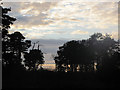
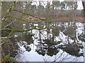
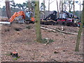
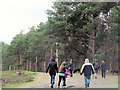
Nearby Images from Geograph Britain and Ireland:
©2011(licence)
©2008(licence)
©2008(licence)

©2012(licence)
©2011(licence)
The above images may not be of the site on this page, they are loaded from Geograph.
Please Submit an Image of this site or go out and take one for us!
Click here to see more info for this site
Nearby sites
Key: Red: member's photo, Blue: 3rd party photo, Yellow: other image, Green: no photo - please go there and take one, Grey: site destroyed
Download sites to:
KML (Google Earth)
GPX (GPS waypoints)
CSV (Garmin/Navman)
CSV (Excel)
To unlock full downloads you need to sign up as a Contributory Member. Otherwise downloads are limited to 50 sites.
Turn off the page maps and other distractions
Nearby sites listing. In the following links * = Image available
274m E 81° Cockrow Hill Bell Barrow* Round Barrow(s) (TQ07905915)
1.0km ENE 61° Red Hill (Surrey)* Henge (TQ08505961)
2.8km NNE 19° St George's Hill* Hillfort (TQ085618)
3.2km WNW 287° Jack Temple Healing Centre* Modern Stone Circle etc (TQ045600)
3.8km W 266° Pyrford Stone* Marker Stone (TQ0382258782)
6.0km W 278° Horsell Common E* Round Barrow(s) (TQ01615977)
6.3km W 278° Horsell Common W* Barrow Cemetery (TQ01405980)
8.7km NNW 337° Chertsey Museum Museum (TQ040670)
8.8km W 274° Horsell Birch Natural Stone / Erratic / Other Natural Feature (SU98805956)
8.9km SW 235° Jacobs Well* Holy Well or Sacred Spring (TQ004538)
9.2km N 2° Shepperton Henge* Henge (TQ07686832)
9.5km WNW 302° Chobham Common (1)* Misc. Earthwork (SU994639)
9.6km ESE 111° Thorncroft Spring (Leatherhead)* Holy Well or Sacred Spring (TQ167558)
9.7km WSW 237° Whitmoor Common* Round Barrow(s) (SU996536)
9.9km NNW 331° St Ann's Hill* Hillfort (TQ026676)
10.0km E 86° Ashtead Common Earthwork* Misc. Earthwork (TQ176600)
10.1km NNW 331° The Nun's Well (Surrey)* Holy Well or Sacred Spring (TQ0247767756)
10.1km NW 304° Longcross Barrow* Round Barrow(s) (SU99126466)
10.4km NW 307° Flutters Hill Barrow* Round Barrow(s) (SU99206516)
10.6km S 190° The Silent Pool* Holy Well or Sacred Spring (TQ0606148582)
10.9km SSW 192° Weston Woods Cromlech* Standing Stones (TQ05644839)
10.9km SSW 192° Weston Wood Platform Mound* Round Barrow(s) (TQ055484)
10.9km NW 308° Barrowhills Round Barrow(s) (SU98866567)
11.3km SSW 193° Albury Fishponds* Natural Stone / Erratic / Other Natural Feature (TQ053480)
11.4km WNW 298° Albury Bottom Enclosure* Misc. Earthwork (SU97426430)
View more nearby sites and additional images


 We would like to know more about this location. Please feel free to add a brief description and any relevant information in your own language.
 Wir möchten mehr über diese Stätte erfahren. Bitte zögern Sie nicht, eine kurze Beschreibung und relevante Informationen in Deutsch hinzuzufügen.
 Nous aimerions en savoir encore un peu sur les lieux. S'il vous plaît n'hesitez pas à ajouter une courte description et tous les renseignements pertinents dans votre propre langue.
 Quisieramos informarnos un poco más de las lugares. No dude en añadir una breve descripción y otros datos relevantes en su propio idioma.