


<< Our Photo Pages >> Chobham Common (1) - Misc. Earthwork in England in Surrey
Submitted by kelpie on Sunday, 22 August 2004 Page Views: 11933
Multi-periodSite Name: Chobham Common (1) Alternative Name: Old Slade Bog, Bat's HogstyeCountry: England County: Surrey Type: Misc. Earthwork
Nearest Town: Chertsey Nearest Village: Chobham
Map Ref: SU994639
Latitude: 51.365476N Longitude: 0.573583W
Condition:
| 5 | Perfect |
| 4 | Almost Perfect |
| 3 | Reasonable but with some damage |
| 2 | Ruined but still recognisable as an ancient site |
| 1 | Pretty much destroyed, possibly visible as crop marks |
| 0 | No data. |
| -1 | Completely destroyed |
| 5 | Superb |
| 4 | Good |
| 3 | Ordinary |
| 2 | Not Good |
| 1 | Awful |
| 0 | No data. |
| 5 | Can be driven to, probably with disabled access |
| 4 | Short walk on a footpath |
| 3 | Requiring a bit more of a walk |
| 2 | A long walk |
| 1 | In the middle of nowhere, a nightmare to find |
| 0 | No data. |
| 5 | co-ordinates taken by GPS or official recorded co-ordinates |
| 4 | co-ordinates scaled from a detailed map |
| 3 | co-ordinates scaled from a bad map |
| 2 | co-ordinates of the nearest village |
| 1 | co-ordinates of the nearest town |
| 0 | no data |
Internal Links:
External Links:
I have visited· I would like to visit
Andy B has visited here
 (PID:12214)")
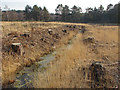
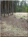
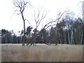
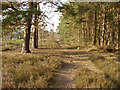
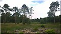
Small earthwork on Chobham Common.
Cross the road opposite Fishpool Car Park, take the left-hand footpath and follow this round the edge of the open space. Just beyond the trees of the clearing is a small dyke/ditch/dyke surrounded enclosure. Lots of rabbit holes !
You may be viewing yesterday's version of this page. To see the most up to date information please register for a free account.
 (PID:12213)")
 (PID:12212)")
 (PID:12211)")
 (PID:7855)")
Do not use the above information on other web sites or publications without permission of the contributor.
Nearby Images from Geograph Britain and Ireland:
©2014(licence)
©2011(licence)
©2006(licence)
©2014(licence)
©2014(licence)
The above images may not be of the site on this page, they are loaded from Geograph.
Please Submit an Image of this site or go out and take one for us!
Click here to see more info for this site
Nearby sites
Key: Red: member's photo, Blue: 3rd party photo, Yellow: other image, Green: no photo - please go there and take one, Grey: site destroyed
Download sites to:
KML (Google Earth)
GPX (GPS waypoints)
CSV (Garmin/Navman)
CSV (Excel)
To unlock full downloads you need to sign up as a Contributory Member. Otherwise downloads are limited to 50 sites.
Turn off the page maps and other distractions
Nearby sites listing. In the following links * = Image available
809m NNW 341° Longcross Barrow* Round Barrow(s) (SU99126466)
1.3km N 352° Flutters Hill Barrow* Round Barrow(s) (SU99206516)
1.8km NNW 344° Barrowhills Round Barrow(s) (SU98866567)
2.0km WNW 283° Albury Bottom Enclosure* Misc. Earthwork (SU97426430)
4.3km NNW 342° Leptis Magna (Virginia Waters)* Ancient Temple (SU980680)
4.4km S 189° Horsell Birch Natural Stone / Erratic / Other Natural Feature (SU98805956)
4.6km SSE 155° Horsell Common W* Barrow Cemetery (TQ01405980)
4.7km SSE 153° Horsell Common E* Round Barrow(s) (TQ01615977)
4.9km WNW 302° Sunningdale Barrows Round Barrow(s) (SU952664)
4.9km NE 42° St Ann's Hill* Hillfort (TQ026676)
4.9km NE 40° The Nun's Well (Surrey)* Holy Well or Sacred Spring (TQ0247767756)
5.5km ENE 57° Chertsey Museum Museum (TQ040670)
5.8km SW 222° St John the Baptist's Well* Holy Well or Sacred Spring (SU956595)
6.3km WSW 247° New England Barrow Round Barrow(s) (SU93616129)
6.4km SE 129° Jack Temple Healing Centre* Modern Stone Circle etc (TQ045600)
6.8km SE 140° Pyrford Stone* Marker Stone (TQ0382258782)
6.8km WSW 249° West End Common Barrows* Barrow Cemetery (SU931614)
8.3km NNE 27° Negen Stones Standing Stones (TQ030714)
9.2km NNE 20° Staines Enclosure* Causewayed Enclosure (TQ024726)
9.3km ESE 104° St George's Hill* Hillfort (TQ085618)
9.4km ENE 63° Shepperton Henge* Henge (TQ07686832)
9.4km WNW 302° Bowledge Hill Bell Barrow* Round Barrow(s) (SU91336872)
9.5km ESE 121° Bowl barrow west of Cockcrow Hill* Round Barrow(s) (TQ07635910)
9.7km SSW 209° Bullswater Common Barrows Barrow Cemetery (SU9487555356)
9.7km NE 39° Ashford Henge* Henge (TQ054715)
View more nearby sites and additional images


 We would like to know more about this location. Please feel free to add a brief description and any relevant information in your own language.
 Wir möchten mehr über diese Stätte erfahren. Bitte zögern Sie nicht, eine kurze Beschreibung und relevante Informationen in Deutsch hinzuzufügen.
 Nous aimerions en savoir encore un peu sur les lieux. S'il vous plaît n'hesitez pas à ajouter une courte description et tous les renseignements pertinents dans votre propre langue.
 Quisieramos informarnos un poco más de las lugares. No dude en añadir una breve descripción y otros datos relevantes en su propio idioma.