<< Our Photo Pages >> Strawberry Lea - Ring Cairn in England in Derbyshire
Submitted by vicky on Friday, 21 March 2003 Page Views: 7057
Neolithic and Bronze AgeSite Name: Strawberry LeaCountry: England
NOTE: This site is 0.4 km away from the location you searched for.
County: Derbyshire Type: Ring Cairn
Nearest Town: Dronfield Nearest Village: Lidgate
Map Ref: SK287799 Landranger Map Number: 119
Latitude: 53.315260N Longitude: 1.570675W
Condition:
| 5 | Perfect |
| 4 | Almost Perfect |
| 3 | Reasonable but with some damage |
| 2 | Ruined but still recognisable as an ancient site |
| 1 | Pretty much destroyed, possibly visible as crop marks |
| 0 | No data. |
| -1 | Completely destroyed |
| 5 | Superb |
| 4 | Good |
| 3 | Ordinary |
| 2 | Not Good |
| 1 | Awful |
| 0 | No data. |
| 5 | Can be driven to, probably with disabled access |
| 4 | Short walk on a footpath |
| 3 | Requiring a bit more of a walk |
| 2 | A long walk |
| 1 | In the middle of nowhere, a nightmare to find |
| 0 | No data. |
| 5 | co-ordinates taken by GPS or official recorded co-ordinates |
| 4 | co-ordinates scaled from a detailed map |
| 3 | co-ordinates scaled from a bad map |
| 2 | co-ordinates of the nearest village |
| 1 | co-ordinates of the nearest town |
| 0 | no data |
Internal Links:
External Links:
I have visited· I would like to visit
maddy visited on 1st Jan 1996 This is actually in Yorkshire above Totley en route to the Fox House Road.
")
Have you visited this site? Please add a comment below.
You may be viewing yesterday's version of this page. To see the most up to date information please register for a free account.
Do not use the above information on other web sites or publications without permission of the contributor.
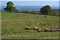
Nearby Images from Geograph Britain and Ireland:
©2020(licence)
©2016(licence)
©2019(licence)
©2010(licence)
©2019(licence)
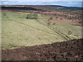
The above images may not be of the site on this page, they are loaded from Geograph.
Please Submit an Image of this site or go out and take one for us!
Click here to see more info for this site
Nearby sites
Key: Red: member's photo, Blue: 3rd party photo, Yellow: other image, Green: no photo - please go there and take one, Grey: site destroyed
Download sites to:
KML (Google Earth)
GPX (GPS waypoints)
CSV (Garmin/Navman)
CSV (Excel)
To unlock full downloads you need to sign up as a Contributory Member. Otherwise downloads are limited to 50 sites.
Turn off the page maps and other distractions
Nearby sites listing. In the following links * = Image available
905m S 174° Brown Edge* Stone Circle (SK288790)
1.5km NW 307° Ciceley Low II* Ring Cairn (SK2752080782)
1.5km NW 307° Ciceley Low I* Ring Cairn (SK2752080782)
1.6km NNE 15° Giant's Chair (Yorkshire)* Standing Stone (Menhir) (SK291814)
1.7km NW 306° Fingerem Stone* Cairn (SK273809)
1.9km SSE 168° Owler Bar Cairn (SK291780)
2.2km WSW 257° Little John's Well (Hathersage)* Holy Well or Sacred Spring (SK266794)
2.2km N 350° God's Spring* Holy Well or Sacred Spring (SK283821)
2.5km ENE 62° Peace Well* Holy Well or Sacred Spring (SK3093881126)
2.5km N 349° Harrys Stone* Ancient Temple (SK282824)
2.6km S 188° Barbrook 3* Stone Circle (SK28337728)
2.8km SW 220° The Hurkling Stone* Marker Stone (SK269777)
2.9km SW 219° White Edge Cairn* Cairn (SK26847762)
3.0km WNW 284° Toads Mouth (Hathersage)* Natural Stone / Erratic / Other Natural Feature (SK258806)
3.1km WNW 301° Carl Wark* Hillfort (SK260815)
3.2km WNW 289° Hathersage Moor Ring Cairn (SK257809)
3.4km W 269° Lawrence Field* Stone Circle (SK253798)
3.7km WNW 293° Winyards Nick* Round Barrow(s) (SK253813)
4.2km SSW 193° Barbrook 2* Stone Circle (SK27757582)
4.3km SSW 196° Big Moor Cairns SW* Barrow Cemetery (SK27587579)
4.3km S 177° Barbrook 4* Ring Cairn (SK2896375621)
4.3km SSW 192° Big Moor Cairn Field* Barrow Cemetery (SK278757)
4.4km S 191° Barbrook cairn* Cairn (SK27917561)
4.4km SSW 191° Barbrook 1* Stone Circle (SK27857558)
4.4km SSW 194° Barbrook Cupmarked Stone* Standing Stone (Menhir) (SK27647560)
View more nearby sites and additional images


 We would like to know more about this location. Please feel free to add a brief description and any relevant information in your own language.
 Wir möchten mehr über diese Stätte erfahren. Bitte zögern Sie nicht, eine kurze Beschreibung und relevante Informationen in Deutsch hinzuzufügen.
 Nous aimerions en savoir encore un peu sur les lieux. S'il vous plaît n'hesitez pas à ajouter une courte description et tous les renseignements pertinents dans votre propre langue.
 Quisieramos informarnos un poco más de las lugares. No dude en añadir una breve descripción y otros datos relevantes en su propio idioma.