Featured: Hare and Tabor T Shirts for discerning antiquarians

Hare and Tabor T Shirts for discerning antiquarians

Prehistoric Cumbria

Prehistoric Cumbria

Who's Online

There are currently, 333 guests and 4 members online.

You are a guest. To join in, please register for free by clicking here

Sponsors

<< Our Photo Pages >> Carl Wark - Hillfort in England in Derbyshire

Submitted by vicky on Sunday, 11 July 2010  Page Views: 20534

Iron Age and Later PrehistorySite Name: Carl Wark
Country: England County: Derbyshire Type: Hillfort
Nearest Town: Sheffield  Nearest Village: Hathersage
Map Ref: SK260815  Landranger Map Number: 110
Latitude: 53.329781N  Longitude: 1.61107W
Condition:
5Perfect
4Almost Perfect
3Reasonable but with some damage
2Ruined but still recognisable as an ancient site
1Pretty much destroyed, possibly visible as crop marks
0No data.
-1Completely destroyed
3 Ambience:
5Superb
4Good
3Ordinary
2Not Good
1Awful
0No data.
4 Access:
5Can be driven to, probably with disabled access
4Short walk on a footpath
3Requiring a bit more of a walk
2A long walk
1In the middle of nowhere, a nightmare to find
0No data.
3 Accuracy:
5co-ordinates taken by GPS or official recorded co-ordinates
4co-ordinates scaled from a detailed map
3co-ordinates scaled from a bad map
2co-ordinates of the nearest village
1co-ordinates of the nearest town
0no data
3

Internal Links:
External Links:

I have visited· I would like to visit

SolarMegalith elad13 would like to visit

Marko visited on 22nd Oct 2022 - their rating: Cond: 2 Amb: 3 Access: 3

Couplands visited on 18th Aug 2022 - their rating: Cond: 2 Amb: 4 Access: 3

h_fenton TimPrevett MartinRS have visited here

Average ratings for this site from all visit loggers: Condition: 2 Ambience: 3.5 Access: 3

Carl Wark
Carl Wark submitted by Vicky : Carl Wark, near Hathersage, Derbyshire GR: SK260815 The huge dry-stone wall defences at Carl Wark hillfort. (Vote or comment on this photo)
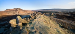
Hillfort in Derbyshire. Described as ‘amongst the most spectacular and easily accessible forts in the country’, Carl Wark is located on a rocky outcrop of gritstone on Hathersage Moor, 380m (1246 ft) above sea level.

The site encloses an area of about 0.8 hectares (2 acres) and is defended naturally on most sides by steep slopes. The side that is not protected by nature has seen the addition of a high rampart, constructed from earth and faced with a wall of large gritstone boulders.

Note: Two walks, Sun 18 July and Wed 21st July for the Festival of British Archaeology 2010
You may be viewing yesterday's version of this page. To see the most up to date information please register for a free account.
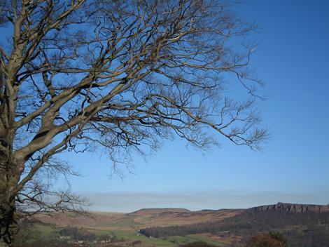

Carl Wark viewed from Eyam Moor
Carl Wark viewed from Eyam Moor submitted by rjbardell : View of Hathersage Moor in the Peak District including Carl Wark stoneage fort SK260814 (1 comment - Vote or comment on this photo)

Carl Wark
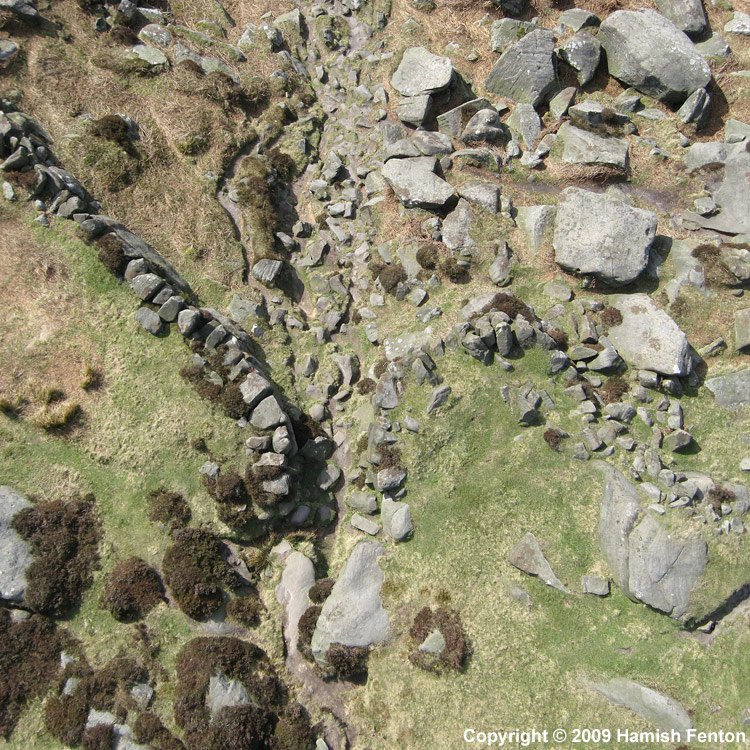
Carl Wark submitted by h_fenton : Carl Wark Kite Aerial Photograph, 5 April 2009 (4 comments - Vote or comment on this photo)

Carl Wark
Carl Wark submitted by PaulM : The boulder-strewn interior of Carl Wark hillfort in Derbyshire. GR: SK260815 (1 comment - Vote or comment on this photo)

Carl Wark
Carl Wark submitted by h_fenton : Vertical Kite Aerial View of the entrance to Carl Wark, the bottom of the photo is inside. Kite Aerial Photograph, 5 April 2009 (Vote or comment on this photo)

Carl Wark
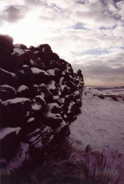
Carl Wark submitted by bigjohnbooth : Carl Wark Escarpment Hillfort, Derbyshire - Grid ref:258815 This picture was taken at the beginning of this January 01/03. It was a bitterly cold day but I was glad that I went up there after being rewarded with this tremendous shot. (1 comment - Vote or comment on this photo)

Carl Wark
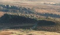
Carl Wark submitted by royston7 : Here we see Carl Wark in the distance as shot from Higgor Tor. From this angle the shape of the "hillfort" is clear.

Carl Wark
Carl Wark submitted by royston7 : The great west wall shown with a 1.25m high pole for scale. The wall is now leaning inwards as it slowly sinks into the earth foundations.

Carl Wark
Carl Wark submitted by postman : From on Higger Tor

Carl Wark
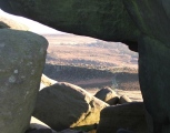
Carl Wark submitted by postman : Through the rocks on Higger Tor

Carl Wark
Carl Wark submitted by postman : From on Higger Tor

Carl Wark
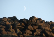
Carl Wark submitted by postman : walling up the moon.

Carl Wark
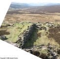
Carl Wark submitted by h_fenton : Vertical Kite Aerial Photograph of the rampart on the western end of Carl Wark 5 April 2009

Carl Wark
Carl Wark submitted by h_fenton : Oblique aerial view (from the north) of the rampart on the western end of Carl Wark Kite Aerial Photograph, 5 April 2009

Carl Wark
Carl Wark submitted by funsize : Carl Wark hillfort is of disputed age - possibly Iron Age with Roman modifications. The jury is still out. It is a fantastic structure: this view shows the earthen bank which tops the fortification made up of an oversized drystone wall. The site is on a natural plateau overlooked by flat-topped Higger Tor (hill) to the north west. (1 comment)

Carl Wark
Carl Wark submitted by cityofgold : This picture taken after walking down to the base of Higgar Tor gives an idea of the size of the hillfort. Carl Wark is an escarpment hill fort which uses the very steep natural cliffs to give the fort around 90% of its defenses. To give a feel for dimension, the man made wall seen in the first picture on this site is 3m in height, which means the sheer cliffs rise from a height of 15m to about 25...

Carl Wark
Carl Wark submitted by cityofgold : A balancing rock at Carls Wark.

Carl Wark
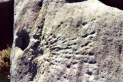
Carl Wark submitted by andy_h : Possible carving on near by Higger Tor (7 comments)

Carl Wark
Carl Wark submitted by andy_h : Possible carved line in rock, facing approx NE (9 comments)

Carl Wark
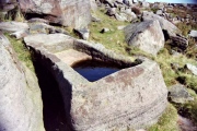
Carl Wark submitted by andy_h : Stone Basin (Horse Trough?) (2 comments)

Carl Wark
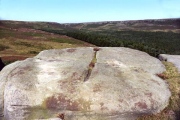
Carl Wark submitted by TimPrevett : Features at Carl Wark - notice the straight wall forming a right angle, bottom right, and the trough like boulder in the top left, and stone with a large hollow, in the centre. An intriguing site, to say the least! (1 comment)

Carl Wark
Carl Wark submitted by PaulM : Carl Wark Hillfort, near Hathersage, Derbyshire GR: SK260815 Described as ‘amongst the most spectacular and easily accessible forts in the country’, Carl Wark is located on a rocky outcrop of gritstone on Hathersage Moor, 380m (1246 ft) above sea level. The site encloses an area of about 0.8 hectares (2 acres) and is defended naturally on most sides by steep slopes. The side that is not p... (1 comment)

Carl Wark
Carl Wark submitted by royston7 : The southern wall of carl wark. Many boulders have fallen- or been used for later purposes - from the walls. On the eastern lower edges can be found remains of damaged millstones, worked in the 16th - 18th C.

Carl Wark
Carl Wark submitted by royston7 : This shot is of the south-west entrance - where the great west wall turns inwards. Taken from below the entrance.

Carl Wark
Carl Wark submitted by royston7 : (See other shot looking east). Another explanation for this site could be that it was used as a meeting place, as used by the "hundreds" and "burrs" in post-roman times.

These are just the first 25 photos of Carl Wark. If you log in with a free user account you will be able to see our entire collection.

Do not use the above information on other web sites or publications without permission of the contributor.
Click here to see more info for this site

Nearby sites

Click here to view sites on an interactive OS map

Key: Red: member's photo, Blue: 3rd party photo, Yellow: other image, Green: no photo - please go there and take one, Grey: site destroyed

Download sites to:
KML (Google Earth)
GPX (GPS waypoints)
CSV (Garmin/Navman)
CSV (Excel)

To unlock full downloads you need to sign up as a Contributory Member. Otherwise downloads are limited to 50 sites.


Turn off the page maps and other distractions

Nearby sites listing. In the following links * = Image available
 670m SSW 207° Hathersage Moor Ring Cairn (SK257809)
 726m WSW 254° Winyards Nick* Round Barrow(s) (SK253813)
 921m SSW 193° Toads Mouth (Hathersage)* Natural Stone / Erratic / Other Natural Feature (SK258806)
 1.4km ESE 115° Fingerem Stone* Cairn (SK273809)
 1.7km ESE 116° Ciceley Low I* Ring Cairn (SK2752080782)
 1.7km ESE 116° Ciceley Low II* Ring Cairn (SK2752080782)
 1.8km SSW 203° Lawrence Field* Stone Circle (SK253798)
 2.2km SSE 164° Little John's Well (Hathersage)* Holy Well or Sacred Spring (SK266794)
 2.4km ENE 76° God's Spring* Holy Well or Sacred Spring (SK283821)
 2.4km ENE 68° Harrys Stone* Ancient Temple (SK282824)
 2.6km NW 323° Robin Hood's Cave* Cave or Rock Shelter (SK244836)
 3.1km W 270° Healing Spring* Holy Well or Sacred Spring (SK229815)
 3.1km E 92° Giant's Chair (Yorkshire)* Standing Stone (Menhir) (SK291814)
 3.1km ESE 121° Strawberry Lea* Ring Cairn (SK287799)
 3.2km NW 307° Trinity Well (Hathersage)* Holy Well or Sacred Spring (SK234834)
 3.4km NW 311° North Lees Romano British Village* Ancient Village or Settlement (SK2343083673)
 3.7km SW 228° Eyam Moor II* Stone Circle (SK232790)
 3.7km SE 132° Brown Edge* Stone Circle (SK288790)
 3.9km SW 226° Eyam Moor III* Stone Circle (SK232788)
 3.9km SSE 167° The Hurkling Stone* Marker Stone (SK269777)
 4.0km SSE 168° White Edge Cairn* Cairn (SK26847762)
 4.0km NW 312° Sheepwash Bank Cairn (SK230842)
 4.1km NW 309° Dennis Knoll* Cairn (SK228841)
 4.3km SW 234° Wet Withens* Stone Circle (SK22557900)
 4.3km SW 234° Eyam Moor Barrow* Long Barrow (SK22547900)
View more nearby sites and additional images

<< Musee du Chatillonais

Levenwick Broch >>

Please add your thoughts on this site

Chariot of the Soul by Linda Proud - a compelling tale of Britain, Rome and one man

Chariot of the Soul by Linda Proud - a compelling tale of Britain, Rome and one man

Sponsors

Auto-Translation (Google)

Translate from English into:

"Carl Wark" | Login/Create an Account | 6 News and Comments
  
Go back to top of page    Comments are owned by the poster. We aren't responsible for their content.
Re: Burbage Valley Time Traveller Audio Trail by Anonymous on Friday, 08 July 2016
After a lovely walk to Carl Wark hillside foot we came across a large stone water trough and wondered when this would have been carved out.
Kind Regards
Fell Walkers Tina & Bill
six
[ Reply to This ]

Re: Carl Wark by Climbingrev on Saturday, 18 January 2014
(User Info | Send a Message)
http://twitter.com/climbingrev/status/424549011106697216/photo/1

Came across this stone when walking near Carl Wark. Rock art, or military damage? The longest line does point pretty much at the setting winter sun (seen around sunset on 8th December).
[ Reply to This ]
    Re: Carl Wark by Blingo_von_Trumpenstein on Monday, 20 January 2014
    (User Info | Send a Message)
    .303 bullet impact from a Lee Enfield rifle. Target range during WW2. Have found many bullets around there...sorry...
    [ Reply to This ]

Moving Stone through the Ages: Carl Wark Hillfort and the Quarries, Wed 21 July by Andy B on Sunday, 11 July 2010
(User Info | Send a Message)
Moving Stone through the Ages: Carl Wark Hillfort and the Burbage Quarries

Wed 21 July 10.30–16.00

A walk taking in quarries, iron smelting, a prehistoric cairnfield and the enigmatic carl Wark hillfort. c. 5 miles, rough ground. Bring packed lunch. …

A daytime walk with an archaeologist taking in impressive quarries of medieval to recent date, early iron smelting, a prehistoric cairnfield, and the impressive but enigmatic carl Wark hillfort. Led by John Barnatt. The walk is about 5 miles and includes footpaths and off-path walking across rough ground. Bring packed lunch. Booking essential.

Location: Pay and Display Car Park just west of Upper Burbage Bridge. Next to minor road between Ringinglow on the outskirts of Sheffield and Hathersage

O: Peak District National Park Authority
T: 01626 816200
E: customer.service@peakdistrict.gov.uk
[ Reply to This ]

Sheffield's Prehistoric Past walk, Sun 18 July by Andy B on Sunday, 11 July 2010
(User Info | Send a Message)
Sheffield's Prehistoric Past

Sun 18 July 11.00–16.00

A guided walk, on the outskirts of the city, investigating the remains of a prehistoric community and the enigmatic carl Wark hillfort. …

A guided walk on the outskirts of Sheffield, visiting a prehistoric landscape where the remains left behind by prehistoric people can still be identified. The walk will also ascend the ramparts of the enigmatic carl Wark hillfort and climb to the top of a hill to see the tomb of a community ancestor. Most of the features visited are now Scheduled Ancient Monuments. The walk is about 4km in length across moorland and includes some rough ground and boggy areas. A packed lunch will be necessary and appropriate clothing and footwear. For safety and logistic reasons, the tour is restricted to around 25 people but, if demand is high, the walk will be repeated on the following weekend. The walk will be guided by Dr. Phil Sidebottom of West Riding Archaeological Consultancy (WRAC). Please e-mail us at WRACarch@aol.com to reserve your place or for further details (or write to WRAC at 22, Bramwith Road, Sheffield S11 7EZ). £2.00 per person. Free entry for YAC groups when accompanied by YAC leaders.

Location: Meet at the ‘Surprise’ car park, west of Sheffield, on the A6187.. Leave Sheffield westwards on the A625 and take the A6187 at Fox House. After approx. ¾ mile, the Surprise car park is on the right.

O: West Riding Archaeological Consultancy
N: Dr Phil Sidebottom
T: 07538 895250
E: wracarch@aol.com
W: http://www.wrac.eu

Festival of British Archaeology 2010
[ Reply to This ]

Burbage Valley Time Traveller Audio Trail by Andy B on Saturday, 13 February 2010
(User Info | Send a Message)
Take a trip through the Burbage Valley from pre-historic times until today with Macey, a 2nd Class Accredited Interpreter-Traveller with the Institute of Time Travellers. Using state-of-the-art time travelling equipment you will be able to see how life has changed in this valley over the past 3000 years

http://www.moorsforthefuture.org.uk/mftf/audio_trails/burbage.htm
[ Reply to This ]

Your Name: Anonymous [ Register Now ]
Subject:


Add your comment or contribution to this page. Spam or offensive posts are deleted immediately, don't even bother

<<< What is five plus one as a number? (Please type the answer to this question in the little box on the left)
You can also embed videos and other things. For Youtube please copy and paste the 'embed code'.
For Google Street View please include Street View in the text.
Create a web link like this: <a href="https://www.megalithic.co.uk">This is a link</a>  

Allowed HTML is:
<p> <b> <i> <a> <img> <em> <br> <strong> <blockquote> <tt> <li> <ol> <ul> <object> <param> <embed> <iframe>

We would like to know more about this location. Please feel free to add a brief description and any relevant information in your own language.
Wir möchten mehr über diese Stätte erfahren. Bitte zögern Sie nicht, eine kurze Beschreibung und relevante Informationen in Deutsch hinzuzufügen.
Nous aimerions en savoir encore un peu sur les lieux. S'il vous plaît n'hesitez pas à ajouter une courte description et tous les renseignements pertinents dans votre propre langue.
Quisieramos informarnos un poco más de las lugares. No dude en añadir una breve descripción y otros datos relevantes en su propio idioma.