<< Our Photo Pages >> Barbrook Cupmarked Stone - Standing Stone (Menhir) in England in Derbyshire
Submitted by charlton on Monday, 26 March 2018 Page Views: 3496
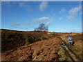
Neolithic and Bronze AgeSite Name: Barbrook Cupmarked StoneCountry: England County: Derbyshire Type: Standing Stone (Menhir)
Map Ref: SK27647560
Latitude: 53.276666N Longitude: 1.586958W
Condition:
| 5 | Perfect |
| 4 | Almost Perfect |
| 3 | Reasonable but with some damage |
| 2 | Ruined but still recognisable as an ancient site |
| 1 | Pretty much destroyed, possibly visible as crop marks |
| 0 | No data. |
| -1 | Completely destroyed |
| 5 | Superb |
| 4 | Good |
| 3 | Ordinary |
| 2 | Not Good |
| 1 | Awful |
| 0 | No data. |
| 5 | Can be driven to, probably with disabled access |
| 4 | Short walk on a footpath |
| 3 | Requiring a bit more of a walk |
| 2 | A long walk |
| 1 | In the middle of nowhere, a nightmare to find |
| 0 | No data. |
| 5 | co-ordinates taken by GPS or official recorded co-ordinates |
| 4 | co-ordinates scaled from a detailed map |
| 3 | co-ordinates scaled from a bad map |
| 2 | co-ordinates of the nearest village |
| 1 | co-ordinates of the nearest town |
| 0 | no data |
Internal Links:
External Links:
I have visited· I would like to visit
Alma23 would like to visit
Catrinm visited on 17th Nov 2018 - their rating: Cond: 4 Amb: 4 Access: 3
")
Rich32 says: They're almost certainly bullet impacts rather than prehistoric cup marks. All the markings seem to have secondary irregular fracturing (spalling) around a deeper depression. I've surveyed rock art for EH/HE on MOD firing ranges and these markings are typical of the type caused by projectiles.
You may be viewing yesterday's version of this page. To see the most up to date information please register for a free account.
")
")
Do not use the above information on other web sites or publications without permission of the contributor.
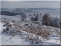
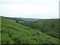
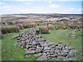
Nearby Images from Geograph Britain and Ireland:
©2013(licence)
©2010(licence)
©2013(licence)
©2005(licence)
©2009(licence)
The above images may not be of the site on this page, they are loaded from Geograph.
Please Submit an Image of this site or go out and take one for us!
Click here to see more info for this site
Nearby sites
Key: Red: member's photo, Blue: 3rd party photo, Yellow: other image, Green: no photo - please go there and take one, Grey: site destroyed
Download sites to:
KML (Google Earth)
GPX (GPS waypoints)
CSV (Garmin/Navman)
CSV (Excel)
To unlock full downloads you need to sign up as a Contributory Member. Otherwise downloads are limited to 50 sites.
Turn off the page maps and other distractions
Nearby sites listing. In the following links * = Image available
188m ENE 58° Big Moor Cairn Field* Barrow Cemetery (SK278757)
199m NNW 343° Big Moor Cairns SW* Barrow Cemetery (SK27587579)
210m E 96° Barbrook 1* Stone Circle (SK27857558)
244m SW 215° Big Moor* Ancient Village or Settlement (SK275754)
246m NNE 27° Barbrook 2* Stone Circle (SK27757582)
269m E 88° Barbrook cairn* Cairn (SK27917561)
743m SW 217° Swine Sty* Ancient Village or Settlement (SK272750)
753m WSW 238° Barbrook 5* Ring Cairn (SK270752)
1.3km E 89° Barbrook 4* Ring Cairn (SK2896375621)
1.8km NNE 23° Barbrook 3* Stone Circle (SK28337728)
2.2km NNW 339° White Edge Cairn* Cairn (SK26847762)
2.2km NNW 341° The Hurkling Stone* Marker Stone (SK269777)
2.3km S 181° Gardoms Edge 2 (Baslow)* Rock Art (SK2761773339)
2.3km SSE 158° Birchen Edge 1* Ring Cairn (SK285735)
2.3km S 186° Gardoms Edge Cairns* Barrow Cemetery (SK27407330)
2.3km S 183° Gardoms Edge 02 (Baslow) Rock Art (SK27527328)
2.4km S 190° Gardoms Edge Stone* Standing Stone (Menhir) (SK2725273225)
2.4km SSW 192° Gardoms Edge Enclosure* Causewayed Enclosure (SK2716473201)
2.6km S 188° Gardoms Edge 1* Rock Art (SK2728573037)
2.8km NNE 32° Owler Bar Cairn (SK291780)
2.9km S 190° Three Men of Gardoms* Round Barrow(s) (SK2716172774)
2.9km WNW 294° Stoke Flat* Stone Circle (SK24967679)
3.1km S 170° Birchen Edge Stone* Natural Stone / Erratic / Other Natural Feature (SK28207256)
3.2km S 185° Gardoms Edge Ringcairn* Ring Cairn (SK274724)
3.2km S 170° Birchen Edge 2 Ring Cairn (SK282724)
View more nearby sites and additional images


 We would like to know more about this location. Please feel free to add a brief description and any relevant information in your own language.
 Wir möchten mehr über diese Stätte erfahren. Bitte zögern Sie nicht, eine kurze Beschreibung und relevante Informationen in Deutsch hinzuzufügen.
 Nous aimerions en savoir encore un peu sur les lieux. S'il vous plaît n'hesitez pas à ajouter une courte description et tous les renseignements pertinents dans votre propre langue.
 Quisieramos informarnos un poco más de las lugares. No dude en añadir una breve descripción y otros datos relevantes en su propio idioma.