
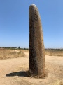

<< Our Photo Pages >> Ringham Low - Chambered Cairn in England in Derbyshire
Submitted by vicky on Monday, 25 October 2004 Page Views: 14537
Neolithic and Bronze AgeSite Name: Ringham LowCountry: England County: Derbyshire Type: Chambered Cairn
Nearest Town: Bakewell Nearest Village: Over Haddon
Map Ref: SK169664 Landranger Map Number: 119
Latitude: 53.194419N Longitude: 1.748502W
Condition:
| 5 | Perfect |
| 4 | Almost Perfect |
| 3 | Reasonable but with some damage |
| 2 | Ruined but still recognisable as an ancient site |
| 1 | Pretty much destroyed, possibly visible as crop marks |
| 0 | No data. |
| -1 | Completely destroyed |
| 5 | Superb |
| 4 | Good |
| 3 | Ordinary |
| 2 | Not Good |
| 1 | Awful |
| 0 | No data. |
| 5 | Can be driven to, probably with disabled access |
| 4 | Short walk on a footpath |
| 3 | Requiring a bit more of a walk |
| 2 | A long walk |
| 1 | In the middle of nowhere, a nightmare to find |
| 0 | No data. |
| 5 | co-ordinates taken by GPS or official recorded co-ordinates |
| 4 | co-ordinates scaled from a detailed map |
| 3 | co-ordinates scaled from a bad map |
| 2 | co-ordinates of the nearest village |
| 1 | co-ordinates of the nearest town |
| 0 | no data |
Internal Links:
External Links:
")
Have you visited this site? Please add a comment below.
You may be viewing yesterday's version of this page. To see the most up to date information please register for a free account.
")
")
")
Do not use the above information on other web sites or publications without permission of the contributor.
Nearby Images from Geograph Britain and Ireland:
©2012(licence)
©2012(licence)

©2011(licence)

©2012(licence)

©2019(licence)
The above images may not be of the site on this page, they are loaded from Geograph.
Please Submit an Image of this site or go out and take one for us!
Click here to see more info for this site
Nearby sites
Key: Red: member's photo, Blue: 3rd party photo, Yellow: other image, Green: no photo - please go there and take one, Grey: site destroyed
Download sites to:
KML (Google Earth)
GPX (GPS waypoints)
CSV (Garmin/Navman)
CSV (Excel)
To unlock full downloads you need to sign up as a Contributory Member. Otherwise downloads are limited to 50 sites.
Turn off the page maps and other distractions
Nearby sites listing. In the following links * = Image available
886m SSE 156° One Ash Shelter* Cave or Rock Shelter (SK17266559)
1.8km SE 124° Calling Low Dale* Cave or Rock Shelter (SK184654)
1.9km NE 47° Bole Hill Bowl Barrow* Round Barrow(s) (SK18286771)
2.0km S 188° Cales Dale* Round Barrow(s) (SK16636437)
2.2km WNW 291° Monyash Round Barrow 1* Round Barrow(s) (SK148672)
2.5km NNE 24° Sheldon Henge* Henge (SK1788068650)
2.5km WNW 296° Monyash Round Barrow 2 Round Barrow(s) (SK146675)
2.6km N 1° Sheldon 1 (Derbyshire)* Round Barrow(s) (SK16926898)
2.8km SE 127° Bee Lowe Round Cairn (SK19166473)
2.8km N 359° Sheldon 2 (Derbyshire) Round Barrow(s) (SK16836925)
3.0km SSW 197° Arbor Low 1* Stone Circle (SK16036355)
3.0km SSW 197° Arbor Low Earthwork* Multiple Stone Rows / Avenue (SK16026350)
3.2km SW 227° Benty Grange Barrow* Barrow Cemetery (SK1461064220)
3.3km SSW 199° Gib Hill* Long Barrow (SK15826332)
3.3km SSW 201° Arbor Low 2* Henge (SK157633)
3.3km SSW 198° Gib Hill Plantation* Misc. Earthwork (SK15876322)
3.4km E 99° Cranes Fort* Hillfort (SK203659)
3.6km NNE 13° Skinner's Well* Holy Well or Sacred Spring (SK177699)
3.6km ESE 110° Back Lane Cairn Circle Ring Cairn (SK2030365151)
4.0km N 0° Demons Dale Cave* Cave or Rock Shelter (SK16897045)
4.1km SW 217° Parsley Hay* Round Cairn (SK144631)
4.2km SW 229° Custard Field Farm* Round Barrow(s) (SK137636)
4.6km NE 41° Sheepwash Well Holy Well or Sacred Spring (SK199699)
4.6km NNW 330° Taddington Barrow* Round Barrow(s) (SK146704)
4.6km N 8° Fin Cop* Hillfort (SK175710)
View more nearby sites and additional images


 We would like to know more about this location. Please feel free to add a brief description and any relevant information in your own language.
 Wir möchten mehr über diese Stätte erfahren. Bitte zögern Sie nicht, eine kurze Beschreibung und relevante Informationen in Deutsch hinzuzufügen.
 Nous aimerions en savoir encore un peu sur les lieux. S'il vous plaît n'hesitez pas à ajouter une courte description et tous les renseignements pertinents dans votre propre langue.
 Quisieramos informarnos un poco más de las lugares. No dude en añadir una breve descripción y otros datos relevantes en su propio idioma.