

<< Our Photo Pages >> Skinner's Well - Holy Well or Sacred Spring in England in Derbyshire
Submitted by HOLYWELL on Tuesday, 25 January 2011 Page Views: 4632
Springs and Holy WellsSite Name: Skinner''s WellCountry: England County: Derbyshire Type: Holy Well or Sacred Spring
Nearest Town: Bakewell Nearest Village: Ashford in the water
Map Ref: SK177699
Latitude: 53.225853N Longitude: 1.736335W
Condition:
| 5 | Perfect |
| 4 | Almost Perfect |
| 3 | Reasonable but with some damage |
| 2 | Ruined but still recognisable as an ancient site |
| 1 | Pretty much destroyed, possibly visible as crop marks |
| 0 | No data. |
| -1 | Completely destroyed |
| 5 | Superb |
| 4 | Good |
| 3 | Ordinary |
| 2 | Not Good |
| 1 | Awful |
| 0 | No data. |
| 5 | Can be driven to, probably with disabled access |
| 4 | Short walk on a footpath |
| 3 | Requiring a bit more of a walk |
| 2 | A long walk |
| 1 | In the middle of nowhere, a nightmare to find |
| 0 | No data. |
| 5 | co-ordinates taken by GPS or official recorded co-ordinates |
| 4 | co-ordinates scaled from a detailed map |
| 3 | co-ordinates scaled from a bad map |
| 2 | co-ordinates of the nearest village |
| 1 | co-ordinates of the nearest town |
| 0 | no data |
Internal Links:
External Links:
")
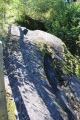
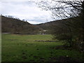
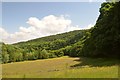
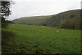
Although Ashford is one of the county’s traditional well dressing places, however none of the wells dressed appear to have been significant. But the Skinner’s or Sinner’s Well a mile or so from the village is certainly very ancient. Antiquarian Addy (1895) notes it was visited by children on Easter Sunday Morning with a quarter of sugar, honey or liquorice and dissolved in its water. It arises in a small dell along a footpath off the Bakewell road at the base of Great Shucklow a few yards from a cave where prehistoric remains have been found. It is surrounded by a number of dressed and undressed stones which earlier photographs show formed a semi-circular structure.
You may be viewing yesterday's version of this page. To see the most up to date information please register for a free account.
Do not use the above information on other web sites or publications without permission of the contributor.
Nearby Images from Geograph Britain and Ireland:
©2010(licence)
©2016(licence)
![SK1769 : Four ways to go [1] by Michael Dibb](https://s1.geograph.org.uk/geophotos/05/85/34/5853417_609dc491_120x120.jpg)
©2018(licence)
©2021(licence)
©2010(licence)
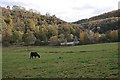
The above images may not be of the site on this page, they are loaded from Geograph.
Please Submit an Image of this site or go out and take one for us!
Click here to see more info for this site
Nearby sites
Key: Red: member's photo, Blue: 3rd party photo, Yellow: other image, Green: no photo - please go there and take one, Grey: site destroyed
Download sites to:
KML (Google Earth)
GPX (GPS waypoints)
CSV (Garmin/Navman)
CSV (Excel)
To unlock full downloads you need to sign up as a Contributory Member. Otherwise downloads are limited to 50 sites.
Turn off the page maps and other distractions
Nearby sites listing. In the following links * = Image available
977m NW 304° Demons Dale Cave* Cave or Rock Shelter (SK16897045)
1.1km SW 233° Sheldon 2 (Derbyshire) Round Barrow(s) (SK16836925)
1.1km N 350° Fin Cop* Hillfort (SK175710)
1.2km SW 220° Sheldon 1 (Derbyshire)* Round Barrow(s) (SK16926898)
1.4km N 352° Hob’s House Cave* Cave or Rock Shelter (SK175713)
2.2km E 90° Sheepwash Well Holy Well or Sacred Spring (SK199699)
2.9km NNE 11° Castlegate Lane* Round Barrow(s) (SK18267276)
3.1km W 279° Taddington Barrow* Round Barrow(s) (SK146704)
3.4km WNW 286° Taddington High Well* Holy Well or Sacred Spring (SK1442470824)
3.6km NNE 19° Longstone Moor* Round Barrow(s) (SK18887328)
3.6km SSW 193° Ringham Low* Chambered Cairn (SK169664)
3.7km N 356° Ravenscliffe Cave Cave or Rock Shelter (SK174736)
3.8km NNE 11° Rolley Low* Round Barrow(s) (SK18447362)
3.9km SW 232° Monyash Round Barrow 2 Round Barrow(s) (SK146675)
4.0km SW 227° Monyash Round Barrow 1* Round Barrow(s) (SK148672)
4.1km N 2° Wardlow Hay Cop* Round Barrow(s) (SK17857397)
4.1km ESE 111° Bakewell Churchyard* Ancient Cross (SK2154768458)
4.3km ESE 108° Bath House Spring* Holy Well or Sacred Spring (SK218686)
4.3km S 186° One Ash Shelter* Cave or Rock Shelter (SK17266559)
4.6km S 171° Calling Low Dale* Cave or Rock Shelter (SK184654)
4.6km WNW 296° Priestcliffe Low* Round Barrow(s) (SK13497190)
4.7km NE 42° Longstone Edge barrows* Round Barrow(s) (SK20887341)
4.8km SSE 147° Cranes Fort* Hillfort (SK203659)
4.8km ESE 113° St Peter's Well (Bakewell)* Holy Well or Sacred Spring (SK2209768025)
5.1km E 99° Ball Cross* Hillfort (SK228691)
View more nearby sites and additional images


 We would like to know more about this location. Please feel free to add a brief description and any relevant information in your own language.
 Wir möchten mehr über diese Stätte erfahren. Bitte zögern Sie nicht, eine kurze Beschreibung und relevante Informationen in Deutsch hinzuzufügen.
 Nous aimerions en savoir encore un peu sur les lieux. S'il vous plaît n'hesitez pas à ajouter une courte description et tous les renseignements pertinents dans votre propre langue.
 Quisieramos informarnos un poco más de las lugares. No dude en añadir una breve descripción y otros datos relevantes en su propio idioma.