


<< Our Photo Pages >> Ringmoor Settlement - Ancient Village or Settlement in England in Dorset
Submitted by lewisw on Monday, 09 April 2012 Page Views: 8622
Multi-periodSite Name: Ringmoor Settlement Alternative Name: Turnworth DownCountry: England
NOTE: This site is 2.5 km away from the location you searched for.
County: Dorset Type: Ancient Village or Settlement
Nearest Town: Blandford Nearest Village: Turnworth
Map Ref: ST809086
Latitude: 50.876577N Longitude: 2.27284W
Condition:
| 5 | Perfect |
| 4 | Almost Perfect |
| 3 | Reasonable but with some damage |
| 2 | Ruined but still recognisable as an ancient site |
| 1 | Pretty much destroyed, possibly visible as crop marks |
| 0 | No data. |
| -1 | Completely destroyed |
| 5 | Superb |
| 4 | Good |
| 3 | Ordinary |
| 2 | Not Good |
| 1 | Awful |
| 0 | No data. |
| 5 | Can be driven to, probably with disabled access |
| 4 | Short walk on a footpath |
| 3 | Requiring a bit more of a walk |
| 2 | A long walk |
| 1 | In the middle of nowhere, a nightmare to find |
| 0 | No data. |
| 5 | co-ordinates taken by GPS or official recorded co-ordinates |
| 4 | co-ordinates scaled from a detailed map |
| 3 | co-ordinates scaled from a bad map |
| 2 | co-ordinates of the nearest village |
| 1 | co-ordinates of the nearest town |
| 0 | no data |
Internal Links:
External Links:
")
The site has a number of pits usually described as evidence of medieval quarrying, and a more modern brick ruin sometimes called 'Ringmoor Cottage'.
You may be viewing yesterday's version of this page. To see the most up to date information please register for a free account.
")
")
")
")
Do not use the above information on other web sites or publications without permission of the contributor.
Nearby Images from Geograph Britain and Ireland:
©2016(licence)
©2007(licence)

©2022(licence)
©2022(licence)
©2019(licence)
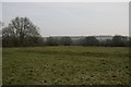
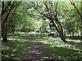
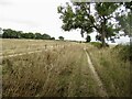
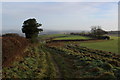
The above images may not be of the site on this page, they are loaded from Geograph.
Please Submit an Image of this site or go out and take one for us!
Click here to see more info for this site
Nearby sites
Key: Red: member's photo, Blue: 3rd party photo, Yellow: other image, Green: no photo - please go there and take one, Grey: site destroyed
Download sites to:
KML (Google Earth)
GPX (GPS waypoints)
CSV (Garmin/Navman)
CSV (Excel)
To unlock full downloads you need to sign up as a Contributory Member. Otherwise downloads are limited to 50 sites.
Turn off the page maps and other distractions
Nearby sites listing. In the following links * = Image available
3.8km NNW 330° Banbury Hill Hillfort (ST790119)
4.5km SW 230° Bul Barrow Round Barrow(s) (ST774057)
5.0km SW 236° Rawlsbury Camp* Hillfort (ST76750580)
5.1km ENE 67° Hod Hill* Hillfort (ST856106)
5.2km NE 48° Southern cross-dyke* Misc. Earthwork (ST84791202)
5.3km NE 49° Hambledon Hill south long barrow* Long Barrow (ST84891205)
5.3km NE 47° Hambledon Hill enclosure* Causewayed Enclosure (ST848122)
5.4km ENE 57° Stepleton Enclosure* Causewayed Enclosure (ST8540311526)
5.4km NE 41° Hambledon Hill north long barrow* Long Barrow (ST84511265)
5.5km NE 41° Hambledon Hill hillfort* Hillfort (ST84511270)
5.5km NE 38° Hambledon Hillfort Spur Enclosure* Misc. Earthwork (ST84351290)
5.6km NE 47° Eastern Cross Dyke* Misc. Earthwork (ST85051242)
5.9km NE 34° Hambledon Farm Stone Circle* Modern Stone Circle etc (ST8420413467)
7.6km SSE 147° Combs Ditch (Whatcombe Down)* Misc. Earthwork (ST8508002199)
8.0km ESE 110° Blandford Forum Stones* Standing Stones (ST884058)
8.3km SW 229° Nordon Hill Tumulus* Round Barrow(s) (ST746032)
8.4km SE 144° Combs Ditch (Chariston)* Misc. Earthwork (ST8578001800)
8.4km E 98° Pimperne Maze Maze or Labyrinth (ST892074)
8.6km SW 217° Giant's Grave Sarsen Stone* Standing Stone (Menhir) (ST757017)
9.0km SW 233° Nettlecombe Tout* Promontory Fort / Cliff Castle (ST737032)
9.4km SE 144° Combs Ditch (East Down)* Misc. Earthwork (ST8637001000)
9.4km WSW 255° Brockhampton Green Standing Stone (Menhir) (ST718062)
9.7km S 173° Deverel Barrow* Round Barrow(s) (SY820990)
10.0km SE 142° Combs Ditch (Little Coll Wood)* Misc. Earthwork (ST8708000719)
10.1km SSE 156° Duropolis Ancient Village or Settlement (SY8505099380)
View more nearby sites and additional images


 We would like to know more about this location. Please feel free to add a brief description and any relevant information in your own language.
 Wir möchten mehr über diese Stätte erfahren. Bitte zögern Sie nicht, eine kurze Beschreibung und relevante Informationen in Deutsch hinzuzufügen.
 Nous aimerions en savoir encore un peu sur les lieux. S'il vous plaît n'hesitez pas à ajouter une courte description et tous les renseignements pertinents dans votre propre langue.
 Quisieramos informarnos un poco más de las lugares. No dude en añadir una breve descripción y otros datos relevantes en su propio idioma.