<< Text Pages >> Eastern Cross Dyke - Misc. Earthwork in England in Dorset
Submitted by coldrum on Wednesday, 01 September 2010 Page Views: 2806
Multi-periodSite Name: Eastern Cross DykeCountry: England County: Dorset Type: Misc. Earthwork
Map Ref: ST85051242
Latitude: 50.911050N Longitude: 2.214014W
Condition:
| 5 | Perfect |
| 4 | Almost Perfect |
| 3 | Reasonable but with some damage |
| 2 | Ruined but still recognisable as an ancient site |
| 1 | Pretty much destroyed, possibly visible as crop marks |
| 0 | No data. |
| -1 | Completely destroyed |
| 5 | Superb |
| 4 | Good |
| 3 | Ordinary |
| 2 | Not Good |
| 1 | Awful |
| 0 | No data. |
| 5 | Can be driven to, probably with disabled access |
| 4 | Short walk on a footpath |
| 3 | Requiring a bit more of a walk |
| 2 | A long walk |
| 1 | In the middle of nowhere, a nightmare to find |
| 0 | No data. |
| 5 | co-ordinates taken by GPS or official recorded co-ordinates |
| 4 | co-ordinates scaled from a detailed map |
| 3 | co-ordinates scaled from a bad map |
| 2 | co-ordinates of the nearest village |
| 1 | co-ordinates of the nearest town |
| 0 | no data |
Be the first person to rate this site - see the 'Contribute!' box in the right hand menu.
Internal Links:
External Links:
Misc. Earthwork in Dorset
From Pastscape:
"A ploughed out Neolithic causewayed double cross-dyke on Hambledon Hill. Two,and possibly all three, of the spurs which joined the central domed summit of Hambledon Hill are "re-inforced" by double cross-dykes. The superficial form of the cross dykes and their excavated profiles are similar to those of the main causewayed enclosure (ST 81 SW 17). Excavation by Bonney (1958-60) and Mercer (1974-86) confirmed the Neolithic dating and causewayed nature. Their initial creation may well have been contemporary with the main causewayed enclosure. The earthworks on Hambledon Hill were surveyed by RCHME in 1996. See the parent record (ST 81 SW 17) and the archive report for full details. The eastern cross-dyke is now only visible on the ground as an intermittent and vestigial scarp, together with a pale soil mark along the line of the bank. However, the form of the earthwork was recorded during an earlier RCHME survey in 1959, prior to the commencement of modern ploughing on the hill. Then, the earthwork extended roughly north-south for about 280 metres across the Shroton Spur in a gentle arc, echoing the eastern corner of the main causewayed enclosure, and separated from it by a distance of about 25 metres. It comprised a double bank and ditch, similar to the southern cross-dyke (ST 81 SW 63) but with no evidence for a counterscarp bank."
http://www.pastscape.org.uk/hob.aspx?hob_id=1058086 Source: Pastscape
You may be viewing yesterday's version of this page. To see the most up to date information please register for a free account.
Do not use the above information on other web sites or publications without permission of the contributor.
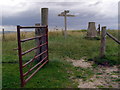
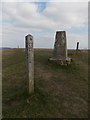
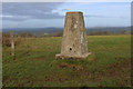
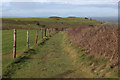
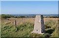
Nearby Images from Geograph Britain and Ireland:
©2008(licence)
©2015(licence)
©2019(licence)
©2019(licence)
©2009(licence)
The above images may not be of the site on this page, they are loaded from Geograph.
Please Submit an Image of this site or go out and take one for us!
Click here to see more info for this site
Nearby sites
Key: Red: member's photo, Blue: 3rd party photo, Yellow: other image, Green: no photo - please go there and take one, Grey: site destroyed
Download sites to:
KML (Google Earth)
GPX (GPS waypoints)
CSV (Garmin/Navman)
CSV (Excel)
To unlock full downloads you need to sign up as a Contributory Member. Otherwise downloads are limited to 50 sites.
Turn off the page maps and other distractions
Nearby sites listing. In the following links * = Image available
332m SW 228° Hambledon Hill enclosure* Causewayed Enclosure (ST848122)
403m SSW 203° Hambledon Hill long barrow* Long Barrow (ST84891205)
477m SSW 213° Southern cross-dyke* Misc. Earthwork (ST84791202)
586m WNW 293° Hambledon Hill long barrow Long Barrow (ST84511265)
607m WNW 297° Hambledon Hill hillfort* Hillfort (ST84511270)
847m NW 304° Hambledon Hillfort Spur Enclosure Misc. Earthwork (ST84351290)
961m SSE 158° Stepleton Enclosure Causewayed Enclosure (ST8540311526)
1.3km NW 321° Hambledon Farm Stone Circle* Modern Stone Circle etc (ST8420413467)
1.9km SSE 163° Hod Hill* Hillfort (ST856106)
5.6km SW 227° Ringmoor Settlement* Ancient Village or Settlement (ST809086)
6.1km W 265° Banbury Hill Hillfort (ST790119)
6.5km SE 140° Pimperne Maze Turf Maze (ST892074)
6.8km NNE 29° Fontmell Down* Misc. Earthwork (ST884183)
6.9km ESE 106° Pimperne Long Barrow* Long Barrow (ST917105)
7.4km SSE 153° Blandford Forum Stones* Standing Stones (ST884058)
7.5km ESE 123° Blandford Race Down Round Barrow(s) (ST91360836)
8.5km ENE 68° Caesar's Camp (Dorset)* Hillfort (ST930156)
8.7km SE 131° Tarrant Rawston Long Barrow* Long Barrow (ST91550667)
8.7km E 83° Chettle Long Barrow* Long Barrow (ST937135)
9.4km SE 133° Buzbury Rings* Ancient Village or Settlement (ST919060)
10.0km E 88° Chettle House* Long Barrow (ST9506612803)
10.2km SW 228° Bul Barrow Round Barrow(s) (ST774057)
10.3km S 180° Combs Ditch Ancient Village or Settlement (ST851021)
10.6km SW 231° Rawlsbury Camp* Hillfort (ST76750580)
10.9km NNE 29° Chapel Well (Donhead St Mary) Holy Well or Sacred Spring (ST90372196)
View more nearby sites and additional images


 We would like to know more about this location. Please feel free to add a brief description and any relevant information in your own language.
 Wir möchten mehr über diese Stätte erfahren. Bitte zögern Sie nicht, eine kurze Beschreibung und relevante Informationen in Deutsch hinzuzufügen.
 Nous aimerions en savoir encore un peu sur les lieux. S'il vous plaît n'hesitez pas à ajouter une courte description et tous les renseignements pertinents dans votre propre langue.
 Quisieramos informarnos un poco más de las lugares. No dude en añadir una breve descripción y otros datos relevantes en su propio idioma.