


<< Our Photo Pages >> Giant's Grave Sarsen Stone - Standing Stone (Menhir) in England in Dorset
Submitted by JimChampion on Saturday, 06 December 2003 Page Views: 11865
Neolithic and Bronze AgeSite Name: Giant's Grave Sarsen StoneCountry: England County: Dorset Type: Standing Stone (Menhir)
Nearest Town: Blandford Forum Nearest Village: Melcombe Horsey
Map Ref: ST757017 Landranger Map Number: 194
Latitude: 50.814333N Longitude: 2.346287W
Condition:
| 5 | Perfect |
| 4 | Almost Perfect |
| 3 | Reasonable but with some damage |
| 2 | Ruined but still recognisable as an ancient site |
| 1 | Pretty much destroyed, possibly visible as crop marks |
| 0 | No data. |
| -1 | Completely destroyed |
| 5 | Superb |
| 4 | Good |
| 3 | Ordinary |
| 2 | Not Good |
| 1 | Awful |
| 0 | No data. |
| 5 | Can be driven to, probably with disabled access |
| 4 | Short walk on a footpath |
| 3 | Requiring a bit more of a walk |
| 2 | A long walk |
| 1 | In the middle of nowhere, a nightmare to find |
| 0 | No data. |
| 5 | co-ordinates taken by GPS or official recorded co-ordinates |
| 4 | co-ordinates scaled from a detailed map |
| 3 | co-ordinates scaled from a bad map |
| 2 | co-ordinates of the nearest village |
| 1 | co-ordinates of the nearest town |
| 0 | no data |
Internal Links:
External Links:
I have visited· I would like to visit
JimChampion has visited here
")
The Giant's Grave is found on the steep west-facing slope of Henning Hill. Lying roughly north-south along the contour of the hill, it is exactly what its name suggests: a very low grass covered mound, approximately 20 metres long and 4 metres wide with a "headstone" at the southern end.
Pastscape identifies the earthwork as a medieval pillow mound and describes the stone as an 'uncertain' sarsen boulder. These so-called pillow mounds are often the remains of late and post-medieval rabbit warrens (when rabbits were farmed for their meat) and have no prehistoric provenance!
Legend has it that the giant lost a stone-throwing contest with a giant from Nordon Hill, died of disappointment and was buried in this mound.
Access Park/get off the bus at Cross Lanes to the southwest of Melcombe Bingham village. Walk southwest along the road and take the footpath/bridleway that runs alongside the road after the last house. The grave is about 300m along the path on the grassy slope of Henning Hill. Its low profile means that it is difficult to see close up, but it is quite visible when viewed from a distance: for example, from Nordon Hill to the north.
You may be viewing yesterday's version of this page. To see the most up to date information please register for a free account.
Do not use the above information on other web sites or publications without permission of the contributor.
coldrum has found this location on Google Street View:
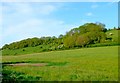
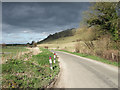
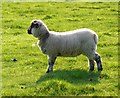
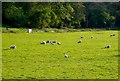
Nearby Images from Geograph Britain and Ireland:

©2005(licence)
©2009(licence)
©2007(licence)
©2009(licence)
©2009(licence)
The above images may not be of the site on this page, they are loaded from Geograph.
Please Submit an Image of this site or go out and take one for us!
Click here to see more info for this site
Nearby sites
Key: Red: member's photo, Blue: 3rd party photo, Yellow: other image, Green: no photo - please go there and take one, Grey: site destroyed
Download sites to:
KML (Google Earth)
GPX (GPS waypoints)
CSV (Garmin/Navman)
CSV (Excel)
To unlock full downloads you need to sign up as a Contributory Member. Otherwise downloads are limited to 50 sites.
Turn off the page maps and other distractions
Nearby sites listing. In the following links * = Image available
1.9km NW 324° Nordon Hill Tumulus* Round Barrow(s) (ST746032)
2.5km NW 307° Nettlecombe Tout* Promontory Fort / Cliff Castle (ST737032)
2.8km SW 219° Cheselbourne Round Barrow(s) (SY739995)
4.2km NNE 14° Rawlsbury Camp* Hillfort (ST76750580)
4.3km NNE 23° Bul Barrow Round Barrow(s) (ST774057)
4.6km WNW 294° Church Hill Enclosure (Alton Pancras)* Artificial Mound (ST7145403608)
5.9km NW 319° Brockhampton Green Standing Stone (Menhir) (ST718062)
6.8km ESE 113° Deverel Barrow* Round Barrow(s) (SY820990)
7.4km SE 138° Weatherby Castle* Hillfort (SY807962)
8.0km W 268° Alton Lane Field System Misc. Earthwork (ST677014)
8.4km W 259° Oxencombe Bottom Bowl Barrow Round Barrow(s) (ST67380018)
8.5km ESE 121° Milborne St Andrew 2 Round Barrow(s) (SY830973)
8.5km SE 125° Milborne St Andrew 1 Round Barrow(s) (SY827968)
8.6km W 262° Black Hill Farm Enclosure Ancient Village or Settlement (ST672005)
8.6km NE 37° Ringmoor Settlement* Ancient Village or Settlement (ST809086)
8.7km W 274° Bowl Barrow (Dorset) Round Barrow(s) (ST67030229)
8.7km W 273° Giant Hill Settlement Ancient Village or Settlement (ST66950225)
8.8km NW 310° Dungeon Hill* Hillfort (ST690074)
8.8km WSW 254° Green Hill Field System Misc. Earthwork (SY672993)
8.9km SW 221° Culliford Tree* Barrow Cemetery (SY699950)
8.9km WSW 255° Green Hill Barrows Barrow Cemetery (SY67069943)
8.9km W 271° Giant Hill Bowl Barrow Round Barrow(s) (ST66760187)
8.9km W 270° The Trendle* Misc. Earthwork (ST66730167)
9.0km W 270° Giant Hill Cross Ridge Dyke Misc. Earthwork (ST667018)
9.0km W 270° Cerne Abbas Giant* Hill Figure or Geoglyph (ST66660168)
View more nearby sites and additional images


 We would like to know more about this location. Please feel free to add a brief description and any relevant information in your own language.
 Wir möchten mehr über diese Stätte erfahren. Bitte zögern Sie nicht, eine kurze Beschreibung und relevante Informationen in Deutsch hinzuzufügen.
 Nous aimerions en savoir encore un peu sur les lieux. S'il vous plaît n'hesitez pas à ajouter une courte description et tous les renseignements pertinents dans votre propre langue.
 Quisieramos informarnos un poco más de las lugares. No dude en añadir una breve descripción y otros datos relevantes en su propio idioma.