


<< Our Photo Pages >> Nettlecombe Tout - Promontory Fort / Cliff Castle in England in Dorset
Submitted by JimChampion on Tuesday, 01 February 2005 Page Views: 13678
Iron Age and Later PrehistorySite Name: Nettlecombe ToutCountry: England
NOTE: This site is 1.1 km away from the location you searched for.
County: Dorset Type: Promontory Fort / Cliff Castle
Nearest Town: Puddletown Nearest Village: Mappowder
Map Ref: ST737032
Latitude: 50.827734N Longitude: 2.374783W
Condition:
| 5 | Perfect |
| 4 | Almost Perfect |
| 3 | Reasonable but with some damage |
| 2 | Ruined but still recognisable as an ancient site |
| 1 | Pretty much destroyed, possibly visible as crop marks |
| 0 | No data. |
| -1 | Completely destroyed |
| 5 | Superb |
| 4 | Good |
| 3 | Ordinary |
| 2 | Not Good |
| 1 | Awful |
| 0 | No data. |
| 5 | Can be driven to, probably with disabled access |
| 4 | Short walk on a footpath |
| 3 | Requiring a bit more of a walk |
| 2 | A long walk |
| 1 | In the middle of nowhere, a nightmare to find |
| 0 | No data. |
| 5 | co-ordinates taken by GPS or official recorded co-ordinates |
| 4 | co-ordinates scaled from a detailed map |
| 3 | co-ordinates scaled from a bad map |
| 2 | co-ordinates of the nearest village |
| 1 | co-ordinates of the nearest town |
| 0 | no data |
Internal Links:
External Links:
I have visited· I would like to visit
JimChampion has visited here
")
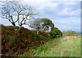
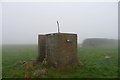
Access This fort is high in the "Hardy Country" part of Dorset, half a kilometre to the west of the Dorsetshire Gap*. The area is criss-crossed with footpaths and bridleways, and the most direct access is along the bridleway from the hamlet of Folly to the Dorsetshire Gap. An agricultural water tower stands on the summit of the hill, and from here the (partly overgrown) rampart of the hillfort is obvious, about 200m to the north.
Note: *The nearby Dorsetshire Gap is an intersection of five ancient trackways, linking the trails of the Ridgeway with the drove roads to the north. It is about as remote a spot as you will find in Dorset, and bizarrely has a visitors book that you can sign.
You may be viewing yesterday's version of this page. To see the most up to date information please register for a free account.
")
")
")
Do not use the above information on other web sites or publications without permission of the contributor.
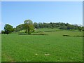
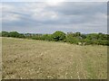
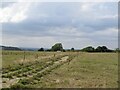
Nearby Images from Geograph Britain and Ireland:
©2011(licence)
©2009(licence)
©2022(licence)
©2022(licence)
©2019(licence)
The above images may not be of the site on this page, they are loaded from Geograph.
Please Submit an Image of this site or go out and take one for us!
Click here to see more info for this site
Nearby sites
Key: Red: member's photo, Blue: 3rd party photo, Yellow: other image, Green: no photo - please go there and take one, Grey: site destroyed
Download sites to:
KML (Google Earth)
GPX (GPS waypoints)
CSV (Garmin/Navman)
CSV (Excel)
To unlock full downloads you need to sign up as a Contributory Member. Otherwise downloads are limited to 50 sites.
Turn off the page maps and other distractions
Nearby sites listing. In the following links * = Image available
898m E 90° Nordon Hill Tumulus* Round Barrow(s) (ST746032)
2.3km W 280° Church Hill Enclosure (Alton Pancras)* Artificial Mound (ST7145403608)
2.5km SE 127° Giant's Grave Sarsen Stone* Standing Stone (Menhir) (ST757017)
3.5km NNW 327° Brockhampton Green Standing Stone (Menhir) (ST718062)
3.7km S 177° Cheselbourne Round Barrow(s) (SY739995)
4.0km NE 49° Rawlsbury Camp* Hillfort (ST76750580)
4.5km NE 56° Bul Barrow Round Barrow(s) (ST774057)
6.2km WSW 253° Alton Lane Field System Misc. Earthwork (ST677014)
6.3km NW 312° Dungeon Hill* Hillfort (ST690074)
6.7km W 262° Bowl Barrow (Dorset) Round Barrow(s) (ST67030229)
6.8km W 262° Giant Hill Settlement* Ancient Village or Settlement (ST6695002250)
7.0km WSW 244° Oxencombe Bottom Bowl Barrow* Round Barrow(s) (ST6738000180)
7.0km WSW 247° Black Hill Farm Enclosure* Ancient Village or Settlement (ST6720000500)
7.0km W 259° Giant Hill Bowl Barrow Round Barrow(s) (ST66760187)
7.1km WSW 257° The Trendle* Misc. Earthwork (ST66730167)
7.1km WSW 258° Giant Hill Cross Ridge Dyke* Misc. Earthwork (ST6670001800)
7.2km WSW 257° Cerne Abbas Giant* Hill Figure or Geoglyph (ST66660168)
7.3km WSW 255° St Augustine's Well (Cerne Abbas)* Holy Well or Sacred Spring (ST6664001369)
7.6km WSW 239° Green Hill Field System* Misc. Earthwork (SY6720099300)
7.6km WSW 240° Green Hill Barrows Barrow Cemetery (SY67069943)
7.8km W 271° Farm Hill Bowl Barrow Round Barrow(s) (ST65880334)
8.0km W 270° High Cank Henge Henge (ST65720319)
8.4km W 259° Weam Commen Hill Field System Misc. Earthwork (ST654016)
8.5km W 275° East Hill field System* Misc. Earthwork (ST65250405)
8.5km WSW 250° Dickley Hill Settlement Ancient Village or Settlement (ST65650027)
View more nearby sites and additional images


 We would like to know more about this location. Please feel free to add a brief description and any relevant information in your own language.
 Wir möchten mehr über diese Stätte erfahren. Bitte zögern Sie nicht, eine kurze Beschreibung und relevante Informationen in Deutsch hinzuzufügen.
 Nous aimerions en savoir encore un peu sur les lieux. S'il vous plaît n'hesitez pas à ajouter une courte description et tous les renseignements pertinents dans votre propre langue.
 Quisieramos informarnos un poco más de las lugares. No dude en añadir una breve descripción y otros datos relevantes en su propio idioma.