<< Our Photo Pages >> Craigmyle - Class I Pictish Symbol Stone in Scotland in Aberdeenshire
Submitted by alligator on Thursday, 26 February 2004 Page Views: 9779
Early Medieval (Dark Age)Site Name: Craigmyle Alternative Name: Cothill, Craigmyle HouseCountry: Scotland
NOTE: This site is 1.3 km away from the location you searched for.
County: Aberdeenshire Type: Class I Pictish Symbol Stone
Map Ref: NJ64020235 Landranger Map Number: 37
Latitude: 57.110687N Longitude: 2.595669W
Condition:
| 5 | Perfect |
| 4 | Almost Perfect |
| 3 | Reasonable but with some damage |
| 2 | Ruined but still recognisable as an ancient site |
| 1 | Pretty much destroyed, possibly visible as crop marks |
| 0 | No data. |
| -1 | Completely destroyed |
| 5 | Superb |
| 4 | Good |
| 3 | Ordinary |
| 2 | Not Good |
| 1 | Awful |
| 0 | No data. |
| 5 | Can be driven to, probably with disabled access |
| 4 | Short walk on a footpath |
| 3 | Requiring a bit more of a walk |
| 2 | A long walk |
| 1 | In the middle of nowhere, a nightmare to find |
| 0 | No data. |
| 5 | co-ordinates taken by GPS or official recorded co-ordinates |
| 4 | co-ordinates scaled from a detailed map |
| 3 | co-ordinates scaled from a bad map |
| 2 | co-ordinates of the nearest village |
| 1 | co-ordinates of the nearest town |
| 0 | no data |
Internal Links:
External Links:
I have visited· I would like to visit
Chrus visited on 28th Mar 2017 - their rating: Cond: 4 Amb: 5 Access: 3
")
For details, visit: http://www.archaeoptics.co.uk/products/ecms/134.html
You may be viewing yesterday's version of this page. To see the most up to date information please register for a free account.
")
")
Do not use the above information on other web sites or publications without permission of the contributor.
Nearby Images from Geograph Britain and Ireland:
©2007(licence)
©2007(licence)
©2007(licence)
©2007(licence)
©2007(licence)
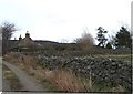
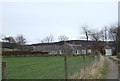
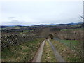
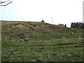
The above images may not be of the site on this page, they are loaded from Geograph.
Please Submit an Image of this site or go out and take one for us!
Click here to see more info for this site
Nearby sites
Key: Red: member's photo, Blue: 3rd party photo, Yellow: other image, Green: no photo - please go there and take one, Grey: site destroyed
Download sites to:
KML (Google Earth)
GPX (GPS waypoints)
CSV (Garmin/Navman)
CSV (Excel)
To unlock full downloads you need to sign up as a Contributory Member. Otherwise downloads are limited to 50 sites.
Turn off the page maps and other distractions
Nearby sites listing. In the following links * = Image available
1.9km WNW 295° Learney Standing Stone* Standing Stone (Menhir) (NJ62290318)
2.8km SSE 161° Glassel* Stone Circle (NO64909969)
3.9km WNW 287° Balnacraig Stone Circle* Stone Circle (NJ60330353)
5.2km W 277° Cairn Mude* Cairn (NJ58870301)
5.5km N 11° Tomnagorn* Stone Circle (NJ651077)
5.5km WSW 241° St Erchan's Well* Holy Well or Sacred Spring (NO592997)
6.9km WNW 295° Macbeth's Cairn* Cairn (NJ578053)
7.0km NNW 347° Auld Kirk O Tough* Stone Circle (NJ625092)
7.0km SSW 205° Inchbaire Stone Circle (NO610960)
7.1km NE 54° Corsefield Cattle Rubbing Stone* Standing Stone (Menhir) (NJ69790648)
7.2km NE 54° Midmar Kirk S* Stone Circle (NJ69940649)
7.2km NE 54° Midmar Kirk N* Standing Stone (Menhir) (NJ69870659)
7.5km SE 145° Inchmarlo* Standing Stone (Menhir) (NO68249613)
8.3km ENE 66° Sunhoney* Stone Circle (NJ71590569)
8.9km WSW 253° Dess Stone Circle* Modern Stone Circle etc (NO55449985)
9.2km SW 214° Berrysloch* Standing Stone (Menhir) (NO588947)
9.3km SSW 207° Corsedardar* Standing Stone (Menhir) (NO59709405)
9.5km SSW 208° Dardannus Stone* Standing Stone (Menhir) (NO595940)
9.5km SSE 168° Bucharn* Round Cairn (NO65949300)
9.8km ENE 60° Barmekin of Echt* Ancient Village or Settlement (NJ72600712)
9.9km WSW 239° Birse* Class I Pictish Symbol Stone (NO555973)
9.9km SSW 209° Finzean House* Chambered Cairn (NO591937)
10.1km WSW 257° Formaston* Class II Pictish Symbol Stone (NJ541001)
10.3km NW 324° Howemill* Stone Circle (NJ580107)
11.1km N 1° Whitehill Stone Circle* Stone Circle (NJ643135)
View more nearby sites and additional images


 We would like to know more about this location. Please feel free to add a brief description and any relevant information in your own language.
 Wir möchten mehr über diese Stätte erfahren. Bitte zögern Sie nicht, eine kurze Beschreibung und relevante Informationen in Deutsch hinzuzufügen.
 Nous aimerions en savoir encore un peu sur les lieux. S'il vous plaît n'hesitez pas à ajouter une courte description et tous les renseignements pertinents dans votre propre langue.
 Quisieramos informarnos un poco más de las lugares. No dude en añadir una breve descripción y otros datos relevantes en su propio idioma.