<< Our Photo Pages >> Knap of Howar - Ancient Village or Settlement in Scotland in Orkney
Submitted by PaulH on Tuesday, 26 July 2005 Page Views: 20562
Multi-periodSite Name: Knap of HowarCountry: Scotland County: Orkney Type: Ancient Village or Settlement
Map Ref: HY483518 Landranger Map Number: 5
Latitude: 59.349347N Longitude: 2.910851W
Condition:
| 5 | Perfect |
| 4 | Almost Perfect |
| 3 | Reasonable but with some damage |
| 2 | Ruined but still recognisable as an ancient site |
| 1 | Pretty much destroyed, possibly visible as crop marks |
| 0 | No data. |
| -1 | Completely destroyed |
| 5 | Superb |
| 4 | Good |
| 3 | Ordinary |
| 2 | Not Good |
| 1 | Awful |
| 0 | No data. |
| 5 | Can be driven to, probably with disabled access |
| 4 | Short walk on a footpath |
| 3 | Requiring a bit more of a walk |
| 2 | A long walk |
| 1 | In the middle of nowhere, a nightmare to find |
| 0 | No data. |
| 5 | co-ordinates taken by GPS or official recorded co-ordinates |
| 4 | co-ordinates scaled from a detailed map |
| 3 | co-ordinates scaled from a bad map |
| 2 | co-ordinates of the nearest village |
| 1 | co-ordinates of the nearest town |
| 0 | no data |
Internal Links:
External Links:
I have visited· I would like to visit
43559959 coin whese001 would like to visit
drolaf visited on 13th Jun 2022 - their rating: Cond: 3 Access: 3
Estrela visited on 31st May 2014 - their rating: Cond: 4 Amb: 5 Access: 3 I thought we had missed the chance to visit the Knap of Howar. We had only 24 hours in Westray and the likelihood of getting to Papa Westray at the weekend seemed impossible. However on the ferry to Westray from Kirkwall I got talking to a local girl who was returning from college in Glasgow to play at a wedding in Papa Westray and stay with her grandparents. She said there would be a couple of extra ferries going over and to ask the bus driver. Michael phoned his boss who also ran the ferry to Papa Westray and it was arranged that we would leave our bags at our B&B whilst he waited and then took us straight round to the other ferry for the trip over.
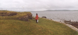
So we landed in Papa Westray at 7 pm with no food, drink or coats, and walked from the pier at the south end of the island to the Knap of Howar, a couple of miles north to the Knap of Howar. We were lucky with weather and it was a light dry evening and only at about ten o'clock on our way back to catch the return ferry at 11.30 we began to get cold.
If we had flown in we would have been extremely close to the Knap of Howar at the airfield. It was a manageable walk for us oldies but that would depend on your health and fitness.
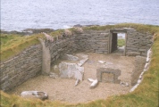
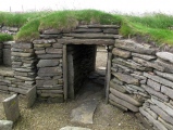
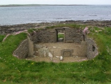
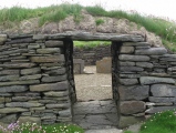
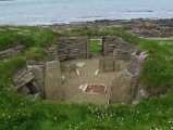
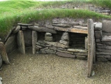
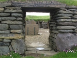
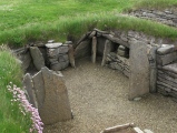
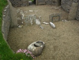
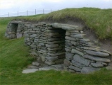
The site is stunning, along a footpath across a field, close to the shore. Part of the 'workshop' portion of the site was covered with a plastic tent and signs to keep out as it is being dug at present, although not when we were there in the evening. The site was unattended and we could go in through the low doorway and walk around in the house, and the near end of the workshop. I was impressed by the quality of the building work, with a curved outer wall and alcoves built into the walls. I imagine it may well have been roofed with flagstones, similar to the wall material. In many bays on Westray we saw the 'pavements' of stratified rock that splits easily and still is used to roof houses today, the flagstones outlasting even slate.
We passed such a cottage on our way to and from the Knap of Howar. It is amazing to think that many of the techniques used with stone building remain unchanged after 7,000 years. I am including a picture of the cottage with the flagstone roof.
We had encountered one near the Ring of Brodgar and the Stones of Stenness and had been told by the tenant that the roofer was resident on Westray.
At the time the Knap of Howar was built a thin causeway would still have connected Papa Westray to Westray island.
DrewParsons jeffrep Redfun have visited here
Average ratings for this site from all visit loggers: Condition: 3.5 Access: 3

Excavation by Anna Ritchie in the 1970's revealed sherds of Unstan Ware (identical to that found in the many chambered cairns on Orkney) and material giving radiocarbon dates of between 3600 to 3100 BC.
The two structures face the sea to the west. The west wall is thick to create an entrance passage that would help reduce draughts. The doors would have been against the inner end of this passage.
The structures are divided within by vertical stone partitions similar to those found in the contemporary chambered cairns (see photo of Midhowe chambered cairn). As with Skara brae, there are stone shelves and cupboards built into the walls.
The larger, Northern building is thought to have been built first, and served as the main living place. The smaller, southern structure was added later, and thought to have been a workshop. The structures were surrounded by a midden that had been spread thin so as to provide an area for small scale cultivation.
Animal bones found were of domesticated sheep and cattle, with evidence also of a few pigs being kept. The size of some of the fish bones found suggests some offshore fishing up to 5 miles out to sea using hook and line. There are a very large number of limpet shells on the site. Limpets are apparently too rubbery, even when cooked, and poor in calories to be useful as human food. They were probably used as bait for fishing. A quern was found in the main house.
Source: Anna Ritchie, "Prehistoric Orkney", Batsford/Historic Scotland 1995
You may be viewing yesterday's version of this page. To see the most up to date information please register for a free account.








These are just the first 25 photos of Knap of Howar. If you log in with a free user account you will be able to see our entire collection.
Do not use the above information on other web sites or publications without permission of the contributor.
Click here to see more info for this site
Nearby sites
Key: Red: member's photo, Blue: 3rd party photo, Yellow: other image, Green: no photo - please go there and take one, Grey: site destroyed
Download sites to:
KML (Google Earth)
GPX (GPS waypoints)
CSV (Garmin/Navman)
CSV (Excel)
To unlock full downloads you need to sign up as a Contributory Member. Otherwise downloads are limited to 50 sites.
Turn off the page maps and other distractions
Nearby sites listing. In the following links * = Image available
1.0km NNE 29° St Boniface's Church Hog Back Stone* Early Christian Sculptured Stone (HY48825270)
1.1km NNE 26° Munkerhoose* Ancient Village or Settlement (HY48785274)
1.7km ESE 122° St Tredwell's Chapel Stone Row / Alignment (HY497509)
2.2km ENE 77° Holm of Papa Westray North* Chambered Cairn (HY50445228)
2.4km E 88° Holm of Papa Westray Central Chambered Cairn (HY50705185)
2.6km E 89° Holm of Papa Westray South* Chambered Cairn (HY50915183)
2.8km WSW 241° Vere Point (Westray) Chambered Cairn (HY45845046)
4.7km SSW 201° Tofts Ness (Sanday) Cairn (HY4654547449)
5.2km WSW 237° Pierowall Quarry* Chambered Cairn (HY43894905)
5.8km SW 231° Westray Heritage Centre* Museum (HY43724825)
6.0km WSW 245° Links of Noltland* Ancient Village or Settlement (HY42804930)
6.6km WSW 245° The Lum Head (Westray) Chambered Cairn (HY4221649107)
6.7km S 171° East Surrigarth (Westray) Chambered Cairn (HY49214520)
6.9km SW 228° Curquoy, Westray Cairn (HY431473)
7.2km SW 228° Knucker Hill (Westray) Chambered Cairn (HY4287547013)
8.8km SSW 214° Fitty Hill (Westray) Chambered Cairn (HY43324451)
9.5km SSW 210° Powdykes (Westray) Chambered Cairn (HY4343543627)
10.8km SSW 202° Berst Ness Ancient Village or Settlement (HY441418)
14.3km SSE 150° Linkertaing* Chambered Cairn (HY55393937)
14.5km SSE 161° Faray Chambered Cairn (HY52743797)
15.3km SSE 147° Carrick House* Chambered Cairn (HY56363880)
15.7km SSE 150° Vinquoy* Chambered Cairn (HY56013809)
16.1km SSE 150° Huntersquoy* Chambered Cairn (HY56263773)
16.3km SE 143° Calf of Eday (Long) Chambered Cairn (HY57863861)
16.3km SE 143° Calf of Eday, North West Round Cairn (HY57883858)
View more nearby sites and additional images


 We would like to know more about this location. Please feel free to add a brief description and any relevant information in your own language.
 Wir möchten mehr über diese Stätte erfahren. Bitte zögern Sie nicht, eine kurze Beschreibung und relevante Informationen in Deutsch hinzuzufügen.
 Nous aimerions en savoir encore un peu sur les lieux. S'il vous plaît n'hesitez pas à ajouter une courte description et tous les renseignements pertinents dans votre propre langue.
 Quisieramos informarnos un poco más de las lugares. No dude en añadir una breve descripción y otros datos relevantes en su propio idioma.