<< Text Pages >> Fitty Hill (Westray) - Chambered Cairn in Scotland in Orkney
Submitted by AKFisher on Sunday, 14 April 2024 Page Views: 23
Neolithic and Bronze AgeSite Name: Fitty Hill (Westray)Country: Scotland County: Orkney Type: Chambered Cairn
Map Ref: HY43324451
Latitude: 59.283252N Longitude: 2.996487W
Condition:
| 5 | Perfect |
| 4 | Almost Perfect |
| 3 | Reasonable but with some damage |
| 2 | Ruined but still recognisable as an ancient site |
| 1 | Pretty much destroyed, possibly visible as crop marks |
| 0 | No data. |
| -1 | Completely destroyed |
| 5 | Superb |
| 4 | Good |
| 3 | Ordinary |
| 2 | Not Good |
| 1 | Awful |
| 0 | No data. |
| 5 | Can be driven to, probably with disabled access |
| 4 | Short walk on a footpath |
| 3 | Requiring a bit more of a walk |
| 2 | A long walk |
| 1 | In the middle of nowhere, a nightmare to find |
| 0 | No data. |
| 5 | co-ordinates taken by GPS or official recorded co-ordinates |
| 4 | co-ordinates scaled from a detailed map |
| 3 | co-ordinates scaled from a bad map |
| 2 | co-ordinates of the nearest village |
| 1 | co-ordinates of the nearest town |
| 0 | no data |
Internal Links:
External Links:
Chambered Cairn in Orkney
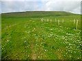
Chambered cairn, turf covered, 16.9m in diameter and 1m in height. Seven earthfast slabs are visible on the east side of the flattop and may indicate a Orkney-Cromarty type stalled chamber. Part of the structure may have been used as a container for sheep fodder and may not be original.
Additional information links:
1. canmore.org.uk/site/2846/westray-fitty-hill
2. archaeologyorkney.com/tombs-of-the-isles/westray/fitty-hill-westray/
You may be viewing yesterday's version of this page. To see the most up to date information please register for a free account.
Do not use the above information on other web sites or publications without permission of the contributor.
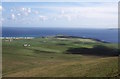
Nearby Images from Geograph Britain and Ireland:
©2015(licence)
©2009(licence)
©2007(licence)
©2015(licence)
©2014(licence)
The above images may not be of the site on this page, they are loaded from Geograph.
Please Submit an Image of this site or go out and take one for us!
Click here to see more info for this site
Nearby sites
Key: Red: member's photo, Blue: 3rd party photo, Yellow: other image, Green: no photo - please go there and take one, Grey: site destroyed
Download sites to:
KML (Google Earth)
GPX (GPS waypoints)
CSV (Garmin/Navman)
CSV (Excel)
To unlock full downloads you need to sign up as a Contributory Member. Otherwise downloads are limited to 50 sites.
Turn off the page maps and other distractions
Nearby sites listing. In the following links * = Image available
889m S 172° Powdykes (Westray) Chambered Cairn (HY4343543627)
2.5km N 349° Knucker Hill (Westray) Chambered Cairn (HY4287547013)
2.8km N 355° Curquoy, Westray Cairn (HY431473)
2.8km SSE 163° Berst Ness Ancient Village or Settlement (HY441418)
3.8km N 5° Westray Heritage Centre* Museum (HY43724825)
4.4km NE 47° Tofts Ness (Sanday) Cairn (HY4654547449)
4.6km N 6° Pierowall Quarry* Chambered Cairn (HY43894905)
4.7km NNW 346° The Lum Head (Westray) Chambered Cairn (HY4221649107)
4.8km N 353° Links of Noltland* Ancient Village or Settlement (HY42804930)
5.9km E 82° East Surrigarth (Westray) Chambered Cairn (HY49214520)
6.5km NNE 22° Vere Point (Westray) Chambered Cairn (HY45845046)
8.8km NNE 33° Knap of Howar* Ancient Village or Settlement (HY483518)
9.0km NE 44° St Tredwell's Chapel Stone Row / Alignment (HY497509)
9.8km NNE 33° St Boniface's Church Hog Back Stone* Early Christian Sculptured Stone (HY48825270)
9.9km NNE 33° Munkerhoose* Ancient Village or Settlement (HY48785274)
10.4km NE 44° Holm of Papa Westray Central Chambered Cairn (HY50705185)
10.5km NE 42° Holm of Papa Westray North* Chambered Cairn (HY50445228)
10.5km NE 45° Holm of Papa Westray South* Chambered Cairn (HY50915183)
11.4km SE 124° Faray Chambered Cairn (HY52743797)
11.7km SSW 198° Wasbister* Crannog (HY395334)
11.8km S 176° Faraclett Head East Cairn (HY43993271)
11.8km SSW 197° Bretta Ness* Ancient Village or Settlement (HY39723324)
11.8km S 176° Faraclett Head West Cairn (HY44003270)
11.9km S 172° Yetnasteen* Standing Stone (Menhir) (HY447327)
12.0km S 177° Bigland Round* Chambered Cairn (HY438325)
View more nearby sites and additional images


 We would like to know more about this location. Please feel free to add a brief description and any relevant information in your own language.
 Wir möchten mehr über diese Stätte erfahren. Bitte zögern Sie nicht, eine kurze Beschreibung und relevante Informationen in Deutsch hinzuzufügen.
 Nous aimerions en savoir encore un peu sur les lieux. S'il vous plaît n'hesitez pas à ajouter une courte description et tous les renseignements pertinents dans votre propre langue.
 Quisieramos informarnos un poco más de las lugares. No dude en añadir una breve descripción y otros datos relevantes en su propio idioma.