<< Text Pages >> Berst Ness - Ancient Village or Settlement in Scotland in Orkney
Submitted by Andy B on Monday, 07 August 2006 Page Views: 6048
Multi-periodSite Name: Berst Ness Alternative Name: BerstnessCountry: Scotland County: Orkney Type: Ancient Village or Settlement
Nearest Town: Island of Westray Nearest Village: Midbea
Map Ref: HY441418
Latitude: 59.259024N Longitude: 2.982099W
Condition:
| 5 | Perfect |
| 4 | Almost Perfect |
| 3 | Reasonable but with some damage |
| 2 | Ruined but still recognisable as an ancient site |
| 1 | Pretty much destroyed, possibly visible as crop marks |
| 0 | No data. |
| -1 | Completely destroyed |
| 5 | Superb |
| 4 | Good |
| 3 | Ordinary |
| 2 | Not Good |
| 1 | Awful |
| 0 | No data. |
| 5 | Can be driven to, probably with disabled access |
| 4 | Short walk on a footpath |
| 3 | Requiring a bit more of a walk |
| 2 | A long walk |
| 1 | In the middle of nowhere, a nightmare to find |
| 0 | No data. |
| 5 | co-ordinates taken by GPS or official recorded co-ordinates |
| 4 | co-ordinates scaled from a detailed map |
| 3 | co-ordinates scaled from a bad map |
| 2 | co-ordinates of the nearest village |
| 1 | co-ordinates of the nearest town |
| 0 | no data |
Be the first person to rate this site - see the 'Contribute!' box in the right hand menu.
Internal Links:
External Links:
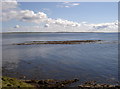
Ancient Settlement on the Isle of Westray, Orkney. At the south-western end of the island, on top of the headland at Berst Ness is an ancient settlement and what appears to be a Neolithic chambered tomb. The site was excavated in 2001, 2004 and again this summer.
According to Radio Orkney (via Wideford), Carbon 14 dates for burials have pushed back their age from what were previously thought to be Viking to Iron Age, 200BC-400AD. Many of them (mostly children) consisted of bagged bodies dropped vertically into spaces created by removing material from the structures' walls.
More on the 2001 digs at: http://www.orkneydigs.org.uk/westray/.
Note: "90 per cent of the known Iron Age remains found in Scotland to date", unearthed at Berst Ness, see comment
You may be viewing yesterday's version of this page. To see the most up to date information please register for a free account.
Do not use the above information on other web sites or publications without permission of the contributor.
Nearby Images from Geograph Britain and Ireland:
©2007(licence)
©2007(licence)
©2014(licence)
©2007(licence)
©2007(licence)
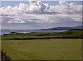
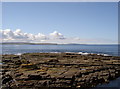
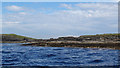
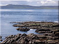
The above images may not be of the site on this page, they are loaded from Geograph.
Please Submit an Image of this site or go out and take one for us!
Click here to see more info for this site
Nearby sites
Key: Red: member's photo, Blue: 3rd party photo, Yellow: other image, Green: no photo - please go there and take one, Grey: site destroyed
Download sites to:
KML (Google Earth)
GPX (GPS waypoints)
CSV (Garmin/Navman)
CSV (Excel)
To unlock full downloads you need to sign up as a Contributory Member. Otherwise downloads are limited to 50 sites.
Turn off the page maps and other distractions
Nearby sites listing. In the following links * = Image available
1.9km NNW 339° Powdykes (Westray) Chambered Cairn (HY4343543627)
2.8km NNW 343° Fitty Hill (Westray) Chambered Cairn (HY43324451)
5.3km NNW 346° Knucker Hill (Westray) Chambered Cairn (HY4287547013)
5.6km N 349° Curquoy, Westray Cairn (HY431473)
6.1km NE 55° East Surrigarth (Westray) Chambered Cairn (HY49214520)
6.1km NNE 23° Tofts Ness (Sanday) Cairn (HY4654547449)
6.5km N 356° Westray Heritage Centre* Museum (HY43724825)
7.2km N 358° Pierowall Quarry* Chambered Cairn (HY43894905)
7.5km NNW 345° The Lum Head (Westray) Chambered Cairn (HY4221649107)
7.6km N 349° Links of Noltland* Ancient Village or Settlement (HY42804930)
8.8km N 10° Vere Point (Westray) Chambered Cairn (HY45845046)
9.1km S 180° Faraclett Head East Cairn (HY43993271)
9.1km S 180° Faraclett Head West Cairn (HY44003270)
9.1km S 175° Yetnasteen* Standing Stone (Menhir) (HY447327)
9.3km S 181° Bigland Round* Chambered Cairn (HY438325)
9.4km ESE 113° Faray Chambered Cairn (HY52743797)
9.6km SSW 208° Wasbister* Crannog (HY395334)
9.6km SSW 206° Bretta Ness* Ancient Village or Settlement (HY39723324)
9.7km S 183° Bigland Long (Rousay) Cairn (HY43533214)
9.7km S 172° Scockness* Ancient Village or Settlement (HY45263214)
10.0km S 189° Kierfea Hill (Rousay) Cairn (HY42423196)
10.4km SSW 204° Knowe of Lingro Cairn (HY3964832378)
10.5km S 191° Knowe of Craie* Chambered Cairn (HY41963153)
10.7km NNE 31° St Tredwell's Chapel Stone Row / Alignment (HY497509)
10.8km NNE 22° Knap of Howar* Ancient Village or Settlement (HY483518)
View more nearby sites and additional images


 We would like to know more about this location. Please feel free to add a brief description and any relevant information in your own language.
 Wir möchten mehr über diese Stätte erfahren. Bitte zögern Sie nicht, eine kurze Beschreibung und relevante Informationen in Deutsch hinzuzufügen.
 Nous aimerions en savoir encore un peu sur les lieux. S'il vous plaît n'hesitez pas à ajouter une courte description et tous les renseignements pertinents dans votre propre langue.
 Quisieramos informarnos un poco más de las lugares. No dude en añadir una breve descripción y otros datos relevantes en su propio idioma.