Featured: Friendly specialist tours to ancient, mystical and historical sites in the UK and beyond

Friendly specialist tours to ancient, mystical and historical sites in the UK and beyond

Random Image


Aberlemno

See Your Book Here

See Your Book Here

Who's Online

There are currently, 412 guests and 2 members online.

You are a guest. To join in, please register for free by clicking here

Sponsors

<< Our Photo Pages >> Wasbister - Crannog in Scotland in Orkney

Submitted by TimPrevett on Thursday, 15 February 2001  Page Views: 8679

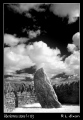
Iron Age and Later PrehistorySite Name: Wasbister
Country: Scotland County: Orkney Type: Crannog

Map Ref: HY395334  Landranger Map Number: 6
Latitude: 59.182970N  Longitude: 3.060414W
Condition:
5Perfect
4Almost Perfect
3Reasonable but with some damage
2Ruined but still recognisable as an ancient site
1Pretty much destroyed, possibly visible as crop marks
0No data.
-1Completely destroyed
3 Ambience:
5Superb
4Good
3Ordinary
2Not Good
1Awful
0No data.
4 Access:
5Can be driven to, probably with disabled access
4Short walk on a footpath
3Requiring a bit more of a walk
2A long walk
1In the middle of nowhere, a nightmare to find
0No data.
no data Accuracy:
5co-ordinates taken by GPS or official recorded co-ordinates
4co-ordinates scaled from a detailed map
3co-ordinates scaled from a bad map
2co-ordinates of the nearest village
1co-ordinates of the nearest town
0no data
3

Internal Links:
External Links:

I have visited· I would like to visit

whese001 would like to visit

PAB jeffrep TimPrevett have visited here

Wasbister
Wasbister submitted by TimPrevett : The more northerly of the two crannogs in Wasbister Loch. (Vote or comment on this photo)
Crannog in Orkney

Have you visited this site? Please contribute a description or any thoughts by adding a comment.
You may be viewing yesterday's version of this page. To see the most up to date information please register for a free account.


Wasbister Disc Barrow
Wasbister Disc Barrow submitted by howar : Wasbister Disc Barrow and end of Dyke of Se(e)an seen from top of Salt Knowe (Vote or comment on this photo)

Wasbister
Wasbister submitted by PAB : To help identification, this image shows the Loch of Wasbister, and the two pieces of land it contains. NB. The island at the western (left on image) end of the loch is referred to by Canmore as 'The Burrian', rather than simply 'Wasbister' as used on the Portal. Photo: June 2016 (Vote or comment on this photo)

Wasbister
Wasbister submitted by PAB : The Burrian, island in the Loch of Wasbister. As can be seen from the many comments on the Portal's site page, there is significant disagreement about the original and subsequent function and use of this island in the Loch of Wasbister. From my very fleeting visit, I can offer no opinion apart from the fact that it was striking enough for curiosity to lead me to take some photos for subs... (Vote or comment on this photo)

Wasbister
Wasbister submitted by howar : The Burrian (Vote or comment on this photo)

Wasbister
Wasbister submitted by howar : part of The Burrian with Knowe of Ham(m)ar at top of picture (Vote or comment on this photo)

Wasbister
Wasbister submitted by howar : The Burrian with modern graveyard on the land behind - Corse Kirk no longer there

Wasbister
Wasbister submitted by howar : The Burrian showing early walling at waterline

Wasbister
Wasbister submitted by jeffrep : Loch of Wasbister Crannogs from a Distance, Rousay, Orkney, Scotland

Wasbister
Wasbister submitted by jeffrep : Burrian, Loch of Wasbister Crannog, Rousay, Orkney, Scotland

Wasbister
Wasbister submitted by jeffrep : Closer View of Burrian, Loch of Wasbister Crannog, Rousay, Orkney, Scotland

Wasbister
Wasbister submitted by jeffrep : Brettaness, Loch of Wasbister Crannog, Rousay, Orkney, Scotland

Wasbister
Wasbister submitted by jeffrep : Closer View of Brettaness, Loch of Wasbister Crannog, Rousay, Orkney, Scotland

Wasbister Disc Barrow
Wasbister Disc Barrow submitted by howar : exposure along northern 'rim' [IIRC]

Wasbister Disc Barrow
Wasbister Disc Barrow submitted by howar : exposure of mound [IIRC]

Wasbister Disc Barrow
Wasbister Disc Barrow submitted by howar : exposure across top of northern 'rim'

Wasbister Disc Barrow
Wasbister Disc Barrow submitted by howar : barrow profile with Hoy in background

Wasbister Disc Barrow
Wasbister Disc Barrow submitted by howar : from northwards

Wasbister Disc Barrow
Wasbister Disc Barrow submitted by howar : from southwards to Wasbister hill

Wasbister Disc Barrow
Wasbister Disc Barrow submitted by howar : barrow and Wasbister hill

Wasbister Disc Barrow
Wasbister Disc Barrow submitted by howar : east 'half'

Wasbister Disc Barrow
Wasbister Disc Barrow submitted by howar : west 'half' with Dyke of Sean behind

Wasbister Disc Barrow
Wasbister Disc Barrow submitted by howar : view northwards across bank and mound

Wasbister Disc Barrow
Wasbister Disc Barrow submitted by howar : bank with mound

Wasbister Disc Barrow
Wasbister Disc Barrow submitted by howar : view westwards across mound and bank at northern side

Wasbister Cairn
Wasbister Cairn submitted by howar : mound L cairn R, looking W

These are just the first 25 photos of Wasbister. If you log in with a free user account you will be able to see our entire collection.

Do not use the above information on other web sites or publications without permission of the contributor.
Click here to see more info for this site

Nearby sites

Click here to view sites on an interactive OS map

Key: Red: member's photo, Blue: 3rd party photo, Yellow: other image, Green: no photo - please go there and take one, Grey: site destroyed

Download sites to:
KML (Google Earth)
GPX (GPS waypoints)
CSV (Garmin/Navman)
CSV (Excel)

To unlock full downloads you need to sign up as a Contributory Member. Otherwise downloads are limited to 50 sites.

Ancient Sites Directory by Chris Tweed


Turn off the page maps and other distractions

Nearby sites listing. In the following links * = Image available
 271m SE 125° Bretta Ness* Ancient Village or Settlement (HY39723324)
 1.0km S 171° Knowe of Lingro Cairn (HY3964832378)
 2.4km WSW 238° Knowe of Dale* Misc. Earthwork (HY37423217)
 3.1km SE 126° Knowe of Craie* Chambered Cairn (HY41963153)
 3.2km ESE 115° Kierfea Hill (Rousay) Cairn (HY42423196)
 3.6km SW 218° Midhowe Broch* Broch or Nuraghe (HY372306)
 3.6km SW 221° North Howe Broch* Broch or Nuraghe (HY3705130722)
 3.7km SW 217° Midhowe Chambered Cairn* Chambered Cairn (HY37223051)
 4.2km ESE 106° Bigland Long (Rousay) Cairn (HY43533214)
 4.2km SSW 210° Knowe of Rowiegar* Chambered Cairn (HY37332978)
 4.2km SSW 207° Knowe of Swandro* Chambered Cairn (HY37532966)
 4.4km E 101° Bigland Round* Chambered Cairn (HY438325)
 4.5km E 98° Faraclett Head East Cairn (HY43993271)
 4.5km E 98° Faraclett Head West Cairn (HY44003270)
 4.5km SSW 193° Westness Chambererd Tomb* Chambered Tomb (HY38402898)
 5.2km E 97° Yetnasteen* Standing Stone (Menhir) (HY447327)
 5.3km SE 144° Tammaskirk* Ancient Village or Settlement (HY42502907)
 5.3km S 182° Viera Lodge Broch or Nuraghe (HY392281)
 5.4km S 173° Knowe of Ramsay* Chambered Cairn (HY40042800)
 5.4km S 175° Knowe of Lairo* Chambered Cairn (HY39922796)
 5.5km S 169° Knowe of Yarso* Chambered Cairn (HY40482795)
 5.9km ESE 101° Scockness* Ancient Village or Settlement (HY45263214)
 6.0km S 170° Langstane (Orkney)* Standing Stone (Menhir) (HY404275)
 6.0km S 174° Knowe of Burrian (Frotoft)* Broch or Nuraghe (HY40062745)
 6.1km SSE 161° Blackhammer* Chambered Tomb (HY41422761)
View more nearby sites and additional images

<< Winterbourne Stoke

Callanish 4 >>

Please add your thoughts on this site

Neolithic Britain And Ireland

Neolithic Britain And Ireland

Archived Web links for Wasbister

Ancient Sites Directory by Chris Tweed

Sponsors

Auto-Translation (Google)

Translate from English into:

"Wasbister" | Login/Create an Account | 9 News and Comments
  
Go back to top of page    Comments are owned by the poster. We aren't responsible for their content.
Re: Wasbister by PAB on Tuesday, 12 January 2021
(User Info | Send a Message)
The Burrian

Further information and images are available on Canmore

[ Reply to This ]

Re: Wasbister by JohnRognvald on Wednesday, 09 October 2013
(User Info | Send a Message)
I don't see how the little island can be a crannog. I know this area well and have visited and rowed about Wasbister loch many times. I know that the loch is mostly artificial (note the dam and boathouse on the north-east side) where the Saviskail burn exits. There is also a local rumour that this island was once joined to the mainland by a causeway. Some evidence can be seen in aerial photographs.
[ Reply to This ]
    Re: Wasbister by golux on Thursday, 10 October 2013
    (User Info | Send a Message)
    If you look at any Scottish loch and find a very small island with vegetation but no subsurface rock then there is a good chance it is the remains of a crannog. They are much more common than you might expect.
    The fact that there are other man-made structures is no reason to think the loch is a modern construction. The presence of a causeway (not just a rumour, you can see it on the aerial photograph on the RCAHMS web page for this site) is good evidence for a crannog. And just to remove any possible doubt - RCAHMS report that a 2004 survey of the loch by snorkel divers found that "the edge of the island had a largely artificial appearance due to the stones from which it is formed. Mostly they are the common slabs from the area ...".
    Check out the RCAHMS page by the External Link above - it's the dark blue hieroglyph just left of the brown beer mug.
    [ Reply to This ]

Re: Wasbister by howar on Wednesday, 28 November 2012
(User Info | Send a Message)
RCAHMS record no. HY33SE 13 - the 1880 Namebook confusingly also givees this as the loch chapel site, with finds of deer remains and coins and reference to possible earlier building. In 1912 "The Orcadian" tells us that this island was still connected to the west shoreline by the remains of a bridge (then a foot underwater) with a fault half-way. Later underwater features were observed where it met the shore but these are apparently buried now. A 1972 report tells us that the stepping stones start midway along the north-west side of a ?modern wall on the island and continued visibly in that direction for some thirty metres. This wall running around the island is sub-divided into two unequal enclosures, but salmonberry hides any internal remains there might be. There may be traces of sections of an earlier wall a metre or two outside this, and just above the waterline walling has been noted. The combination of an island, The Burrian, and a promontory, Bretta Ness, is highly reminiscent of the Loch of Wasdale in Firth where these were seen as a kirk and its burial ground.
[ Reply to This ]

Re: Wasbister by howar on Sunday, 25 November 2012
(User Info | Send a Message)
1) Bretta Ness HY33SE 12 at HY39723324, 'headland' with mediaeval remains is a traditional kirk site
2) The Burrian HY33SE 77 at HY 395334 crannog with causeway. Burrian usually means a broch, and many of these do have causeways (though often on maps with legend "stepping Stones"), such as that in the Loch of Wasdale in Firth postulated as a causewayed island dun. NGR HY39493341.
N.B. HY33SE 13 at HY39493338 conflates the kirk and "(possible) broch"
[ Reply to This ]

Re: Wasbister by jeffrep on Monday, 30 August 2010
(User Info | Send a Message)
In Loch Wasbister on the Orkney isle of Rousay, there are two crannogs, artificial or natural islands found in Scotland and Ireland that were used for settlements during the Iron Age.

According to the "Around Rousay" website (http://www.aroundrousay.co.uk/): One of these islands is called Burrian. It is man-made, or artificial. The other, which has a similar structure, yet is at the edge of the loch, is Brettaness, which during a 1974 excavation indicated evidence it of being inhabited during Pictish times. It is the more southerly crannog with a small neck of land attaching it to the shore.
[ Reply to This ]

Re: Wasbister Loch by Anonymous on Wednesday, 11 February 2009
Sorry to disagree with these comments but I don't think that these are crannogs. One is just an ordinary island and the other "island" is attached to the surrounding ground. I visited both as a child way back in the fifties and rowed about in the loch many times. I seem to remember that there was some kind of structure on the island - someone told us that it had been a church.
The loch is actually partially artificial - there is a weir adjacent to the boathouse at the north side of the loch where it drains to Saviskail Bay. This has the effect of raising the level of the loch’s surface by about half a metre - to help the fishing of trout?. I have also heard tell that the island in the middle was once attached to the surrounding ground. Why would the ancients build a crannog attached to the surrounding land? Negates the whole thing.
[ Reply to This ]

Re: Wasbister by jeffrep on Thursday, 21 February 2008
(User Info | Send a Message)
In Loch Wasbister on Rousay, there are two crannogs, artificial or natural islands found in Scotland and Ireland that were used for settlements during the Iron Age. According to the "Around Rousay" website (http://www.aroundrousay.co.uk/wester.shtml#wasbisterloch): One of these islands is called Burrian. It is man-made, or artificial. The other, which has a similar structure, yet is at the edge of the loch, is Brettaness, which during a 1974 excavation indicated evidence it of being inhabitied during Pictish times. It is the more southerly crannog with a small neck of land attaching it to the shore.
[ Reply to This ]

Re: Wasbister by TimPrevett on Thursday, 22 June 2006
(User Info | Send a Message)
There are actually two crannogs here, the more southerly linked slightly still to the land. The tourist map for the Island has the names "Burrian" with the more northerly and "Bretta Ness" to the more southerly; it is unclear if they are the names for each respective crannog.
[ Reply to This ]

Your Name: Anonymous [ Register Now ]
Subject:


Add your comment or contribution to this page. Spam or offensive posts are deleted immediately, don't even bother

<<< What is five plus one as a number? (Please type the answer to this question in the little box on the left)
You can also embed videos and other things. For Youtube please copy and paste the 'embed code'.
For Google Street View please include Street View in the text.
Create a web link like this: <a href="https://www.megalithic.co.uk">This is a link</a>  

Allowed HTML is:
<p> <b> <i> <a> <img> <em> <br> <strong> <blockquote> <tt> <li> <ol> <ul> <object> <param> <embed> <iframe>

We would like to know more about this location. Please feel free to add a brief description and any relevant information in your own language.
Wir möchten mehr über diese Stätte erfahren. Bitte zögern Sie nicht, eine kurze Beschreibung und relevante Informationen in Deutsch hinzuzufügen.
Nous aimerions en savoir encore un peu sur les lieux. S'il vous plaît n'hesitez pas à ajouter une courte description et tous les renseignements pertinents dans votre propre langue.
Quisieramos informarnos un poco más de las lugares. No dude en añadir una breve descripción y otros datos relevantes en su propio idioma.