<< Our Photo Pages >> Llancayo Camp - Hillfort in Wales in Monmouthshire
Submitted by vicky on Sunday, 21 July 2002 Page Views: 8026
Iron Age and Later PrehistorySite Name: Llancayo CampCountry: Wales County: Monmouthshire Type: Hillfort
Nearest Town: Usk Nearest Village: Gwehelog Fawr
Map Ref: SO37830383 Landranger Map Number: 161
Latitude: 51.729722N Longitude: 2.901572W
Condition:
| 5 | Perfect |
| 4 | Almost Perfect |
| 3 | Reasonable but with some damage |
| 2 | Ruined but still recognisable as an ancient site |
| 1 | Pretty much destroyed, possibly visible as crop marks |
| 0 | No data. |
| -1 | Completely destroyed |
| 5 | Superb |
| 4 | Good |
| 3 | Ordinary |
| 2 | Not Good |
| 1 | Awful |
| 0 | No data. |
| 5 | Can be driven to, probably with disabled access |
| 4 | Short walk on a footpath |
| 3 | Requiring a bit more of a walk |
| 2 | A long walk |
| 1 | In the middle of nowhere, a nightmare to find |
| 0 | No data. |
| 5 | co-ordinates taken by GPS or official recorded co-ordinates |
| 4 | co-ordinates scaled from a detailed map |
| 3 | co-ordinates scaled from a bad map |
| 2 | co-ordinates of the nearest village |
| 1 | co-ordinates of the nearest town |
| 0 | no data |
Be the first person to rate this site - see the 'Contribute!' box in the right hand menu.
Internal Links:
External Links:
")
Coflein site no. 306434
You may be viewing yesterday's version of this page. To see the most up to date information please register for a free account.
Do not use the above information on other web sites or publications without permission of the contributor.
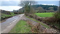
Nearby Images from Geograph Britain and Ireland:
©2012(licence)
©2012(licence)
©2012(licence)
©2012(licence)
©2016(licence)
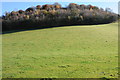
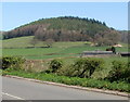
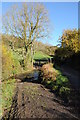
The above images may not be of the site on this page, they are loaded from Geograph.
Please Submit an Image of this site or go out and take one for us!
Click here to see more info for this site
Nearby sites
Key: Red: member's photo, Blue: 3rd party photo, Yellow: other image, Green: no photo - please go there and take one, Grey: site destroyed
Download sites to:
KML (Google Earth)
GPX (GPS waypoints)
CSV (Garmin/Navman)
CSV (Excel)
To unlock full downloads you need to sign up as a Contributory Member. Otherwise downloads are limited to 50 sites.
Turn off the page maps and other distractions
Nearby sites listing. In the following links * = Image available
1.9km WNW 285° Trostrey Stone Circle (SO35950435)
2.3km SE 125° Gwehelog Fawr Ancient Village or Settlement (SO397025)
2.5km WSW 242° Llancayo Barrow Cemetery* Barrow Cemetery (SO356027)
3.3km NNW 335° Coed y Bwynydd Camp* Hillfort (SO36500680)
3.8km S 184° Twyn Bell Camp Ancient Village or Settlement (SO375000)
4.3km NNE 17° Camp Hill Bryngwyn Ancient Village or Settlement (SO391079)
5.0km NW 326° Llanover Fawr Round Barrow(s) (SO351080)
5.2km NE 42° Raglan Cross* Ancient Cross (SO4134007660)
5.3km ESE 120° Earthwork Misc. Earthwork (SO424011)
5.4km E 95° Great House Camp* Hillfort (SO432033)
6.4km SE 130° Camp Farm* Misc. Earthwork (ST427997)
7.2km S 182° St Cybi's Well (Llangybi)* Holy Well or Sacred Spring (ST3744796662)
7.5km S 178° Llangybi Bottom Stone* Standing Stone (Menhir) (ST38049638)
7.9km SE 142° Golden Hill Earthwork Hillfort (ST42579753)
8.1km W 278° Ffynnon Angaeron* Holy Well or Sacred Spring (SO298051)
8.1km ESE 119° Cwrt-Y-Gaer Misc. Earthwork (ST449998)
8.1km NW 306° Ffynnon Gofer (Llanover)* Holy Well or Sacred Spring (SO313087)
8.2km SE 129° Gaer Fawr (Monmouthshire) Hillfort (ST441986)
8.6km SSW 192° Cefn-Carnau* Stone Circle (ST360954)
9.3km SSW 193° Llwyn-celyn Defended Enclosure Hillfort (ST3556294790)
9.4km WSW 253° Pontypool Gorsedd Circle Modern Stone Circle etc (SO2875001181)
9.5km S 175° Bwllfa Cottages Henge Henge (ST38509431)
9.7km S 187° Cae Camp standing stone* Modern Stone Circle etc (ST36489422)
9.9km SE 135° y Garn Llwyd* Chambered Tomb (ST44769674)
9.9km S 187° Cefn-Henllan Stone Circle* Modern Stone Circle etc (ST36589400)
View more nearby sites and additional images


 We would like to know more about this location. Please feel free to add a brief description and any relevant information in your own language.
 Wir möchten mehr über diese Stätte erfahren. Bitte zögern Sie nicht, eine kurze Beschreibung und relevante Informationen in Deutsch hinzuzufügen.
 Nous aimerions en savoir encore un peu sur les lieux. S'il vous plaît n'hesitez pas à ajouter une courte description et tous les renseignements pertinents dans votre propre langue.
 Quisieramos informarnos un poco más de las lugares. No dude en añadir una breve descripción y otros datos relevantes en su propio idioma.