


<< Our Photo Pages >> Cairn Kenny - Passage Grave in Scotland in Dumfries and Galloway
Submitted by vicky on Sunday, 21 July 2002 Page Views: 5261
Neolithic and Bronze AgeSite Name: Cairn KennyCountry: Scotland County: Dumfries and Galloway Type: Passage Grave
Nearest Town: Stranraer Nearest Village: Glenwhilly
Map Ref: NX17467525 Landranger Map Number: 76
Latitude: 55.038147N Longitude: 4.858158W
Condition:
| 5 | Perfect |
| 4 | Almost Perfect |
| 3 | Reasonable but with some damage |
| 2 | Ruined but still recognisable as an ancient site |
| 1 | Pretty much destroyed, possibly visible as crop marks |
| 0 | No data. |
| -1 | Completely destroyed |
| 5 | Superb |
| 4 | Good |
| 3 | Ordinary |
| 2 | Not Good |
| 1 | Awful |
| 0 | No data. |
| 5 | Can be driven to, probably with disabled access |
| 4 | Short walk on a footpath |
| 3 | Requiring a bit more of a walk |
| 2 | A long walk |
| 1 | In the middle of nowhere, a nightmare to find |
| 0 | No data. |
| 5 | co-ordinates taken by GPS or official recorded co-ordinates |
| 4 | co-ordinates scaled from a detailed map |
| 3 | co-ordinates scaled from a bad map |
| 2 | co-ordinates of the nearest village |
| 1 | co-ordinates of the nearest town |
| 0 | no data |
Internal Links:
External Links:
")
For more information about this Neolithic Chambered Cairn see Canmore ID 61771.
Their 1985 entry records: "This cairn has been considerably disturbed (since 1962). Measuring 15m in diameter, the cairn still stands to a maximum height of 1.6m, although the upper 0.5m appears to be spoil from the excavation trench that has revealed the chamber at its centre. All that is now visible of the chamber, however, are four massive side slabs set in opposed pairs at the W end of the chamber. The western slab on the S has been displaced, obscuring the end of the passage and the broken lintel that was previously recorded. Nothing can be seen of the other two pairs of orthostats recorded to the E, and the lintel that spanned the second pair appears to have been removed."
You may be viewing yesterday's version of this page. To see the most up to date information please register for a free account.
")
")
Do not use the above information on other web sites or publications without permission of the contributor.
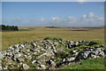
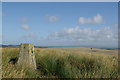
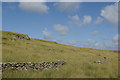
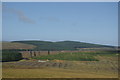
Nearby Images from Geograph Britain and Ireland:
©2009(licence)
©2009(licence)
©2009(licence)
©2009(licence)
©2008(licence)
The above images may not be of the site on this page, they are loaded from Geograph.
Please Submit an Image of this site or go out and take one for us!
Click here to see more info for this site
Nearby sites
Key: Red: member's photo, Blue: 3rd party photo, Yellow: other image, Green: no photo - please go there and take one, Grey: site destroyed
Download sites to:
KML (Google Earth)
GPX (GPS waypoints)
CSV (Garmin/Navman)
CSV (Excel)
To unlock full downloads you need to sign up as a Contributory Member. Otherwise downloads are limited to 50 sites.
Turn off the page maps and other distractions
Nearby sites listing. In the following links * = Image available
516m SE 137° Markdhu White Cairn* Cairn (NX17807486)
2.1km ESE 123° Miltonish Stone Circle (NX192740)
2.1km ESE 122° Miltonise North Cairn* Cairn (NX19257405)
3.0km N 358° Arecleoch Chambered Cairn Chambered Cairn (NX175783)
4.1km N 10° Cave Cairn (Chirmorrie)* Chambered Cairn (NX18317924)
5.1km WSW 238° Laganbeastie East* Cairn (NX13057271)
5.1km WSW 238° Laganabeastie West* Cairn (NX13007271)
5.3km SW 229° Grey Hill (Shennas)* Cairn (NX13307198)
5.8km S 173° Craigbirnoch NW Cairn* Cairn (NX17946944)
5.9km S 172° Craigbirnoch NE Cairn* Cairn (NX18026940)
6.0km SE 125° Laggangarn* Standing Stones (NX22237166)
6.0km S 176° Craigbirnoch Central NW Cairn* Cairn (NX17656925)
6.0km S 175° Craigbirnoch Central SE Cairn* Cairn (NX17706920)
6.2km ESE 116° Wells of the Rees* Holy Well or Sacred Spring (NX22977232)
6.4km S 175° Craigbirnoch S Cairn* Cairn (NX17806884)
6.4km ENE 56° Laggish White Cairn* Cairn (NX22987860)
7.0km N 0° Arecleoch Standing Stone* Standing Stone (Menhir) (NX178822)
7.0km SSW 193° Kilfeddar Farm* Cairn (NX15626852)
7.2km S 187° Altigoukie Burn Cairn* Cairn (NX16266817)
7.2km WSW 242° Drumanwherran N* Cairn (NX10967212)
7.2km S 187° Altigoukie Burn Burnt Mound* Misc. Earthwork (NX16336811)
7.2km WSW 237° Drumanwherran S Cairn Cemetery* Cairn (NX11207160)
7.4km WSW 251° Friar's Kirk SE* Cairn (NX10407308)
7.5km WSW 252° Friar's Kirk NW* Cairn (NX10197322)
7.9km SW 233° Brockloch Fell* Cairn (NX10947075)
View more nearby sites and additional images


 We would like to know more about this location. Please feel free to add a brief description and any relevant information in your own language.
 Wir möchten mehr über diese Stätte erfahren. Bitte zögern Sie nicht, eine kurze Beschreibung und relevante Informationen in Deutsch hinzuzufügen.
 Nous aimerions en savoir encore un peu sur les lieux. S'il vous plaît n'hesitez pas à ajouter une courte description et tous les renseignements pertinents dans votre propre langue.
 Quisieramos informarnos un poco más de las lugares. No dude en añadir una breve descripción y otros datos relevantes en su propio idioma.