<< Our Photo Pages >> Knowe of Swandro - Chambered Cairn in Scotland in Orkney
Submitted by SolarMegalith on Tuesday, 03 July 2018 Page Views: 9612
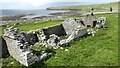
Neolithic and Bronze AgeSite Name: Knowe of SwandroCountry: Scotland County: Orkney Type: Chambered Cairn
Nearest Village: Isle of Rousay
Map Ref: HY37532966
Latitude: 59.149105N Longitude: 3.093806W
Condition:
| 5 | Perfect |
| 4 | Almost Perfect |
| 3 | Reasonable but with some damage |
| 2 | Ruined but still recognisable as an ancient site |
| 1 | Pretty much destroyed, possibly visible as crop marks |
| 0 | No data. |
| -1 | Completely destroyed |
| 5 | Superb |
| 4 | Good |
| 3 | Ordinary |
| 2 | Not Good |
| 1 | Awful |
| 0 | No data. |
| 5 | Can be driven to, probably with disabled access |
| 4 | Short walk on a footpath |
| 3 | Requiring a bit more of a walk |
| 2 | A long walk |
| 1 | In the middle of nowhere, a nightmare to find |
| 0 | No data. |
| 5 | co-ordinates taken by GPS or official recorded co-ordinates |
| 4 | co-ordinates scaled from a detailed map |
| 3 | co-ordinates scaled from a bad map |
| 2 | co-ordinates of the nearest village |
| 1 | co-ordinates of the nearest town |
| 0 | no data |
Internal Links:
External Links:
I have visited· I would like to visit
whese001 would like to visit
RBaker visited on 4th Jul 2018 - their rating: Amb: 4 Access: 3 Ongoing Dig Site with the Swandro Archaeology Trust - with lovely guided tour and friendly greeting with lots of information.
Redfun Andy B have visited here
")
Source: MacKie, E. 2002. Roundhouses, Brochs and Wheelhouses of Atlantic Scotland c. 700 BC – AD 500. Part I: The Orkney and Shetland Isles. Oxford: Archaeopress. (p. 233)
Note: Knowe of Swandro excavation underway, with Dig Diary and Videos - Open Days every Sunday
You may be viewing yesterday's version of this page. To see the most up to date information please register for a free account.
")
Do not use the above information on other web sites or publications without permission of the contributor.
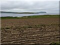
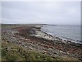
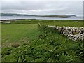
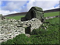
Nearby Images from Geograph Britain and Ireland:
©2023(licence)
©2007(licence)
©2023(licence)
©2013(licence)
©2021(licence)
The above images may not be of the site on this page, they are loaded from Geograph.
Please Submit an Image of this site or go out and take one for us!
Click here to see more info for this site
Nearby sites
Key: Red: member's photo, Blue: 3rd party photo, Yellow: other image, Green: no photo - please go there and take one, Grey: site destroyed
Download sites to:
KML (Google Earth)
GPX (GPS waypoints)
CSV (Garmin/Navman)
CSV (Excel)
To unlock full downloads you need to sign up as a Contributory Member. Otherwise downloads are limited to 50 sites.
Turn off the page maps and other distractions
Nearby sites listing. In the following links * = Image available
233m WNW 300° Knowe of Rowiegar* Chambered Cairn (HY37332978)
903m NNW 339° Midhowe Chambered Cairn* Chambered Cairn (HY37223051)
995m NNW 340° Midhowe Broch* Broch or Nuraghe (HY372306)
1.1km SE 127° Westness Chambererd Tomb* Chambered Tomb (HY38402898)
1.2km NNW 335° North Howe Broch* Broch or Nuraghe (HY3705130722)
2.3km SE 132° Viera Lodge Broch or Nuraghe (HY392281)
2.5km N 357° Knowe of Dale* Misc. Earthwork (HY37423217)
2.9km SSE 166° Aikerness Class I Pictish Symbol Stone (HY38182685)
2.9km SSE 166° Gurness* Broch or Nuraghe (HY3818926842)
2.9km SE 125° Knowe of Lairo* Chambered Cairn (HY39922796)
3.0km ESE 123° Knowe of Ramsay* Chambered Cairn (HY40042800)
3.0km SW 218° Knowe of Grugar* Broch or Nuraghe (HY35642730)
3.0km SW 229° Burgar* Broch or Nuraghe (HY352277)
3.1km SSW 200° Knowe of Stenso* Broch or Nuraghe (HY3639426747)
3.3km SW 235° West Broch of Burgar* Chambered Cairn (HY34822782)
3.4km SE 130° Knowe of Burrian (Frotoft)* Broch or Nuraghe (HY40062745)
3.4km ESE 119° Knowe of Yarso* Chambered Cairn (HY40482795)
3.4km NE 37° Knowe of Lingro Cairn (HY3964832378)
3.5km SW 219° Grugar* Carving (HY353270)
3.6km SE 126° Langstane (Orkney)* Standing Stone (Menhir) (HY404275)
3.9km WSW 255° Peterkirk* Broch or Nuraghe (HY337287)
4.2km NNE 30° Bretta Ness* Ancient Village or Settlement (HY39723324)
4.2km NNE 27° Wasbister* Crannog (HY395334)
4.4km ESE 117° Blackhammer* Chambered Tomb (HY41422761)
4.6km S 175° Quoys Chambered Cairn Chambered Cairn (HY37822507)
View more nearby sites and additional images


 We would like to know more about this location. Please feel free to add a brief description and any relevant information in your own language.
 Wir möchten mehr über diese Stätte erfahren. Bitte zögern Sie nicht, eine kurze Beschreibung und relevante Informationen in Deutsch hinzuzufügen.
 Nous aimerions en savoir encore un peu sur les lieux. S'il vous plaît n'hesitez pas à ajouter une courte description et tous les renseignements pertinents dans votre propre langue.
 Quisieramos informarnos un poco más de las lugares. No dude en añadir una breve descripción y otros datos relevantes en su propio idioma.