


<< Our Photo Pages >> Knowe of Burrian (Frotoft) - Broch or Nuraghe in Scotland in Orkney
Submitted by howar on Tuesday, 30 May 2017 Page Views: 1472
Iron Age and Later PrehistorySite Name: Knowe of Burrian (Frotoft)Country: Scotland County: Orkney Type: Broch or Nuraghe
Nearest Town: Kirkwall Nearest Village: Trumland
Map Ref: HY40062745
Latitude: 59.129627N Longitude: 3.048979W
Condition:
| 5 | Perfect |
| 4 | Almost Perfect |
| 3 | Reasonable but with some damage |
| 2 | Ruined but still recognisable as an ancient site |
| 1 | Pretty much destroyed, possibly visible as crop marks |
| 0 | No data. |
| -1 | Completely destroyed |
| 5 | Superb |
| 4 | Good |
| 3 | Ordinary |
| 2 | Not Good |
| 1 | Awful |
| 0 | No data. |
| 5 | Can be driven to, probably with disabled access |
| 4 | Short walk on a footpath |
| 3 | Requiring a bit more of a walk |
| 2 | A long walk |
| 1 | In the middle of nowhere, a nightmare to find |
| 0 | No data. |
| 5 | co-ordinates taken by GPS or official recorded co-ordinates |
| 4 | co-ordinates scaled from a detailed map |
| 3 | co-ordinates scaled from a bad map |
| 2 | co-ordinates of the nearest village |
| 1 | co-ordinates of the nearest town |
| 0 | no data |
Internal Links:
External Links:
 (PID:166255)")
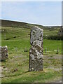
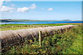
NMRS record no. HY42NW 13 mostly carried away by the sea and suffered from quarrying, but fragments of masonry along the shore show it is a broch and fallen stones are heaped up landward. A substantial steep-sided ~2m high mound represents the N section and there is a possible outer bank beyond a naust on the W side (there is a corresponding naust on the E side). Coincidentally it is in the same position relative to the Langsteen that the Knowe of Hunclett is to a modern standing stone.
For more information see Canmore ID 2627 which says: "Knowe of Burrian: A considerable portion of this knoll has been carried away by the sea, and it has also suffered severely through quarrying ..... a substantial, steep mound containing a broch. Stone-built nausts or boat-houses are constructed against the broch on the E and W sides. Beyond the boat-house on the W, there are some indications of an outer bank."
You may be viewing yesterday's version of this page. To see the most up to date information please register for a free account.
 (PID:166256)")
 (PID:166254)")
 (PID:166257)")
 (PID:166253)")
Do not use the above information on other web sites or publications without permission of the contributor.
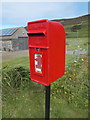
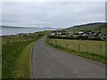
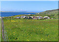
Nearby Images from Geograph Britain and Ireland:
©2015(licence)
©2023(licence)
©2023(licence)
©2021(licence)
©2009(licence)
The above images may not be of the site on this page, they are loaded from Geograph.
Please Submit an Image of this site or go out and take one for us!
Click here to see more info for this site
Nearby sites
Key: Red: member's photo, Blue: 3rd party photo, Yellow: other image, Green: no photo - please go there and take one, Grey: site destroyed
Download sites to:
KML (Google Earth)
GPX (GPS waypoints)
CSV (Garmin/Navman)
CSV (Excel)
To unlock full downloads you need to sign up as a Contributory Member. Otherwise downloads are limited to 50 sites.
Turn off the page maps and other distractions
Nearby sites listing. In the following links * = Image available
343m E 81° Langstane (Orkney)* Standing Stone (Menhir) (HY404275)
528m NNW 344° Knowe of Lairo* Chambered Cairn (HY39922796)
550m N 357° Knowe of Ramsay* Chambered Cairn (HY40042800)
652m NE 39° Knowe of Yarso* Chambered Cairn (HY40482795)
1.1km NW 306° Viera Lodge Broch or Nuraghe (HY392281)
1.4km E 82° Blackhammer* Chambered Tomb (HY41422761)
1.4km E 99° Knowe of Hunclett* Broch or Nuraghe (HY41442722)
2.0km WSW 251° Gurness* Broch or Nuraghe (HY3818926842)
2.0km WSW 251° Aikerness Class I Pictish Symbol Stone (HY38182685)
2.3km NW 312° Westness Chambererd Tomb* Chambered Tomb (HY38402898)
2.5km E 85° Taversoe Tuick* Chambered Cairn (HY42572761)
2.6km S 179° Ness of Woodwick* Broch or Nuraghe (HY40072487)
2.9km NE 55° Tammaskirk* Ancient Village or Settlement (HY42502907)
3.3km SW 222° Quoys Chambered Cairn Chambered Cairn (HY37822507)
3.3km SW 217° Redland South* Chambered Cairn (HY38002484)
3.4km NW 310° Knowe of Swandro* Chambered Cairn (HY37532966)
3.6km NW 310° Knowe of Rowiegar* Chambered Cairn (HY37332978)
3.7km WSW 258° Knowe of Stenso* Broch or Nuraghe (HY3639426747)
3.8km S 183° Knowe of Midgarth* Ancient Village or Settlement (HY39812361)
3.9km E 81° Cubbie Roo's Burden* Chambered Cairn (HY43932800)
4.2km NW 316° Midhowe Chambered Cairn* Chambered Cairn (HY37223051)
4.2km NW 317° Midhowe Broch* Broch or Nuraghe (HY372306)
4.4km W 267° Knowe of Grugar* Broch or Nuraghe (HY35642730)
4.4km NW 317° North Howe Broch* Broch or Nuraghe (HY3705130722)
4.5km NNE 24° Knowe of Craie* Chambered Cairn (HY41963153)
View more nearby sites and additional images


 We would like to know more about this location. Please feel free to add a brief description and any relevant information in your own language.
 Wir möchten mehr über diese Stätte erfahren. Bitte zögern Sie nicht, eine kurze Beschreibung und relevante Informationen in Deutsch hinzuzufügen.
 Nous aimerions en savoir encore un peu sur les lieux. S'il vous plaît n'hesitez pas à ajouter une courte description et tous les renseignements pertinents dans votre propre langue.
 Quisieramos informarnos un poco más de las lugares. No dude en añadir una breve descripción y otros datos relevantes en su propio idioma.