<< Our Photo Pages >> Swinside - Stone Circle in England in Cumbria
Submitted by Andy B on Monday, 20 April 2020 Page Views: 70034
Neolithic and Bronze AgeSite Name: Swinside Alternative Name: Sunkenkirk, Sunken KirkCountry: England County: Cumbria Type: Stone Circle
Nearest Town: Millom Nearest Village: Broughton in Furness
Map Ref: SD17168817 Landranger Map Number: 96
Latitude: 54.282426N Longitude: 3.273902W
Condition:
| 5 | Perfect |
| 4 | Almost Perfect |
| 3 | Reasonable but with some damage |
| 2 | Ruined but still recognisable as an ancient site |
| 1 | Pretty much destroyed, possibly visible as crop marks |
| 0 | No data. |
| -1 | Completely destroyed |
| 5 | Superb |
| 4 | Good |
| 3 | Ordinary |
| 2 | Not Good |
| 1 | Awful |
| 0 | No data. |
| 5 | Can be driven to, probably with disabled access |
| 4 | Short walk on a footpath |
| 3 | Requiring a bit more of a walk |
| 2 | A long walk |
| 1 | In the middle of nowhere, a nightmare to find |
| 0 | No data. |
| 5 | co-ordinates taken by GPS or official recorded co-ordinates |
| 4 | co-ordinates scaled from a detailed map |
| 3 | co-ordinates scaled from a bad map |
| 2 | co-ordinates of the nearest village |
| 1 | co-ordinates of the nearest town |
| 0 | no data |
Internal Links:
External Links:
I have visited· I would like to visit
aluta celticmaiden55 branenalsem jeffrep 43559959 DrewParsons PAB irv coin taysMP jimstone whese001 sirius_b Grianan would like to visit
rvbaker2003 visited on 2nd Jan 2025 - their rating: Cond: 5 Amb: 5 Access: 2
Hogeybare visited on 18th Nov 2023 - their rating: Cond: 4 Amb: 5 Access: 3 This is a lovely site, at the top of the hill, pathway past the farm route is a nightmare unless you are in a 4x4 so park up and walk the narrow pothole ridden path.
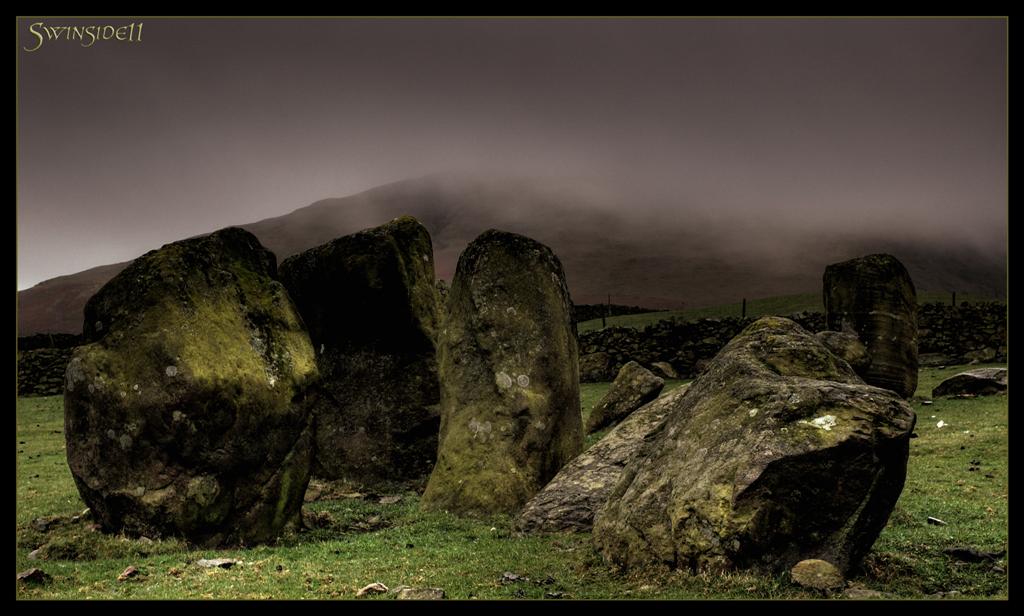
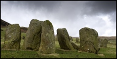
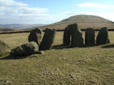
Stones are large and mostly upright, great views across the valley, we had clouds about 50m above us which made it very atmospheric.
bishop_pam visited on 22nd Jun 2023 - their rating: Cond: 5 Amb: 5 Access: 2
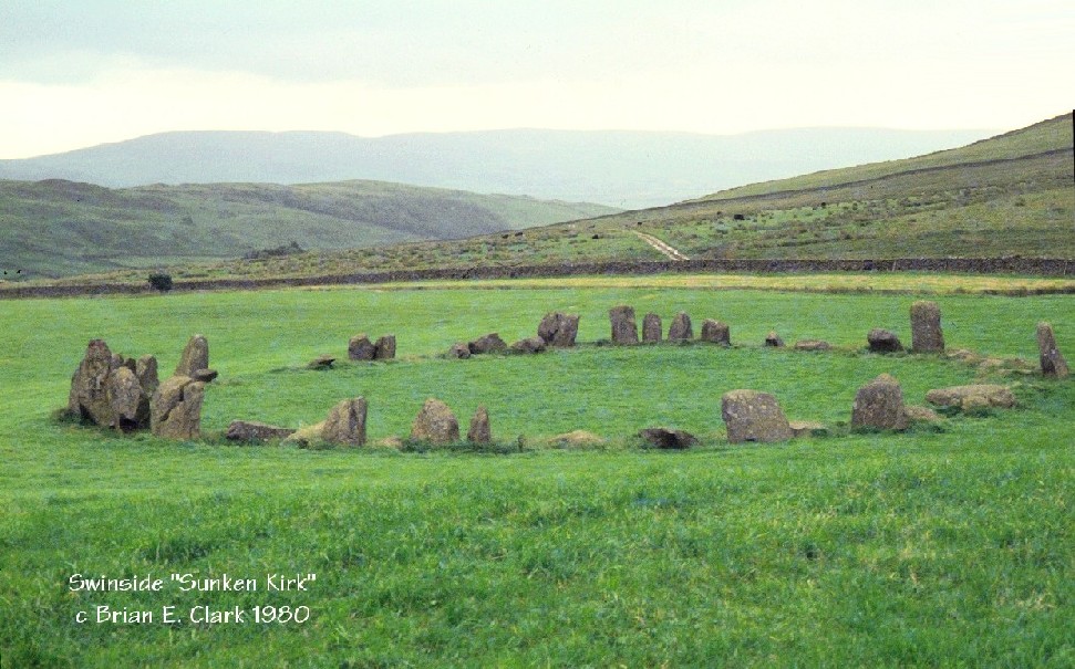
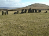
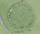
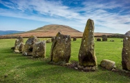
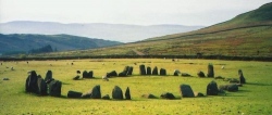
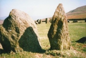
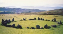
drolaf visited on 20th Sep 2020 - their rating: Cond: 4 Amb: 5 Access: 4 Distinctive tall pointed northerly and large squared southerly stones. At some parts of the ring, stones are very close or touching, suggesting that originally it was a solid circle. So it is possible not correct to say it is complete and perfect. To the north east can be seen the peaks of Dunnerdale, ergo you can see Swinside from Dunnerdale fells. There is a good view of the stone circle if you climb up Swinside fell to the west, from where you will also see a grand view of the Lakes peaks, the Dudder estuary, and offshore windmills (sailing just isn’t fun anymore).
GMHobbit visited on 29th Oct 2019 - their rating: Cond: 3 Amb: 5 Access: 2
Meaty_Mungus visited on 19th Jan 2019 - their rating: Cond: 5 Amb: 5 Access: 3
sba_dk visited on 10th Jul 2018 - their rating: Cond: 5 Amb: 5 Access: 3
trystan_hughes visited on 14th Apr 2016 - their rating: Cond: 5 Amb: 5 Access: 3
RockHugger visited on 28th Feb 2016 - their rating: Cond: 5 Amb: 4 Access: 4
NorthernerInLondon visited on 1st Dec 2015 - their rating: Cond: 4 Amb: 5 Access: 4 Perhaps my favourite stone circle (beating Castlerigg!)
Anne T visited on 5th Jul 2014 - their rating: Cond: 4 Amb: 5 Access: 3 After an afternoon spent visiting the Shap Stone Row, my husband was particularly keen to see Swinside Stone Circle, so we took an additional hour to travel to this site. I have to say it was well worth the visit, and I would very definitely go again.
We parked in a small layby just down from Cragg Hall and walked up the marked public bridleway to Swinside (Sunkenkirk) Stone Circle. The first part of the track was steep, but concreted and thankfully short; the rest of the walk was relatively level and had magnificent views. Visibility during our visit was amazing, and we estimated we could see a good 30 miles to the eastern lakes in the far distance. The tide was out, but we had a good view of (what I am assuming from my limited map reading skills!) Duddon Sands in the estuary below until the land levelled out and we could see the circle in the far distance ahead of us.
Surprisingly, we were passed by two separate cars heading up to the farmhouses further up the track - what a remote, but very lovely place to live.
The circle surpassed my expectations. It had a wonderful atmosphere, and I would happily have stayed there until sunset, which, being summer, was a good 5 or 6 hours away, and sadly we had to get home the same evening.
My photographs aren't as good as some of the ones already on the Portal website, so in the images I've submitted, I've tried to pick out some of the features which stood out for me, which include the portal stones at the entrance to the circle.
On reflection, I think we should have climbed up Swinside Fell to get a distant shot of the circle, which would have completed my album for the circle. Next time.
Just to note that in the fields to either side of the bridlepath (particularly the right hand side) leading up to the circle, there were a large number of what appeared to be shaped stones, and we wondered if at one time there had been an avenue leading up to the circle. I've submitted a picture of one stone which has a striking resemblance to the stone in the circle with the quartz banding across it.
SumDoood visited on 1st Jul 2014 - their rating: Cond: 4 Amb: 4 Access: 3 Any suggestions / thoughts on the track / path seen here leading south from the sharp turning in the farm road a very short distance south of the circle: http://goo.gl/maps/HKskO ? I didn't notice the track on my visit, but wonder now if it is the original approach route to the circle, rather than a modern but (almost) disused farmer's horse / quad bike route.
kthdsn visited on 10th May 2014 - their rating: Cond: 4 Amb: 4 Access: 3
ModernExplorers visited on 2nd Mar 2013 - their rating: Cond: 4 Amb: 4 Access: 3 A well preserved stone circle surrounded by beautiful scenery
Swinside visited on 1st May 2012 - their rating: Cond: 4 Amb: 5 Access: 5 My favourite stone circle - great condition, wonderful ambience and we had the place to ourselves. A short walk down a (flat) country road. The circle is in a farmer's field and visible from the road.
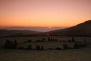
Hesperides visited on 1st Jun 2011 - their rating: Cond: 4 Amb: 5 Access: 3 Magnificent site, especially beautiful just before sunset. When we visited, there was only one other party, who soon left.
casterton visited on 10th Feb 2011 - their rating: Cond: 5 Amb: 4 Access: 3 lovely majestic site, sunkenkirk the site of a goddodin stand against the saxon
markj99 visited on 18th Jan 2011 - their rating: Cond: 4 Amb: 5 Access: 3 It takes time and planning to visit Sunkenkirk Stone Circle. However this stone circle, virtually complete in a beautiful location, more than compensates the effort required.
SteveC visited on 23rd Sep 2010 - their rating: Cond: 5 Amb: 4 Access: 3
BolshieBoris visited on 1st Jan 1992 - their rating: Cond: 5 Amb: 5 Access: 2
Andy B: would like to visit Sunkenkirk stone circle (alternative name) - Episode Three of BBC's History of Ancient Britain
ssituationist visited - their rating: Amb: 5
Izozo Humbucker TheCaptain MAIGO Bladup rldixon TheWhiteRider nicoladidsbury AngieLake Linanjohn have visited here
Average ratings for this site from all visit loggers: Condition: 4.4 Ambience: 4.71 Access: 3.05
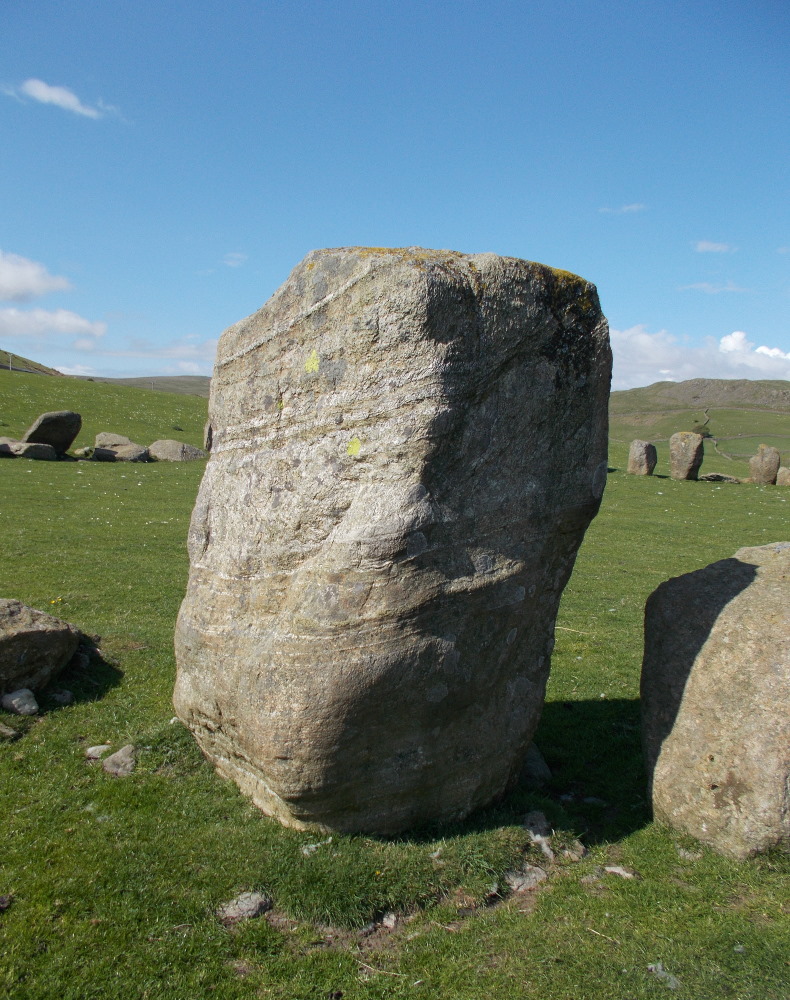
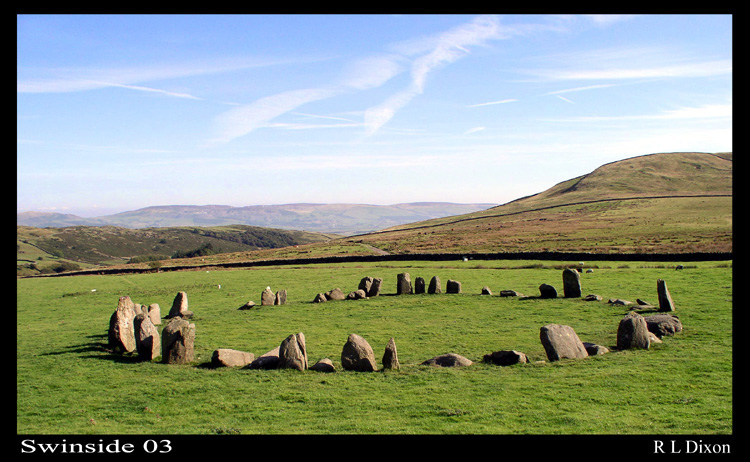
Swinside Circle near Millom is one of my favourites. Located at SD172883, access is via a long farm track from a minor road branching off the A595. (SD180865).
There is a very brief entry on Pastscape Monument No. 37229.
Swinside (also known as Sunkenkirk) was featured in Episode Three of BBC's History of Ancient Britain. View all the sites visited in Andy B's site visit log and see the page comments for links.
Note: Apparently this stone is made of porphyritic slate. I just thought it was gneiss. (groan)
You may be viewing yesterday's version of this page. To see the most up to date information please register for a free account.
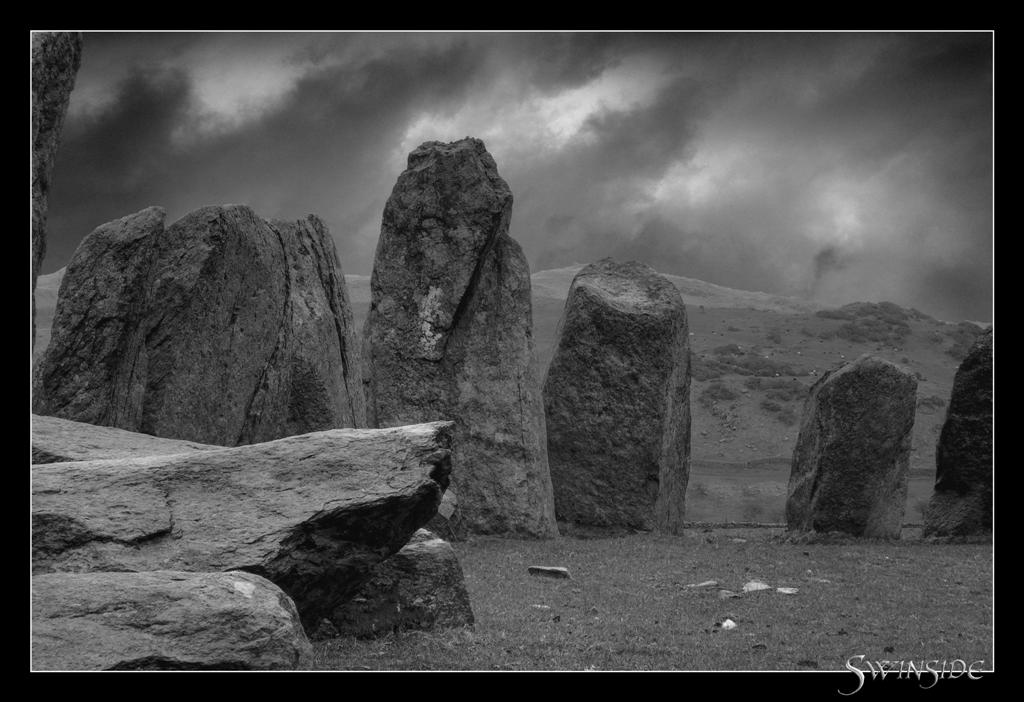
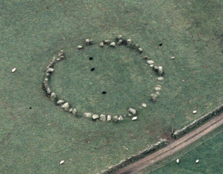




These are just the first 25 photos of Swinside. If you log in with a free user account you will be able to see our entire collection.
Do not use the above information on other web sites or publications without permission of the contributor.
Click here to see more info for this site
Nearby sites
Key: Red: member's photo, Blue: 3rd party photo, Yellow: other image, Green: no photo - please go there and take one, Grey: site destroyed
Download sites to:
KML (Google Earth)
GPX (GPS waypoints)
CSV (Garmin/Navman)
CSV (Excel)
To unlock full downloads you need to sign up as a Contributory Member. Otherwise downloads are limited to 50 sites.
Turn off the page maps and other distractions
Nearby sites listing. In the following links * = Image available
2.0km NNE 32° Thwaites Fell* Standing Stone (Menhir) (SD1824089813)
2.3km ESE 112° Ash House* Standing Stones (SD19288729)
2.5km NNE 20° Beckstones and Logan Beck Bridge* Ancient Village or Settlement (SD18069051)
3.5km NW 325° Buckbarrow Crag, Hare Raise, Burn Moor and Whitfell Cairn (SD152911)
3.7km WNW 283° Bootle Fell Round Cairn 1* Round Cairn (SD1354789043)
3.8km W 278° Bootle Fell Round Cairn 2/3* Round Cairn (SD1336388790)
3.8km NNE 26° Frith Hall* Ancient Village or Settlement (SD189916)
3.9km WNW 281° Bootle Fell Round Cairn 4* Round Cairn (SD1333389018)
3.9km WNW 283° Bootle Fell Cairns* Cairn (SD1331989116)
4.5km SW 233° Black Combe* Cairn (SD135855)
5.8km NE 41° Tarn Hill Cairn* Ring Cairn (SD211925)
6.4km WSW 246° Hall Foss Stone Circle (SD112857)
6.8km NW 326° Whitrow Beck* Stone Circle (SD13429387)
7.2km SSW 197° Lacra A.* Stone Circle (SD14988133)
7.2km SSW 195° Lacra Avenue (I)* Multiple Stone Rows / Avenue (SD15158126)
7.2km SSW 195° Lacra E Stone Circle (SD15118127)
7.2km SSW 196° Lacra* Stone Circle (SD150813)
7.3km SSW 195° Lacra D* Stone Circle (SD15098121)
7.3km SSW 196° Lacra Avenue (II)* Multiple Stone Rows / Avenue (SD15088121)
7.5km SSW 196° Lacra C* Stone Circle (SD1501480971)
7.5km SSW 196° Lacra B* Stone Circle (SD1492380982)
7.6km WSW 238° Kirkstones Stone Circle (SD106843)
7.8km ESE 119° St Mary's Well (Kirkby Ireleth) Holy Well or Sacred Spring (SD2389584270)
7.8km SSW 206° Kirksanton Stone Circle Stone Circle (SD136812)
7.9km WSW 248° Annaside Stone Circle (SD098853)
View more nearby sites and additional images


 We would like to know more about this location. Please feel free to add a brief description and any relevant information in your own language.
 Wir möchten mehr über diese Stätte erfahren. Bitte zögern Sie nicht, eine kurze Beschreibung und relevante Informationen in Deutsch hinzuzufügen.
 Nous aimerions en savoir encore un peu sur les lieux. S'il vous plaît n'hesitez pas à ajouter une courte description et tous les renseignements pertinents dans votre propre langue.
 Quisieramos informarnos un poco más de las lugares. No dude en añadir una breve descripción y otros datos relevantes en su propio idioma.