<< Text Pages >> Berry Castle (Exmoor) - Hillfort in England in Somerset
Submitted by vicky on Thursday, 25 March 2004 Page Views: 11467
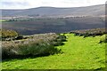
Iron Age and Later PrehistorySite Name: Berry Castle (Exmoor)Country: England County: Somerset Type: Hillfort
Nearest Town: Minehead Nearest Village: West Porlock
Map Ref: SS859449 Landranger Map Number: 181
Latitude: 51.191896N Longitude: 3.634185W
Condition:
| 5 | Perfect |
| 4 | Almost Perfect |
| 3 | Reasonable but with some damage |
| 2 | Ruined but still recognisable as an ancient site |
| 1 | Pretty much destroyed, possibly visible as crop marks |
| 0 | No data. |
| -1 | Completely destroyed |
| 5 | Superb |
| 4 | Good |
| 3 | Ordinary |
| 2 | Not Good |
| 1 | Awful |
| 0 | No data. |
| 5 | Can be driven to, probably with disabled access |
| 4 | Short walk on a footpath |
| 3 | Requiring a bit more of a walk |
| 2 | A long walk |
| 1 | In the middle of nowhere, a nightmare to find |
| 0 | No data. |
| 5 | co-ordinates taken by GPS or official recorded co-ordinates |
| 4 | co-ordinates scaled from a detailed map |
| 3 | co-ordinates scaled from a bad map |
| 2 | co-ordinates of the nearest village |
| 1 | co-ordinates of the nearest town |
| 0 | no data |
Internal Links:
External Links:
Hillfort in Somerset
Not to be confused with Bury Castle (Exmoor).
Have you visited this site? Please add a comment below.
You may be viewing yesterday's version of this page. To see the most up to date information please register for a free account.
Do not use the above information on other web sites or publications without permission of the contributor.
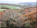
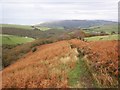
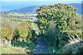
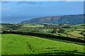
Nearby Images from Geograph Britain and Ireland:
©2013(licence)
©2013(licence)
©2023(licence)
©2023(licence)
©2023(licence)
The above images may not be of the site on this page, they are loaded from Geograph.
Please Submit an Image of this site or go out and take one for us!
Click here to see more info for this site
Nearby sites
Key: Red: member's photo, Blue: 3rd party photo, Yellow: other image, Green: no photo - please go there and take one, Grey: site destroyed
Download sites to:
KML (Google Earth)
GPX (GPS waypoints)
CSV (Garmin/Navman)
CSV (Excel)
To unlock full downloads you need to sign up as a Contributory Member. Otherwise downloads are limited to 50 sites.
Turn off the page maps and other distractions
Nearby sites listing. In the following links * = Image available
1.3km WSW 258° Porlock Common SW* Multiple Stone Rows / Avenue (SS8457544654)
1.4km W 259° Porlock Circle* Stone Circle (SS84514467)
1.5km NNW 336° Whit Stones* Standing Stones (SS8532846255)
1.9km W 263° Porlock Allotment NE* Standing Stones (SS84014471)
1.9km WSW 253° Coley Water, South* Stone Row / Alignment (SS84074438)
1.9km NW 305° Porlock Common North East* Stone Row / Alignment (SS8434946032)
2.8km WSW 245° Porlock Allotment SW* Multiple Stone Rows / Avenue (SS8335543785)
2.8km S 185° Wilmersham Common North* Stone Row / Alignment (SS8561242129)
2.9km S 183° Wilmersham Common South* Multiple Stone Rows / Avenue (SS85664197)
3.0km WSW 248° Hoscombe SE* Stone Row / Alignment (SS8311443876)
3.0km WSW 253° Hoscombe NW Standing Stones (SS830441)
3.4km SW 219° Alderman's Barrow* Round Barrow(s) (SS837423)
3.5km NW 314° Culbone Hill* Stone Row / Alignment (SS83434738)
3.6km SSW 205° Almsworthy* Stone Circle (SS8430941698)
3.6km NW 311° Culbone Stone* Early Christian Sculptured Stone (SS8321047374)
3.7km SW 228° Madacombe* Stone Row / Alignment (SS831425)
3.7km SW 230° Madacombe Barrows Barrow Cemetery (SS830426)
3.7km SSE 153° Rowbarrow Group* Barrow Cemetery (SS87544154)
3.9km S 174° Hoar Moor (E)* Standing Stone (Menhir) (SS86214106)
3.9km SE 127° Sweetworthy settlement* Ancient Village or Settlement (SS890425)
4.0km WSW 254° Kittuck* Multiple Stone Rows / Avenue (SS8203443885)
4.1km S 179° Hoar Moor (W) Standing Stone (Menhir) (SS85864075)
4.5km SE 146° Codsend Moor Multiple Stone Rows / Avenue (SS88364110)
4.7km SE 134° Dunkery Beacon* Barrow Cemetery (SS892416)
5.1km ENE 69° Pixy Well* Holy Well or Sacred Spring (SS9066646634)
View more nearby sites and additional images


 We would like to know more about this location. Please feel free to add a brief description and any relevant information in your own language.
 Wir möchten mehr über diese Stätte erfahren. Bitte zögern Sie nicht, eine kurze Beschreibung und relevante Informationen in Deutsch hinzuzufügen.
 Nous aimerions en savoir encore un peu sur les lieux. S'il vous plaît n'hesitez pas à ajouter une courte description et tous les renseignements pertinents dans votre propre langue.
 Quisieramos informarnos un poco más de las lugares. No dude en añadir una breve descripción y otros datos relevantes en su propio idioma.