


<< Our Photo Pages >> Waun Leuci Standing Stone - Standing Stone (Menhir) in Wales in Powys
Submitted by cerrig on Sunday, 05 September 2021 Page Views: 551
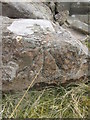
Neolithic and Bronze AgeSite Name: Waun Leuci Standing StoneCountry: Wales County: Powys Type: Standing Stone (Menhir)
Nearest Town: Brecon Nearest Village: Trecastle
Map Ref: SN8512021200
Latitude: 51.877496N Longitude: 3.670264W
Condition:
| 5 | Perfect |
| 4 | Almost Perfect |
| 3 | Reasonable but with some damage |
| 2 | Ruined but still recognisable as an ancient site |
| 1 | Pretty much destroyed, possibly visible as crop marks |
| 0 | No data. |
| -1 | Completely destroyed |
| 5 | Superb |
| 4 | Good |
| 3 | Ordinary |
| 2 | Not Good |
| 1 | Awful |
| 0 | No data. |
| 5 | Can be driven to, probably with disabled access |
| 4 | Short walk on a footpath |
| 3 | Requiring a bit more of a walk |
| 2 | A long walk |
| 1 | In the middle of nowhere, a nightmare to find |
| 0 | No data. |
| 5 | co-ordinates taken by GPS or official recorded co-ordinates |
| 4 | co-ordinates scaled from a detailed map |
| 3 | co-ordinates scaled from a bad map |
| 2 | co-ordinates of the nearest village |
| 1 | co-ordinates of the nearest town |
| 0 | no data |
Internal Links:
External Links:
")
Coflein listing
You may be viewing yesterday's version of this page. To see the most up to date information please register for a free account.
")
Do not use the above information on other web sites or publications without permission of the contributor.
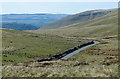
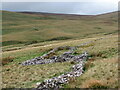
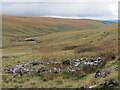
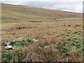
Nearby Images from Geograph Britain and Ireland:
©2019(licence)
©2021(licence)
©2021(licence)
©2021(licence)
©2015(licence)
The above images may not be of the site on this page, they are loaded from Geograph.
Please Submit an Image of this site or go out and take one for us!
Click here to see more info for this site
Nearby sites
Key: Red: member's photo, Blue: 3rd party photo, Yellow: other image, Green: no photo - please go there and take one, Grey: site destroyed
Download sites to:
KML (Google Earth)
GPX (GPS waypoints)
CSV (Garmin/Navman)
CSV (Excel)
To unlock full downloads you need to sign up as a Contributory Member. Otherwise downloads are limited to 50 sites.
Turn off the page maps and other distractions
Nearby sites listing. In the following links * = Image available
333m N 6° Tawe valley Triangle* Standing Stones (SN8516421530)
369m N 11° Maen Leuci stone setting* Standing Stones (SN85202156)
453m NE 47° Waen Llechi* Standing Stone (Menhir) (SN85462150)
516m S 188° Cerrig Duon Compass stones* Standing Stones (SN8503820690)
559m S 176° Cerrig Duon Row* Multiple Stone Rows / Avenue (SN8515120642)
560m S 179° Maen Mawr* Stone Row / Alignment (SN85122064)
590m S 179° Cerrig Duon stone circle* Stone Circle (SN85122061)
770m S 177° Nant-y-Llyn (Powys)* Cairn (SN85142043)
1.2km ESE 117° Waun Leuci summit cairns* Cairn (SN8618320639)
1.2km NNE 19° Bwllch Cerrig Duon Barrow* Round Barrow(s) (SN85552235)
1.3km NNW 330° Moel Feity cairn* Cairn (SN8450722336)
1.6km NNE 14° Bwlch Cerrig Duon Cist west* Cist (SN8553122708)
1.6km NNE 19° Bwlch Cerrig Duon Cist east* Cairn (SN85682272)
2.3km WNW 284° Llyn y Fan Fawr* Standing Stones (SN82882180)
2.6km WNW 282° Fan Brycheiniog* Cairn (SN82532179)
2.8km WNW 286° Twr-y-Fan Foel cairn* Cairn (SN82432206)
3.2km WNW 290° Fan Foel Cairns* Round Cairn (SN8214722341)
3.5km WNW 302° Rhyd Wen Fach* Stone Circle (SN82232312)
4.0km W 278° Picws Du* Cairn (SN81172185)
4.3km SW 222° Waun Fignen Felen Ancient Village or Settlement (SN82201810)
4.3km NW 325° Garn Las cairn 2* Cairn (SN82782476)
4.4km NNW 328° Garn Las cairn 1* Cairn (SN82872499)
4.7km SSW 202° Twyn Ddu* Cairn (SN833169)
4.7km NW 322° Godre'r Garn Las Stone* Standing Stones (SN82292493)
4.7km SSE 149° Pwll Byfre Hut Circle 2 Ancient Village or Settlement (SN87471711)
View more nearby sites and additional images


 We would like to know more about this location. Please feel free to add a brief description and any relevant information in your own language.
 Wir möchten mehr über diese Stätte erfahren. Bitte zögern Sie nicht, eine kurze Beschreibung und relevante Informationen in Deutsch hinzuzufügen.
 Nous aimerions en savoir encore un peu sur les lieux. S'il vous plaît n'hesitez pas à ajouter une courte description et tous les renseignements pertinents dans votre propre langue.
 Quisieramos informarnos un poco más de las lugares. No dude en añadir una breve descripción y otros datos relevantes en su propio idioma.