<< Our Photo Pages >> Withypool Circle - Stone Circle in England in Somerset
Submitted by thecaptain on Friday, 17 November 2006 Page Views: 21477
Neolithic and Bronze AgeSite Name: Withypool Circle Alternative Name: Withypool Hill CircleCountry: England County: Somerset Type: Stone Circle
Nearest Town: Dulverton Nearest Village: Withypool
Map Ref: SS83833431 Landranger Map Number: 181
Latitude: 51.096293N Longitude: 3.660374W
Condition:
| 5 | Perfect |
| 4 | Almost Perfect |
| 3 | Reasonable but with some damage |
| 2 | Ruined but still recognisable as an ancient site |
| 1 | Pretty much destroyed, possibly visible as crop marks |
| 0 | No data. |
| -1 | Completely destroyed |
| 5 | Superb |
| 4 | Good |
| 3 | Ordinary |
| 2 | Not Good |
| 1 | Awful |
| 0 | No data. |
| 5 | Can be driven to, probably with disabled access |
| 4 | Short walk on a footpath |
| 3 | Requiring a bit more of a walk |
| 2 | A long walk |
| 1 | In the middle of nowhere, a nightmare to find |
| 0 | No data. |
| 5 | co-ordinates taken by GPS or official recorded co-ordinates |
| 4 | co-ordinates scaled from a detailed map |
| 3 | co-ordinates scaled from a bad map |
| 2 | co-ordinates of the nearest village |
| 1 | co-ordinates of the nearest town |
| 0 | no data |
Internal Links:
External Links:
I have visited· I would like to visit
Starryways visited on 4th Aug 2022 - their rating: Cond: 3 Amb: 5 Access: 3 Its easy access if you drive south out of Withypool for a few minutes on Worth Lane- you will find a layby at 51.09909/ -3.6492. Cross the road onto the moor proceed due E on gentle slope to highest point which is a tumulus on OS map- a modern cairn on top. The circle is a couple of hundred yards south west of the cairn. Hard to see if you are not looking for it. Do not park in the village and access the moor via the edge of Withypool- it is a horrid walk up steep contours to to top through thick heather with good chance of turning or breaking an ankle or getting bitten by an adder, we saw two. The circle is full of the detritus of Exmoor conservation who have not removed their rubbish of various signposts. Its a lovely place with lovely views. We could only count 25 stones, through thick heather.
Starryways visited on 4th Aug 2022 - their rating: Cond: 3 Amb: 5 Access: 3 Its easy access if you drive south out of Withypool for a few minutes on Worth Lane- you will find a layby at 51.09909/ -3.6492. Cross the road onto the moor proceed due E on gentle slope to highest point which is a tumulus on OS map- a modern cairn on top. The circle is a couple of hundred yards south west of the cairn. Hard to see if you are not looking for it. Do not park in the village and access the moor via the edge of Withypool- it is a horrid walk up steep contours to to top through thick heather with good chance of turning or breaking an ankle or getting bitten by an adder, we saw two. The circle is full of the detritus of Exmoor conservation who have not removed their rubbish of various signposts. Its a lovely place with lovely views. We could only count 25 stones, through thick heather.
bishop_pam visited on 27th Apr 2019 - their rating: Cond: 3 Amb: 4 Access: 3
BolshieBoris visited on 1st Jul 1997 - their rating: Cond: 3 Amb: 4 Access: 3
TheCaptain TimPrevett mdensham have visited here
Average ratings for this site from all visit loggers: Condition: 3 Ambience: 4.5 Access: 3
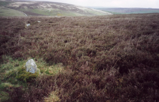
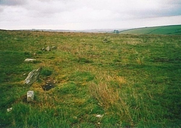
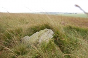
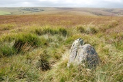
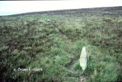
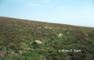
I counted 37 stones around the circumference, several of which were just loose on the surface, but the majority were still fast in the ground, and facing slab side inwards. Most of the stones are much less than a foot high, the biggest being less than half a metre, or 18 inches.
The spacing of the stones looks to have originally been about a metre apart from each other, and there are several sections with about 4 stones together with this spacing. I paced out the diameter of the circle to be just under 40 metres, so that would have meant over 100 stones originally.
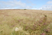
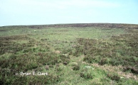
The grass and heather here is thankfully fairly short, and it all looks beautiful in the low golden evening sunlight, but there was lots of water in the air making the views hazy when I visited.
Park by the cattle grid to the east of the hill and walk along the well used track for half a mile, and then the circle is a couple of hundred metres north towards the top of the hill.
You may be viewing yesterday's version of this page. To see the most up to date information please register for a free account.





Do not use the above information on other web sites or publications without permission of the contributor.
Click here to see more info for this site
Nearby sites
Key: Red: member's photo, Blue: 3rd party photo, Yellow: other image, Green: no photo - please go there and take one, Grey: site destroyed
Download sites to:
KML (Google Earth)
GPX (GPS waypoints)
CSV (Garmin/Navman)
CSV (Excel)
To unlock full downloads you need to sign up as a Contributory Member. Otherwise downloads are limited to 50 sites.
Turn off the page maps and other distractions
Nearby sites listing. In the following links * = Image available
228m NE 51° Withypool Hill Barrow* Round Barrow(s) (SS84013445)
2.0km W 276° Green Barrow* Round Barrow(s) (SS81793456)
3.7km SE 126° Tarr Steps Prehistoric Bridge* Ancient Trackway (SS86773211)
3.8km E 89° Wambarrows* Barrow Cemetery (SS87613431)
4.0km WSW 238° Twitchen barrows* Barrow Cemetery (SS804323)
5.0km SSE 166° West Anstey Long Stone* Standing Stone (Menhir) (SS84932942)
5.2km E 97° Caratacus Stone* Standing Stone (Menhir) (SS88973355)
5.3km NW 304° Cow Castle* Hillfort (SS795374)
5.4km SSE 161° West Anstey Barrows* Barrow Cemetery (SS85452918)
5.7km WNW 301° Horsen Stone Rows Multiple Stone Rows / Avenue (SS790373)
6.4km SE 134° Brewer's Castle Hillfort (SS88332977)
6.6km WNW 283° Long Holcombe (N) Standing Stone (Menhir) (SS77383593)
6.7km SE 134° Mounsey Castle Hillfort (SS88562955)
6.7km NNE 16° Hoar Moor (W) Standing Stone (Menhir) (SS85864075)
6.8km NNW 345° Wester Mill Multiple Stone Rows / Avenue (SS822409)
6.8km NNW 345° Larkbarrow Corner Stone Setting* Standing Stones (SS82224097)
7.0km W 278° Long Holcombe (S)* Standing Stone (Menhir) (SS76943543)
7.1km NNW 344° Larkbarrow Corner Standing Stone* Standing Stone (Menhir) (SS82084116)
7.2km NNE 18° Hoar Moor (E)* Standing Stone (Menhir) (SS86214106)
7.4km N 2° Almsworthy* Stone Circle (SS8430941698)
7.5km W 278° The Buttery Stone* Standing Stone (Menhir) (SS76403550)
7.9km NNE 12° Wilmersham Common South* Multiple Stone Rows / Avenue (SS85664197)
7.9km WNW 299° Halscombe* Multiple Stone Rows / Avenue (SS7702238336)
8.0km N 358° Alderman's Barrow* Round Barrow(s) (SS837423)
8.0km NNE 12° Wilmersham Common North* Stone Row / Alignment (SS8561242129)
View more nearby sites and additional images


 We would like to know more about this location. Please feel free to add a brief description and any relevant information in your own language.
 Wir möchten mehr über diese Stätte erfahren. Bitte zögern Sie nicht, eine kurze Beschreibung und relevante Informationen in Deutsch hinzuzufügen.
 Nous aimerions en savoir encore un peu sur les lieux. S'il vous plaît n'hesitez pas à ajouter une courte description et tous les renseignements pertinents dans votre propre langue.
 Quisieramos informarnos un poco más de las lugares. No dude en añadir una breve descripción y otros datos relevantes en su propio idioma.