<< Text Pages >> Mounsey Castle - Hillfort in England in Somerset
Submitted by SolarMegalith on Monday, 09 May 2011 Page Views: 5531
Iron Age and Later PrehistorySite Name: Mounsey CastleCountry: England County: Somerset Type: Hillfort
Nearest Village: Highercombe
Map Ref: SS88562955
Latitude: 51.054447N Longitude: 3.591386W
Condition:
| 5 | Perfect |
| 4 | Almost Perfect |
| 3 | Reasonable but with some damage |
| 2 | Ruined but still recognisable as an ancient site |
| 1 | Pretty much destroyed, possibly visible as crop marks |
| 0 | No data. |
| -1 | Completely destroyed |
| 5 | Superb |
| 4 | Good |
| 3 | Ordinary |
| 2 | Not Good |
| 1 | Awful |
| 0 | No data. |
| 5 | Can be driven to, probably with disabled access |
| 4 | Short walk on a footpath |
| 3 | Requiring a bit more of a walk |
| 2 | A long walk |
| 1 | In the middle of nowhere, a nightmare to find |
| 0 | No data. |
| 5 | co-ordinates taken by GPS or official recorded co-ordinates |
| 4 | co-ordinates scaled from a detailed map |
| 3 | co-ordinates scaled from a bad map |
| 2 | co-ordinates of the nearest village |
| 1 | co-ordinates of the nearest town |
| 0 | no data |
Internal Links:
External Links:
Hillfort in Somerset
A small Iron Age univallate hillfort covering area of 1,75 ha. It has two entrances, inside of it remains of a small stone building were discovered.
Read More at PastScape.
You may be viewing yesterday's version of this page. To see the most up to date information please register for a free account.
Do not use the above information on other web sites or publications without permission of the contributor.
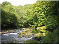
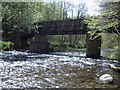
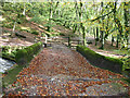
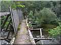
Nearby Images from Geograph Britain and Ireland:
©2006(licence)
©2008(licence)
©2005(licence)
©2010(licence)
©2010(licence)
The above images may not be of the site on this page, they are loaded from Geograph.
Please Submit an Image of this site or go out and take one for us!
Click here to see more info for this site
Nearby sites
Key: Red: member's photo, Blue: 3rd party photo, Yellow: other image, Green: no photo - please go there and take one, Grey: site destroyed
Download sites to:
KML (Google Earth)
GPX (GPS waypoints)
CSV (Garmin/Navman)
CSV (Excel)
To unlock full downloads you need to sign up as a Contributory Member. Otherwise downloads are limited to 50 sites.
Turn off the page maps and other distractions
Nearby sites listing. In the following links * = Image available
318m NW 313° Brewer's Castle Hillfort (SS88332977)
2.7km ESE 118° Oldberry Castle Hillfort (SS90932820)
3.1km NW 324° Tarr Steps Prehistoric Bridge* Ancient Trackway (SS86773211)
3.1km W 262° West Anstey Barrows* Barrow Cemetery (SS85452918)
3.6km W 267° West Anstey Long Stone* Standing Stone (Menhir) (SS84932942)
4.0km N 5° Caratacus Stone* Standing Stone (Menhir) (SS88973355)
4.9km NNW 348° Wambarrows* Barrow Cemetery (SS87613431)
6.7km NW 316° Withypool Hill Barrow* Round Barrow(s) (SS84013445)
6.7km NW 314° Withypool Circle* Stone Circle (SS83833431)
8.4km NW 305° Green Barrow* Round Barrow(s) (SS81793456)
8.6km WNW 287° Twitchen barrows* Barrow Cemetery (SS804323)
9.2km SSW 212° Knowstone Inner Moor Round Barrow(s) (SS8346021869)
9.8km NE 39° Lype Hill Barrows* Barrow Cemetery (SS949370)
9.9km SW 216° Beaples Hill* Standing Stone (Menhir) (SS8248621693)
10.0km NE 51° Cutcombe Barrow* Round Barrow(s) (SS9649635711)
11.5km NNW 345° Hoar Moor (W) Standing Stone (Menhir) (SS85864075)
11.5km N 358° Codsend Moor Multiple Stone Rows / Avenue (SS88364110)
11.7km NNW 347° Hoar Moor (E)* Standing Stone (Menhir) (SS86214106)
11.8km SSW 196° Holy Trinity Well (Rackenford)* Holy Well or Sacred Spring (SS85001825)
11.9km ENE 59° Leather Barrow Round Barrow(s) (SS98903553)
12.0km NW 310° Cow Castle* Hillfort (SS795374)
12.0km N 354° Rowbarrow Group* Barrow Cemetery (SS87544154)
12.1km N 2° Dunkery Beacon* Barrow Cemetery (SS892416)
12.3km NW 308° Horsen Stone Rows Multiple Stone Rows / Avenue (SS790373)
12.5km SSE 154° Castle Close* Misc. Earthwork (SS937182)
View more nearby sites and additional images


 We would like to know more about this location. Please feel free to add a brief description and any relevant information in your own language.
 Wir möchten mehr über diese Stätte erfahren. Bitte zögern Sie nicht, eine kurze Beschreibung und relevante Informationen in Deutsch hinzuzufügen.
 Nous aimerions en savoir encore un peu sur les lieux. S'il vous plaît n'hesitez pas à ajouter une courte description et tous les renseignements pertinents dans votre propre langue.
 Quisieramos informarnos un poco más de las lugares. No dude en añadir una breve descripción y otros datos relevantes en su propio idioma.