<< Our Photo Pages >> Lanacombe 4 - Stone Row / Alignment in England in Somerset
Submitted by thecaptain on Saturday, 24 March 2007 Page Views: 4133
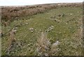
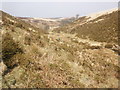
Neolithic and Bronze AgeSite Name: Lanacombe 4 Alternative Name: Lanacombe (NE)Country: England County: Somerset Type: Stone Row / Alignment
Nearest Town: Minehead Nearest Village: Simonsbath
Map Ref: SS78644316
Latitude: 51.174760N Longitude: 3.73744W
Condition:
| 5 | Perfect |
| 4 | Almost Perfect |
| 3 | Reasonable but with some damage |
| 2 | Ruined but still recognisable as an ancient site |
| 1 | Pretty much destroyed, possibly visible as crop marks |
| 0 | No data. |
| -1 | Completely destroyed |
| 5 | Superb |
| 4 | Good |
| 3 | Ordinary |
| 2 | Not Good |
| 1 | Awful |
| 0 | No data. |
| 5 | Can be driven to, probably with disabled access |
| 4 | Short walk on a footpath |
| 3 | Requiring a bit more of a walk |
| 2 | A long walk |
| 1 | In the middle of nowhere, a nightmare to find |
| 0 | No data. |
| 5 | co-ordinates taken by GPS or official recorded co-ordinates |
| 4 | co-ordinates scaled from a detailed map |
| 3 | co-ordinates scaled from a bad map |
| 2 | co-ordinates of the nearest village |
| 1 | co-ordinates of the nearest town |
| 0 | no data |
Internal Links:
External Links:
I have visited· I would like to visit
TheCaptain has visited here
")
You may be viewing yesterday's version of this page. To see the most up to date information please register for a free account.
Do not use the above information on other web sites or publications without permission of the contributor.
Nearby Images from Geograph Britain and Ireland:
©2020(licence)
©2015(licence)
©2008(licence)
©2015(licence)
©2015(licence)
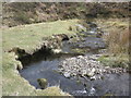
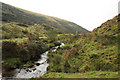
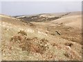
The above images may not be of the site on this page, they are loaded from Geograph.
Please Submit an Image of this site or go out and take one for us!
Click here to see more info for this site
Nearby sites
Key: Red: member's photo, Blue: 3rd party photo, Yellow: other image, Green: no photo - please go there and take one, Grey: site destroyed
Download sites to:
KML (Google Earth)
GPX (GPS waypoints)
CSV (Garmin/Navman)
CSV (Excel)
To unlock full downloads you need to sign up as a Contributory Member. Otherwise downloads are limited to 50 sites.
Turn off the page maps and other distractions
Nearby sites listing. In the following links * = Image available
153m S 190° Lanacombe 3* Multiple Stone Rows / Avenue (SS78614301)
339m ESE 113° Trout Hill 4* Standing Stones (SS78954302)
354m SW 215° Lanacombe 2* Stone Row / Alignment (SS7843242873)
594m WNW 294° Hoccombe Hill (E)* Multiple Stone Rows / Avenue (SS78104341)
659m SW 233° Lanacombe 1* Multiple Stone Rows / Avenue (SS78104278)
760m E 84° Trout Hill 1* Standing Stones (SS79404322)
798m ESE 109° Trout Hill 3* Standing Stones (SS79394288)
834m SW 226° Lanacombe 5* Multiple Stone Rows / Avenue (SS78024260)
918m E 91° Trout Hill 2* Standing Stones (SS79564312)
1.1km ESE 114° East Pinford Cairn* Cairn (SS7962642688)
1.1km ESE 112° East Pinford (NW)* Multiple Stone Rows / Avenue (SS79654272)
1.2km SSE 152° West Pinford* Stone Row / Alignment (SS7916442117)
1.3km N 360° Hoccombe Coombe* Multiple Stone Rows / Avenue (SS7866444434)
1.4km ESE 115° East Pinford 2* Multiple Stone Rows / Avenue (SS79874254)
1.4km N 2° Badgworthy Lees Stone Row / Alignment (SS78724456)
1.5km N 349° Badgworthy Leas Standing Stones (SS784446)
1.5km E 84° Toms Hill* Multiple Stone Rows / Avenue (SS80184329)
1.6km WNW 287° Hoccombe Hill (W)* Standing Stones (SS77074368)
1.9km ESE 104° Swap Hill (N)* Standing Stone (Menhir) (SS80514266)
2.0km ESE 105° Swap Hill* Standing Stones (SS80554261)
2.1km WNW 282° Brendon Two Gates (W)* Standing Stones (SS76604364)
2.1km ESE 110° Beckham Hill* Multiple Stone Rows / Avenue (SS8063242382)
2.8km W 279° Clannon Ball* Standing Stones (SS75924366)
3.2km W 271° Cheriton Ridge 4* Multiple Stone Rows / Avenue (SS75414332)
3.2km WNW 292° Pig Hill (S)* Standing Stones (SS7567944460)
View more nearby sites and additional images


 We would like to know more about this location. Please feel free to add a brief description and any relevant information in your own language.
 Wir möchten mehr über diese Stätte erfahren. Bitte zögern Sie nicht, eine kurze Beschreibung und relevante Informationen in Deutsch hinzuzufügen.
 Nous aimerions en savoir encore un peu sur les lieux. S'il vous plaît n'hesitez pas à ajouter une courte description et tous les renseignements pertinents dans votre propre langue.
 Quisieramos informarnos un poco más de las lugares. No dude en añadir una breve descripción y otros datos relevantes en su propio idioma.