<< Other Photo Pages >> Lyn and Exmoor Museum - Museum in England in Devon
Submitted by vicky on Saturday, 30 November 2002 Page Views: 8589
MuseumsSite Name: Lyn and Exmoor MuseumCountry: England
NOTE: This site is 4.7 km away from the location you searched for.
County: Devon Type: Museum
Nearest Town: Lynton
Map Ref: SS7202849362 Landranger Map Number: 180
Latitude: 51.229056N Longitude: 3.834188W
Condition:
| 5 | Perfect |
| 4 | Almost Perfect |
| 3 | Reasonable but with some damage |
| 2 | Ruined but still recognisable as an ancient site |
| 1 | Pretty much destroyed, possibly visible as crop marks |
| 0 | No data. |
| -1 | Completely destroyed |
| 5 | Superb |
| 4 | Good |
| 3 | Ordinary |
| 2 | Not Good |
| 1 | Awful |
| 0 | No data. |
| 5 | Can be driven to, probably with disabled access |
| 4 | Short walk on a footpath |
| 3 | Requiring a bit more of a walk |
| 2 | A long walk |
| 1 | In the middle of nowhere, a nightmare to find |
| 0 | No data. |
| 5 | co-ordinates taken by GPS or official recorded co-ordinates |
| 4 | co-ordinates scaled from a detailed map |
| 3 | co-ordinates scaled from a bad map |
| 2 | co-ordinates of the nearest village |
| 1 | co-ordinates of the nearest town |
| 0 | no data |
Internal Links:
External Links:
Museum in Devon
Social history of Lynton and the surrounding villages through the ages. Neolithic and Bronze Age flint artefacts.
Address: St Vincent`s Cottage, Market Street, EX35 6AF
Phone: 01598 752225
Opening Hours: Mon- Thurs and Saturday: 10.30-1.30, 2-5pm; Sun: 14.00 - 16.00; Friday: Closed
Admission: £1 adult, 50p children. Free admission on Sunday afternoons.
Website: Devon Museums.
You may be viewing yesterday's version of this page. To see the most up to date information please register for a free account.
Do not use the above information on other web sites or publications without permission of the contributor.
davidmorgan has found this location on Google Street View:
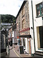
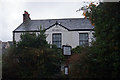
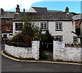
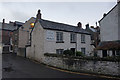
Nearby Images from Geograph Britain and Ireland:
©2008(licence)
©2015(licence)
©2014(licence)
©2015(licence)
©2023(licence)
The above images may not be of the site on this page, they are loaded from Geograph.
Please Submit an Image of this site or go out and take one for us!
Click here to see more info for this site
Nearby sites
Key: Red: member's photo, Blue: 3rd party photo, Yellow: other image, Green: no photo - please go there and take one, Grey: site destroyed
Download sites to:
KML (Google Earth)
GPX (GPS waypoints)
CSV (Garmin/Navman)
CSV (Excel)
To unlock full downloads you need to sign up as a Contributory Member. Otherwise downloads are limited to 50 sites.
Turn off the page maps and other distractions
Nearby sites listing. In the following links * = Image available
2.0km SSE 158° Long Stone (Lyn Down)* Standing Stones (SS7272247528)
2.0km E 90° Wind Hill* Hillfort (SS740493)
4.5km S 180° Ilkerton Ridge Barrows* Barrow Cemetery (SS719449)
4.6km S 178° Ilkerton Ridge stones* Standing Stones (SS72074475)
4.7km SSE 157° Furzehill Common Standing Stone* Standing Stone (Menhir) (SS73754494)
5.0km SSE 157° Furzehill Common 5* Multiple Stone Rows / Avenue (SS73894472)
5.0km SSE 164° Furzehill Common 0* Standing Stones (SS73324451)
5.1km SSE 162° Furzehill Common cairn* Cairn (SS73444451)
5.1km SSE 165° Furzehill Common Barrow* Round Barrow(s) (SS732444)
5.2km S 169° Warcombe Water row* Stone Row / Alignment (SS72864424)
5.2km SSE 150° Cheriton Ridge ring cairn* Ring Cairn (SS74564478)
5.3km S 170° Warcombe Water stone* Standing Stone (Menhir) (SS72854417)
5.3km SSW 211° Woolhanger henge* Henge (SS692449)
5.4km SSE 160° Furzehill Common 2* Standing Stones (SS73744425)
5.6km S 186° Thornworthy Little Common* Stone Row / Alignment (SS71264381)
5.6km S 176° Winnaway* Stone Row / Alignment (SS72264376)
5.6km SSE 147° Farley Water stones* Standing Stones (SS74994458)
5.6km SSE 163° Furzehill Common 1* Stone Row / Alignment (SS7351843922)
5.7km SSE 160° Furzehill Common stone row * Stone Row / Alignment (SS73844396)
5.8km SSE 148° Cheriton Ridge 3* Standing Stones (SS75014439)
5.8km SSE 148° Cheriton Ridge 1* Standing Stones (SS74994437)
5.8km SSE 149° Cheriton Ridge 2* Multiple Stone Rows / Avenue (SS7491444322)
5.9km SE 138° Pig Hill (N)* Standing Stones (SS75834489)
5.9km SSE 159° Hoaroak 1* Multiple Stone Rows / Avenue (SS7397543789)
5.9km SSE 155° Hoaroak Hill* Standing Stones (SS74444394)
View more nearby sites and additional images


 We would like to know more about this location. Please feel free to add a brief description and any relevant information in your own language.
 Wir möchten mehr über diese Stätte erfahren. Bitte zögern Sie nicht, eine kurze Beschreibung und relevante Informationen in Deutsch hinzuzufügen.
 Nous aimerions en savoir encore un peu sur les lieux. S'il vous plaît n'hesitez pas à ajouter une courte description et tous les renseignements pertinents dans votre propre langue.
 Quisieramos informarnos un poco más de las lugares. No dude en añadir una breve descripción y otros datos relevantes en su propio idioma.