 with our Megalithic Portal iPhone app")


<< Other Photo Pages >> Ardachearanbeg Standing Stone - Standing Stone (Menhir) in Scotland in Cowal
Submitted by Anonymous on Monday, 04 November 2002 Page Views: 4858
Neolithic and Bronze AgeSite Name: Ardachearanbeg Standing StoneCountry: Scotland County: Cowal Type: Standing Stone (Menhir)
Nearest Town: Strachur Nearest Village: Ardachearanbeg
Map Ref: NS00218612 Landranger Map Number: 55
Latitude: 56.026199N Longitude: 5.207698W
Condition:
| 5 | Perfect |
| 4 | Almost Perfect |
| 3 | Reasonable but with some damage |
| 2 | Ruined but still recognisable as an ancient site |
| 1 | Pretty much destroyed, possibly visible as crop marks |
| 0 | No data. |
| -1 | Completely destroyed |
| 5 | Superb |
| 4 | Good |
| 3 | Ordinary |
| 2 | Not Good |
| 1 | Awful |
| 0 | No data. |
| 5 | Can be driven to, probably with disabled access |
| 4 | Short walk on a footpath |
| 3 | Requiring a bit more of a walk |
| 2 | A long walk |
| 1 | In the middle of nowhere, a nightmare to find |
| 0 | No data. |
| 5 | co-ordinates taken by GPS or official recorded co-ordinates |
| 4 | co-ordinates scaled from a detailed map |
| 3 | co-ordinates scaled from a bad map |
| 2 | co-ordinates of the nearest village |
| 1 | co-ordinates of the nearest town |
| 0 | no data |
Internal Links:
External Links:
I have visited· I would like to visit
Anne T visited on 21st Sep 2017 - their rating: Cond: -1 Amb: 4 Access: 4 Ardachearanbeg Standing Stone, Argyll: Hunted all along the fence line, peering into the river and along the banks for around 100 metres each side of the grid reference and couldn’t find this stone. There was no phone signal, so wasn’t able to call up the Canmore record to double check. Later found out (see below) it has fallen into the river, although we had a pretty good check, looking through the trees and in the river itself, for about 100 metres each way from the grid reference. The river was higher than normal due to all the rain in this part of the world.
Access into the field was from a gate along a small lane just west of the A886 leading to two farms/holiday cottages. There is a small layby at NS 00298 86038 at the junction to these lanes. The field slopes down to the River Ruel. Wellies are advised, as the field was pretty boggy at the time of our visit.
")
For more information see Canmore site no. 40511, an extract of which reads: "Situated 260m N of Ardachearanbeg near the edge of a field on a level gravel terrace overlooking the River Ruel, this stone measures 1.57m in height and 1m by 0.2m at the base; aligned NE-SW and now leaning distinctly to the SE, it rises with slanting sides to a pointed top."
Update September 2017: A visit on 21st September 2017 determined that the stone has fallen into the river and is no longer visible; we later found out there had been an update on Canmore from November 2012 which reads: "A member of the public has informed RCAHMS that this stone has now fallen into the river. Information from RCAHMS (SIH) 2 November 2012".
Note: Note: this standing stone has fallen into the river.
You may be viewing yesterday's version of this page. To see the most up to date information please register for a free account.
")
")
")
Do not use the above information on other web sites or publications without permission of the contributor.
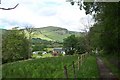
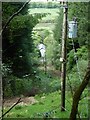
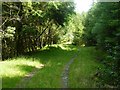
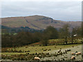
Nearby Images from Geograph Britain and Ireland:
©2007(licence)
©2020(licence)
©2020(licence)
©2011(licence)
©2009(licence)
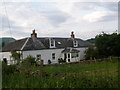
The above images may not be of the site on this page, they are loaded from Geograph.
Please Submit an Image of this site or go out and take one for us!
Click here to see more info for this site
Nearby sites
Key: Red: member's photo, Blue: 3rd party photo, Yellow: other image, Green: no photo - please go there and take one, Grey: site destroyed
Download sites to:
KML (Google Earth)
GPX (GPS waypoints)
CSV (Garmin/Navman)
CSV (Excel)
To unlock full downloads you need to sign up as a Contributory Member. Otherwise downloads are limited to 50 sites.
![]()
Turn off the page maps and other distractions
Nearby sites listing. In the following links * = Image available
963m SSE 160° Ardachearanbeg Chambered Cairn (NS005852)
1.8km S 175° Lephinkill* Chambered Cairn (NS00278432)
2.1km SSW 197° Glendaruel Churchyard* Sculptured Stone (NR9951984165)
3.7km S 177° Barmore Fort* Hillfort (NS00258237)
4.0km S 171° Auchnagarran* Standing Stone (Menhir) (NS00648215)
5.4km S 171° Meckan's Grave (Loch Riddon)* Cist (NS00858070)
5.6km ESE 104° Balliemore (Craigendive)* Standing Stones (NS0565084540)
7.1km WSW 240° Barr Iola* Stone Fort or Dun (NR93838287)
7.2km SW 234° Barr Lagan* Stone Fort or Dun (NR94188223)
8.2km SW 235° Auchnaha* Chambered Cairn (NR93298170)
8.4km N 359° Cnoc Mor (Garbhallt) Standing Stone (Menhir) (NS005945)
8.5km WNW 294° Pointhouse Chambered Cairn (NR926899)
9.0km N 3° Tobar Cill Moire* Holy Well or Sacred Spring (NS0106295054)
9.0km SW 231° Barr Ganuisg* Stone Fort or Dun (NR92898080)
9.1km N 3° Kilmorie Cross* Ancient Cross (NS0108595167)
9.1km SW 225° Lindsaig* Rock Art (NR93477991)
9.3km NNW 341° Brainport Bay Standing stones and Alignment* Standing Stone (Menhir) (NR9759595075)
9.8km NNW 338° Barr (Minard) Rock Art (NR96899535)
9.9km SW 228° Fearnoch Rock Art* Rock Art (NR92617980)
10.1km SW 225° Fearnoch Cairn* Cairn (NR9268879398)
10.2km SW 225° Fearnoch Stone* Standing Stone (Menhir) (NR92637932)
10.9km SSE 169° Eilean Buidhe* Stone Fort or Dun (NS01867532)
11.2km NE 35° Kilmartin Timber Circle Timber Circle (NS070950)
11.3km N 349° Crarae* Chambered Cairn (NR9859097283)
11.3km WNW 301° Loch Glashan Crannog (NR908924)
View more nearby sites and additional images


 We would like to know more about this location. Please feel free to add a brief description and any relevant information in your own language.
 Wir möchten mehr über diese Stätte erfahren. Bitte zögern Sie nicht, eine kurze Beschreibung und relevante Informationen in Deutsch hinzuzufügen.
 Nous aimerions en savoir encore un peu sur les lieux. S'il vous plaît n'hesitez pas à ajouter une courte description et tous les renseignements pertinents dans votre propre langue.
 Quisieramos informarnos un poco más de las lugares. No dude en añadir una breve descripción y otros datos relevantes en su propio idioma.