<< Our Photo Pages >> Harrowthorn - Cairn in England in Devon
Submitted by Anne T on Friday, 14 October 2016 Page Views: 1240
Neolithic and Bronze AgeSite Name: Harrowthorn Alternative Name: Harrowthorn (North of); Harrow Thorn; Grinsell Cornwood 15; Dixon 83Country: England
NOTE: This site is 0.4 km away from the location you searched for.
County: Devon Type: Cairn
Nearest Town: Ivybridge Nearest Village: Harford / Cornwood
Map Ref: SX6244662645
Latitude: 50.447478N Longitude: 3.938757W
Condition:
| 5 | Perfect |
| 4 | Almost Perfect |
| 3 | Reasonable but with some damage |
| 2 | Ruined but still recognisable as an ancient site |
| 1 | Pretty much destroyed, possibly visible as crop marks |
| 0 | No data. |
| -1 | Completely destroyed |
| 5 | Superb |
| 4 | Good |
| 3 | Ordinary |
| 2 | Not Good |
| 1 | Awful |
| 0 | No data. |
| 5 | Can be driven to, probably with disabled access |
| 4 | Short walk on a footpath |
| 3 | Requiring a bit more of a walk |
| 2 | A long walk |
| 1 | In the middle of nowhere, a nightmare to find |
| 0 | No data. |
| 5 | co-ordinates taken by GPS or official recorded co-ordinates |
| 4 | co-ordinates scaled from a detailed map |
| 3 | co-ordinates scaled from a bad map |
| 2 | co-ordinates of the nearest village |
| 1 | co-ordinates of the nearest town |
| 0 | no data |
Be the first person to rate this site - see the 'Contribute!' box in the right hand menu.
Internal Links:
External Links:
")
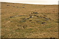
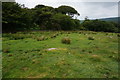
This site, Harrowthorn (north of) Cist, is featured on the Prehistoric Dartmoor Walks website. Lying between Dendles Waste to the west and Stalldown Barrow to the east, the PDW notes tell us this cist is: "located 200m due east up hill of the Coome Brook enclosure, a cist lies 700 yards north of Harrowthorn Plantation and a few feet west of the track from Watercombe Moorgate to Ranny Brook. Only the two side stones and the eastern end stone remain. The structure is unusual in that the southern side stone is an earth fast boulder, an approximately vertical face of which forms a side of the cist."
More details can found on the Pastscape website, see Monument Number 442240, which adds that "the cist lies on a gentle, well drained south facing slops at 335m above OD. Its internal dimensions are 0.8m by 0.5m and it is aligned on a grid bearing of 121 degrees. The natural boulder, which forms the southwest side measures, 1.5m by 1.1m and 0.8m high. The surrounding cairn, 3.2m diameter and 0.8m high is built of small stones."
The Heritage Gateway for Devon & Dartmoor HER number MDV4269 dates the cairn and cist from the Early Neolithic to the Late Bronze Age (4000BC to 701BC).
You may be viewing yesterday's version of this page. To see the most up to date information please register for a free account.
Do not use the above information on other web sites or publications without permission of the contributor.
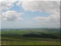
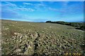
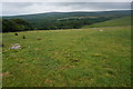
Nearby Images from Geograph Britain and Ireland:
©2005(licence)
©2006(licence)
©2009(licence)
©2014(licence)
©2014(licence)
The above images may not be of the site on this page, they are loaded from Geograph.
Please Submit an Image of this site or go out and take one for us!
Click here to see more info for this site
Nearby sites
Key: Red: member's photo, Blue: 3rd party photo, Yellow: other image, Green: no photo - please go there and take one, Grey: site destroyed
Download sites to:
KML (Google Earth)
GPX (GPS waypoints)
CSV (Garmin/Navman)
CSV (Excel)
To unlock full downloads you need to sign up as a Contributory Member. Otherwise downloads are limited to 50 sites.
Turn off the page maps and other distractions
Nearby sites listing. In the following links * = Image available
520m SE 129° Stalldown West* Cist (SX6284462309)
776m E 100° Stalldown Encircled Cairn* Cairn (SX6320862489)
799m E 100° Stalldon Row* Stone Row / Alignment (SX63236248)
826m ESE 105° Stalldown Cairn Circle* Stone Circle (SX63246241)
854m ESE 102° Stalldown Stone Row Cairn E* Cairn (SX63286245)
910m N 9° Ranny Brookhead Cist* Cist (SX62616354)
913m N 351° Ranny Brook Enclosure Ancient Village or Settlement (SX6232963551)
925m W 278° Dendles Waste* Cairn (SX61536279)
941m NNW 331° Yealm Steps* Ancient Village or Settlement (SX62016348)
952m NNW 340° Ranny Brook North Cist* Cist (SX62156355)
1.0km NE 53° Stalldown North* Cairn (SX63276323)
1.1km SE 134° Stalldown Stone Row Cairn S* Cairn (SX63226186)
1.1km ESE 106° Stalldown Ring Cairn Circle* Ring Cairn (SX63526230)
1.2km SE 140° Stalldown Southern Terminal Cairn Circle* Cairn (SX6317661737)
1.3km ESE 105° Hillson's House* Cairn (SX63666228)
1.6km NE 42° Blatchford Brook Foot Settlement* Ancient Village or Settlement (SX63566380)
1.7km NE 55° Dry Lake North Settlement* Ancient Village or Settlement (SX639636)
1.8km SW 223° Rook Tor Ring Cairn (SX612614)
1.9km E 86° Three Barrows West prehistoric settlement* Ancient Village or Settlement (SX6436762738)
1.9km W 270° High-house Waste Ancient Village or Settlement (SX60506270)
1.9km SE 127° Stalldown Settlement* Ancient Village or Settlement (SX6397361429)
2.0km SE 139° Stalldown South East* Stone Row / Alignment (SX63756107)
2.1km NNE 29° Stall Moor circle* Stone Circle (SX6351764442)
2.1km NNE 29° Upper Erme Row* Stone Row / Alignment (SX63526447)
2.2km W 275° Penn Moor Reave East Misc. Earthwork (SX60306289)
View more nearby sites and additional images


 We would like to know more about this location. Please feel free to add a brief description and any relevant information in your own language.
 Wir möchten mehr über diese Stätte erfahren. Bitte zögern Sie nicht, eine kurze Beschreibung und relevante Informationen in Deutsch hinzuzufügen.
 Nous aimerions en savoir encore un peu sur les lieux. S'il vous plaît n'hesitez pas à ajouter une courte description et tous les renseignements pertinents dans votre propre langue.
 Quisieramos informarnos un poco más de las lugares. No dude en añadir una breve descripción y otros datos relevantes en su propio idioma.