

<< Our Photo Pages >> Mynydd Egryn Settlement - Ancient Village or Settlement in Wales in Gwynedd
Submitted by pab on Sunday, 22 June 2008 Page Views: 5097
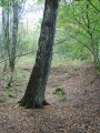
Multi-periodSite Name: Mynydd Egryn SettlementCountry: Wales County: Gwynedd Type: Ancient Village or Settlement
Nearest Town: Harlech Nearest Village: Dyffryn Ardudwy
Map Ref: SH61632030
Latitude: 52.762528N Longitude: 4.05209W
Condition:
| 5 | Perfect |
| 4 | Almost Perfect |
| 3 | Reasonable but with some damage |
| 2 | Ruined but still recognisable as an ancient site |
| 1 | Pretty much destroyed, possibly visible as crop marks |
| 0 | No data. |
| -1 | Completely destroyed |
| 5 | Superb |
| 4 | Good |
| 3 | Ordinary |
| 2 | Not Good |
| 1 | Awful |
| 0 | No data. |
| 5 | Can be driven to, probably with disabled access |
| 4 | Short walk on a footpath |
| 3 | Requiring a bit more of a walk |
| 2 | A long walk |
| 1 | In the middle of nowhere, a nightmare to find |
| 0 | No data. |
| 5 | co-ordinates taken by GPS or official recorded co-ordinates |
| 4 | co-ordinates scaled from a detailed map |
| 3 | co-ordinates scaled from a bad map |
| 2 | co-ordinates of the nearest village |
| 1 | co-ordinates of the nearest town |
| 0 | no data |
Internal Links:
External Links:
I have visited· I would like to visit
PAB has visited here
")
The features were clear enough on the ground for us to note the GPS readings to help us find out more - having now had a chance to look on COFLEIN, there are clearly the remains of the 'unenclosed hut circle settlement.
The COFLEIN entry also includes an aerial picture of the excavations in 2005, as well as a general aerial photo on which the Hengwm Circle Cairn is also visible.
There certainly seems to be much in the area worth further investigation, and presumably the 2005 excavations will have been written up - so more research beckons! I have also found some items written by the Gwynedd Archaeology Society about this general area, which I will try and sift through to see if it throws any more light... There seem to have been later excavations of the circles just visible at the top right-hand corner of COFLEIN's aerial photo - there were a number of disturbed circles there, and I will post some pictures shortly.
COFLEIN entry: NPRN 55995: Mynydd Egryn Hut Circle Settlement
You may be viewing yesterday's version of this page. To see the most up to date information please register for a free account.
")
")
")
")
")
")
")
")
Do not use the above information on other web sites or publications without permission of the contributor.
Click here to see more info for this site
Nearby sites
Key: Red: member's photo, Blue: 3rd party photo, Yellow: other image, Green: no photo - please go there and take one, Grey: site destroyed
Download sites to:
KML (Google Earth)
GPX (GPS waypoints)
CSV (Garmin/Navman)
CSV (Excel)
To unlock full downloads you need to sign up as a Contributory Member. Otherwise downloads are limited to 50 sites.
Turn off the page maps and other distractions
Nearby sites listing. In the following links * = Image available
36m WNW 302° Hengwm Ring Cairn* Ring Cairn (SH61602032)
397m NW 307° Carneddau Hengwm* Chambered Cairn (SH61322055)
989m N 359° Ffridd Newydd* Stone Circle (SH61642129)
1.1km SE 138° Mynydd Egryn Cairn* Cairn (SH62331949)
1.1km WNW 301° Pen-y-Dinas (Gwynedd)* Hillfort (SH607209)
1.1km ESE 102° Bwlch y Rhiwgyr* Ring Cairn (SH62712004)
1.5km WNW 288° Cae'r Llwyn Homestead* Ancient Village or Settlement (SH602208)
1.5km W 272° Settlement West of Mynydd Egryn* Ancient Village or Settlement (SH601204)
1.5km NNW 339° Llecheiddior* Stone Circle (SH61112174)
1.7km N 6° Llyn Irddyn Hut Circle* Cairn (SH61862198)
1.7km W 262° Egryn Abbey Settlement* Ancient Village or Settlement (SH599201)
1.8km NNW 344° Cairns SE from Pont Fadog* Cairn (SH612220)
1.9km W 281° Hendre Eirian Hut Circles* Ancient Village or Settlement (SH598207)
2.0km NNE 15° Tumulus, Llyn Irddyn* Round Barrow(s) (SH62232225)
2.1km N 350° Ponfadog Bridge* Natural Stone / Erratic / Other Natural Feature (SH61312235)
2.1km SE 131° Cerrig Arthur* Stone Circle (SH63161889)
2.1km SSW 198° Settlement North of Hendre Coed Uchaf* Ancient Village or Settlement (SH609183)
2.2km NNE 21° Llyn Irddyn W* Ancient Village or Settlement (SH62462229)
2.2km ESE 116° Cae-Tudur Ancient Village or Settlement (SH63601929)
2.2km SSW 197° Cairn North of Hendre Coed Uchaf* Cairn (SH609182)
2.4km SSW 207° Bodfan Llanaber Standing Stone* Standing Stone (Menhir) (SH605182)
2.4km S 179° Ffridd Fechan Hill Fort* Hillfort (SH616179)
2.5km NNW 340° Pont Fadog N Hut Circles* Ancient Village or Settlement (SH60842272)
2.7km W 277° Enclosed Hut Circle Settlement North of Tyddyn Mawr* Ancient Village or Settlement (SH590207)
2.7km NNW 331° Pont Fadog W Hut Circle* Ancient Village or Settlement (SH60392265)
View more nearby sites and additional images

")
 We would like to know more about this location. Please feel free to add a brief description and any relevant information in your own language.
 Wir möchten mehr über diese Stätte erfahren. Bitte zögern Sie nicht, eine kurze Beschreibung und relevante Informationen in Deutsch hinzuzufügen.
 Nous aimerions en savoir encore un peu sur les lieux. S'il vous plaît n'hesitez pas à ajouter une courte description et tous les renseignements pertinents dans votre propre langue.
 Quisieramos informarnos un poco más de las lugares. No dude en añadir una breve descripción y otros datos relevantes en su propio idioma.