


<< Our Photo Pages >> Hendre Eirian Hut Circles - Ancient Village or Settlement in Wales in Gwynedd
Submitted by TAlanJones on Friday, 06 November 2020 Page Views: 498
Multi-periodSite Name: Hendre Eirian Hut CirclesCountry: Wales County: Gwynedd Type: Ancient Village or Settlement
Nearest Town: Abermaw (Barmouth) Nearest Village: Tal Y Bont
Map Ref: SH598207
Latitude: 52.765649N Longitude: 4.079363W
Condition:
| 5 | Perfect |
| 4 | Almost Perfect |
| 3 | Reasonable but with some damage |
| 2 | Ruined but still recognisable as an ancient site |
| 1 | Pretty much destroyed, possibly visible as crop marks |
| 0 | No data. |
| -1 | Completely destroyed |
| 5 | Superb |
| 4 | Good |
| 3 | Ordinary |
| 2 | Not Good |
| 1 | Awful |
| 0 | No data. |
| 5 | Can be driven to, probably with disabled access |
| 4 | Short walk on a footpath |
| 3 | Requiring a bit more of a walk |
| 2 | A long walk |
| 1 | In the middle of nowhere, a nightmare to find |
| 0 | No data. |
| 5 | co-ordinates taken by GPS or official recorded co-ordinates |
| 4 | co-ordinates scaled from a detailed map |
| 3 | co-ordinates scaled from a bad map |
| 2 | co-ordinates of the nearest village |
| 1 | co-ordinates of the nearest town |
| 0 | no data |
Internal Links:
External Links:
")
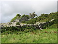
The larger hut circle has a 7m diameter and it's eastern side is cut into the steep slope. The adjacent hut circle has a 5m diameter. The buildings appear to have had southern entrances.
The immediate area appears to have been used as a dumping ground for field clearances. There is a rather large clearance cairn to the south that may be covering further archaeological features of the settlement.
You may be viewing yesterday's version of this page. To see the most up to date information please register for a free account.
")
")
")
Do not use the above information on other web sites or publications without permission of the contributor.
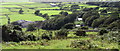
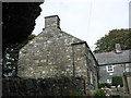
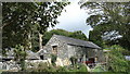
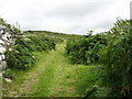
Nearby Images from Geograph Britain and Ireland:
©2007(licence)
©2007(licence)
©2007(licence)
©2007(licence)
©2007(licence)
The above images may not be of the site on this page, they are loaded from Geograph.
Please Submit an Image of this site or go out and take one for us!
Click here to see more info for this site
Nearby sites
Key: Red: member's photo, Blue: 3rd party photo, Yellow: other image, Green: no photo - please go there and take one, Grey: site destroyed
Download sites to:
KML (Google Earth)
GPX (GPS waypoints)
CSV (Garmin/Navman)
CSV (Excel)
To unlock full downloads you need to sign up as a Contributory Member. Otherwise downloads are limited to 50 sites.
Turn off the page maps and other distractions
Nearby sites listing. In the following links * = Image available
411m ENE 74° Cae'r Llwyn Homestead* Ancient Village or Settlement (SH602208)
423m SE 133° Settlement West of Mynydd Egryn* Ancient Village or Settlement (SH601204)
608m S 169° Egryn Abbey Settlement* Ancient Village or Settlement (SH599201)
798m W 268° Enclosed Hut Circle Settlement North of Tyddyn Mawr* Ancient Village or Settlement (SH590207)
919m ENE 76° Pen-y-Dinas (Gwynedd)* Hillfort (SH607209)
1.5km E 94° Carneddau Hengwm* Chambered Cairn (SH61322055)
1.7km NE 50° Llecheiddior* Stone Circle (SH61112174)
1.8km E 100° Hengwm Ring Cairn* Ring Cairn (SH61602032)
1.9km E 101° Mynydd Egryn Settlement* Ancient Village or Settlement (SH61632030)
1.9km NE 45° Cairns SE from Pont Fadog* Cairn (SH612220)
1.9km ENE 71° Ffridd Newydd* Stone Circle (SH61642129)
2.0km NNE 15° Pont Fadog W Hut Circle* Ancient Village or Settlement (SH60392265)
2.2km NNE 12° Cors y Gedol* Chambered Tomb (SH60332282)
2.2km NNE 17° Cors Y Gedol Field System* Ancient Village or Settlement (SH605228)
2.2km NE 41° Ponfadog Bridge* Natural Stone / Erratic / Other Natural Feature (SH61312235)
2.3km NNE 26° Pont Fadog N Hut Circles* Ancient Village or Settlement (SH60842272)
2.3km NNW 335° Dyffryn Ardudwy* Portal Tomb (SH58862284)
2.3km NNW 336° Hut Circles and Field System, Dyffryn Ardudwy* Ancient Village or Settlement (SH58912287)
2.4km NNE 12° Cors-y-Gedol Settlement* Ancient Village or Settlement (SH60382304)
2.4km ENE 56° Llyn Irddyn Hut Circle* Cairn (SH61862198)
2.6km NNE 28° Hut Circle, N of Afon Ysgethin* Ancient Village or Settlement (SH61062293)
2.6km SSE 163° Bodfan Llanaber Standing Stone* Standing Stone (Menhir) (SH605182)
2.6km SSE 154° Settlement North of Hendre Coed Uchaf* Ancient Village or Settlement (SH609183)
2.7km SSE 155° Cairn North of Hendre Coed Uchaf* Cairn (SH609182)
2.8km NNE 30° Cors-Y-Gedol E* Cairn (SH61252305)
View more nearby sites and additional images


 We would like to know more about this location. Please feel free to add a brief description and any relevant information in your own language.
 Wir möchten mehr über diese Stätte erfahren. Bitte zögern Sie nicht, eine kurze Beschreibung und relevante Informationen in Deutsch hinzuzufügen.
 Nous aimerions en savoir encore un peu sur les lieux. S'il vous plaît n'hesitez pas à ajouter une courte description et tous les renseignements pertinents dans votre propre langue.
 Quisieramos informarnos un poco más de las lugares. No dude en añadir una breve descripción y otros datos relevantes en su propio idioma.