

<< Our Photo Pages >> Llyn Irddyn Hut Circle - Cairn in Wales in Gwynedd
Submitted by rthomas on Monday, 29 June 2020 Page Views: 862
Neolithic and Bronze AgeSite Name: Llyn Irddyn Hut CircleCountry: Wales County: Gwynedd Type: Cairn
Nearest Village: Dyffryn Ardudwy
Map Ref: SH61862198
Latitude: 52.777679N Longitude: 4.049393W
Condition:
| 5 | Perfect |
| 4 | Almost Perfect |
| 3 | Reasonable but with some damage |
| 2 | Ruined but still recognisable as an ancient site |
| 1 | Pretty much destroyed, possibly visible as crop marks |
| 0 | No data. |
| -1 | Completely destroyed |
| 5 | Superb |
| 4 | Good |
| 3 | Ordinary |
| 2 | Not Good |
| 1 | Awful |
| 0 | No data. |
| 5 | Can be driven to, probably with disabled access |
| 4 | Short walk on a footpath |
| 3 | Requiring a bit more of a walk |
| 2 | A long walk |
| 1 | In the middle of nowhere, a nightmare to find |
| 0 | No data. |
| 5 | co-ordinates taken by GPS or official recorded co-ordinates |
| 4 | co-ordinates scaled from a detailed map |
| 3 | co-ordinates scaled from a bad map |
| 2 | co-ordinates of the nearest village |
| 1 | co-ordinates of the nearest town |
| 0 | no data |
Internal Links:
External Links:
")
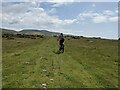
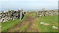
A Hut Circle (possible) or Ring Cairn (possible) near Llyn Irddyn.
Details at Coflein.
There is another (smaller) site approx 20 metres to the north at SH61842203.
You may be viewing yesterday's version of this page. To see the most up to date information please register for a free account.
")
")
")
")
Do not use the above information on other web sites or publications without permission of the contributor.
Nearby Images from Geograph Britain and Ireland:
©2015(licence)
©2011(licence)
©2011(licence)
©2024(licence)
©2019(licence)
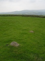
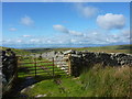
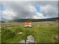
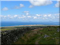
The above images may not be of the site on this page, they are loaded from Geograph.
Please Submit an Image of this site or go out and take one for us!
Click here to see more info for this site
Nearby sites
Key: Red: member's photo, Blue: 3rd party photo, Yellow: other image, Green: no photo - please go there and take one, Grey: site destroyed
Download sites to:
KML (Google Earth)
GPX (GPS waypoints)
CSV (Garmin/Navman)
CSV (Excel)
To unlock full downloads you need to sign up as a Contributory Member. Otherwise downloads are limited to 50 sites.
Turn off the page maps and other distractions
Nearby sites listing. In the following links * = Image available
457m NE 52° Tumulus, Llyn Irddyn* Round Barrow(s) (SH62232225)
658m W 270° Cairns SE from Pont Fadog* Cairn (SH612220)
661m WNW 302° Ponfadog Bridge* Natural Stone / Erratic / Other Natural Feature (SH61312235)
674m ENE 61° Llyn Irddyn W* Ancient Village or Settlement (SH62462229)
724m SSW 196° Ffridd Newydd* Stone Circle (SH61642129)
785m WSW 251° Llecheiddior* Stone Circle (SH61112174)
1.2km NNE 28° Craig-y-Dinas (Dyffryn Ardudwy)* Hillfort (SH62432300)
1.2km N 358° Craig-y-Dinas W* Cairn (SH61852315)
1.2km NE 36° Hut Circle Settlement East of Craig Y Dinas* Ancient Village or Settlement (SH62602295)
1.2km NNW 329° Cors-Y-Gedol E* Cairn (SH61252305)
1.2km NW 318° Hut Circle, N of Afon Ysgethin* Ancient Village or Settlement (SH61062293)
1.3km NW 304° Pont Fadog N Hut Circles* Ancient Village or Settlement (SH60842272)
1.5km NNW 333° Cors Uchaf S* Cairn (SH61232330)
1.5km SSW 199° Carneddau Hengwm* Chambered Cairn (SH61322055)
1.6km SW 225° Pen-y-Dinas (Gwynedd)* Hillfort (SH607209)
1.6km WNW 300° Cors Y Gedol Field System* Ancient Village or Settlement (SH605228)
1.6km WNW 293° Pont Fadog W Hut Circle* Ancient Village or Settlement (SH60392265)
1.6km N 352° Cors Uchaf E Hut Group* Ancient Village or Settlement (SH61682361)
1.7km S 187° Hengwm Ring Cairn* Ring Cairn (SH61602032)
1.7km NNE 24° Cairns North of Craig Y Dinas* Cairn (SH626235)
1.7km S 186° Mynydd Egryn Settlement* Ancient Village or Settlement (SH61632030)
1.7km WNW 297° Cors y Gedol* Chambered Tomb (SH60332282)
1.8km NW 304° Cors-y-Gedol Settlement* Ancient Village or Settlement (SH60382304)
1.9km NNE 26° Pont Scethin A* Standing Stone (Menhir) (SH62732364)
1.9km NNE 27° Pont Scethin B* Standing Stone (Menhir) (SH62792367)
View more nearby sites and additional images


 We would like to know more about this location. Please feel free to add a brief description and any relevant information in your own language.
 Wir möchten mehr über diese Stätte erfahren. Bitte zögern Sie nicht, eine kurze Beschreibung und relevante Informationen in Deutsch hinzuzufügen.
 Nous aimerions en savoir encore un peu sur les lieux. S'il vous plaît n'hesitez pas à ajouter une courte description et tous les renseignements pertinents dans votre propre langue.
 Quisieramos informarnos un poco más de las lugares. No dude en añadir una breve descripción y otros datos relevantes en su propio idioma.