<< Other Photo Pages >> Cholwichtown stone row - Stone Row / Alignment in England in Devon
Submitted by TheCaptain on Tuesday, 01 October 2002 Page Views: 7342
Neolithic and Bronze AgeSite Name: Cholwichtown stone row Alternative Name: Cholwich Town Waste stone row; Cholwichtown Stone RowCountry: England County: Devon Type: Stone Row / Alignment
Nearest Town: Plymouth Nearest Village: Lee Moor
Map Ref: SX585623 Landranger Map Number: 202
Latitude: 50.443439N Longitude: 3.994169W
Condition:
| 5 | Perfect |
| 4 | Almost Perfect |
| 3 | Reasonable but with some damage |
| 2 | Ruined but still recognisable as an ancient site |
| 1 | Pretty much destroyed, possibly visible as crop marks |
| 0 | No data. |
| -1 | Completely destroyed |
| 5 | Superb |
| 4 | Good |
| 3 | Ordinary |
| 2 | Not Good |
| 1 | Awful |
| 0 | No data. |
| 5 | Can be driven to, probably with disabled access |
| 4 | Short walk on a footpath |
| 3 | Requiring a bit more of a walk |
| 2 | A long walk |
| 1 | In the middle of nowhere, a nightmare to find |
| 0 | No data. |
| 5 | co-ordinates taken by GPS or official recorded co-ordinates |
| 4 | co-ordinates scaled from a detailed map |
| 3 | co-ordinates scaled from a bad map |
| 2 | co-ordinates of the nearest village |
| 1 | co-ordinates of the nearest town |
| 0 | no data |
Internal Links:
External Links:
")
As is fairly normal for Dartmoor stone rows, this row had a circle of stones at the higher end, made with 8 stones with a diameter of about 5 metres. The stone row ran downhill from here at an orientation of 22°, the spacing of the stones being variable, the size of the stones was mostly about a metre in length, the largest was 2 metres tall unusually being in the middle.
Much damage had happened to the row before the excavation, thought to have mostly been in 1848, with less than half of its stones remaining at the time, and its large terminal menhir, recorded at 3.7 metres tall, being completely missing.
Unfortunately during the excavations, nothing at all was found which could provide a date for the row, but pollen analysis suggested that it was erected in a woodland glade.
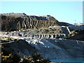
Update August 2019: This stone row, now covered by china clay waste, is featured on Prehistoric Dartmoor Walks (PDW) - see their entry for the Cholwich Town Stone Row.
The row is also recorded as Pastscape Monument No. 439202 (Stone Row and Cairn Circle (site of)) and as Devon & Dartmoor HER MDV2438 (Alignment).
The Stone Rows of Great Britain also includes an entry for this now destroyed row: Cholwichtown, which includes a description, a plan of the row and historic photographs of the row from 1914 and 1940.
You may be viewing yesterday's version of this page. To see the most up to date information please register for a free account.
Do not use the above information on other web sites or publications without permission of the contributor.
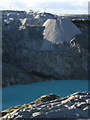
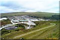
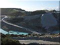
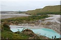
Nearby Images from Geograph Britain and Ireland:
©2007(licence)
©2005(licence)
©2007(licence)
©2009(licence)
©2007(licence)
The above images may not be of the site on this page, they are loaded from Geograph.
Please Submit an Image of this site or go out and take one for us!
Click here to see more info for this site
Nearby sites
Key: Red: member's photo, Blue: 3rd party photo, Yellow: other image, Green: no photo - please go there and take one, Grey: site destroyed
Download sites to:
KML (Google Earth)
GPX (GPS waypoints)
CSV (Garmin/Navman)
CSV (Excel)
To unlock full downloads you need to sign up as a Contributory Member. Otherwise downloads are limited to 50 sites.
![]()
![]()
Turn off the page maps and other distractions
Nearby sites listing. In the following links * = Image available
64m SW 217° Cholwich Town Cairn Circle* Stone Circle (SX58466225)
1.0km N 4° Lee Moor Settlement* Ancient Village or Settlement (SX586633)
1.0km E 79° Penn Beacon SW* Multiple Stone Rows / Avenue (SX5952062471)
1.0km ENE 78° Penn Beacon 1 Cairn Circle & Cist* Cairn (SX5953262482)
1.2km N 6° Shell Top Chambered Cairn* Cairn (SX58666349)
1.3km NE 47° Shell Top South-West stone row* Stone Row / Alignment (SX59466315)
1.3km E 91° Penn Beacon Platform Cairn Circle Cairn (SX59826225)
1.4km ENE 71° Penn Beacon NE Stone Row / Alignment (SX598627)
1.4km N 353° Lee Moor South* Stone Row / Alignment (SX5835963682)
1.4km N 353° Hanging Stone (Lee Moor)* Standing Stone (Menhir) (SX58376371)
1.4km NE 36° Shell Top South West* Ancient Village or Settlement (SX59386344)
1.5km E 79° Penn Beacon SE* Stone Row / Alignment (SX5994762546)
1.5km ENE 69° Penn Moor Reave West Misc. Earthwork (SX59956282)
1.5km ENE 65° Penn Beacon Cairn* Cairn (SX59916292)
1.8km NNW 329° Trowlesworthy East row* Multiple Stone Rows / Avenue (SX57626383)
1.8km NNW 329° Trowlesworthy* Barrow Cemetery (SX57606390)
1.9km NNW 332° Trowlesworthy East circle* Stone Circle (SX57656398)
1.9km ENE 70° Penn Moor Reave East Misc. Earthwork (SX60306289)
1.9km NNW 329° Trowlesworthy West circle* Stone Circle (SX57556398)
2.0km NW 325° Trowlesworthy West enclosure* Ring Cairn (SX57436394)
2.0km NE 38° Shell Top Platform Cairn Circle Cairn (SX5976163799)
2.0km NNW 327° Trowlesworthy West row* Stone Row / Alignment (SX57466397)
2.0km NE 39° Shell Top Cairn Circle Ring Cairn (SX5983063830)
2.0km ENE 77° High-house Waste Ancient Village or Settlement (SX60506270)
2.1km N 360° Upper Spanish Lake* Cist (SX58546445)
View more nearby sites and additional images


 We would like to know more about this location. Please feel free to add a brief description and any relevant information in your own language.
 Wir möchten mehr über diese Stätte erfahren. Bitte zögern Sie nicht, eine kurze Beschreibung und relevante Informationen in Deutsch hinzuzufügen.
 Nous aimerions en savoir encore un peu sur les lieux. S'il vous plaît n'hesitez pas à ajouter une courte description et tous les renseignements pertinents dans votre propre langue.
 Quisieramos informarnos un poco más de las lugares. No dude en añadir una breve descripción y otros datos relevantes en su propio idioma.