<< Our Photo Pages >> Minions Mound - Round Barrow(s) in England in Cornwall
Submitted by coldrum on Wednesday, 14 October 2009 Page Views: 6014
Neolithic and Bronze AgeSite Name: Minions MoundCountry: England County: Cornwall Type: Round Barrow(s)
Nearest Town: Liskeard Nearest Village: Minions
Map Ref: SX26017112
Latitude: 50.513947N Longitude: 4.455443W
Condition:
| 5 | Perfect |
| 4 | Almost Perfect |
| 3 | Reasonable but with some damage |
| 2 | Ruined but still recognisable as an ancient site |
| 1 | Pretty much destroyed, possibly visible as crop marks |
| 0 | No data. |
| -1 | Completely destroyed |
| 5 | Superb |
| 4 | Good |
| 3 | Ordinary |
| 2 | Not Good |
| 1 | Awful |
| 0 | No data. |
| 5 | Can be driven to, probably with disabled access |
| 4 | Short walk on a footpath |
| 3 | Requiring a bit more of a walk |
| 2 | A long walk |
| 1 | In the middle of nowhere, a nightmare to find |
| 0 | No data. |
| 5 | co-ordinates taken by GPS or official recorded co-ordinates |
| 4 | co-ordinates scaled from a detailed map |
| 3 | co-ordinates scaled from a bad map |
| 2 | co-ordinates of the nearest village |
| 1 | co-ordinates of the nearest town |
| 0 | no data |
Internal Links:
External Links:
I have visited· I would like to visit
markj99 visited on 6th Jun 2023 - their rating: Cond: 2 Amb: 3 Access: 4 The stone wall constructed round the mound may be protecting it for future antiquarians, however it also disguises the antiquity of the site.
Richard13 visited on 1st Jul 2018 - their rating: Cond: 2 Amb: 3 Access: 5
hevveh have visited here
Average ratings for this site from all visit loggers: Condition: 2 Ambience: 3 Access: 4.5
")
From Pastscape:
http://www.pastscape.org.uk/hob.aspx?hob_id=435732
You may be viewing yesterday's version of this page. To see the most up to date information please register for a free account.
")
Do not use the above information on other web sites or publications without permission of the contributor.
Runemage has found this location on Google Street View:
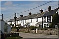
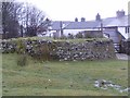
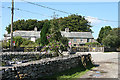
Nearby Images from Geograph Britain and Ireland:

©2006(licence)
©2007(licence)
©2012(licence)
©2010(licence)

©2006(licence)
The above images may not be of the site on this page, they are loaded from Geograph.
Please Submit an Image of this site or go out and take one for us!
Click here to see more info for this site
Nearby sites
Key: Red: member's photo, Blue: 3rd party photo, Yellow: other image, Green: no photo - please go there and take one, Grey: site destroyed
Download sites to:
KML (Google Earth)
GPX (GPS waypoints)
CSV (Garmin/Navman)
CSV (Excel)
To unlock full downloads you need to sign up as a Contributory Member. Otherwise downloads are limited to 50 sites.
Turn off the page maps and other distractions
Nearby sites listing. In the following links * = Image available
231m W 261° Minions Platform Round Barrow* Cairn (SX25787109)
289m NW 315° The Hurlers (S)* Stone Circle (SX25817133)
330m NW 323° The Hurlers (C)* Stone Circle (SX25827139)
332m NW 325° The Hurlers* Stone Circle (SX25837140)
349m NNW 327° The Hurlers causeway* Ancient Trackway (SX25837142)
371m NNW 331° The Hurlers (N)* Stone Circle (SX25847145)
377m NW 306° The Hurlers Pipers* Standing Stones (SX25717135)
490m NNW 342° The Hurlers North* Stone Circle (SX25877159)
738m SW 218° The Long Stone (Minions)* Standing Stone (Menhir) (SX25547055)
765m WSW 237° Minions Cairns Cairn (SX25357073)
773m W 261° Minions Kerbed Cairn Cairn (SX25247103)
783m NNW 340° The Hurlers Avenue* Multiple Stone Rows / Avenue (SX2576371864)
790m N 359° Rillaton Barrow* Round Barrow(s) (SX26027191)
802m NNE 12° Minions Settlement* Ancient Village or Settlement (SX262719)
830m N 357° Rillaton N Cairn* Cairn (SX26007195)
862m W 262° Minions Bronze Age round cairn. Cairn (SX25157103)
869m W 277° Minions Round Cairns* Round Cairn (SX25157126)
899m W 264° Trewalla Farm Settlement* Ancient Village or Settlement (SX25117106)
1.2km SE 139° Caradon Hill stone row Stone Row / Alignment (SX26797016)
1.3km ESE 108° Caradon Hill cairns* Barrow Cemetery (SX272707)
1.3km NNW 348° The Cheesewring* Natural Stone / Erratic / Other Natural Feature (SX25787239)
1.3km NW 308° Craddock Moor platform cairn* Cairn (SX25027196)
1.3km WNW 300° Craddock Moor circle* Stone Circle (SX24877183)
1.4km NNW 348° Stowe's Pound* Ancient Village or Settlement (SX25787247)
1.7km W 279° Craddock Moor Cairn Cemetery* Barrow Cemetery (SX2435071429)
View more nearby sites and additional images


 We would like to know more about this location. Please feel free to add a brief description and any relevant information in your own language.
 Wir möchten mehr über diese Stätte erfahren. Bitte zögern Sie nicht, eine kurze Beschreibung und relevante Informationen in Deutsch hinzuzufügen.
 Nous aimerions en savoir encore un peu sur les lieux. S'il vous plaît n'hesitez pas à ajouter une courte description et tous les renseignements pertinents dans votre propre langue.
 Quisieramos informarnos un poco más de las lugares. No dude en añadir una breve descripción y otros datos relevantes en su propio idioma.