


<< Text Pages >> Raven's Stone (Elgol) - Standing Stone (Menhir) in Scotland in Isle of Skye
Submitted by Anne T on Thursday, 04 January 2018 Page Views: 2657
Neolithic and Bronze AgeSite Name: Raven's Stone (Elgol) Alternative Name: The Raven's BeakCountry: Scotland
NOTE: This site is 0.9 km away from the location you searched for.
County: Isle of Skye Type: Standing Stone (Menhir)
Nearest Village: Elgol
Map Ref: NG520144
Latitude: 57.153265N Longitude: 6.102271W
Condition:
| 5 | Perfect |
| 4 | Almost Perfect |
| 3 | Reasonable but with some damage |
| 2 | Ruined but still recognisable as an ancient site |
| 1 | Pretty much destroyed, possibly visible as crop marks |
| 0 | No data. |
| -1 | Completely destroyed |
| 5 | Superb |
| 4 | Good |
| 3 | Ordinary |
| 2 | Not Good |
| 1 | Awful |
| 0 | No data. |
| 5 | Can be driven to, probably with disabled access |
| 4 | Short walk on a footpath |
| 3 | Requiring a bit more of a walk |
| 2 | A long walk |
| 1 | In the middle of nowhere, a nightmare to find |
| 0 | No data. |
| 5 | co-ordinates taken by GPS or official recorded co-ordinates |
| 4 | co-ordinates scaled from a detailed map |
| 3 | co-ordinates scaled from a bad map |
| 2 | co-ordinates of the nearest village |
| 1 | co-ordinates of the nearest town |
| 0 | no data |
Internal Links:
External Links:
Standing Stone (Menhir) in Isle of Skye
The Northern Antiquarian (TNA) tell us about this now destroyed standing stone near Elgol on the Isle of Sky - see their page for the Raven’s Stone, Elgol, Strathaird, Skye.
TNA tells us: "(this stone) was described in Otta Swire’s (1961:230) superb book on the folklore of Skye, where she wrote: 'Overlooking Elgol is Bidein an Fhithich. Near here once stood the famous Raven’s Stone, about which the Brahn Seer prophesied. It is believed that this prophecy, however, can never be fulfilled, as seventy or eighty years ago the stone was broken up and the main portion of it is now incorporated in one wall of the Glendale church, according to the Rev. A. R. Forbes’ Place Names of Skye. The stone was believed to have had some connexion with old pagan religious ceremonies.'"
Note: Do you have any historical information, images or photographs of this now lost/destroyed standing stone to contribute?
You may be viewing yesterday's version of this page. To see the most up to date information please register for a free account.
Do not use the above information on other web sites or publications without permission of the contributor.
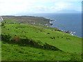
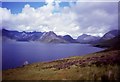
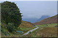
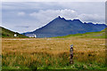
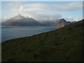
Nearby Images from Geograph Britain and Ireland:
©2006(licence)
©2011(licence)
©2013(licence)
©2008(licence)
©2009(licence)
The above images may not be of the site on this page, they are loaded from Geograph.
Please Submit an Image of this site or go out and take one for us!
Click here to see more info for this site
Nearby sites
Key: Red: member's photo, Blue: 3rd party photo, Yellow: other image, Green: no photo - please go there and take one, Grey: site destroyed
Download sites to:
KML (Google Earth)
GPX (GPS waypoints)
CSV (Garmin/Navman)
CSV (Excel)
To unlock full downloads you need to sign up as a Contributory Member. Otherwise downloads are limited to 50 sites.
Turn off the page maps and other distractions
Nearby sites listing. In the following links * = Image available
1.5km E 82° Allt Na Cille Standing Stone (Menhir) (NG53501453)
1.9km E 96° Allt Na Cille Souterrain (Fogou, Earth House) (NG539141)
2.3km E 90° Dun Liath (Elgol)* Broch or Nuraghe (NG54331427)
2.6km SE 140° Dun Grugaig (Skye)* Stone Fort or Dun (NG53541229)
2.9km ENE 65° An Reidhean* Stone Circle (NG54701548)
3.8km ENE 57° Cadha nan Ingrean* Stone Fort or Dun (NG55331625)
4.0km NNE 32° Na Clachan Bhreige* Stone Circle (NG5433817681)
4.2km NE 45° Kilmarie (Strathaird) Stone Circle (NG552172)
4.4km NE 44° Cnocan nan Gobhar* Round Cairn (NG55261735)
4.5km NNE 31° Kilmarie Standing Stones (NG54591814)
4.8km NE 54° Dun Ringill* Broch or Nuraghe (NG561170)
5.7km NNE 24° Abhainn Cille Mhaire Standing Stones (NG54611952)
7.7km NE 42° Dun Beag (Loch Slapin)* Stone Fort or Dun (NG57511984)
7.9km NE 40° Dun Mor (Torrin)* Broch or Nuraghe (NG57402015)
8.1km ESE 116° Cnoc an Temple* Burial Chamber or Dolmen (NG591104)
8.2km ENE 64° Dun Kearstack* Hillfort (NG596175)
8.6km E 99° Inver Aulavaig 1* Cairn (NG60441259)
8.7km E 98° Inver Aulavaig 2* Cairn (NG6059112629)
9.1km NE 46° Clach na h'Annait* Standing Stone (Menhir) (NG58952029)
9.1km NE 51° High Pasture Cave* Cave or Rock Shelter (NG59431971)
9.6km ENE 76° Dun Boreraig Fort* Hillfort (NG615162)
9.7km E 92° Tobar Chaon* Holy Well or Sacred Spring (NG61711340)
9.9km E 93° Teampuill Chaon* Early Christian Sculptured Stone (NG61831321)
10.1km ENE 75° Dun Boreraig Stone* Standing Stone (Menhir) (NG61951638)
10.7km SSE 150° Dun Geilbt* Stone Fort or Dun (NG56750480)
View more nearby sites and additional images


 We would like to know more about this location. Please feel free to add a brief description and any relevant information in your own language.
 Wir möchten mehr über diese Stätte erfahren. Bitte zögern Sie nicht, eine kurze Beschreibung und relevante Informationen in Deutsch hinzuzufügen.
 Nous aimerions en savoir encore un peu sur les lieux. S'il vous plaît n'hesitez pas à ajouter une courte description et tous les renseignements pertinents dans votre propre langue.
 Quisieramos informarnos un poco más de las lugares. No dude en añadir una breve descripción y otros datos relevantes en su propio idioma.