<< Our Photo Pages >> Clach An Truishal - Standing Stone (Menhir) in Scotland in Isle of Lewis
Submitted by sithean on Friday, 13 September 2019 Page Views: 19659
Neolithic and Bronze AgeSite Name: Clach An Truishal Alternative Name: Trushal Stone, Clach an Truiseil, Clach an Trushal, Stone of CompassionCountry: Scotland County: Isle of Lewis Type: Standing Stone (Menhir)
Nearest Town: Stornoway Nearest Village: Ballantrushal
Map Ref: NB3756053775 Landranger Map Number: 8
Latitude: 58.393407N Longitude: 6.492906W
Condition:
| 5 | Perfect |
| 4 | Almost Perfect |
| 3 | Reasonable but with some damage |
| 2 | Ruined but still recognisable as an ancient site |
| 1 | Pretty much destroyed, possibly visible as crop marks |
| 0 | No data. |
| -1 | Completely destroyed |
| 5 | Superb |
| 4 | Good |
| 3 | Ordinary |
| 2 | Not Good |
| 1 | Awful |
| 0 | No data. |
| 5 | Can be driven to, probably with disabled access |
| 4 | Short walk on a footpath |
| 3 | Requiring a bit more of a walk |
| 2 | A long walk |
| 1 | In the middle of nowhere, a nightmare to find |
| 0 | No data. |
| 5 | co-ordinates taken by GPS or official recorded co-ordinates |
| 4 | co-ordinates scaled from a detailed map |
| 3 | co-ordinates scaled from a bad map |
| 2 | co-ordinates of the nearest village |
| 1 | co-ordinates of the nearest town |
| 0 | no data |
Internal Links:
External Links:
I have visited· I would like to visit
SolarMegalith angband would like to visit
bishop_pam visited on 10th Sep 2024 - their rating: Cond: 5 Amb: 5 Access: 4
drolaf visited on 22nd May 2024 - their rating: Cond: 4 Amb: 4 Access: 4 parking area nearby with a short 50m walk
Fiona1320 visited on 22nd Jun 2023 - their rating: Cond: 5 Amb: 5 Access: 4
rrmoser visited on 28th Jun 2017 - their rating: Cond: 4 Amb: 4 Despite it height it is hidden behind some buildings. Left off the "main" road.
markhewins visited on 7th Nov 2016 Beautiful still day.
BIG stone!
mark_a visited September 2020
Andy B visited #9 in our rundown of favourite standing stones (and pairs) in Britain
SandyG PAB DrewParsons have visited here
Average ratings for this site from all visit loggers: Condition: 4.5 Ambience: 4.5 Access: 4

There was a battle nearby. Others suggest it was a sea marker, the nearby beach is still one of the few safe harbours in the area.
The size of the monument can only be appreciated by visiting the site, Archaeologists are still unsure of the methods Neolithic and Bronze Age man employed to erect these huge masses of stone.
Note: Two new panoramic photos from Bernard Edwards: Preparing to watch over-night and Morning before Bahama Storm Dorian remnant rolls in (see above)
You may be viewing yesterday's version of this page. To see the most up to date information please register for a free account.

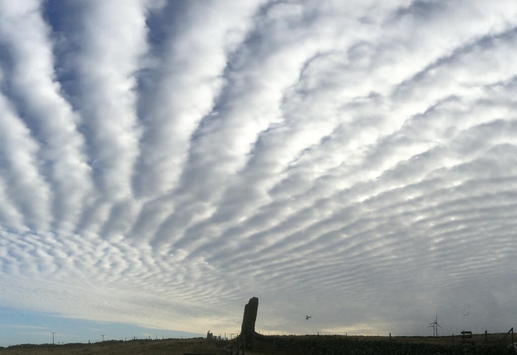

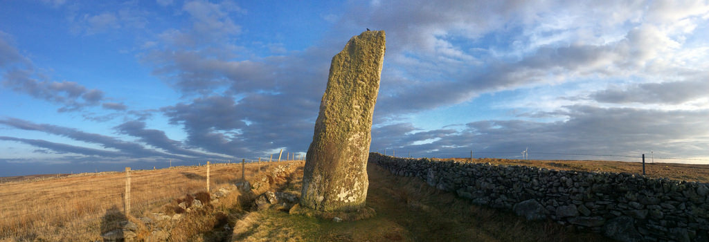




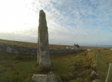
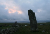
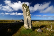

These are just the first 25 photos of Clach An Truishal. If you log in with a free user account you will be able to see our entire collection.
Do not use the above information on other web sites or publications without permission of the contributor.
Click here to see more info for this site
Nearby sites
Key: Red: member's photo, Blue: 3rd party photo, Yellow: other image, Green: no photo - please go there and take one, Grey: site destroyed
Download sites to:
KML (Google Earth)
GPX (GPS waypoints)
CSV (Garmin/Navman)
CSV (Excel)
To unlock full downloads you need to sign up as a Contributory Member. Otherwise downloads are limited to 50 sites.
Turn off the page maps and other distractions
Nearby sites listing. In the following links * = Image available
173m SE 128° Baile an Truiseil Stone Circle (NB37695366)
1.5km SSW 203° Barabhas-standing stones Standing Stones (NB36915247)
1.8km ENE 68° Loch an Dùin (Shader)* Broch or Nuraghe (NB39295435)
2.1km ENE 78° Steinacleit* Chambered Tomb (NB39635408)
2.3km ENE 66° Clach Stei Lin* Stone Circle (NB3969454546)
5.0km NE 40° Tobar Bhrìghde* Holy Well or Sacred Spring (NB41035738)
5.3km SW 229° Barabhas* Modern Stone Circle etc (NB333506)
8.9km NE 45° Dun Sabhuill Stone Fort or Dun (NB44305956)
11.1km SW 231° Loch an Duna* Broch or Nuraghe (NB285473)
13.8km SE 132° Carn A' Mharc Chambered Cairn (NB4722543846)
15.6km SE 127° Dun Beinn Ivor Stone Fort or Dun (NB495436)
16.1km WSW 238° Shawbost* Stone Circle (NB233461)
17.3km ESE 121° Dun Beinn Earba Stone Fort or Dun (NB518438)
18.5km SSE 165° Benside Newmarket* Stone Circle (NB4129735652)
18.9km SSE 165° Priest's Glen* Stone Circle (NB41103516)
19.0km NE 53° Clach Stein* Standing Stones (NB5348764187)
19.4km NE 51° Dùn Èistean* Ancient Village or Settlement (NB5349164962)
19.8km S 169° Loch Airidh Na Lic* Crannog (NB39923410)
20.2km SW 234° Clach An Tursa* Stone Row / Alignment (NB2042242952)
21.6km SW 234° Dun Lewis Stone Fort or Dun (NB19274217)
22.3km SW 232° Dun Carloway* Broch or Nuraghe (NB1900441224)
22.5km SW 228° Dun Doune Braes* Stone Fort or Dun (NB1976039906)
23.2km S 175° Druim Dubh* Stone Circle (NB382305)
23.6km SW 216° Callanish 11* Standing Stone (Menhir) (NB22233569)
24.3km SW 215° Cnoc Gearraidh Nighean Choinnich Stone Circle (NB22183484)
View more nearby sites and additional images


 We would like to know more about this location. Please feel free to add a brief description and any relevant information in your own language.
 Wir möchten mehr über diese Stätte erfahren. Bitte zögern Sie nicht, eine kurze Beschreibung und relevante Informationen in Deutsch hinzuzufügen.
 Nous aimerions en savoir encore un peu sur les lieux. S'il vous plaît n'hesitez pas à ajouter une courte description et tous les renseignements pertinents dans votre propre langue.
 Quisieramos informarnos un poco más de las lugares. No dude en añadir una breve descripción y otros datos relevantes en su propio idioma.