Featured: Lost Secrets - an adventure during Neolithic times

Lost Secrets - an adventure during Neolithic times

Stonehenge: The Story So Far, Julian Richards

Stonehenge: The Story So Far, Julian Richards

Who's Online

There are currently, 305 guests and 1 members online.

You are a guest. To join in, please register for free by clicking here

Sponsors

<< Our Photo Pages >> Callanish 11 - Standing Stone (Menhir) in Scotland in Isle of Lewis

Submitted by Gerald_Ponting on Friday, 07 February 2020  Page Views: 12534

Neolithic and Bronze AgeSite Name: Callanish 11 Alternative Name: Airigh na Beinne Bige, Callanish XI
Country: Scotland County: Isle of Lewis Type: Standing Stone (Menhir)
Nearest Town: Stornoway  Nearest Village: Breasclete
Map Ref: NB22233569  Landranger Map Number: 8
Latitude: 58.222084N  Longitude: 6.732531W
Condition:
5Perfect
4Almost Perfect
3Reasonable but with some damage
2Ruined but still recognisable as an ancient site
1Pretty much destroyed, possibly visible as crop marks
0No data.
-1Completely destroyed
3 Ambience:
5Superb
4Good
3Ordinary
2Not Good
1Awful
0No data.
4 Access:
5Can be driven to, probably with disabled access
4Short walk on a footpath
3Requiring a bit more of a walk
2A long walk
1In the middle of nowhere, a nightmare to find
0No data.
3 Accuracy:
5co-ordinates taken by GPS or official recorded co-ordinates
4co-ordinates scaled from a detailed map
3co-ordinates scaled from a bad map
2co-ordinates of the nearest village
1co-ordinates of the nearest town
0no data
5

Internal Links:
External Links:

Callanish 11
Callanish 11 submitted by snapr : About a third of the way down there is the rusted remains of a metal wedge. North-easterly view. (Vote or comment on this photo)
Standing Stone in Lewis on a peat-covered terrace about fifty metres across. There is a fine view across the whole Callanish area from this spot.

Gerald Ponting writes: The single standing stone has long been known to the people of Breasclete. Surprisingly, it had never been recorded in any archaeological literature. All the information known about this site was gathered by Margaret Pontinq, Ron Curtis and myself.

Local tradition records that this site has been used, perhaps for generations as a source of suitable slabs for use as door lintels for black houses. A piece of metal embedded in a crack in the erect stone tends to confirm this - the result of an unsuccessful attempt to split the remaining stone. The stones were sometimes taken to the village on sledges in winter. There is even a tale of regular hauntings at one house due to the of fending "Druidical" lintel; which continued till the occupier emigrated!

Initially, we thought that the site was the remains of a large circle. Having found about twenty possible features it was clear that the site was not a circle.

Latterly, Margaret and I suggested that it could be a southward facing "observatory" site (to match the predominantly north facing observatory of site V?).

The features near the cliff represent observing positions and the features at the lower edge of the terrace act as markers for horizon positions.

Remarkably, all the other sites in the "Callanish Complex" are visible from this site, with the exception of site VIII - and this was "marked" by site XV, which would have been visible when erect. XI. XV and VIII are in a straight line.

Access: In Breasclete village take the Pentland road towards the moors. Immediately beyond the first cattle grid, leave the road and climb steeply up the hill on the left for about five minutes.

Text reused with permission from "The Stones around Callanish" by Gerald Ponting and Margaret Ponting (now Margaret Curtis).
Gerald Ponting's web site

Canmore site no. 4151.

Note: Geophysical survey finds evidence of a stone circle at this standing stone site in the Calanias complex, and possibly an ancient lightning strike at the site - more in the comments on our page
You may be viewing yesterday's version of this page. To see the most up to date information please register for a free account.


Do not use the above information on other web sites or publications without permission of the contributor.

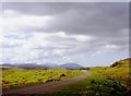
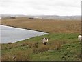
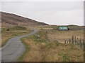
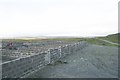
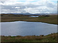
Nearby Images from Geograph Britain and Ireland:
NB2235 : Pentland Road by Alan Reid
by Alan Reid
©2018(licence)
NB2235 : Sheep, Breascleit by Richard Webb
by Richard Webb
©2010(licence)
NB2235 : Pentland Road by Richard Webb
by Richard Webb
©2010(licence)
NB2235 : Sheep Pens and Sheep Wash by Bob Embleton
by Bob Embleton
©2007(licence)
NB2235 : Lochs and hills by James Allan
by James Allan
©2013(licence)

The above images may not be of the site on this page, they are loaded from Geograph.
Please Submit an Image of this site or go out and take one for us!


Click here to see more info for this site

Nearby sites

Click here to view sites on an interactive OS map

Key: Red: member's photo, Blue: 3rd party photo, Yellow: other image, Green: no photo - please go there and take one, Grey: site destroyed

Download sites to:
KML (Google Earth)
GPX (GPS waypoints)
CSV (Garmin/Navman)
CSV (Excel)

To unlock full downloads you need to sign up as a Contributory Member. Otherwise downloads are limited to 50 sites.

Stones of Wonder by Robert Pollock
Megalithic Mysteries by Andy Burnham

STILE by Clive Ruggles


Turn off the page maps and other distractions

Nearby sites listing. In the following links * = Image available
 986m SW 219° Callanish 12* Standing Stone (Menhir) (NB2155634967)
 1.0km SSW 200° Olcote Kerbed Cairn* Cairn (NB2179634733)
 1.1km WSW 256° Cnoc a Phrionnsa* Chambered Cairn (NB211355)
 1.7km SSW 201° Callanish 13* Standing Stones (NB215341)
 2.1km SSW 202° Callanish 16* Standing Stone (Menhir) (NB213338)
 2.2km SSE 156° Callanish 10* Stone Circle (NB22973362)
 2.6km S 185° Callanish 19* Stone Circle (NB218331)
 2.8km SSW 195° Callanish* Stone Circle (NB2129833013)
 2.8km SSW 195° Callanish I* Stone Circle (NB2128633009)
 2.8km SSE 164° Callanish 14* Standing Stone (Menhir) (NB228329)
 3.0km S 171° Callanish 3* Stone Circle (NB2251532710)
 3.1km S 176° Callanish 2* Stone Circle (NB2221432614)
 3.2km S 177° Loch Roag Timber Circle (NB222325)
 3.6km S 169° Cnoc Fillibhir Mhor* Stone Row / Alignment (NB22683207)
 4.0km SSE 154° Callanish 17* Stone Circle (NB237320)
 4.7km WSW 251° Callanish 15* Standing Stone (Menhir) (NB177345)
 4.9km NW 326° Dun Doune Braes* Stone Fort or Dun (NB1976039906)
 5.3km SSE 168° Callanish 4* Stone Circle (NB2298830412)
 5.6km SSE 166° Callanish 7* Ancient Mine, Quarry or other Industry (NB232302)
 5.6km WSW 252° Dun Barraglom Broch or Nuraghe (NB16773435)
 5.7km WSW 252° Barraglom Cup-Marked Rock Rock Art (NB167343)
 5.9km SSE 152° Callanish 6* Standing Stones (NB24653034)
 5.9km SSE 164° Callanish 5* Stone Row / Alignment (NB23432990)
 6.0km WSW 250° Callanish 8A* Standing Stone (Menhir) (NB165340)
 6.0km WSW 252° Callanish 8* Stone Circle (NB16423424)
View more nearby sites and additional images

<< Clickhimin

Gallow Hill Cairn >>

Please add your thoughts on this site

Callanish, Gerald Ponting

Callanish, Gerald Ponting

Web Links for Callanish 11

Stones of Wonder by Robert Pollock
Megalithic Mysteries by Andy Burnham

Archived Web links for Callanish 11

STILE by Clive Ruggles

Sponsors

Auto-Translation (Google)

Translate from English into:

"Callanish 11" | Login/Create an Account | 6 News and Comments
  
Go back to top of page    Comments are owned by the poster. We aren't responsible for their content.
New discoveries in the Neolithic landscape of the Callanish Stones by Andy B on Friday, 07 February 2020
(User Info | Send a Message)
A project to survey the prehistoric landscape around the Callanish Stones on the Isle of Lewis in the Outer Hebrides has revealed evidence of other stone circles hidden beneath the peat, including one with evidence of a large lightning strike in its centre.

The main stone circle, known in Gaelic as Tursachan Chalanais, is a significant Neolithic monument consisting of an arrangement of standing stones situated on a ridge above Loch Roag. In the surrounding area, over 15 other sites have been identified that may be ‘satellite’ stone circles to the main Tursachan, labelled Calanais Sites I to XIII. The Calanais Virtual Reconstruction Project, led by the University of St Andrews with Urras nan Tursachan and the University of Bradford, was designed to increase understanding of these features.

The project used several different geophysical techniques, in order to determine their effectiveness in mapping the Neolithic landscapes of Scotland’s Western Isles, much of which has been buried by blanket peat and rising sea levels during the Holocene. The test-site chosen was Calanais Site XI, or Airigh na Beinne Bige, a single standing stone on an exposed rocky outcrop surrounded by blanket peat bog, overlooking the Tursachan.

The geomagnetic survey of Site XI identified 13 anomalies in a circular pattern, c.30m in diameter. One was associated with the existing standing stone, and the other 12 are believed to be buried stones or settings for stones that were part of a circle of megaliths extending from the one stone remaining.
Results of geomagnetic survey of site XI, showing anomalies representing a stone circle, and evidence of the lightning strike in the middle

In the middle of the buried stone circle, the survey found evidence for a magnetic feature in a pattern typically associated with large lightning strikes. The clarity of the strike indicates that it occurred prior to the accumulation of the peat, meaning that it must have taken place over c.3,900 years ago, while its size and intensity suggest that it may be the result of multiple high-density strikes, either in a single storm or through multiple events over time.

It is not known whether the lightning strike occurred before or after the construction of the monument. Lightning is usually attracted to large upstanding features and, although there is currently no such feature in this location, it has been suggested that there may have been a tree or large natural rock on this spot, which the stone circle could have been constructed to memorialise. However, even without such a feature, the exposed area with its rocky outcrops would still have been susceptible to lightning strikes, and it is possible that the monument was simply intended to record the natural phenomenon alone.

Despite the uncertainty surrounding the relationship between the stone circle and the lightning strike, the survey has raised interesting questions about the way in which natural events may have influenced the beliefs of the Neolithic people who occupied this landscape. It has also demonstrated that various types of land and marine geophysics can be used successfully to reconstruct the palaeo-landscape, and the team hopes to return this year to conduct further surveys and learn more about Neolithic activity around the Tursachan.

For further details of the project, see http://hdl.handle.net/10023/19121
The paper is Open Access and can be read here
https://doi.org/10.3390/rs11242975

This news article appeared in issue 360 of Current Archaeology.
[ Reply to This ]

Re: Callanish 11 - Geophysical survey news re ancient Lightning Strike by SumDoood on Monday, 23 December 2019
(User Info | Send a Message)
And from the BBC 23/12/19: Lewis stone circle has star-shaped lightning strike http://bbc.co.uk/news/uk-scotland-highlands-islands-50891787
[ Reply to This ]
    Re: Callanish 11 - Geophysical survey news re ancient Lightning Strike by Sunny100 on Monday, 23 December 2019
    (User Info | Send a Message)
    And there is also this Link from The Guardian newspaper: https://www.theguardian.com/uk-news/2019/dec/21/callanish-standing-stones-lightning-strike-archaeology-lewis-scotland
    [ Reply to This ]
      Re: Callanish 11 - Geophysical survey news re ancient Lightning Strike by Andy B on Friday, 07 February 2020
      (User Info | Send a Message)
      Interesting stuff - sorry I missed this from just before Christmas. I was asked about this at my talk last night. I think it's an intriguing idea - I remembered that Terence Meaden has suggested that some stone circles could have been set up to memorialise the site of tornados (this being the most plausible answer to the few genuine - and actually circular - crop circles that have been found). Terence has understandable gone a bit quiet on crop circles recently but it's a version of the same idea - and again an 'earth mysteries' researcher was there 20 years earlier!
      [ Reply to This ]
        Re: Callanish 11 - Geophysical survey news re ancient Lightning Strike by AngieLake on Saturday, 08 February 2020
        (User Info | Send a Message)
        Was it stone circles or cursus (cursi?) that Terence Meaden referred to ? I seemed to remember the alignment being a factor in his theory...?
        [ Reply to This ]

Callanish 11 - Geophysical survey news re ancient Lightning Strike by AngieLake on Sunday, 22 December 2019
(User Info | Send a Message)
"Bolt from the blue! How lightning strike inspired Neolithic builders to construct the iconic Callanish Stones on Outer Hebrides island some 5,000 years ago."

A geophysical survey around one of the stones has revealed a star-shaped pattern formed by one, or potentially more than one, lightning strikes that shook the earth.

New technology has exposed a pattern covering an area of 20 metres in diameter, which was buried until now beneath peat bogs.The single stone, within 'site XI', is about 2.8km from the famous Callanish great circle in the island's Loch Roag area.

Geophysical techniques mapped buried features and the new evidence shows that this 1.5-metre-high stone was originally part of another circle with the lightning strike pattern at its centre.

Professor Vincent Gaffney, one of the archaeologists told The Guardian: 'We're really excited. 'This was completely and utterly unexpected. 'Seeing the evidence for a massive strike, right in the middle of what now seems to be a stone circle, is remarkable.'

He added that a lightning strike could have hit a tree or a rock and may have been 'part of the game' in creating the stone circle.

Dr Richard Bates, a geoscientist at St Andrews University, who is leading the project, said the discovery was highly exciting.

More at https://www.dailymail.co.uk/news/article-7818885/How-lightning-strike-inspired-Neolithic-builders-construct-iconic-Callanish-Stones.html
[ Reply to This ]

Your Name: Anonymous [ Register Now ]
Subject:


Add your comment or contribution to this page. Spam or offensive posts are deleted immediately, don't even bother

<<< What is five plus one as a number? (Please type the answer to this question in the little box on the left)
You can also embed videos and other things. For Youtube please copy and paste the 'embed code'.
For Google Street View please include Street View in the text.
Create a web link like this: <a href="https://www.megalithic.co.uk">This is a link</a>  

Allowed HTML is:
<p> <b> <i> <a> <img> <em> <br> <strong> <blockquote> <tt> <li> <ol> <ul> <object> <param> <embed> <iframe>

We would like to know more about this location. Please feel free to add a brief description and any relevant information in your own language.
Wir möchten mehr über diese Stätte erfahren. Bitte zögern Sie nicht, eine kurze Beschreibung und relevante Informationen in Deutsch hinzuzufügen.
Nous aimerions en savoir encore un peu sur les lieux. S'il vous plaît n'hesitez pas à ajouter une courte description et tous les renseignements pertinents dans votre propre langue.
Quisieramos informarnos un poco más de las lugares. No dude en añadir una breve descripción y otros datos relevantes en su propio idioma.