<< Text Pages >> Kintore 4 - Class I Pictish Symbol Stone in Scotland in Aberdeenshire
Submitted by alligator on Thursday, 26 February 2004 Page Views: 6204
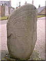
Early Medieval (Dark Age)Site Name: Kintore 4Country: Scotland County: Aberdeenshire Type: Class I Pictish Symbol Stone
Map Ref: NJ790162 Landranger Map Number: 38
Latitude: 57.236031N Longitude: 2.349527W
Condition:
| 5 | Perfect |
| 4 | Almost Perfect |
| 3 | Reasonable but with some damage |
| 2 | Ruined but still recognisable as an ancient site |
| 1 | Pretty much destroyed, possibly visible as crop marks |
| 0 | No data. |
| -1 | Completely destroyed |
| 5 | Superb |
| 4 | Good |
| 3 | Ordinary |
| 2 | Not Good |
| 1 | Awful |
| 0 | No data. |
| 5 | Can be driven to, probably with disabled access |
| 4 | Short walk on a footpath |
| 3 | Requiring a bit more of a walk |
| 2 | A long walk |
| 1 | In the middle of nowhere, a nightmare to find |
| 0 | No data. |
| 5 | co-ordinates taken by GPS or official recorded co-ordinates |
| 4 | co-ordinates scaled from a detailed map |
| 3 | co-ordinates scaled from a bad map |
| 2 | co-ordinates of the nearest village |
| 1 | co-ordinates of the nearest town |
| 0 | no data |
Be the first person to rate this site - see the 'Contribute!' box in the right hand menu.
Internal Links:
External Links:
Class I Pictish Symbol Stone in Aberdeen and the Grampians
For details, visit: http://www.archaeoptics.co.uk/products/ecms/327.html
You may be viewing yesterday's version of this page. To see the most up to date information please register for a free account.
Do not use the above information on other web sites or publications without permission of the contributor.
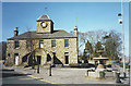
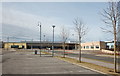
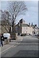
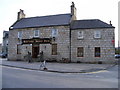
Nearby Images from Geograph Britain and Ireland:
©2006(licence)
©2017(licence)
©2017(licence)
©2008(licence)
©2006(licence)
The above images may not be of the site on this page, they are loaded from Geograph.
Please Submit an Image of this site or go out and take one for us!
Click here to see more info for this site
Nearby sites
Key: Red: member's photo, Blue: 3rd party photo, Yellow: other image, Green: no photo - please go there and take one, Grey: site destroyed
Download sites to:
KML (Google Earth)
GPX (GPS waypoints)
CSV (Garmin/Navman)
CSV (Excel)
To unlock full downloads you need to sign up as a Contributory Member. Otherwise downloads are limited to 50 sites.
Turn off the page maps and other distractions
Nearby sites listing. In the following links * = Image available
310m ENE 75° Kintore 1* Class I Pictish Symbol Stone (NJ79301628)
942m SSE 148° Tuack* Stone Circle (NJ795154)
1.2km SSE 155° Midmill Chambered Cairn (NJ795151)
1.5km NNW 340° Cairnhall Stone Circle (NJ78501759)
1.9km WNW 285° Ratch-hill Ancient Village or Settlement (NJ772167)
1.9km NNW 341° Fullerton* Stone Circle (NJ7839517969)
2.0km SE 143° Ferneybrae* Standing Stone (Menhir) (NJ80211459)
2.7km NE 54° Greenlands* Ancient Village or Settlement (NJ81231778)
3.2km NNW 339° Broomend Stone Seat / Cists* Cist (NJ77871917)
3.2km NNW 341° Gardeners House Standing Stone Standing Stone (Menhir) (NJ7794919226)
3.4km NNW 342° Broomend of Crichie Row Mid Stone Row / Alignment (NJ7792919479)
3.5km NW 322° Bruce's Camp* Hillfort (NJ76851900)
3.6km NNW 342° Broomend of Crichie Stone Row / Alignment (NJ7792119591)
3.6km SE 131° Cairntradlin* Standing Stone (Menhir) (NJ81681385)
3.6km ESE 120° Kinellar Pictish Symbol Stone* Class I Pictish Symbol Stone (NJ821144)
3.6km NNW 342° Broomend of Crichie Avenue* Multiple Stone Rows / Avenue (NJ7791419653)
3.6km ESE 119° Kinellar Churchyard* Stone Circle (NJ82161440)
3.6km NNW 342° Broomend of Crichie Pictish Symbol Stone* Class I Pictish Symbol Stone (NJ77921967)
3.6km NNW 342° Broomend Of Crichie Stone Circle / Henge* Henge (NJ77911968)
3.7km SW 218° South Ley Lodge* Stone Circle (NJ76681326)
3.8km NNW 343° Broomend of Crichie North circle Stone Circle (NJ779198)
4.0km SW 225° The Knock (Leylodge)* Standing Stone (Menhir) (NJ7611813345)
4.1km SE 143° Newton of Lewesk* Class I Pictish Symbol Stone (NJ815129)
4.2km NE 47° Peathill* Standing Stone (Menhir) (NJ8210419068)
4.5km E 88° Mill of Fintray Cursus Multiple Stone Rows / Avenue (NJ835163)
View more nearby sites and additional images


 We would like to know more about this location. Please feel free to add a brief description and any relevant information in your own language.
 Wir möchten mehr über diese Stätte erfahren. Bitte zögern Sie nicht, eine kurze Beschreibung und relevante Informationen in Deutsch hinzuzufügen.
 Nous aimerions en savoir encore un peu sur les lieux. S'il vous plaît n'hesitez pas à ajouter une courte description et tous les renseignements pertinents dans votre propre langue.
 Quisieramos informarnos un poco más de las lugares. No dude en añadir una breve descripción y otros datos relevantes en su propio idioma.