<< Our Photo Pages >> St Mackessog’s Well - Holy Well or Sacred Spring in Scotland in Perth and Kinross
Submitted by KiwiBetsy on Friday, 13 October 2006 Page Views: 5481
Springs and Holy WellsSite Name: St Mackessog’s WellCountry: Scotland
NOTE: This site is 1.298 km away from the location you searched for.
County: Perth and Kinross Type: Holy Well or Sacred Spring
Nearest Town: Auchterarder
Map Ref: NN950137
Latitude: 56.304054N Longitude: 3.698546W
Condition:
| 5 | Perfect |
| 4 | Almost Perfect |
| 3 | Reasonable but with some damage |
| 2 | Ruined but still recognisable as an ancient site |
| 1 | Pretty much destroyed, possibly visible as crop marks |
| 0 | No data. |
| -1 | Completely destroyed |
| 5 | Superb |
| 4 | Good |
| 3 | Ordinary |
| 2 | Not Good |
| 1 | Awful |
| 0 | No data. |
| 5 | Can be driven to, probably with disabled access |
| 4 | Short walk on a footpath |
| 3 | Requiring a bit more of a walk |
| 2 | A long walk |
| 1 | In the middle of nowhere, a nightmare to find |
| 0 | No data. |
| 5 | co-ordinates taken by GPS or official recorded co-ordinates |
| 4 | co-ordinates scaled from a detailed map |
| 3 | co-ordinates scaled from a bad map |
| 2 | co-ordinates of the nearest village |
| 1 | co-ordinates of the nearest town |
| 0 | no data |
Internal Links:
External Links:
")
The well is located on private land a few hundred yards to the south of the ruins of St Mackessog’s Church near Auchterarder. The few remains (of the church) that are visible are fairly recent but former churches on the site date back to the 12th century. St Mackessog (who is also known as Mechessock) lived in the 6th century when he was primarily based at Luss (on Loch Lomond).
You may be viewing yesterday's version of this page. To see the most up to date information please register for a free account.
")
Do not use the above information on other web sites or publications without permission of the contributor.
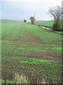
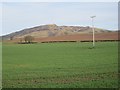
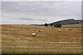
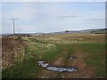
Nearby Images from Geograph Britain and Ireland:
©2007(licence)
©2013(licence)
©2020(licence)
©2013(licence)
©2020(licence)
The above images may not be of the site on this page, they are loaded from Geograph.
Please Submit an Image of this site or go out and take one for us!
Click here to see more info for this site
Nearby sites
Key: Red: member's photo, Blue: 3rd party photo, Yellow: other image, Green: no photo - please go there and take one, Grey: site destroyed
Download sites to:
KML (Google Earth)
GPX (GPS waypoints)
CSV (Garmin/Navman)
CSV (Excel)
To unlock full downloads you need to sign up as a Contributory Member. Otherwise downloads are limited to 50 sites.
Turn off the page maps and other distractions
Nearby sites listing. In the following links * = Image available
2.4km WSW 239° Auchterarder* Standing Stones (NN929125)
2.5km NW 313° Belted Stane, Calfward Standing Stone (Menhir) (NN93181548)
2.9km SE 137° Ogle Hill Hillfort (NN96941148)
3.2km NE 47° Loanhead (Aberuthven) Stone Circle (NN974158)
3.3km ENE 76° Westerton Timber Hall Ancient Village or Settlement (NN9821414444)
3.4km NW 318° North Mains A Timber Circle (NN928163)
3.5km NW 315° North Mains Strathallan round barrow* Round Barrow(s) (NN92621621)
3.5km NW 319° North Mains B Timber Circle (NN928164)
3.8km NE 43° Haugh Of Aberuthven* Standing Stone (Menhir) (NN97711643)
4.6km NNE 15° Trinity Well (Trinity Gask) Holy Well or Sacred Spring (NN96311812)
4.7km SSW 212° Gleneagles B* Standing Stone (Menhir) (NN92430981)
5.0km SW 214° Gleneagles A* Standing Stone (Menhir) (NN9211509625)
6.0km SSW 198° Parks of Gleneagles Stone Circle (NN9308)
6.1km SW 230° Cecilmount Stone Circle (NN90200985)
6.9km E 80° Dunning* Standing Stone (Menhir) (NO01851469)
6.9km E 82° Dupplin Cross* Ancient Cross (NO01901448)
7.2km ENE 72° Leadketty Stone Circle (NO01921581)
7.3km E 84° Dun Knock (Dunning)* Hillfort (NO0230914317)
7.4km ENE 69° Leadketty Stone Circle (NO020162)
7.4km ESE 103° Gray Stone (Dunning)* Standing Stone (Menhir) (NO02191180)
8.1km SE 143° Borland Glen* Stone Circle (NN9976607093)
8.5km S 177° Four Stanes (Glendevon) Stone Circle (NN9529405196)
8.7km NW 313° Millhills Stone Circle (NN88801981)
9.8km NNW 345° New Fowlis* Stone Circle (NN92712329)
9.9km WNW 301° Crieff Cursus Cursus (NN86531897)
View more nearby sites and additional images


 We would like to know more about this location. Please feel free to add a brief description and any relevant information in your own language.
 Wir möchten mehr über diese Stätte erfahren. Bitte zögern Sie nicht, eine kurze Beschreibung und relevante Informationen in Deutsch hinzuzufügen.
 Nous aimerions en savoir encore un peu sur les lieux. S'il vous plaît n'hesitez pas à ajouter une courte description et tous les renseignements pertinents dans votre propre langue.
 Quisieramos informarnos un poco más de las lugares. No dude en añadir una breve descripción y otros datos relevantes en su propio idioma.