


<< Our Photo Pages >> St. Margaret's Well (Lingfield) - Holy Well or Sacred Spring in England in Surrey
Submitted by DavidCWoods on Tuesday, 21 March 2006 Page Views: 8926
Springs and Holy WellsSite Name: St. Margaret's Well (Lingfield)Country: England County: Surrey Type: Holy Well or Sacred Spring
Nearest Town: Crawley Nearest Village: Lingfield
Map Ref: TQ386444
Latitude: 51.182037N Longitude: 0.018371W
Condition:
| 5 | Perfect |
| 4 | Almost Perfect |
| 3 | Reasonable but with some damage |
| 2 | Ruined but still recognisable as an ancient site |
| 1 | Pretty much destroyed, possibly visible as crop marks |
| 0 | No data. |
| -1 | Completely destroyed |
| 5 | Superb |
| 4 | Good |
| 3 | Ordinary |
| 2 | Not Good |
| 1 | Awful |
| 0 | No data. |
| 5 | Can be driven to, probably with disabled access |
| 4 | Short walk on a footpath |
| 3 | Requiring a bit more of a walk |
| 2 | A long walk |
| 1 | In the middle of nowhere, a nightmare to find |
| 0 | No data. |
| 5 | co-ordinates taken by GPS or official recorded co-ordinates |
| 4 | co-ordinates scaled from a detailed map |
| 3 | co-ordinates scaled from a bad map |
| 2 | co-ordinates of the nearest village |
| 1 | co-ordinates of the nearest town |
| 0 | no data |
Internal Links:
External Links:
 (PID:19446)")
Rowland G.M. Baker, in “Holy Wells and Magical Waters of Surrey”, published in Issue 1 of Source Magazine, in March 1985, mentions a spring at Coldharbour on Lingfield Common, the stoup of which was incorporated into St. Peter’s Cross on the village.
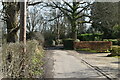
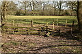
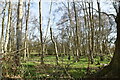
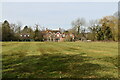
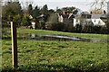
I visited in March 2006, and entering the network of paths by the church found a large notice showing the area. The entrance next to Coldharbour Farm was labelled St. Margaret’s Gate, which sounded promising. I made my way to the farm – approaching Lingfield Common from the north, I passed the Hare and Hounds pub on the left, then took a small drive to the right, immediately before the turning for the Farm Shop. After a few hundred yards I took the fork to the left, which led to Coldharbour Farm on the right. On the left was a stile leading to the footpath network, and beside it a glade containing a large boggy area.
You may be viewing yesterday's version of this page. To see the most up to date information please register for a free account.
 (PID:19448)")
 (PID:19447)")
Do not use the above information on other web sites or publications without permission of the contributor.
Nearby Images from Geograph Britain and Ireland:
©2021(licence)
©2021(licence)
©2021(licence)
©2021(licence)
©2021(licence)
The above images may not be of the site on this page, they are loaded from Geograph.
Please Submit an Image of this site or go out and take one for us!
Click here to see more info for this site
Nearby sites
Key: Red: member's photo, Blue: 3rd party photo, Yellow: other image, Green: no photo - please go there and take one, Grey: site destroyed
Download sites to:
KML (Google Earth)
GPX (GPS waypoints)
CSV (Garmin/Navman)
CSV (Excel)
To unlock full downloads you need to sign up as a Contributory Member. Otherwise downloads are limited to 50 sites.
Turn off the page maps and other distractions
Nearby sites listing. In the following links * = Image available
5.3km ESE 122° Dry Hill Fort* Hillfort (TQ432417)
6.4km S 173° East Grinstead Museum* Museum (TQ3960338031)
6.9km NNW 340° Diana's Well Holy Well or Sacred Spring (TQ361508)
6.9km NNW 341° Leigh Place Stone* Natural Stone / Erratic / Other Natural Feature (TQ362509)
7.6km NNW 340° Walker Miles Memorial* Modern Stone Circle etc (TQ358515)
7.7km NNW 339° St Mary's Well (Godstone)* Holy Well or Sacred Spring (TQ357515)
8.1km SSE 164° Blunds Hole Cave or Rock Shelter (TQ41103670)
8.2km NNW 335° Godstone Tumulus* Artificial Mound (TQ349517)
8.6km S 191° Ridge Hill Rock Shelter Cave or Rock Shelter (TQ37203590)
9.0km SSW 192° Cinder Mead and Furnace Mead Ancient Mine, Quarry or other Industry (TQ37003552)
9.4km N 355° St. Thomas's Well (Godstone) Holy Well or Sacred Spring (TQ375537)
9.5km NW 325° North Park Farm* Ancient Village or Settlement (TQ329520)
9.7km NE 37° Squerries Park Camp* Hillfort (TQ4428052220)
9.7km S 184° Stone Rocks West Sussex Cave or Rock Shelter (TQ381347)
10.5km NNW 329° War Coppice Camp* Hillfort (TQ3298053260)
10.8km NW 325° Spring Bottom* Holy Well or Sacred Spring (TQ321531)
11.1km WNW 294° Royal Earlswood Stones* Modern Stone Circle etc (TQ283487)
11.4km E 88° The Chiding stone* Natural Stone / Erratic / Other Natural Feature (TQ50064509)
11.5km ESE 102° Stonewall Park Rock Shelters Cave or Rock Shelter (TQ49974241)
12.1km SSW 214° Ashdown Forest - Horsham ridgeway Ancient Trackway (TQ32153416)
12.2km S 185° St Mary's Rocks Cave or Rock Shelter (TQ37773226)
12.3km WNW 297° Redhill Common* Round Barrow(s) (TQ274496)
12.6km WNW 298° Whitepost Hill Spring Holy Well or Sacred Spring (TQ273501)
12.7km SSW 199° Philpots Promontory Camp* Hillfort (TQ348323)
12.7km WNW 291° Earlswood Common Barrow Cemetery Barrow Cemetery (TQ266486)
View more nearby sites and additional images


 We would like to know more about this location. Please feel free to add a brief description and any relevant information in your own language.
 Wir möchten mehr über diese Stätte erfahren. Bitte zögern Sie nicht, eine kurze Beschreibung und relevante Informationen in Deutsch hinzuzufügen.
 Nous aimerions en savoir encore un peu sur les lieux. S'il vous plaît n'hesitez pas à ajouter une courte description et tous les renseignements pertinents dans votre propre langue.
 Quisieramos informarnos un poco más de las lugares. No dude en añadir una breve descripción y otros datos relevantes en su propio idioma.