<< Our Photo Pages >> Walker Miles Memorial - Modern Stone Circle etc in England in Surrey
Submitted by amunptah on Friday, 17 September 2010 Page Views: 5996
Modern SitesSite Name: Walker Miles Memorial Alternative Name: Edmund Seyfang Taylor's GraveCountry: England County: Surrey Type: Modern Stone Circle etc
Nearest Town: Oxted Nearest Village: Godstone
Map Ref: TQ358515
Latitude: 51.246514N Longitude: 0.05572W
Condition:
| 5 | Perfect |
| 4 | Almost Perfect |
| 3 | Reasonable but with some damage |
| 2 | Ruined but still recognisable as an ancient site |
| 1 | Pretty much destroyed, possibly visible as crop marks |
| 0 | No data. |
| -1 | Completely destroyed |
| 5 | Superb |
| 4 | Good |
| 3 | Ordinary |
| 2 | Not Good |
| 1 | Awful |
| 0 | No data. |
| 5 | Can be driven to, probably with disabled access |
| 4 | Short walk on a footpath |
| 3 | Requiring a bit more of a walk |
| 2 | A long walk |
| 1 | In the middle of nowhere, a nightmare to find |
| 0 | No data. |
| 5 | co-ordinates taken by GPS or official recorded co-ordinates |
| 4 | co-ordinates scaled from a detailed map |
| 3 | co-ordinates scaled from a bad map |
| 2 | co-ordinates of the nearest village |
| 1 | co-ordinates of the nearest town |
| 0 | no data |
Internal Links:
External Links:
")
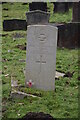
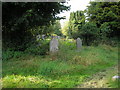
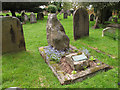
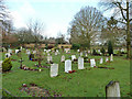
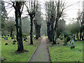
A sarsen stone has been erected in the churchyard of St Nicholas' Church, among the other graves, and marked with a plaque commemorating "Walker Miles", the famous rambler. The plaque reads:
Walker Miles - Edmund Seyfant Taylor [1853-1908]
This is the Bourne to which the footpath led
This is the Spot uncharted i his Works
t'was come upon so suddenly;
but ever will remember be
As were he takes his peaceful rest
You may be viewing yesterday's version of this page. To see the most up to date information please register for a free account.
")
")
Do not use the above information on other web sites or publications without permission of the contributor.
Nearby Images from Geograph Britain and Ireland:
©2023(licence)
©2007(licence)
©2012(licence)
©2018(licence)
©2011(licence)
The above images may not be of the site on this page, they are loaded from Geograph.
Please Submit an Image of this site or go out and take one for us!
Click here to see more info for this site
Nearby sites
Key: Red: member's photo, Blue: 3rd party photo, Yellow: other image, Green: no photo - please go there and take one, Grey: site destroyed
Download sites to:
KML (Google Earth)
GPX (GPS waypoints)
CSV (Garmin/Navman)
CSV (Excel)
To unlock full downloads you need to sign up as a Contributory Member. Otherwise downloads are limited to 50 sites.
Turn off the page maps and other distractions
Nearby sites listing. In the following links * = Image available
100m W 272° St Mary's Well (Godstone)* Holy Well or Sacred Spring (TQ357515)
720m SSE 148° Leigh Place Stone* Natural Stone / Erratic / Other Natural Feature (TQ362509)
761m SSE 158° Diana's Well Holy Well or Sacred Spring (TQ361508)
919m WNW 284° Godstone Tumulus* Artificial Mound (TQ349517)
2.8km NE 39° St. Thomas's Well (Godstone) Holy Well or Sacred Spring (TQ375537)
2.9km WNW 281° North Park Farm* Ancient Village or Settlement (TQ329520)
3.3km WNW 304° War Coppice Camp Hillfort (TQ32985326)
4.0km WNW 295° Spring Bottom* Holy Well or Sacred Spring (TQ321531)
6.2km NNE 22° Nore Hill Bronze Age Enclosure Misc. Earthwork (TQ380573)
6.5km NW 312° St Peter and St Paul's Church (Chaldon)* Ancient Cross (TQ3087455694)
7.6km SSE 160° St. Margaret's Well (Lingfield)* Holy Well or Sacred Spring (TQ386444)
8.0km WSW 251° Royal Earlswood Stones* Modern Stone Circle etc (TQ283487)
8.5km E 87° Squerries Park Camp Hillfort (TQ44285222)
8.6km NW 319° Farthing Downs* Barrow Cemetery (TQ300578)
8.6km WSW 259° Redhill Common* Round Barrow(s) (TQ274496)
8.6km W 262° Whitepost Hill Spring Holy Well or Sacred Spring (TQ273501)
8.7km W 263° Waterslade Spring Holy Well or Sacred Spring (TQ272502)
8.8km W 279° Gatton Park, The Millennium Stones* Modern Stone Circle etc (TQ271527)
9.6km NW 305° Chipstead Well Holy Well or Sacred Spring (TQ278568)
9.6km WSW 254° Earlswood Common Barrow Cemetery Barrow Cemetery (TQ266486)
9.7km NNW 340° Riddlesdown Newe Ditch* Misc. Earthwork (TQ3230460572)
10.6km ENE 67° Holy Well (Westerham) Holy Well or Sacred Spring (TQ455559)
10.7km WNW 292° St. Margaret's Well (Mugswell)* Holy Well or Sacred Spring (TQ258553)
11.9km N 352° Croham Hurst* Round Barrow(s) (TQ338632)
12.1km W 266° Reigate Heath Barrows* Barrow Cemetery (TQ23725042)
View more nearby sites and additional images


 We would like to know more about this location. Please feel free to add a brief description and any relevant information in your own language.
 Wir möchten mehr über diese Stätte erfahren. Bitte zögern Sie nicht, eine kurze Beschreibung und relevante Informationen in Deutsch hinzuzufügen.
 Nous aimerions en savoir encore un peu sur les lieux. S'il vous plaît n'hesitez pas à ajouter une courte description et tous les renseignements pertinents dans votre propre langue.
 Quisieramos informarnos un poco más de las lugares. No dude en añadir una breve descripción y otros datos relevantes en su propio idioma.