Contributory members are able to log private notes and comments about each site
Sites Stonetracker has logged. View this log as a table or view the most recent logs from everyone
Giant City Stone Fort Site
Date Added: 14th Sep 2023
Site Type: Hillfort
Country: United States
Visited: Would like to visit
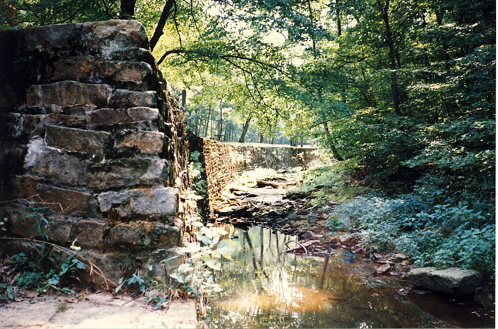
Giant City Stone Fort Site submitted by AKFisher on 28th Aug 2023. Giant City State Park, Illinois depicting stone wall structure. Photo credit: Wiki (Tripp), Creative Commons
(View photo, vote or add a comment)
Ghost Rock Art Panel
Date Added: 15th May 2025
Site Type: Rock Art
Country: United States (The Southwest)
Visited: Yes on 1st May 2025. My rating: Condition 2 Ambience 4 Access 4
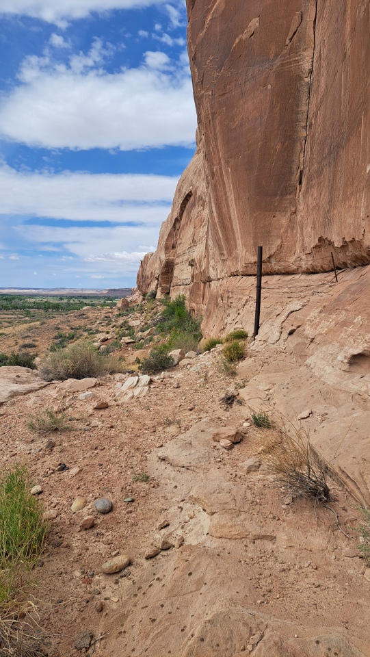
Ghost Rock Art Panel submitted by stonetracker on 14th May 2025. Cliff face where the petros are located
(View photo, vote or add a comment)
Log Text: A mixed modern and ancient petroglyph site about 2.3 miles east of Bluff UT accessible from Route 162.
There is a parking pulloff at 37.282579,-109.505201 and an 800 ft dirt road leads north from there. Suitable for SUVs or lower clearance vehicles (with care). Follow the dirt road north and stay right at the first fork. The road ends in a small turnaround circle. Park here. The rock art is mostly to the left and just a short walk to the cliff face.
You can also park at Route 162 and hike in.
Géants de Kerzerho
Date Added: 2nd Oct 2024
Site Type: Stone Row / Alignment
Country: France (Bretagne:Morbihan (56))
Visited: Yes on 1st Sep 2024. My rating: Condition 3 Ambience 5 Access 4
Géants de Kerzerho submitted by Jimwithnoname on 26th Sep 2010. Site in Bretagne:Morbihan (56) France
(View photo, vote or add a comment)
Log Text: The Kerzerho Geants are located about 200 m north of the northernmost alignment row along a signposted easy footpath through a tunnel-like hedgerow. There are actually three separated groups of menhirs. The southernmost group is composed of somewhat shorter stones. The central group farther north represents the true giants, both upright and recumbent. The northernmost group comprises a mix of sizes and orientations and includes one very large upright stone where the path ends at a T junction.
This entire ensemble is oriented roughly north-south, 90 degrees offset from the east-west axis of the main Kerzerho alignments.
Geant du Manio
Date Added: 9th Oct 2024
Site Type: Standing Stone (Menhir)
Country: France (Bretagne:Morbihan (56))
Visited: Yes on 1st Sep 2024. My rating: Condition 5 Ambience 3 Access 2
Geant du Manio submitted by rw1 on 3rd Mar 2008. 09/2007
(View photo, vote or add a comment)
Log Text: An impressive menhir and one of the bigger ones in the Carnac area. However, the ground trampling and erosion is considerable due to foot traffic, and for that reason I deducted points for Ambience. Like the Quadrilatere 50 m away, this stone is surrounded by both a stone wall and low rope fence, both of which are apparently ignored by many despite some signs discouraging a closer approach in the interests of preservation.
I kept my distance and took a few photos. Perhaps I've been overly sensitized by the reality of certain vandalized and abused prehistoric sites in the U.S. and don't want to see a similar outcome here :-)
For parking and trail access, see my Visitor Log entry for the Quadrilatere de Manio.
Gavrinis Cairn
Date Added: 24th Nov 2024
Site Type: Chambered Cairn
Country: France (Bretagne:Morbihan (56))
Visited: Yes on 1st Sep 2024. My rating: Condition 4 Ambience 4 Access 4
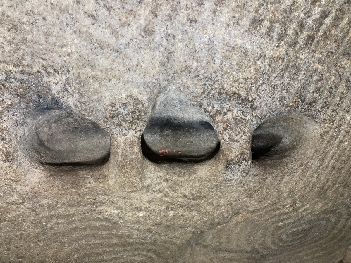
Gavrinis Cairn submitted by markj99 on 26th Sep 2023. Carved recesses in a carved stone in the chamber of Cairn de Gavrinis viewed from South-East.
(View photo, vote or add a comment)
Log Text: This is probably the most famous and best preserved decorated Neolithic passage grave in Europe. Not much to add regarding visit details that others have not already mentioned. The site is only accessible via boat and a guided tour. Boats leave regularly during the summer and early fall months from various port around the Gulf. I happened to embark from Larmor Baden and there is a large free parking lot next to the ticket office. The boat ride to the island is about 15 minutes. From the dock on the island, it's a brief climb up the hill to a small visitors center where a less brief lecture is given by the guide, primarily in French, although I was able to ask a few questions in English. From there, the small group walked around the cairn and was allowed 5-10 minutes to view the passage and chamber. Photography is allowed, but be prepared to work fast !
Fuller Shell Mound Site
Date Added: 16th Feb 2023
Site Type: Artificial Mound
Country: United States (The South)
Visited: Would like to visit

Fuller Shell Mound Site submitted by stonetracker on 17th Feb 2023. Fuller Shell Mound site. Source: https://alabamamoundtrail.org/mound-site/the-fuller-site/. Sponsor: University of Alabama.
(View photo, vote or add a comment)
Frogmore Mound
Date Added: 5th Mar 2025
Site Type: Artificial Mound
Country: United States (The South)
Visited: Yes on 1st Feb 2025. My rating: Condition 3 Ambience 4 Access 5

Frogmore Mound submitted by Andy B on 1st Nov 2019. Frogmore Mound (Frogmore, Louisiana) Frogmore, Louisiana is located between Ferriday and Jonesville in western Concordia Parish. It is noteworthy as the site of a series of ancient Native American earthworks (dating to 700-1200 AD) and the Frogmore Plantation, which dates to 1843. Both sites, along with the nearby historic Piazza Cotton Gin, are listed on the National Register of Historic Places. Image copyright: courthouselover, hosted on Flickr and displayed under the terms of their API.
(View photo, vote or add a comment)
Log Text: Like DePrato, Frogmore is on private property fronting Route 84, but in this case there is a convenient side street (Frogmore Plantation Rd) with a reasonable shoulder leading to a residential subdivision. I was able to pull slightly off the side street and park 100 ft from the mound.
Foxborough Stone Row (2)
Date Added: 25th Jan 2023
Site Type: Stone Row / Alignment
Country: United States
Visited: Yes on 1st Apr 2018. My rating: Condition 3 Ambience 3 Access 3
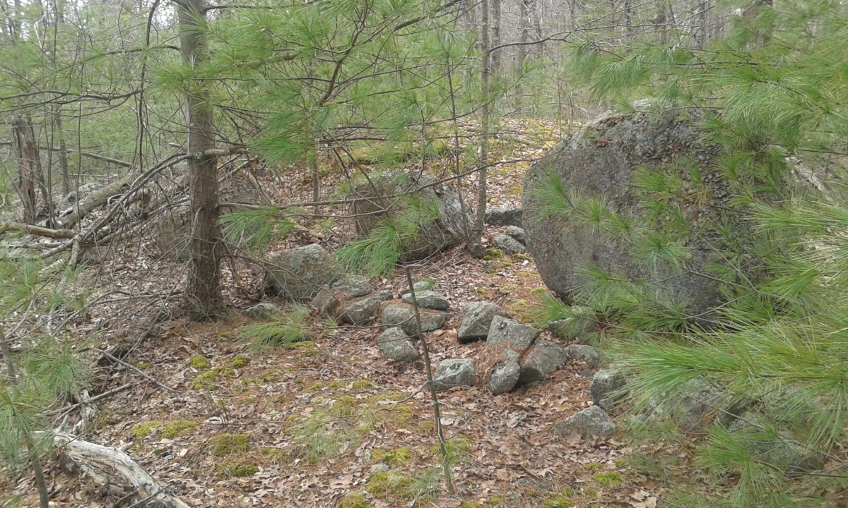
Foxborough Stone Row (2) submitted by stonetracker on 25th Jan 2023. Site now overgrown with pine saplings and difficult to see the entire six-boulder alignment. Several of the boulders are in this photo, flanked by a much smaller stone row segment.
(View photo, vote or add a comment)
Log Text: Probably most easily accessed from High Rock Rd parking lot. Site is not far from the jct of High Rock and Acorn Trails, on a 100 ft side trail off of Acorn Trail.
Foxborough Stone Row (1)
Date Added: 1st Feb 2023
Site Type: Stone Row / Alignment
Country: United States
Visited: Yes on 1st Jan 2023. My rating: Condition 5 Ambience 4 Access 2
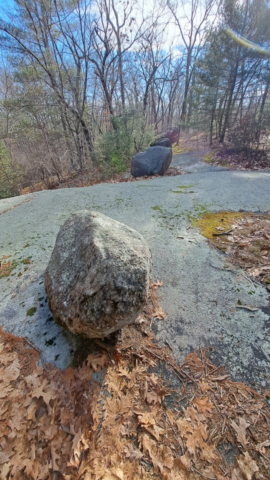
Foxborough Stone Row (1) submitted by stonetracker on 1st Feb 2023. Four aligned boulders from north to south
(View photo, vote or add a comment)
Log Text: Access is the same as that for the Foxborough Dolmen (see that visit log). This site can actually be seen from the dolmen, which is about 100 ft to the north.
Foxborough Stone Ring
Date Added: 23rd Jan 2023
Site Type: Ring Cairn
Country: United States
Visited: Yes on 1st Feb 2017. My rating: Condition 4 Ambience 4 Access 2
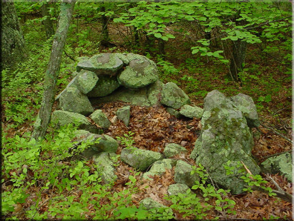
Foxborough Stone Ring submitted by kjsmith on 22nd Sep 2016. Foxboro State Forest
Accessable to the public
This is the stone ring listed on their website at this Lat/Long
There is another, but it isn't on Google Earth
(View photo, vote or add a comment)
Log Text: Thurston St lot the best for access. A bit of a long hike on the first side trail heading east off of Megley Trail, but one plus is that the same trail brings you right by several other sites. Last bit is a 200-300 ft bushwhack into woods and the enclosure is not easily spotted from a distance.
Foxborough Stone Ring
Date Added: 27th Jan 2023
Site Type: Ring Cairn
Country: United States
Visited: Yes on 1st Jan 2023

Foxborough Stone Ring submitted by kjsmith on 22nd Sep 2016. Foxboro State Forest
Accessable to the public
This is the stone ring listed on their website at this Lat/Long
There is another, but it isn't on Google Earth
(View photo, vote or add a comment)
Log Text: Revisited this (Site N) recently. No changes, but got better photos. Also located rockpile nearby.
Foxborough Stone Pile
Date Added: 24th Jan 2023
Site Type: Cairn
Country: United States (New England)
Visited: Yes on 1st Mar 2018. My rating: Condition 4 Ambience 4 Access 2
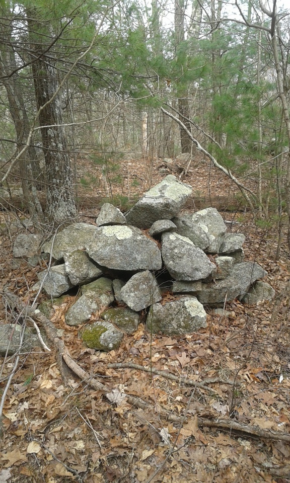
Foxborough Stone Pile submitted by stonetracker on 13th Jan 2023. Rock pile built on ground, not supported by ledge or boulder
(View photo, vote or add a comment)
Log Text: Site W on published map. Medium aggregate rockpile. A significant bushwhack off of Messenger Rd trail.
Foxborough Standing Stone (5)
Date Added: 1st Feb 2023
Site Type: Marker Stone
Country: United States (New England)
Visited: Yes on 1st Jun 2017. My rating: Condition 3 Ambience 3 Access 2
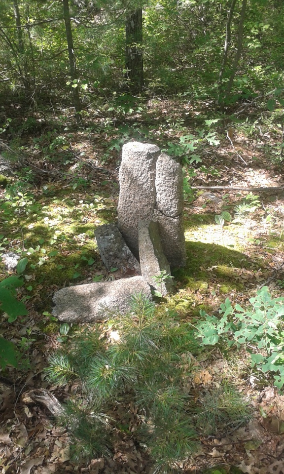
Foxborough Standing Stone (5) submitted by stonetracker on 31st Jan 2023. Standing stone as of 06/2017. Stone has broken in half and at least one piece now lies on ground in front. There are a few other support stones at the base.
(View photo, vote or add a comment)
Log Text: Best accessed from Thurston St lot via Megley Trail. About 400-500 ft past Foxborough Perched Boulder (5), it's a 100 ft or so bushwhack north off the Megley Trail.
Foxborough Standing Stone (4)
Date Added: 19th Jan 2023
Site Type: Marker Stone
Country: United States
Visited: Yes on 1st Mar 2018. My rating: Condition 4 Ambience 4 Access 3
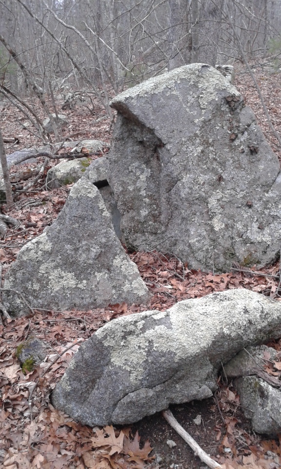
Foxborough Standing Stone (4) submitted by stonetracker on 19th Jan 2023. This is the triangular rock on the left side of the photo. My opinion is that this is natural, either a glacial artifact or a broken off piece of stone due to frost fracture or weathering.
(View photo, vote or add a comment)
Log Text: This is 500 ft or so east of Megley Trail near a side trail. Been a while but I recall this being a bushwhack to some extent. Long walk from any of the parking lots.
Foxborough Standing Stone (3)
Date Added: 24th Jan 2023
Site Type: Marker Stone
Country: United States
Visited: Yes on 1st Feb 2017. My rating: Condition 3 Ambience 3 Access 3
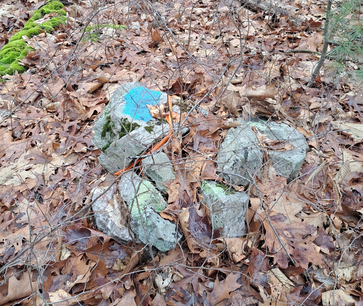
Foxborough Standing Stone (3) submitted by stonetracker on 28th Jan 2023. Small stone mound nearby witn same marking. Likely a state property boundary.
(View photo, vote or add a comment)
Log Text: Site L on published map. Best accessed via a long walk on a side trail east from Megley. The side trailhead is not far from the Thurston St lot. The standing stone is small, slightly off the trail, and rather inconspicuous.
Foxborough Standing Stone (3)
Date Added: 27th Jan 2023
Site Type: Marker Stone
Country: United States
Visited: Yes on 1st Jan 2023
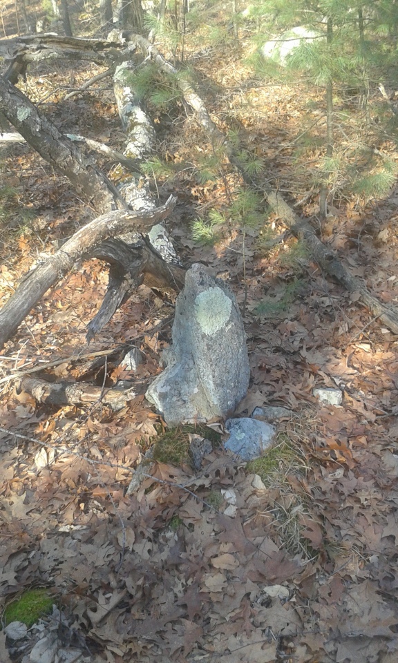
Foxborough Standing Stone (3) submitted by stonetracker on 24th Jan 2023. 2 foot high pointer standing stone is small and easy to miss. Note the small supporting stones surrounding the base of the standing stone.
(View photo, vote or add a comment)
Log Text: Revisited site. Mostly unchanged, except that the top of stone has been painted blue (see comments)
Foxborough Standing Stone (2)
Date Added: 21st Jan 2023
Site Type: Marker Stone
Country: United States
Visited: Yes on 1st Jun 2017. My rating: Condition 3 Ambience 3 Access 3
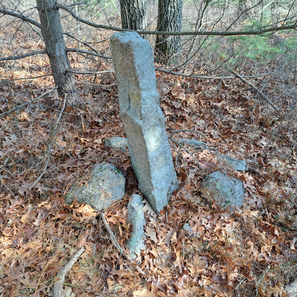
Foxborough Standing Stone (2) submitted by stonetracker on 31st Jan 2023. Another view.
(View photo, vote or add a comment)
Log Text: A short bushwhack north off of Megley Trail. Closest parking is the Thurston St lot.
Foxborough Standing Stone (2)
Date Added: 31st Jan 2023
Site Type: Marker Stone
Country: United States
Visited: Yes on 1st Jan 2023. My rating: Condition 4 Ambience 3 Access 2

Foxborough Standing Stone (5 submitted by stonetracker on 21st Jan 2023. Site Q on published map. This standing stone was originally twice as tall but the top half broke off sometime between 2003 and 2017. The broken half is lying on the ground in the foreground. The buttress stones are still there. Clearly manmade.
(View photo, vote or add a comment)
Log Text: An update on access. This site is accessed from a trail north from Megley, opposite the Dolmen site trailhead. Climb up trail 100 yds or so onto open ledges. Just after the ledges, turn right and bushwhack into the woods about 75 ft. Site is very difficult to spot from trail as it is surrounded by trees; GPS is helpful.
Foxborough Standing Stone (1)
Date Added: 21st Jan 2023
Site Type: Standing Stone (Menhir)
Country: United States (New England)
Visited: Yes on 1st Mar 2018. My rating: Condition 3 Ambience 3 Access 2

Foxborough Standing Stone (1) submitted by stonetracker on 22nd Jan 2023. Another view
(View photo, vote or add a comment)
Log Text: Likely Site F on published map (to be confirmed). This is a significant hike from either the High Rock or Thurston St parking lot. It's about a 50 ft bushwhack off the Megley Trail, opposite the Dolmen site.
Foxborough Prayer Seat and Stone Ring
Date Added: 23rd Jan 2023
Site Type: Cairn
Country: United States (New England)
Visited: Yes on 1st Mar 2018. My rating: Condition 4 Ambience 4 Access 3
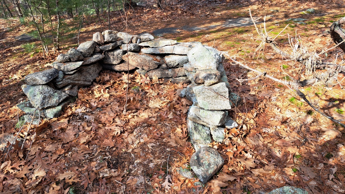
Foxborough Prayer Seat and Stone Ring submitted by stonetracker on 1st Feb 2023. "Prayer seat" detail
(View photo, vote or add a comment)
Log Text: Site is 500-1000 ft north of Megley Trail on a side trail. As I recall it is sitting on a flat stone ledge just above the trail but that needs to be verified. Thurston St lot is best for parking and access.
