Contributory members are able to log private notes and comments about each site
Sites SandyG has logged. View this log as a table or view the most recent logs from everyone
Hart Tor north rows
Date Added: 17th Jan 2018
Site Type: Multiple Stone Rows / Avenue
Country: England (Devon)
Visited: Yes on 20th Oct 2014. My rating: Condition 4 Ambience 4 Access 3
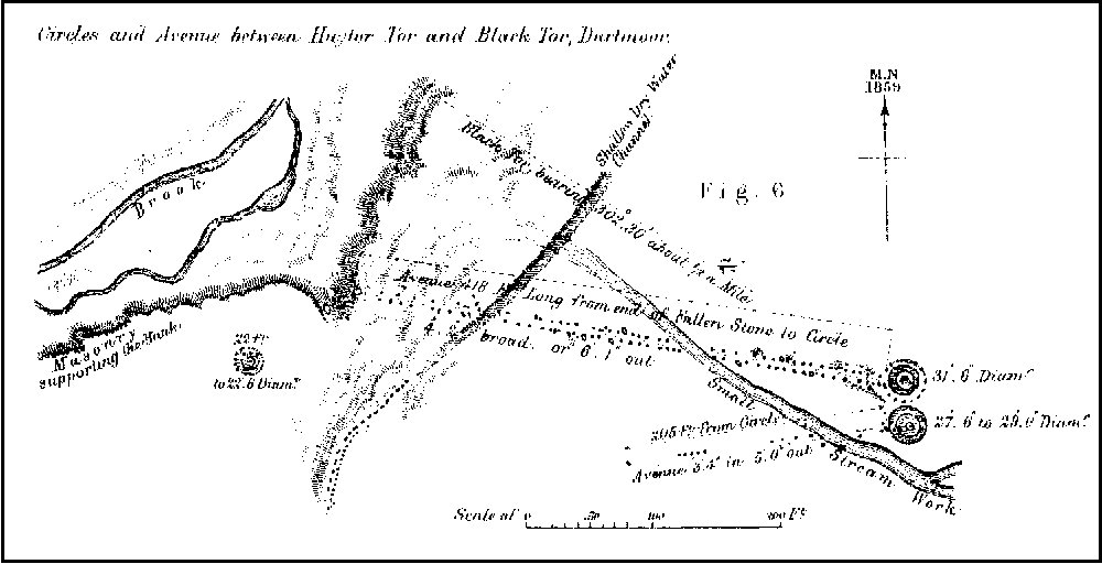
Hart Tor north rows submitted by SandyG on 4th Oct 2014. Plan of Hart Tor stone rows and cairns published by Sir J.G. Wilkinson in 1862.
(View photo, vote or add a comment)
Log Text: Roadside car parking is available at SX 56985 71765. From here the row can be reached across open moorland. The row is situated about 600m to the east. The River Meavy needs to be crossed and it is usually possible to do this via a very narrow “footbridge”.
Hart Tor south row
Date Added: 18th Jan 2018
Site Type: Stone Row / Alignment
Country: England (Devon)
Visited: Yes on 20th Oct 2014. My rating: Condition 3 Ambience 4 Access 3
Hart Tor south row submitted by SandyG on 4th Oct 2014. Single row leading downslope from the cairn. View from west.
(View photo, vote or add a comment)
Log Text: Roadside car parking is available at SX 56985 71765. From here the row can be reached across open moorland. The row is situated about 600m to the east. The River Meavy needs to be crossed and it is usually possible to do this via a very narrow “footbridge”.
Hawk's Tor (South)
Date Added: 4th Feb 2020
Site Type: Stone Row / Alignment
Country: England (Cornwall)
Visited: Yes on 26th Sep 2019. My rating: Condition 5 Ambience 5 Access 3
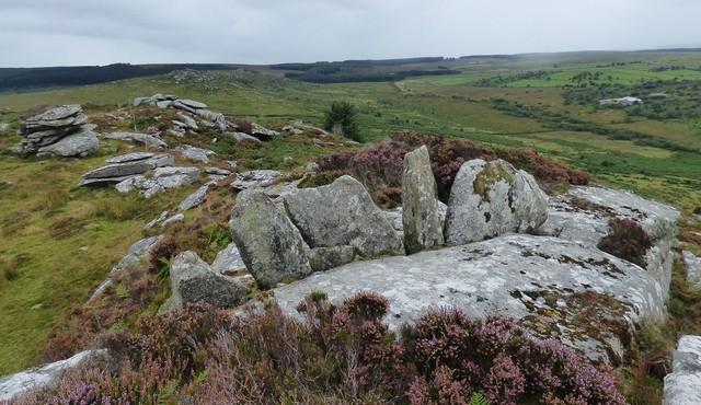
Hawk's Tor (South) submitted by SandyG on 29th Sep 2019. The Hawk's Tor (South) stone row, view from the east.
(View photo, vote or add a comment)
Log Text: Limited parking is available at SX 26006 76124. From here walk north along the bridleway to SX 25940 76282 where the left branch in the track should be followed. The lower slopes of the hill are covered in dense vegetation and it is easy to get lost in the myriad of small tracks, but experience showed that it is best to stick to the more clearly defined ones or alternatively visit in the winter or spring when the vegetation is likely to be less of a problem. It is certainly worth making the effort.
High Bridestones (Yorks)
Date Added: 8th Jan 2018
Site Type: Stone Circle
Country: England (Yorkshire (North))
Visited: Yes on 19th Sep 2017. My rating: Condition 2 Ambience 4 Access 5
High Bridestones (Yorks) submitted by JimChampion on 7th Dec 2007. August 2007. The High Bridestones, on the moor. Just one of the megaliths is still standing, with small change firmly wedged into its many crevices. A megalithic shambles indeed. The heather in bloom says that it is summer, although the temperature (and wind) on this day was more like winter!
(View photo, vote or add a comment)
Log Text: Limited car parking available next to the row at NZ 85048 04719.
Despite the problems associated with determining which stones are natural and which ones were placed it is probable that this is a stone row leading away from one of the two stone circles in this area. The presence of considerable quantities of surface stone means that without excavation it is not possible to be certain that this is a stone row.
Higher White Tor stone row
Date Added: 16th Jan 2018
Site Type: Multiple Stone Rows / Avenue
Country: England (Devon)
Visited: Yes on 26th May 2017. My rating: Condition 3 Ambience 4 Access 3
Higher White Tor stone row submitted by cazzyjane on 9th Jan 2013. Higher White Tor Stone row. Looking down towards Longaford Tor.
(View photo, vote or add a comment)
Log Text: Car parking is available at SX 63757 77614. From here head a short distance along the B3212 towards Postbridge before crossing the road to join the Lychway. Follow the Lychway to SX 61805 77646 and then head towards Higher White Tor.
Hill o'Many Stanes
Date Added: 7th Jan 2019
Site Type: Multiple Stone Rows / Avenue
Country: Scotland (Caithness)
Visited: Yes on 9th Aug 2014. My rating: Condition 5 Ambience 4 Access 5
Hill o'Many Stanes submitted by SandyG on 20th Sep 2014. View from above and south.
(View photo, vote or add a comment)
Log Text: Limited roadside car parking is available at ND 29557 38464. From here it is a short signposted walk to the rows.
Hoaroak 1
Date Added: 4th Feb 2020
Site Type: Multiple Stone Rows / Avenue
Country: England (Devon)
Visited: Yes on 12th Apr 2019. My rating: Condition 2 Ambience 4 Access 3
Hoaroak 1 submitted by TheCaptain on 30th May 2010. Most of the stones are less than 18 inches long, and fallen, or else just stubs of stone still fast in the ground. Only one stone really stands proudly near the centre of the setting.
(View photo, vote or add a comment)
Log Text: This row can be reached either by walking from Brendon Two Gates (SS 76507 43252) which takes you past the rows on Cheriton Ridge or from Shallowford (SS 71409 44955) which avoids a couple of steep climbs.
Hobajons Cross
Date Added: 29th Jan 2019
Site Type: Standing Stone (Menhir)
Country: England (Devon)
Visited: Yes on 9th Mar 2013. My rating: Condition 4 Ambience 5 Access 3
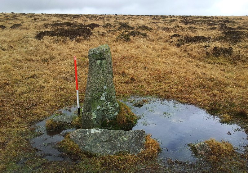
Hobajons Cross submitted by SandyG on 27th Sep 2014. Hobajons Cross may be an original terminal stone for the Butterdon Hill stone row which has been Christianised by the cutting of a simple cross on the western face.
(View photo, vote or add a comment)
Log Text: Car parking is available at SX 64338 59550.
Hoccombe Coombe
Date Added: 18th Jan 2019
Site Type: Multiple Stone Rows / Avenue
Country: England (Devon)
Visited: Yes on 18th Apr 2018. My rating: Condition 3 Ambience 4 Access 1
Hoccombe Coombe submitted by SandyG on 18th Jan 2019. Stone 1 measures 0.76m long by 0.15m wide, stands up to 0.59m high and is orientated at 90°. The stone is leaning very heavily to the south and would have originally been about 0.75m high. View from south (Scale 1m).
(View photo, vote or add a comment)
Log Text: Car parking is available at SS 75924 45192. From here head east along the footpath to SS 78685 44628. The stone row is a short distance to the south.
Hoccombe Hill (E)
Date Added: 10th Feb 2020
Site Type: Multiple Stone Rows / Avenue
Country: England (Devon)
Visited: Yes on 13th Apr 2018. My rating: Condition 3 Ambience 3 Access 2
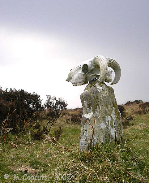
Hoccombe Hill (E) submitted by TheCaptain on 30th Jul 2007. In the deepest, darkest depths of Exmoor, can be found the remains of this stone setting, which is probably hardly ever seen or known by anybody.
(View photo, vote or add a comment)
Log Text: Plenty of car parking is available at Brendon Two Gates at SS 76510 43254. From here head north for a short distance along the road verge to SS 76505 43285 and then take the footpath leading east to SS 78024 43550. The stones are situated to the south below the slope. The footpath may be rather soft underfoot in places.
Holne Moor
Date Added: 18th Jan 2018
Site Type: Multiple Stone Rows / Avenue
Country: England (Devon)
Visited: Yes on 14th Apr 2013. My rating: Condition 3 Ambience 4 Access 3
Holne Moor submitted by SandyG on 4th Oct 2014. This alignment is no less important because only small stones were selected by its builders. Visually it is certainly less spectacular but despite this it provides tangible evidence of prehistoric ritual. View from north west.
(View photo, vote or add a comment)
Log Text: Car parking is available at SX 67544 71401. From here head south across the open moorland for about 400m.
Holne Ridge 7
Date Added: 27th Dec 2014
Site Type: Barrow Cemetery
Country: England (Devon)
Visited: Yes on 4th Oct 2014
Holne Ridge 5 submitted by SandyG on 4th Oct 2014. Cairn 5. View from south west.
(View photo, vote or add a comment)
Log Text: None
Holne Ridge NE
Date Added: 18th Jan 2018
Site Type: Multiple Stone Rows / Avenue
Country: England (Devon)
Visited: Yes on 4th Apr 2013. My rating: Condition 3 Ambience 4 Access 3
Holne Ridge NE submitted by SandyG on 4th Oct 2014. Double stone row leading towards the cairn. View from west.
(View photo, vote or add a comment)
Log Text: Car parking is available at SX 67544 71401. From here head south west across the open moorland for about 850m.
Hook Lake Row
Date Added: 27th Jan 2019
Site Type: Multiple Stone Rows / Avenue
Country: England (Devon)
Visited: Yes on 6th Apr 2013. My rating: Condition 3 Ambience 4 Access 1
Hook Lake Row submitted by SandyG on 4th Oct 2014. Prehistoric stone round house which incorporates a stone row orthostat in its wall. The ranging rod denotes the position of the earlier stone row orthostat. View from north.
(View photo, vote or add a comment)
Log Text: This has never been an easy row to get to. When visited in 2013 car parking was available at SX 62524 61120. Recently (2016) this car parking area has been closed making it much more difficult to access this part of the moor. The alternative car parking location is at SX 64342 59548. From here the easiest way to reach the row is probably to head east to the Two Moors Way at SX 65765 59965. Then follow the track north to SX 64400 64275 where the path to Hook Lake should be taken. Given the effort to get to the area it would be a good idea to have a look at the Upper Erme Row and some the amazing prehistoric settlements at the same time. A full day but hopefully a rewarding one. Best contemplated in the summer.
Hook Lake Settlement
Date Added: 29th Sep 2014
Site Type: Ancient Village or Settlement
Country: England (Devon)
Visited: Yes on 28th Sep 2014
Hook Lake Settlement submitted by SandyG on 28th Sep 2014. The Hook Lake enclosures. View from south west.
(View photo, vote or add a comment)
Log Text: None
Horn's Cross
Date Added: 27th Dec 2014
Site Type: Ancient Cross
Country: England (Devon)
Visited: Yes on 4th Oct 2014
Horn's Cross submitted by SandyG on 4th Oct 2014. Horn's Cross has been heavily restored. The original socket stone supports a crude modern shaft to which the original head and arms have been attached by an iron band. The shaft bears traces of tare and feather working indicating that it was produced sometime after 1800. View from north east.
(View photo, vote or add a comment)
Log Text: None
Hoscombe SE
Date Added: 3rd Feb 2020
Site Type: Stone Row / Alignment
Country: England (Somerset)
Visited: Yes on 10th Apr 2019. My rating: Condition 2 Ambience 4 Access 2
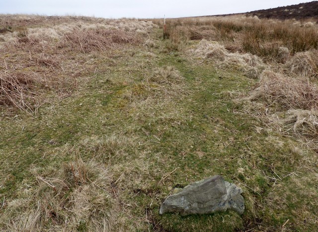
Hoscombe SE submitted by SandyG on 10th Oct 2019. Looking east along the southern part of the Black Barrow, South stone row (Scale 1m). Visited 10th April 2019.
(View photo, vote or add a comment)
Log Text: Limited car parking is available at SS 84543 44569. From here follow the track leading south west to SS 83567 43802. Then head west to the row. This route takes you past Coley Water, South and Porlock Allotment stone rows.
Hurston Ridge
Date Added: 14th Jan 2018
Site Type: Multiple Stone Rows / Avenue
Country: England (Devon)
Visited: Yes on 16th May 2015. My rating: Condition 5 Ambience 5 Access 3
Hurston Ridge submitted by SandyG on 2nd Aug 2015. The tallest stone stands at the upper southern end of the row. (16th May 2015).
(View photo, vote or add a comment)
Log Text: Car parking is available at SX 67576 81091. From here carefully cross the road and head north across open moorland. The row is about 1,300m from the car park. A map or reliable GPS device is highly recomended. Well worth the walk.
Inverewe
Date Added: 16th Feb 2020
Site Type: Class I Pictish Symbol Stone
Country: Scotland (Highlands)
Visited: Yes on 13th Jul 2018. My rating: Condition 2 Ambience 3 Access 5
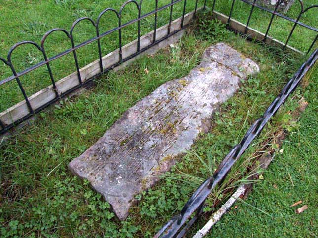
Inverewe submitted by andy_h on 14th Aug 2006. To be found in the ruined churchyard up the turning by the campsite, re-used as a grave slab. The stone is located at the back end of the ruined church and is a little hard to find, as it is very worn and looks much like other grave slabs around it. It depicts a crescent and a 'V'. Another Pictish stone can be seen in Gairloch Heritage Museum, which depicts a fish and the lower part of an eagle.
(View photo, vote or add a comment)
Log Text: Not sure I would have made the journey just to see this but I was staying at the nearby campsite for a few days and visited a few times to see if I could get the light right.
Inverurie 1
Date Added: 30th Jan 2019
Site Type: Class I Pictish Symbol Stone
Country: Scotland (Aberdeenshire)
Visited: Yes on 21st Sep 2014. My rating: Condition 3 Ambience 4 Access 5
Inverurie 1 submitted by SandyG on 29th Dec 2014. Lichen covered Pictish symbol stone (21st September 2014).
(View photo, vote or add a comment)
Log Text: None
