Contributory members are able to log private notes and comments about each site
Sites Anne T has logged. View this log as a table or view the most recent logs from everyone
Yellowmead
Trip No.134 Entry No.18 Date Added: 17th Jul 2019
Site Type: Stone Circle
Country: England (Devon)
Visited: Yes on 15th May 2019. My rating: Condition 3 Ambience 4 Access 3
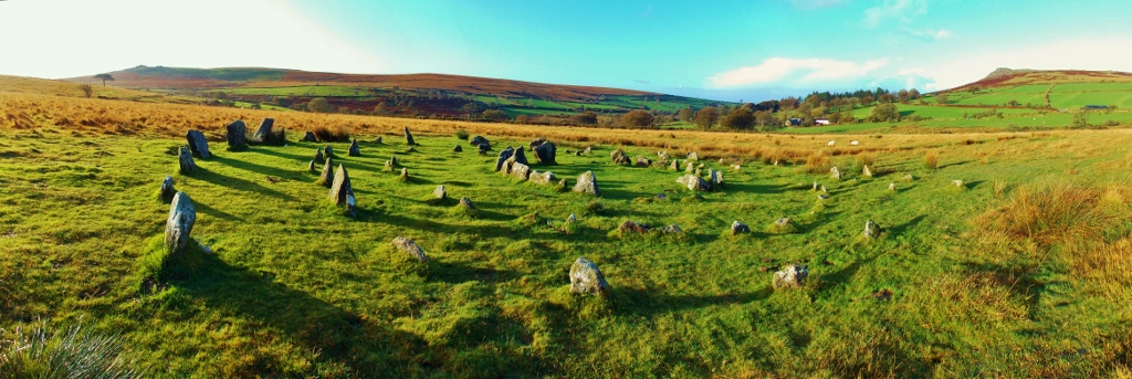
Yellowmead submitted by graemefield on 31st Oct 2013. Panoramic
(View photo, vote or add a comment)
Log Text: Yellowmead Fourfold Stone Circle: This stone circle has long been on my wish-list, but I thought I’d never be able to see it, because access was described as being difficult.
Fortunately, Dave Parks and Sandy G had been here before and knew the pitfalls, selecting the right route for us. We were also extremely fortunate in coming here after a prolonged dry spell, so we encountered no boggy areas, apart from one by the stream on the way back to the car park.
By this time of the afternoon, I was hot and tired, and my feet ached really badly, but I was determined to see this stone circle. I should have swapped my walking boots for my wellies to make the walking a little softer on the soles of my feet, but stubbornly didn’t. Mistake. However, the walk to see this circle was well worth it, although I need to apologise to the rest of the group for being very grumpy on the way back. Also, by this time the sun had come out and everyone was getting sunburned, despite the continuous application of sun-screen.
It was really good to have the experts here to describe the monuments to us. Gordon and Dave Parks wandered off to see if they could find other stones in the stone row further to the WSW of the row, but the grass was knee high in this part of the meadow.
Andrew, on the way back to the pub after our epic trip, was saying that he didn’t think the stone circle was entirely genuine; his thinking was the Victorians had ‘beautified’ it for tourists, so I spent some time in the car pulling up the different websites. The stone circle is described as having been ‘faithfully restored’, but Andrew still has his doubts.
We all met up in the Prince of Wales in Princetown for a couple of ice cold pints, before dispersing for the evening. I confess to not recognising Sandy G in the bar, as he didn’t have his hat on – I’ve never seen him without it!
Yellowmead cairn
Trip No.134 Entry No.20 Date Added: 19th Jul 2019
Site Type: Cairn
Country: England (Devon)
Visited: Yes on 15th May 2019. My rating: Condition 2 Ambience 3 Access 3
Yellowmead cairn submitted by caradoc68 on 25th Aug 2011. EN cairn ( yellowmead group ) SX 575 679. 48m EEN of Yellowmead rings. This lovely little cairn circle, no more then five meters in diameter with five stones remaining in the circle.The centre as been completely robbed out and silted back up again leaving a different coloured grass. Easy to miss but worth a look
(View photo, vote or add a comment)
Log Text: Yellowmead Cairn: Whilst we started walking back to the car park, trying a different path mown through the grass, first running uphill then eastwards then south, we passed this cairn and stopped to take a closer look.
Whilst we were doing this, someone mentioned that the photo of the stone row on the Portal wasn’t the row we’d just looked at, but looked more like a line of stones running above, and parallel to the leat to the south west of the circle, and which we’d crossed to reach it. Some of the group split off to look at this more closely, and decided that the stones in the photo were of tin workings and an old track.
There was not much left of this cairn at all, although the slight mound did stand out nicely at the top of the slope.
Modern Stone Circle near Kestor Rock
Trip No.135 Entry No.3 Date Added: 19th Jul 2019
Site Type: Modern Stone Circle etc
Country: England (Devon)
Visited: Yes on 16th May 2019. My rating: Condition 3 Ambience 4 Access 3
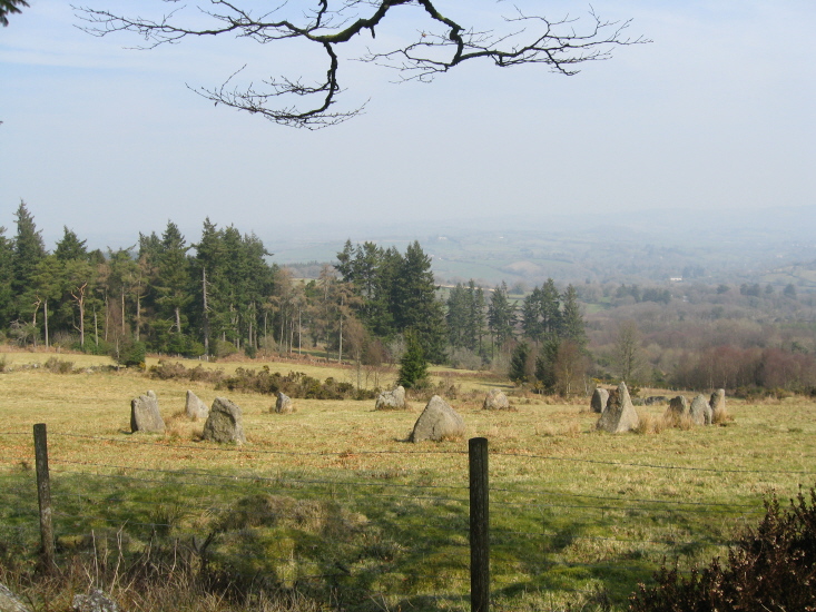
Modern Stone Circle near Kestor Rock submitted by AngieLake on 27th Mar 2011. Looking over wall from south border of field. [NB: All these photos are taken from the open moor.]
(View photo, vote or add a comment)
Log Text: Modern Stone Circle near Kestor Rock: As confirmed by the Dartefacts website, This stone circle is on land that used to the belong to Aid Edmundson and Jennifer Saunders. It is not recorded on Pastscape or Historic England.
The stone circle is on private land, but can be viewed over the fences to the west and southern sides.
We were also lucky enough to be with Janet Daynes and Gordon Fisher who had spent some time on this property doing excavations in years gone by. It was absolutely fascinating to hear them talk about the things they had found. Apparently the whole of the stone circle had, at one time, been surrounded by trees which had blown down or been cut down. The area is surrounded by Historic England List ID 1016691, “Coaxial field system and prehistoric settlements at Kestor”, but this area is not included in the scheduled area.
Kestor Settlement
Trip No.135 Entry No.2 Date Added: 31st Jul 2019
Site Type: Ancient Village or Settlement
Country: England (Devon)
Visited: Yes on 16th May 2019. My rating: Condition 3 Ambience 4 Access 4
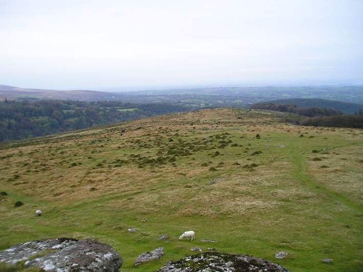
Kestor Settlement submitted by thecaptain on 24th Oct 2004. View northeast from Kestor rocks overlooking Kestor Settlement. The entire hilltop and hillsides here are covered in the ancient remains of ancient huts and field systems.
(View photo, vote or add a comment)
Log Text: Kestor Settlement (of which Round Pound is part of): Only across the road from the Round Pound, which I learned later was part of this settlement and not separate from it, as we walked up the slope to the east of Round Pound, I couldn’t believe the amount, and quality, of the structures that remained here.
At first, it was all a little mind-boggling, but then Sandy G produced a plan of the site, and I kept asking where we were on the plan, so I could sort my photographs accordingly. The views to the east and north east would have been quite amazing, had it not been for the mist around that day.
At home, I poured over Butler's "Dartmoor Atlas of Antiquities", volume 2, pages 170 onwards, which has a map of the settlement and descriptions of the field systems and the individual houses and enclosures within it. Brilliant!
Shovel Down Fourfold Circle
Trip No.135 Entry No.8 Date Added: 1st Aug 2019
Site Type: Stone Circle
Country: England (Devon)
Visited: Yes on 16th May 2019. My rating: Condition 3 Ambience 5 Access 3
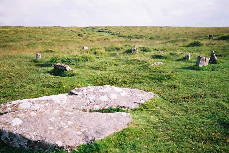
Shovel Down Fourfold circle submitted by simcon on 29th Aug 2003. SX659861 Shovel Down Stone Circle, Dartmoor Devon. I see this Web site lists two circles here, SE and NW. I only saw this circle which matches the description of Shovel Down SE Stone Circle. The view is looking south where the row continues to a large standing stone. Notice the two large standing stones fallen at the bottom of this picture. One has CP carved into it and the large stone over the hill has DC using the same size and style of letters. I do not know what this means. I parked in Fernw...
(View photo, vote or add a comment)
Log Text: Shovel Down Fourfold Stone Circle: Again, so many monuments in such a short walk – but by now, I should have stopped being surprised! At Kes Tor, Sandy G had spotted AngieLake, who had arrived a little later than us at the car park, and who had wandered about looking for us. By this time, it was lunchtime, and we were pleased to re-group and sit and take a welcome break, using the two large stones as the head of row 2 as a convenient picnic spot.
Whilst everyone was sharing out their sandwiches and tea/coffee, I took a few minutes to try and photograph the small-ish stones of the fourfold stone circle, largely hidden by the grassy tussocks, but none-the-less still recognisable as a kerbed cairn, although a little similar (if smaller) than Yellowmead.
With its proximity to row 2 and row 4, and other rows and features I'd not yet seen, this was an amazing spot.
Shovel Down row 2
Trip No.135 Entry No.9 Date Added: 1st Aug 2019
Site Type: Multiple Stone Rows / Avenue
Country: England (Devon)
Visited: Yes on 16th May 2019. My rating: Condition 3 Ambience 5 Access 3
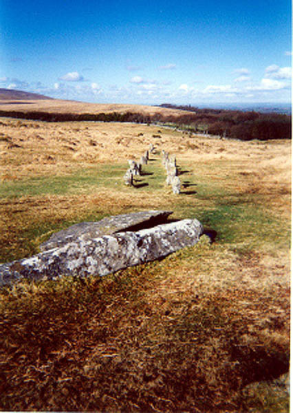
Shovel Down row 2 submitted by AngieLake on 27th Oct 2004. Looking in the opposite direction from Simcon's picture, the fallen portals are in the foreground of this photo and show the avenue leading up to them, and to the concentric circle or cairn.
(Taken on cheap single-use camera, as were the recent Scorhill postings)
(View photo, vote or add a comment)
Log Text: Shovel Down Row 2 with fallen standing stones: We enjoyed a much welcome lunch break at the two pillar stones at the head (southern end) of row 2. Angie got some photographs of Andy B sitting on the larger of the two pillars, and later I wished I’d have stood over her shoulder to get similar shots.
I didn’t walk to the northern most end of this stone circle, as I thought we proposed to visit it on the way back to the car park, but we took a slightly different route, so didn’t see the stones at its other terminus.
By this time of the day, the number of monuments we'd seen already was getting a little overwhelming (so many in such a relatively small piece of moorland), I was really glad I’ been very careful to write down the numbers of the photographs I’d taken for each monument, making it easier to sort the photos out into ‘which monument was which’ that evening.
St Mary's Churchyard Cross (Wirksworth)
Date Added: 24th Feb 2019
Site Type: Ancient Cross
Country: England (Derbyshire)
Visited: Yes on 17th Sep 2015. My rating: Condition 3 Ambience 4 Access 5

St Mary's Churchyard Cross (Wirksworth) submitted by Anne T on 22nd Oct 2015. This cross shaft and base sits in the north west part of the church yard. The church guide tells me that whilst the cross shaft dates from the 13th century, the cross base is pre-Norman.
(View photo, vote or add a comment)
Log Text: St Mary's Churchyard Cross, Wirksworth: I've split this page off as the cross has it's own HE scheduling record and Pastscape record, and got a little lost in with the other Anglo Saxon carved stones within the church itself.
Until we wandered around the churchyard, we didn't know this cross was here, so it was a really nice surprise to have seen it.
St Mary the Virgin (Wirksworth)
Date Added: 22nd Oct 2015
Site Type: Early Christian Sculptured Stone
Country: England (Derbyshire)
Visited: Yes on 17th Sep 2015. My rating: Condition 3 Ambience 4 Access 5
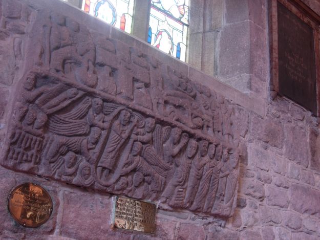
St Mary the Virgin (Wirksworth) submitted by TimPrevett on 29th May 2006. The Wirksworth Stone - 8th or 9th Century carved coffin lid depicting Christ washing the feet of the disciples, the crucifixion, the body of the BVM being borne for burial, the presentation of Christ in the temple before Simeon, Christ's descent into Hell, Christ's Ascension, the Annunciation, and the Mission of the Church.
The picture was very difficult to take; direct sunlight coming through the window, spacial constraints, and the church busying ahead of a Choral Evensong; not that pleased ...
(View photo, vote or add a comment)
Log Text: Anglo Saxon Stones at St. Mary The Virgin, Wirksworth, Derbyshire: My husband's father had died unexpectedly last week and we were down sorting out the funeral and his house. It all got a bit too much, and I asked to 'run away' for the afternoon to do something different. Funny, we'd nearly bought a house here in the early 1980's, on the hills just outside the town, but never really explored this pretty little market town with its boutique shops.
We found the church behind the shops opposite the market square in a pretty oval shaped churchyard. It was much bigger than expected, feeling light and airy - more like a mini-cathedral - and with what Anglo Saxon treasures.
There were groups of stones built into the walls - by the north door, the walls of the south transept and the south western part of the nave.
The church offered a good guide book, but most useful was the 'treasure trail' for children along with the laminated guide sheet which showed the locations of the stones with a short description.
As I only had the camera on my phone we decided to go back with the camera proper, but time has run away with us and we never did get to go back. Thanks to modern technology the phone on my camera is better than the mini digital camera I usually carry with me.
Yew Tree Well
Trip No.170 Entry No.2 Date Added: 11th Aug 2021
Site Type: Holy Well or Sacred Spring
Country: England (Derbyshire)
Visited: Yes on 16th Jul 2021. My rating: Condition 4 Ambience 3 Access 5
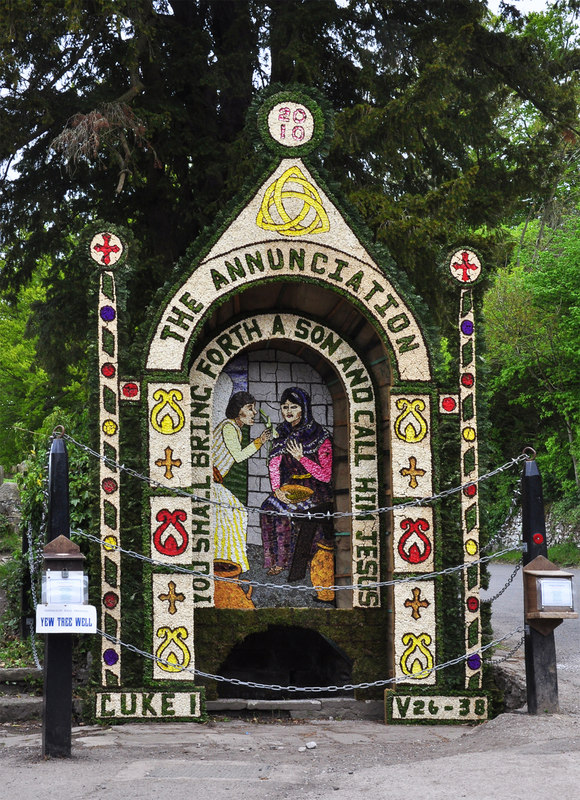
Yew Tree Well submitted by Creative Commons on 6th May 2013. Dressing of Yew Tree Well - Tissington 2010
The last day of the various dressings and colours have faded but do not detract to the effort that goes into dressing of the wells in the village.
Copyright Mick Lobb and licensed for reuse under this Creative Commons Licence.
(View photo, vote or add a comment)
Log Text: Yew Tree Well, Tissington: The second well of the day. We walked down The Street from Hall Well (with the cafe to our right hand side and church to our left), turning left into Narlow Street. This well is almost at the entrance to the Candle Workshop, underneath a tall, but relatively young Yew Tree.
There was water in the well basin, but nothing seemed to be flowing into or out of the well, or along the drainage channel at the front of it, at the time of our visit.
Town Well
Trip No.170 Entry No.3 Date Added: 11th Aug 2021
Site Type: Holy Well or Sacred Spring
Country: England (Derbyshire)
Visited: Yes on 16th Jul 2021. My rating: Condition 4 Ambience 3 Access 4
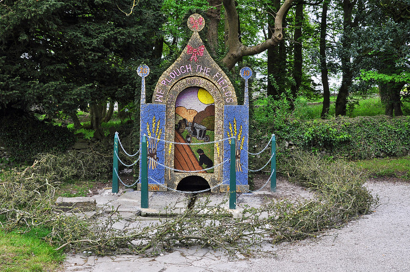
Town Well submitted by Creative Commons on 6th May 2013. Dressing of Town Well - Tissington 2010
The designs are laid out on a frame with stretched sacking to which is applied wet mud into which the decoration is applied. The week saw warm dry weather that dried out the mud which cracked like the dried up bed of a lake. This photograph shows deterioration of the dressing on the final display day.The next day the display was removed.
Copyright Mick Lobb and licensed for reuse under this Creative Commons Licence
(View photo, vote or add a comment)
Log Text: Town Well, Tissington: Our third well out of the six in the village. From Yew Tree Well, we headed east along The Green, past the pond (which had very cute young ducklings being taught to swim by their parents). The well is just to your left hand side at the far side of the green.
Children's Well
Trip No.170 Entry No.5 Date Added: 12th Aug 2021
Site Type: Holy Well or Sacred Spring
Country: England (Derbyshire)
Visited: Yes on 16th Jul 2021. My rating: Condition 3 Ambience 3 Access 5
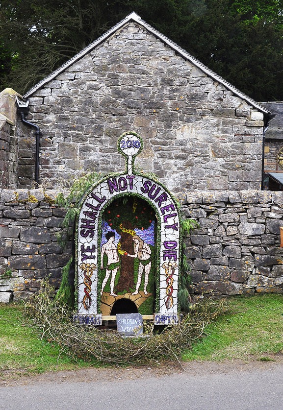
Children's Well submitted by Creative Commons on 6th May 2013. Dressing of Children's Well - Tissington 2010
Rather a macabre sentiment from children I would think.
Copyright Mick Lobb and licensed for reuse under this Creative Commons Licence.
(View photo, vote or add a comment)
Log Text: Children's Well, Tissington: The fifth well we visited in the village, and easy to spot. Not recorded on HE or HERR. The basin within the well head was slightly muddy and dry, but looking over the dry stone wall, there is a boggy area of ground, which is where the water appears to rise, and a stone trough just behind the well head, which was full of water.
Hands Well
Trip No.170 Entry No.6 Date Added: 12th Aug 2021
Site Type: Holy Well or Sacred Spring
Country: England (Derbyshire)
Visited: Yes on 16th Jul 2021. My rating: Condition 3 Ambience 3 Access 5
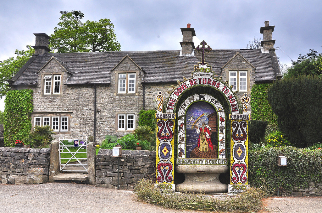
Hands Well submitted by Creative Commons on 6th May 2013. Hands Well dressing and cottage - Tissington 2010
Copyright Mick Lobb and licensed for reuse under the Creative Commons Licence.
(View photo, vote or add a comment)
Log Text: Hands Well, Tissington: The sixth, and final, well marked on the Tissington village leaflet map, and looked like a large, stone cotton-reel. As we approached it, some people were dipping their hands into the water. There was no flow of water into the basin, although the water appeared fresh and clear.
Hall Well (Tissington)
Trip No.170 Entry No.1 Date Added: 11th Aug 2021
Site Type: Holy Well or Sacred Spring
Country: England (Derbyshire)
Visited: Yes on 15th Jul 2021. My rating: Condition 4 Ambience 4 Access 5
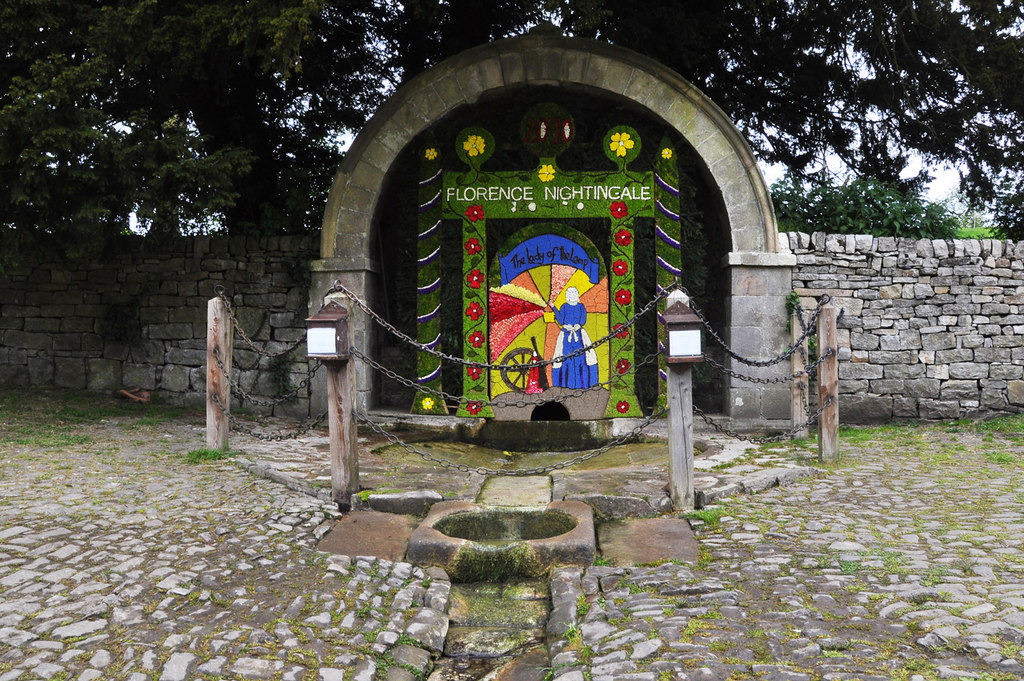
Hall Well (Tissington) submitted by Creative Commons on 6th May 2013. Dressing of Hall Well - Tissington 2010
Copyright Mick Lobb and licensed for reuse under this Creative Commons Licence.
(View photo, vote or add a comment)
Log Text: Hall Well, Tissington: We have been to Tissington before, on a Well Dressing weekend, a long, long time ago (about 38 years!), but because of the sheer number of visitors and really only interested in seeing the church, we took a quick look around only. This time, we walked round to see the wells in their 'ordinary' state. There was a large number of visitors again, but no-one else seemed particularly interested in the wells. It being a very, very hot and humid day, we were grateful for the cafe being open, although the queues to get ice-cream from the traditional sweet shop were horrendous, so we gave up.
I picked up a leaflet in the main cafe which showed the location of the wells, which made locating them easy.
A very pleasant village, and well worth visiting. Would have liked to have spent longer.
Coffin Well
Trip No.170 Entry No.4 Date Added: 11th Aug 2021
Site Type: Holy Well or Sacred Spring
Country: England (Derbyshire)
Visited: Yes on 16th Jul 2021. My rating: Condition 2 Ambience 2 Access 5

Coffin Well submitted by AngieLake on 12th Feb 2007. The beautiful clay-based panel of dried flowers and seeds creating this artistic well-dressing at the Coffin Well in 2003.
(View photo, vote or add a comment)
Log Text: Coffin Well, Tissington: Finding this well was pretty tricky, as even with the leaflet showing the location of all the wells in Tissington, we walked up and down, and down and up a lane called 'The Foot'. Eventually, I realised that whoever was in the cottage had parked their car right across the front of the well, with the front passenger tyre almost in the well itself. I had to do contortions, avoiding the bonnet of the car, to get any photograph at all.
Presumably the main part of the well is behind the garden wall, in the private garden. The gate to the cottage had a sign which said 'no entry' or 'strictly private', and I was reluctant to knock on the front door and seek permission.
Not impressed by the parking, and no sign to say this was the well.
All Saints (Bradbourne)
Trip No.170 Entry No.7 Date Added: 12th Aug 2021
Site Type: Ancient Cross
Country: England (Derbyshire)
Visited: Yes on 16th Jul 2021. My rating: Condition 3 Ambience 4 Access 4
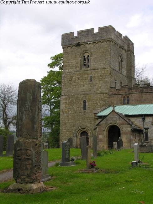
All Saints (Bradbourne) submitted by TimPrevett on 13th May 2007. The remains of the Anglo Saxon cross shaft at Bradbourne, which until quite recently formed parts of a stile... nice, but has not faired as well as that at Eyam.
(View photo, vote or add a comment)
Log Text: All Saints, Bradbourne: Our last visit of this holiday. We had a very 'interesting' journey to Bradbourne, as the police had closed off the main road and routed all traffic down some very minor, single track roads, in which traffic was trying to move in both directions, and not succeeding, which was very frustrating.
There is a large parking area outside the church, although the actual entrance to the churchyard was a bit tricky to find, as there were a number of entrances to different driveways, and we ended up walking down one of these by accident.
The first cross is just inside the churchyard, to your right as you enter from the south. The sundial is just a little further to the north-north-east.
We missed the second cross within the churchyard, as we didn't have access to the HE website at the time of our visit, and whilst looking around, thought it was just another grave marker, so I didn't photograph it.
Loved the carving on the door into the south side of the tower.
Whilst there, a couple of other visitors were very keen for us to see the grave of actor Alan Bates ("Who?" I asked, to much disgust on their part), so we did wander round to find it, out of curiosity.
Grasmere Cup-Marked Rocks
Date Added: 20th Jun 2014
Site Type: Rock Art
Country: England (Cumbria)
Visited: Yes on 2nd Jun 2014
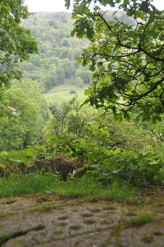
Grasmere Cup-Marked Rocks submitted by Anne T on 2nd Jun 2014. We made an impromptu visit to Grasmere yesterday (1st June) and as the café we were in had WiFi, I checked the Portal, and found the images taken by DrewParsons of the Cup-Marked Rocks at the entrance to the car park we were parked in. Thank you - this was an unexpected treat. This image shows the context of the rock outcrop, overlooking the river Rothay and (I think) Rydal Fell in the background. A beautiful spot.
(View photo, vote or add a comment)
Log Text: None
Goggleby Stone
Date Added: 1st Jul 2014
Site Type: Standing Stone (Menhir)
Country: England (Cumbria)
Visited: Yes on 28th Jun 2014. My rating: Condition 3 Ambience 4 Access 4
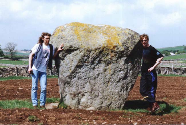
Goggleby Stone submitted by blingo on 30th Jan 2003. Goggleby stone near Shap.
(View photo, vote or add a comment)
Log Text: After failing to park along the narrow lanes around Keld, to see various stones in Shap Row, we finally parked outside the Fire Station on the A6 running through Shap, and followed the footpaths westward to the Googleby Stone and the partially toppled stone in Asper's Field.
This is a short walk, with a couple of stiles to cross, but easy enough.
I was impressed by the size of this stone, although we could discern no cup or ring marks anywhere on it.
I was a bit disappointed to see this stone had been concreted into place to keep it upright!
White Raise Cairn
Date Added: 1st Jul 2014
Site Type: Cairn
Country: England (Cumbria)
Visited: Yes on 28th Jun 2014. My rating: Condition 3 Ambience 4 Access 3
White Raise Cairn submitted by baz on 3rd May 2003. White Raise Cairn (NY489224). This 20m. long cairn has an exposed central cist.
(View photo, vote or add a comment)
Log Text: From the footpath leading from the Cop Stone to The Cockpit Stone Circle, this cairn lies after the Cairn Circle, on the right hand side of the footpath.
It initially appears unremarkable as a large mound with stones marking the extent of the cairn, but walking up the slope I came across the excavated burial chamber, which was a great surprise.
It's clearly a favourite with sheep, as the stones retain the heat from the sun, and they were unmoving as we wandering around.
There are great views across the valley towards Ullswater, although it's not quite possible to see the lake from the cairn.
Well worth a visit.
Moor Divock 3
Date Added: 9th Feb 2023
Site Type: Cairn
Country: England (Cumbria)
Visited: Yes on 28th Jun 2014. My rating: Condition 3 Ambience 4 Access 3
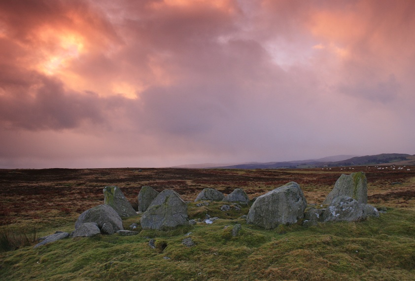
Moor Divock 4 submitted by postman on 25th Oct 2012. Sometimes a friend at work will ask why I do this , but the question isn't why I do, it's why don't you ? (though really I know the answer)
(View photo, vote or add a comment)
Log Text: After visiting the Cop Stone, we walked up to the Cairn Circle (which is clearly visible from the footpath). Whilst ruined, it's atmospheric. The more I sat on the edge of the cairn and looked round, the more there is to see. I'd like to go round with someone who knows this area better than I, so I can understand it better. [Note: I originally confused this with Moor Divock 4, the cairn circle and small stone row just to the north. Looking back on my photographs, I could find no evidence of this feature on the ground].
Cop Stone
Date Added: 1st Jul 2014
Site Type: Standing Stone (Menhir)
Country: England (Cumbria)
Visited: Yes on 28th Jun 2014. My rating: Condition 4 Ambience 4 Access 4
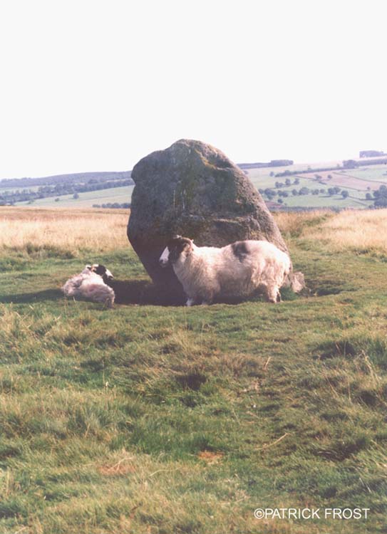
Cop Stone submitted by Patrick Frost on 14th Oct 2002. The Cop Stone in Cumbria at GR: 496216
(View photo, vote or add a comment)
Log Text: For a long time we've wanted to walk along High Street, the Roman Road, but the scramble up from Ullswater side was too difficult for me. My husband managed to identify another route, via the B road through Askham and Helton, then following the track past Outgang Farm and Heltonhead. There were other cars parked on the grass at the side of the road, so we joined them, and walked the 100 yards up to Cop Stone.
This was just the start of our journey through this fascinating landscape; whilst there are obvious quarried area and shake holes, there are a wide variety of cairns and tumuli, with the footpath leading up past The Cockpit Stone Circle and High Street.
The more we looked, the more there was to see. Well worth a visit, and easy walking.
