Contributory members are able to log private notes and comments about each site
Sites Anne T has logged. View this log as a table or view the most recent logs from everyone
Merrivale 6
Trip No.133 Entry No.10 Date Added: 17th Jul 2019
Site Type: Stone Row / Alignment
Country: England (Devon)
Visited: Yes on 14th May 2019. My rating: Condition 2 Ambience 3 Access 4
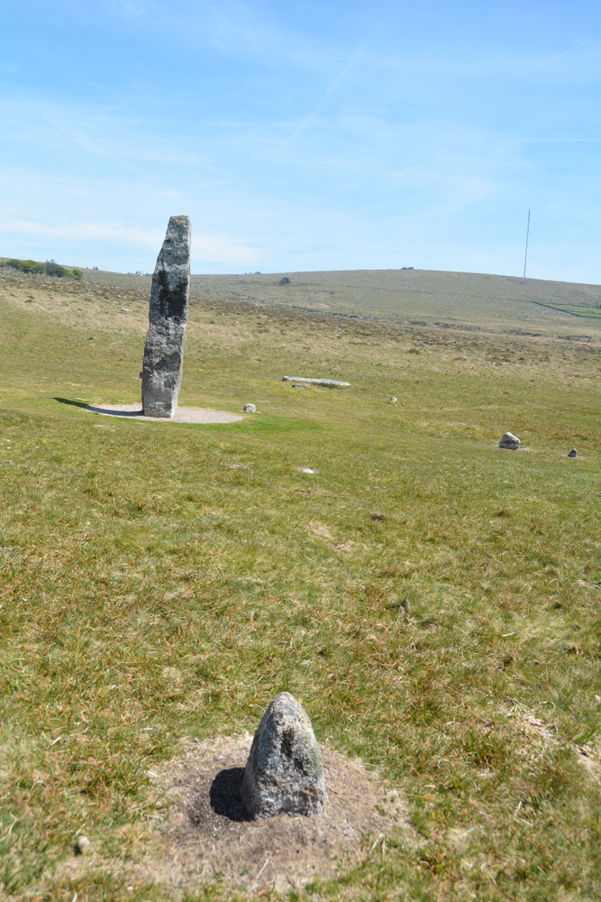
Merrivale 6 submitted by Anne T on 8th Jul 2019. Comparing my photographs to those on Sandy G's Stone Rows of Great Britain website, the only stone visible of Merrivale Row 6 is in the foreground of this photo. Standing just to its west, looking east.
(View photo, vote or add a comment)
Log Text: Merrivale 6 stone row: Only one stone was visible of this row, and thankfully we had Sandy G to point out the location of the row and the only stone of this very short row visible - the western most stone. So many features around the Merrivale Menhir. I'm really glad we had our guide for the day, and also, at home, the Butler "Dartmoor Atlas of Antiquities" (volume 3) to help interpret all the different stones, cairns and pits.
Merrivale Second Menhir and Cairn
Trip No.133 Entry No.12 Date Added: 17th Jul 2019
Site Type: Standing Stone (Menhir)
Country: England (Devon)
Visited: Yes on 14th May 2019. My rating: Condition 3 Ambience 4 Access 4
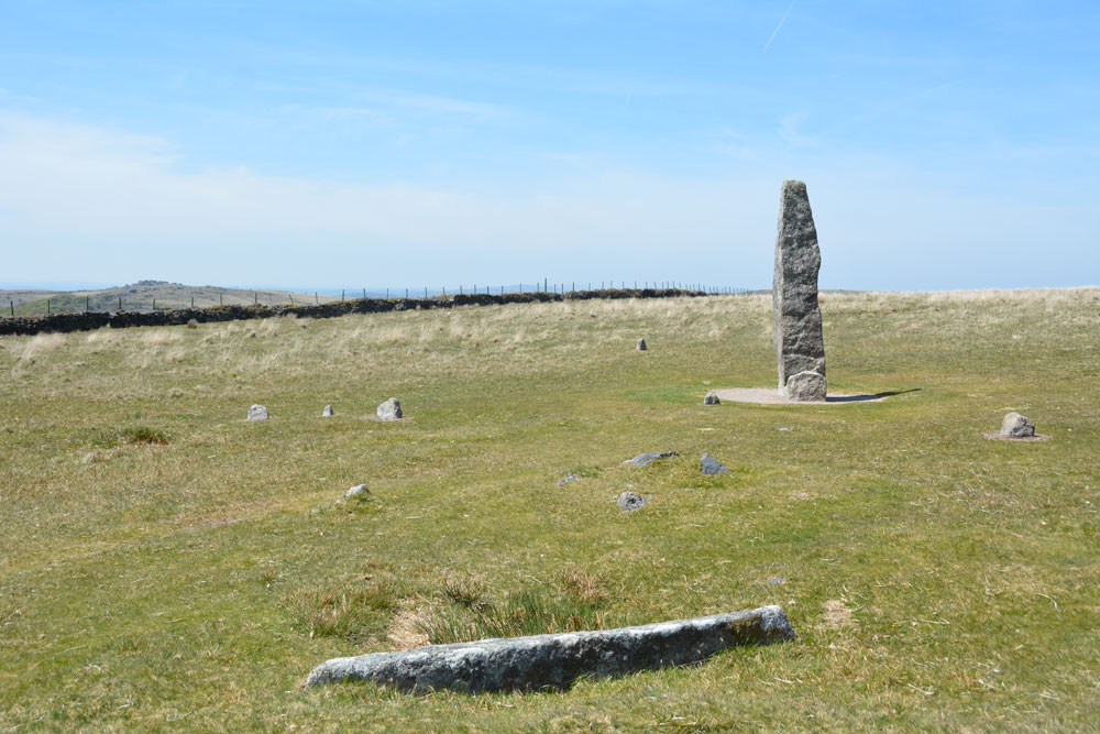
Merrivale Second Menhir and Cairn submitted by Anne T on 9th Jul 2019. To show the relationship of these monuments with the tall Merrivale Menhir, the recumbent granite pillar is in the foreground, with its pit immediately behind it; the cairn is visible as a low mound behind it (just right of centre) The tall menhir is in the background. The cairn is 5.5m from the menhirs and the granite slab 2m from the cairn. Row 4 runs from the centre to the middle left of the photo; the western stone of row 6 is to the left hand side of the menhir.
(View photo, vote or add a comment)
Log Text: Merrivale Second Menhir, pit and cairn: All these monuments were so close together, it was a bit mind-boggling. I made sure I wrote down the monuments and the photo numbers so I didn't mix them up when I processed the photos later (the wind was still gusting strongly so we didn't get my folder with pre-printed notes out in case they blew away).
As a group, we were fascinating with all the pits around here and spent some time exploring them and taking grid references. Dave P later contacted me to tell me these had been documented by Butler in his Volume 3 of "Dartmoor Atlas of Antiquities".
Black Tor (Meavy)
Trip No.133 Entry No.14 Date Added: 17th Jul 2019
Site Type: Multiple Stone Rows / Avenue
Country: England (Devon)
Visited: Yes on 14th May 2019. My rating: Condition 3 Ambience 4 Access 4
Black Tor (Meavy) submitted by Brian Byng on 7th Feb 2002.
(View photo, vote or add a comment)
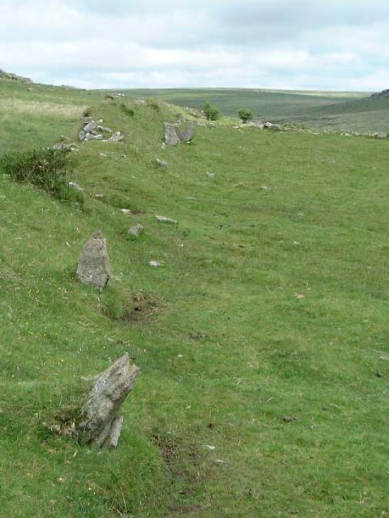
Log Text: Stanlake Stone Row (aka Black Tor): Our second stop of the afternoon, and our hope was that as we crossed the road and descended from the slopes that we'd be more sheltered from the wind. Not a chance! However, this did not spoil my enjoyment of the next few sites.
From the Leeden Tor stone row, we crossed the main road, ending up in what -after a spell of wet weather - would have been a boggy dip, but at the time of our visit was relatively dry. Even so trying to find a way across that I, and my wonky knees could manage, was a little amusing. Angie stopped to have her photographs taken against the Tors and woodland behind.
This double stone row is partly hidden by a dry stone wall/earthen bank, put up when the landowner enclosed his land, telling his workers to ‘enclose up to and including the stone row’ according to Sandy.
We had intended to come back and photograph this stone row on the way back, but because I couldn’t make it to the sites we'd planned to go to later in the afternoon because of the steep drops by the leat, we didn’t return this way.
Black Tor Stone Row Cairns (Stanlake)
Trip No.133 Entry No.15 Date Added: 17th Jul 2019
Site Type: Cairn
Country: England (Devon)
Visited: Yes on 14th May 2019. My rating: Condition 2 Ambience 3 Access 4
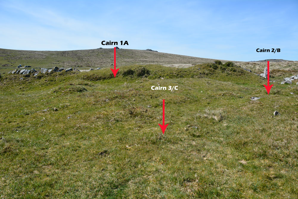
Black Tor Stone Row Cairns (Stanlake) submitted by Anne T on 10th Jul 2019. The three cairns which can be found at the south western end of the Black Tor/Stanlake Stone Row.
(View photo, vote or add a comment)
Log Text: Black Tor, cairns at south-western end of the stone row: These cairns lie just to the south western end of the stone row, to the south of the field boundary containing the northern side of the stone row and just to the west of another field boundary which runs NNW-SSE. Whilst I vaguely recognised these as cairns, without Dave Parks and his magic GPS, and Sandy G coming to give us an explanation, I might have dismissed these as being relatively unimportant. Wrong!
These cairns are recorded on Sandy’s Site Report 4 for the stone row (diagram 6, page 12) but again it was too windy to get these out and study them in any detail. I would really have loved to have spent more time here on a lovely, bright sunny day.
These run just to the west of another field boundary which runs NNW to SSE and just south of the field boundary containing the stone row.
Stanlake Settlement
Trip No.133 Entry No.16 Date Added: 17th Jul 2019
Site Type: Ancient Village or Settlement
Country: England (Devon)
Visited: Yes on 14th May 2019. My rating: Condition 2 Ambience 4 Access 4

Stanlake Settlement submitted by AngieLake on 29th May 2019. With the men out of the way we can see the abundance of lovely bluebells inside the hut circle on this sunny, but very windy, 14 May!
(View photo, vote or add a comment)
Log Text: Stanlake Prehistoric Settlement: Walking down slope from the western end of the stone row, we soon came upon a very interesting, complex and intriguing mix of hut circles, dry stone walls and other features. I lagged behind the group a little, trying to determine what I was seeing as I saw it, but failed miserably - there was so much to take in!
Sandy waited for his Intrepid Dartmoor Expedition Group around the spot marked 6 on his plan (taken from his survey report for Meavy Valley Archaeology: site report 1, figure 3, which I've added as a link to Angie's main site page text.
It is interesting that in his report, Sandy links this settlement to the nearby production of tin, with a large tin works just to the south of the Devonport leat.
Having studied point 6 for some time, we wandered over the hut circles and attached compounds, walking to the south and west, and back round to the long house, of which very little now remains, but there are low banks in the ground, partly cut by a modern field wall.
I was sad to leave, as I could have spent at least another couple of hours here. Yet it was to be my last site of the day, as further to the NW along the Devonport Leat, there was a section of steep drops down into the river and the l eat, and I was unable to proceed any further. As it happened, it was a good job we stopped earlier (it was gone 4pm by this time), as Andy B has caught an earlier train and was waiting in Newton Abbott.
Drizzlecombe Brook
Trip No.134 Entry No.3 Date Added: 17th Jul 2019
Site Type: Marker Stone
Country: England (Devon)
Visited: Yes on 15th May 2019. My rating: Condition 3 Ambience 3 Access 3
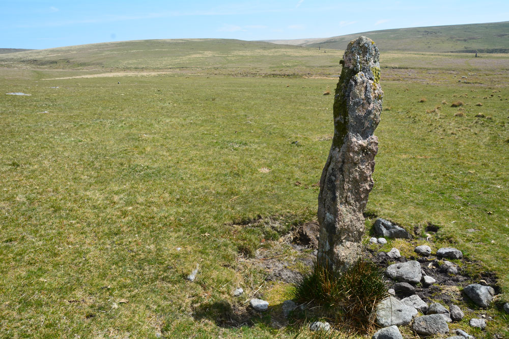
Drizzlecombe Brook submitted by Anne T on 11th Jul 2019. This is the 'standing stone' at SX 5870966946, in between Whittenknowles Rocks Settlement and Drizzlecombe Brook with its old tin workings.
(View photo, vote or add a comment)
Log Text: Drizzlecombe Brook 'Standing Stone': This stone was between the settlement an the tin works that Sandy showed us and I was hopeful of having spotted another monument on the moors not on today's list of sites to visit.
Not having a grid reference from the camera, we’ve tracked it down to one of six stones (one of which I photographed later, but which turns out to be the abandoned gate post!). Looking at the photograph and how near we are to the tin-works at the stream, this stone is at SX 58709 66946.
Judging by the photograph with the group, I estimate it to be just taller than Janet – 1.7m or just over.
Drizzlecombe Giant's Basin
Date Added: 17th Jul 2019
Site Type: Cairn
Country: England (Devon)
Visited: Yes on 15th May 2019. My rating: Condition 3 Ambience 4 Access 3
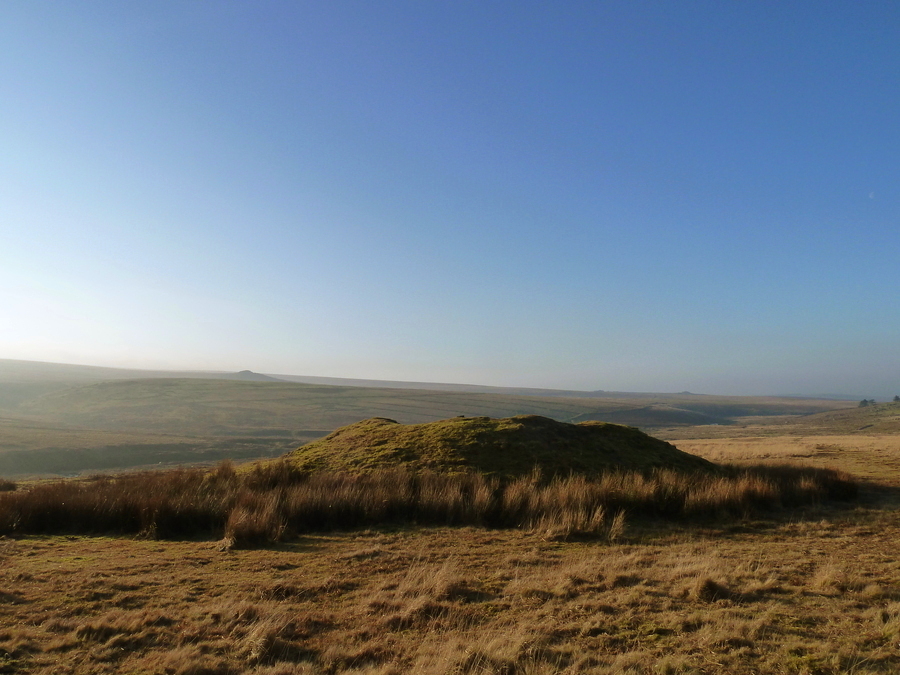
Drizzlecombe Giant's Basin submitted by Bladup on 12th May 2017. The large Giant's Basin.
(View photo, vote or add a comment)
Log Text: Giant's Basin and associated smaller cairns: Before we arrived at the stone rows, despite having printed off the Pastscape and Historic England entries for these sites, I hadn’t really got the full picture of how complex and interesting this area of Drizzlecombe was.
The Giant’s Basin, to the south east of the cairn at the top of Drizzlecombe Stone Row 1/A, is enormous, and reminiscent of the large cairns at Kilmartin, albeit covered in grass.
Thanks to Dave P and his trusty GPS (along with vast knowledge of Dartmoor, of course!) took me over and pointed at the three cairns at its western side.
I walked half way up the slope to the top of the cairn and photographed part of the the robbed out interior.
Drizzlecombe Cist 6
Trip No.134 Entry No.6 Date Added: 17th Jul 2019
Site Type: Cairn
Country: England (Devon)
Visited: Yes on 15th May 2019. My rating: Condition 3 Ambience 4 Access 3
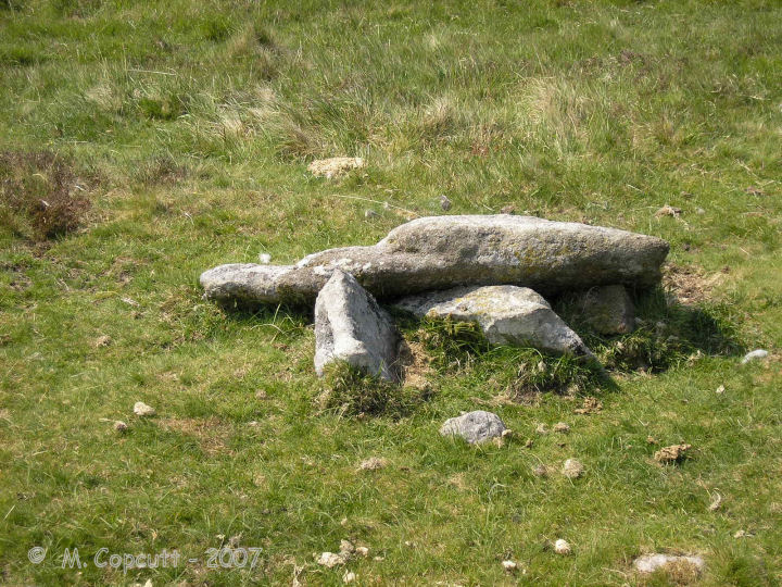
Drizzlecombe Cist 6 submitted by thecaptain on 23rd Feb 2008. Drizzlecombe Cist 6 has a capstone 1.8 m by 1.2 m sitting on top of a broken box, which is now three side set slabs, probably two side slabs and a single end stone.
(View photo, vote or add a comment)
Log Text: Giant's Basin Cist (Drizzlecombe Cist 6): This cist was pointed out to me by Dave Parks and Sandy G, but I only seem to have one photograph of it, although I remember standing over it and taking photos from different angles. Perhaps I've got muddled up with all the other wonderful stone settings and cairns in the area. A brilliant area to visit. So much to see, all in very close proximity.
Drizzlecombe row 2
Trip No.134 Entry No.7 Date Added: 17th Jul 2019
Site Type: Stone Row / Alignment
Country: England (Devon)
Visited: Yes on 15th May 2019. My rating: Condition 3 Ambience 4 Access 3
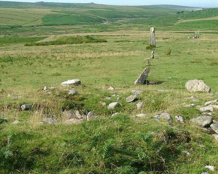
Drizzlecombe row 2 submitted by Brian Byng on 7th Feb 2002. View of what the natives call row C the one with the 14ft (4.3m) high
terminal stone in Burls book page 114. The chinese graphic is on the largest
stone that can be seen at the far end & is facing the camera.
(View photo, vote or add a comment)
Log Text: Drizzlecombe 2: Having three stone rows, their cairns, cists and longstones all in a very close proximity was quite stunning. As we walked up and down this row with Sandy G and the rest of the Intrepid Dartmoor Expedition Group, I was barely able to take it all in - so much to see and understand.
When we started off at the longstone at the western end of the row, there was blue sky and whispy clouds; by the time we'd wandered up to the cairn at the eastern end of the row, a mist/clag had started to descend, so the views from/around the stone row weren't quite as good as earlier, but the atmosphere of this place was just amazing.
The longstone is a really peculiar shape. Butler, volume 3 of "Dartmoor Atlas of Antiquities", page 138, says "According to Worth, it was probably dragged here from Higher Hartor Tor, about a kilometre away".
Drizzlecombe cairn 2
Trip No.134 Entry No.8 Date Added: 17th Jul 2019
Site Type: Ring Cairn
Country: England (Devon)
Visited: Yes on 15th May 2019. My rating: Condition 2 Ambience 4 Access 3
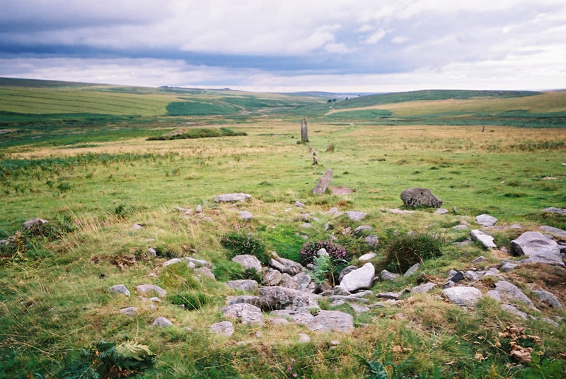
Drizzlecombe cairn 2 submitted by simcon on 27th Aug 2003. SX593671 Drizzle Combe Cairn East, Dartmoor Devon. This cairn is at the top end of the rightmost row at this site. The view in this picture is looking back down the row in a south westerly direction. Left of centre is a huge cairn called Giant's Basin Cairn (so it says on the OS map).
(View photo, vote or add a comment)
Log Text: Drizzlecombe Cairn 2: After a most satisfactory and pleasant morning, we sat at the edges of the cairns heading up rows 2 and 3 and had a quick lunch break. It really is an amazing spot, and so pleased to have visited, although correctly cataloguing my photos to the right site proved a little challenging at the end of the day.
Drizzlecombe cairn 3
Trip No.134 Entry No.9 Date Added: 17th Jul 2019
Site Type: Ring Cairn
Country: England (Devon)
Visited: Yes on 15th May 2019. My rating: Condition 2 Ambience 4 Access 3

Drizzlecombe cairn 3 submitted by simcon on 27th Aug 2003. SX593671 Drizzle Combe Cairn West, Dartmoor Devon. This cairn is at the top end of the leftmost row at this site. The view in this picture is looking back down the row in a south westerly direction. You can clearly see the other row in the left of this picture extending way down the hill.
(View photo, vote or add a comment)
Log Text: Drizzlecombe Cairn 3: cairn at the head of Drizzlecombe Stone Row 3. The stone row is just offset from the centre of the cairn. Butler, in his "Dartmoor Atlas of Antiquities, page 138, says: "the third row descends from cairn 3 surrounded by an outer ring of slabs 8.6m across mostly in contact with its base ... probably only three stones are missing out of t10, the largest of those remaining standing about a metre high facing the row". Of the three cairns at the eastern end of the row, this cairn has the tallest stones protruding out of it, and the most character. See Butler's diagram of it on page 139 (fig. 49.19.3).
After looking at the eastern end of the row, we proceeded up the slope, looking for the Drizzlecombe Cist and the settlements at the top of the slope, meandering back along stone row 3 as we came back.
Drizzlecombe cairn 4
Trip No.134 Entry No.11 Date Added: 17th Jul 2019
Site Type: Stone Circle
Country: England (Devon)
Visited: Yes on 15th May 2019. My rating: Condition 2 Ambience 4 Access 3
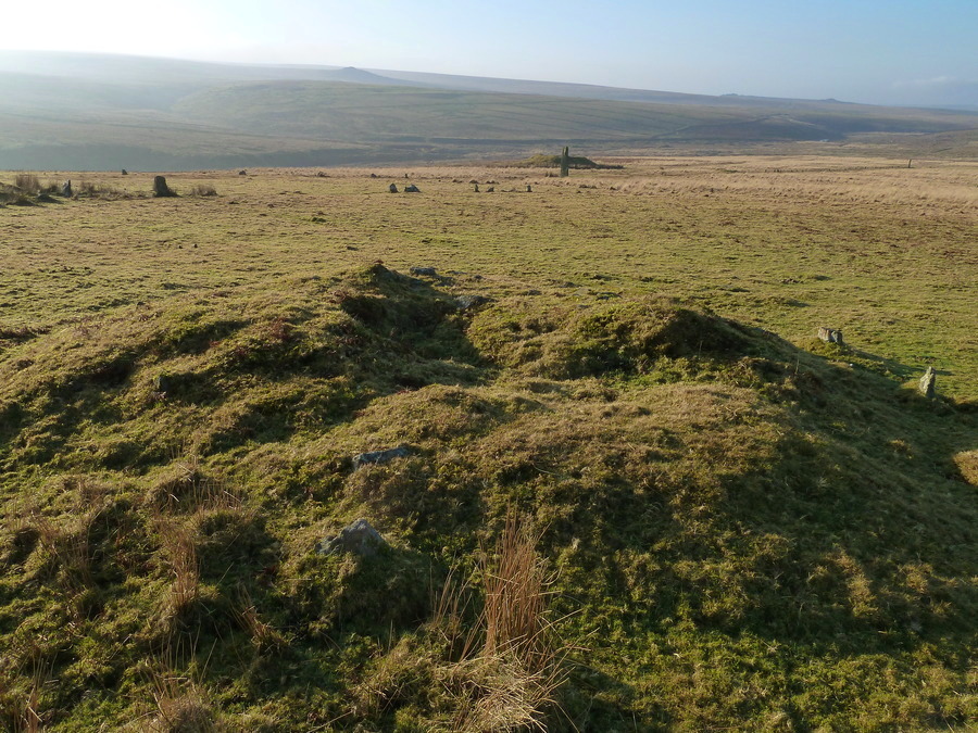
Drizzlecombe cairn 4 submitted by Bladup on 12th May 2017. Drizzlecombe cairn 4 in alignment with the tallest standing stone and the Giant's Basin cairn.
(View photo, vote or add a comment)
Log Text: Drizzlecombe Cairn 4: I took photographs of all three cairns in a row, then one at a time. My notes indicate this is Drizzlecombe Cairn 4. This is the most northerly of the three cairns at the head of rows 2 and 3, but this cairn does not have a row descending from it.
Drizzlecombe cairn 13
Trip No.134 Entry No.12 Date Added: 17th Jul 2019
Site Type: Cist
Country: England (Devon)
Visited: Yes on 15th May 2019. My rating: Condition 3 Ambience 4 Access 3
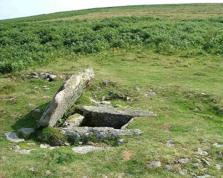
Drizzlecombe cairn 13 submitted by Brian Byng on 7th Feb 2002. View looking east of the large cist at Drizzlecombe which Burl claims has a row running in an Easterly direction in line with the tilted slab. I looked very carefully & found no sign of such a row. None of my references mention such a row & I have asked around those who should know - again without success. I think this is another of Burls iffy sites.
(View photo, vote or add a comment)
Log Text: Drizzlecombe Cairn 13: Leaving the stone rows behind, we walked up slope and to the WNW. This is a beautiful example of a cairn with central cist. What is very noticeable about this cist is that the stones making up two of the sides projects outside the other two ends. Looking at the Butler diagram for these sites (Volume 3, page 135), cairn 13 is indeed in ine with cairns 2, 3 and 4, but about 150m further from the stone rows.
Drizzlecombe W row
Trip No.134 Entry No.13 Date Added: 17th Jul 2019
Site Type: Stone Row / Alignment
Country: England (Devon)
Visited: Yes on 15th May 2019. My rating: Condition 1 Ambience 3 Access 3
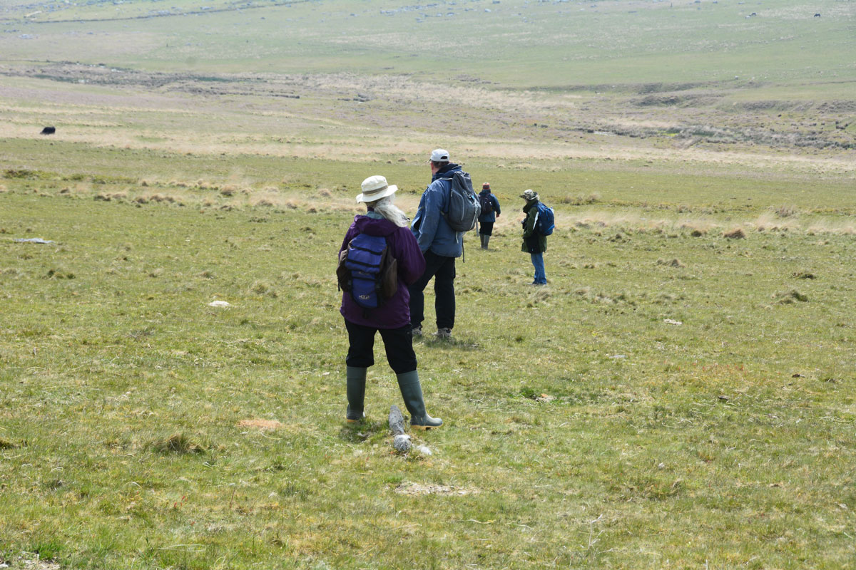
Drizzlecombe W row submitted by Anne T on 15th Jul 2019. In trying to identify this elusive row, Sandy asked members of the group to stand on stones they thought might be part of the stone row. From foreground to background: Janet Daynes, Dave Parks (Prehistoric Dartmoor Walks), Gordon Fisher (just off to the right) and Sandy G. Sandy G is walking down the line of stones. He is planning a return trip later in the year to take a closer look.
(View photo, vote or add a comment)
Log Text: Drizzlecombe West Stone Row: Whilst Sandy G had our group here, he asked us all to help him have a look for this elusive stone row, and we were happy to help, which mentioned in Burl but not in Butler (I haven’t been able to find the mention in Burl, yet).
The others in the group had a far keener eye than me for spotting the lines of stones in the grass, so I wandered up slope and stood on a cairn, observing. Not having my GPS with me, I think this is Butler Drizzlecombe Cairn 15 at SX 5925 6721.
Sandy had the rest of the group stand on stones which they thought might be part of the row, to see how they lined up.
He plans a return visit in September 2019, so I’ll need to watch for an update.
Drizzlecombe Cairn 18
Trip No.134 Entry No.14 Date Added: 17th Jul 2019
Site Type: Cairn
Country: England (Devon)
Visited: Yes on 15th May 2019. My rating: Condition 3 Ambience 4 Access 3
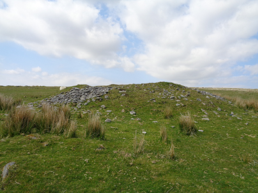
Drizzlecombe Cairn 18 submitted by davep on 16th Jul 2019. Photograph from Prehistoric Dartmoor Walks, site 1520, Drizzlecome 18 Cairn. Photograph taken 15.05.2019
(View photo, vote or add a comment)
Log Text: Drizzlecombe Cairn 18: An enormous cairn, which rivals the Giant's Basin in size, so why there is so little information about it, I'm not sure. I managed to clamber up to the top of the cairn and have a look inside, where there is a hollow where it has been excavated. Built almost on top of one of the settlements at the south-eastern side of Drizzlecombe, it looks over the River Plym to the south.
Drizzlecombe Settlement
Trip No.134 Entry No.15 Date Added: 17th Jul 2019
Site Type: Ancient Village or Settlement
Country: England (Devon)
Visited: Yes on 15th May 2019. My rating: Condition 2 Ambience 4 Access 3
Drizzlecombe Settlement submitted by ernar on 17th Oct 2004. Settlement ruins on Drizzlecombe. With a breathtaking view of the megalithic complex and the valley, this settlement was located uphill from the several cairns and Stone Rows forming the Complex. Behind the stone maniacs and the grass managers (sheep) you can see the westernmost cairn shown on the OS map.
(View photo, vote or add a comment)
Log Text: Drizzlecombe Settlements: After the stone rows, we move up-slope to try and find row 4. Whilst the rest of the group helped Sandy G identify possible stones in this row, I wandered over to Butler's Cairn 18, photographing what looked like some hut circles embedded in the turf. Arriving at Cairn 18, I walked to the top of to look at the enclosed settlement to its south/south western side, which I found fascinating.
Dave Parks was also meandering around the cairn, so he and I wandered back towards the group, with me taking photos of the long, low banks running across the pasture.
Higher up the hill was yet another settlement(s) which I barely took in. This area is so complex and interesting, yet I confess to 'brain overload' by this time of the afternoon, especially as there was so much more yet to come!
I've since managed to get hold of a pdf copy of Jennifer Robertson's unpublished thesis "Archaeology of the Upper Plym Valley" (all 592 pages), which I'll dip into soon, to try and understand more about this area.
Yellowmead
Trip No.134 Entry No.18 Date Added: 17th Jul 2019
Site Type: Stone Circle
Country: England (Devon)
Visited: Yes on 15th May 2019. My rating: Condition 3 Ambience 4 Access 3
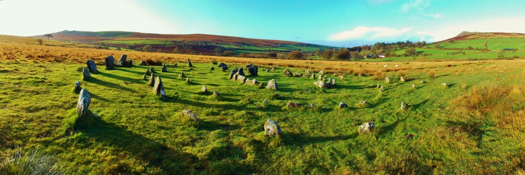
Yellowmead submitted by graemefield on 31st Oct 2013. Panoramic
(View photo, vote or add a comment)
Log Text: Yellowmead Fourfold Stone Circle: This stone circle has long been on my wish-list, but I thought I’d never be able to see it, because access was described as being difficult.
Fortunately, Dave Parks and Sandy G had been here before and knew the pitfalls, selecting the right route for us. We were also extremely fortunate in coming here after a prolonged dry spell, so we encountered no boggy areas, apart from one by the stream on the way back to the car park.
By this time of the afternoon, I was hot and tired, and my feet ached really badly, but I was determined to see this stone circle. I should have swapped my walking boots for my wellies to make the walking a little softer on the soles of my feet, but stubbornly didn’t. Mistake. However, the walk to see this circle was well worth it, although I need to apologise to the rest of the group for being very grumpy on the way back. Also, by this time the sun had come out and everyone was getting sunburned, despite the continuous application of sun-screen.
It was really good to have the experts here to describe the monuments to us. Gordon and Dave Parks wandered off to see if they could find other stones in the stone row further to the WSW of the row, but the grass was knee high in this part of the meadow.
Andrew, on the way back to the pub after our epic trip, was saying that he didn’t think the stone circle was entirely genuine; his thinking was the Victorians had ‘beautified’ it for tourists, so I spent some time in the car pulling up the different websites. The stone circle is described as having been ‘faithfully restored’, but Andrew still has his doubts.
We all met up in the Prince of Wales in Princetown for a couple of ice cold pints, before dispersing for the evening. I confess to not recognising Sandy G in the bar, as he didn’t have his hat on – I’ve never seen him without it!
Drizzlecombe cist 22
Trip No.134 Entry No.17 Date Added: 17th Jul 2019
Site Type: Cist
Country: England (Devon)
Visited: Yes on 15th May 2019. My rating: Condition 2 Ambience 4 Access 3

Drizzlecombe cist 22 submitted by TheCaptain on 6th Jul 2007. To the south of the main Drizzlecombe sites can be found this cairn with cist.
The possible capstone is displaced to the west.
Viewed here looking southeast towards Shavercombe.
(View photo, vote or add a comment)
Log Text: Drizzlecombe Cist 22: This was an ‘added on extra’ as it was only an additional 100m, and if we took a short detour to cross the leat, was on our way anyway. Located in the valley, north of the river, this would have been a pleasant, peaceful spot, within sight of the stone rows.
Standing Stone Near Cairn at Head of Drizzlecombe Row 4
Trip No.134 Entry No.16 Date Added: 16th Jul 2019
Site Type: Standing Stone (Menhir)
Country: England (Devon)
Visited: Yes on 15th May 2019. My rating: Condition 2 Ambience 4 Access 3
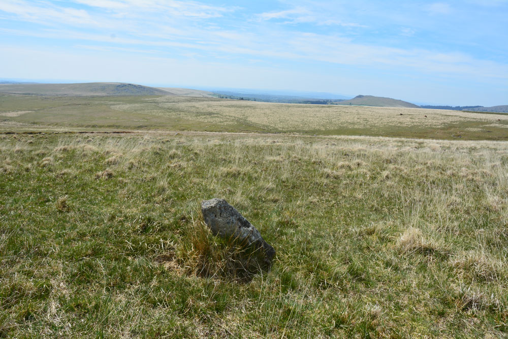
Standing Stone Near Cairn at Head of Drizzlecombe Row 4 submitted by Anne T on 1st Jun 2019. This photo is taken just from the SSW of the stone, showing its north-north-eastern face.
(View photo, vote or add a comment)
Log Text: Drizzlecombe West Standing Stone: Whilst Sandy and the rest of the intrepid "Dartmoor Expedition" were searching lower down the slope for the enigmatic and mysterious Drizzlecome West Stone Row, I'd wandered up slope, stopping at this stone and looking at the nearby cairn. Failing to attract the attention of my fellow explorers, I wandered off to look at the large cairn near the southern and smaller of the two pounds. When I came back, I found Sandy in full 'Bronze Age Mode' with his ranging pole standing by this stone.
We photographed it and took a grid reference with our GPS. More research to be done on this stone - not apparently recorded in Butler or any of the other Dartmoor Archaeology books I now possess. Have asked the rest of the group to contribute to the information on this stone, if they are able. Sandy plans to return in September 2019, so more information to follow.
King Arthur's Well (Walltown Gap)
Trip No.143 Entry No.2 Date Added: 12th Jul 2019
Site Type: Holy Well or Sacred Spring
Country: England (Northumberland)
Visited: Yes on 8th Jul 2019. My rating: Condition 1 Ambience 4 Access 4
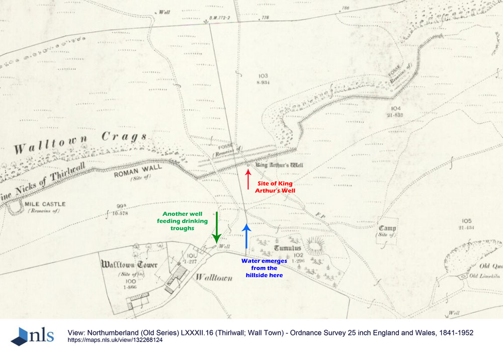
King Arthur's Well (Walltown Gap) submitted by Anne T on 12th Jul 2019. This is an image taken from the National Library of Scotland's 1895 OS map for Thirwall and Wall Town, dated 1895, and licensed for re-use under Creative Commons. Link: https://maps.nls.uk/copyright.html. The location of King Arthur's Well is marked by the red arrow, although if it exists is well hidden under turf and reeds. The blue arrow marks the location NY 68041 66551, where a spring emerges further down the hillside. The green arrow marks the location of another well which feeds drinking t...
(View photo, vote or add a comment)
Log Text: King Arthur's Well, Walltown Crags: Whilst this well may now be destroyed or lost, the scenery here is fantastic, and it was well worth coming out to look.
We were unable to find this holy well, despite having the GPS to guide us to the spot. However, we did see signs of reeds and tall grasses where the water might have pooled and flowed.
On the way up to the nick in the crags where the well is located, there is water emerging from the hillside at NY 68041 66551, which runs in a small stream down the slope, feeding two drinking troughs in the field below. We did visit after a period of prolonged dry weather, so wondered if the water emerges from higher up the hill after wet weather.
